
Derryvree’s Sealed Wetland30188 BCE
30,188 BCE is a label for a Late Pleistocene horizon, not a recoverable Irish year. Derryvree, County Fermanagh, preserves a sequence of glacial till, freshwater organic sediments and later till, demonstrating an ice-free interval between glacier advances. Radiocarbon dating places it broadly within MIS 3, although calibration prevents annual precision. Mosses, sedges and insects indicate cold, treeless wet tundra. Castlepook Cave records cold-stage fauna, but not a single contemporaneous community. Ireland’s ice sheet was expanding unevenly, while sea crossings remained uncertain. No evidence identifies human occupation, social institutions, farming or technology at date. Derryvree documents environmental change before renewed glaciation.
Dateline
30,188 BCE is a modern chronological label, not a year that can be recovered from the Irish archaeological record. There were no calendars, written accounts, named polities or datable events on the island at this depth in time. In calendar terms it is about 32,137 years before AD 1950, the conventional ‘present’ used in radiocarbon dating. That places it in the Late Pleistocene, broadly within Marine Isotope Stage 3 (MIS 3), a climatically unstable part of the last Ice Age. The appropriate subject is therefore Ireland around this point, reconstructed from deposits, fossils and changing ice margins rather than narrated year by year.
The strongest evidence comes not from a settlement but from a buried wetland at Derryvree, near Maguiresbridge in County Fermanagh. There, roadworks in 1969 exposed sediments inside a drumlin: a lower glacial till, freshwater silts and organic layers, then a second till above. This sequence records a large environmental reversal. Ice had occupied the locality, then water, vegetation and animals inhabited an ice-free basin, before later glacier ice overrode and sealed it. It is one of the rare Irish archives capable of illuminating conditions near this remote date.
A Date in Ranges, Not a Day
The Derryvree organic sediments yielded radiocarbon determination BIRM-166: 30,500 radiocarbon years BP, with a substantial uncertainty of +1,170 and −1,030 years. That result should not be translated mechanically into one calendar year. Radiocarbon years measure the remaining carbon-14 in a sample; atmospheric carbon-14 has varied through time. Modern calibration, using the IntCal20 Northern Hemisphere curve, converts such measurements into probability ranges in calibrated years before present rather than an exact historical date. At more than 30,000 years ago, those ranges are necessarily wide. The nominal date 30,188 BCE falls within the broad chronological horizon for which Derryvree is relevant, but it cannot prove that the wetland existed in precisely that numbered year.
This distinction matters. The deposit supplies a secure sequence of environmental events, while its absolute dating is less sharp than the precision of a modern annual timeline implies. It shows that the Derryvree locality was not beneath active glacier ice for a period during the Middle Midlandian. It does not show that every part of Ireland was simultaneously ice-free, nor does it provide a climatic diary for a single season. Different Irish regions could have experienced markedly different conditions, depending on altitude, exposure, proximity to ice and changing North Atlantic weather systems.
Fresh Water Beneath a Drumlin
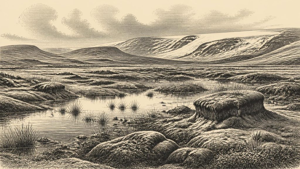
The Derryvree fossils create the clearest picture of the local landscape. Mosses, sedges and other herbaceous plants, including remains associated with cold open ground, occurred in the freshwater sediments. Insect remains also have a northern, cold-climate character. Together they indicate treeless tundra or muskeg: wet, mossy ground with shallow pools, sedge margins and sparse vegetation rather than woodland, farmland or anything resembling the later Irish countryside. The pollen was poorly preserved, so individual identifications and relative abundances deserve caution; yet the combined plant and insect evidence firmly supports an open, periglacial environment.
‘Periglacial’ does not simply mean a land buried under ice. It describes a severe cold-climate setting influenced by repeated freezing and thawing, ground frost and a short growing season. At Derryvree, freshwater could still collect and aquatic or semi-aquatic plants could grow. The wetland was therefore a small ecological refuge, although a harsh one. Summer light may have prompted rapid plant growth, while long winters, frozen ground and strong seasonality limited trees and sustained soil development. The sediment itself preserves this contrast: fine material accumulated in relatively quiet water while organic debris, seeds, mosses and insect fragments entered the basin from its margins.
The later till above these deposits is equally important. It demonstrates that the freshwater landscape did not represent a final recovery from the Ice Age. Instead, it was an interval between advances of ice. The drumlin visible at Derryvree today is consequently a compressed archive of radically different worlds: glacier, wet tundra, then glacier again. This is evidence for environmental change, not evidence for a permanent local population of people or animals.
An Island Near Renewed Glaciation
At this time the British–Irish Ice Sheet was developing unevenly, rather than behaving as one uniform mass that covered every district at the same moment. Recent reconstructions show major expansion during the period from roughly 31,000 years ago onwards, with ice in some north-western sectors advancing early, while the fullest extent of the wider ice sheet was reached later and asynchronously. Its maximum on the Irish and Celtic Sea margins is commonly placed around 25,000–23,000 years ago; the global Last Glacial Maximum spans approximately 26,500–19,000 calibrated years BP. Around 30,188 BCE, the maximum lay ahead, but cooling and advancing ice already made the future of exposed habitats precarious.
Sea level was lower than today because immense quantities of water were locked in northern ice sheets, but lower sea level does not licence a simple picture of a dry, continuous bridge between Ireland and Britain. The Irish Sea basin, changing coastlines, glacial ice and local marine conditions made connections variable and uncertain. The older argument for a late Quaternary Irish Sea land bridge has been strongly qualified by geological work. For animals, and perhaps for any people who reached Ireland, passage was a question of particular corridors at particular times, not an all-purpose highway across a modern map.
Castlepook and the Animal World
County Cork’s Castlepook Cave offers a complementary, though more complicated, record. It is Ireland’s richest known cave assemblage for vertebrate life leading up to the Last Glacial Maximum. More than 2,000 bones have been recovered, and direct dates from the cave stretch broadly from about 45,700 to 19,950 years BP. The collection includes woolly mammoth, giant deer, reindeer, brown bear and spotted hyaena, while later Ice-Age deposits contain Arctic fox, wolf and two kinds of lemming. This is striking testimony that Ireland could support, or at least be visited by, a varied cold-stage fauna before its most extensive later glaciation.
Yet Castlepook is not a snapshot of 30,188 BCE. Cave sediments have been disturbed by water and accumulated over long periods; carnivores also carried or consumed bones there. The presence of a species in the cave does not prove that it stood outside the entrance in the same generation as every other species represented. Re-dating has further shown that several older Irish cave dates needed revision, and that giant deer and spotted hyaena may have disappeared locally before about 40,000 calibrated years BP. The responsible conclusion is that mammoth-steppe and tundra-associated animal communities occurred in Ireland during MIS 3, not that a complete Castlepook ‘menagerie’ can be placed into one precise year.
People: Possibility Is Not Proof
No excavated hearth, dwelling, stone-tool workshop, burial or securely associated human skeleton is known in Ireland from around 30,188 BCE. A cave full of animal bones is not automatically an archaeological site, and the absence of unequivocal artefacts is decisive for any account of social life. Recent work at Castlepook notes that its official archaeological record had been considered redundant because evidence of human occupation was lacking, even while new research seeks to clarify the cave’s complex history. By contrast, the strongest published evidence for human presence in Ireland concerns the much later terminal Pleistocene at Alice and Gwendoline Cave, County Clare.
It follows that there can be no responsible account of Irish political affairs, diplomacy, leaders, warfare, kin groups, religion, learning or trade in this period. There are no known communities from which to infer such institutions. Nor is there evidence for farming, domesticated animals, pottery, metalworking, monuments or long-distance exchange networks on the island. If people briefly crossed into Ireland during favourable intervals, they left no securely dated material record around this time. Such a visit remains a possibility suggested by Ireland’s position within wider north-west European landscapes, not an established event in Irish history.
What Everyday Life Cannot Yet Tell Us
The environmental record does allow a limited reconstruction of opportunity and constraint. A cold wetland could have offered fresh water, seasonally productive plants and a place where animals passed through or grazed. But that is ecology, not proof of human use. Without tools, butchered remains in secure context, fire residues or occupation surfaces, it would be misleading to turn the Derryvree basin into a hunters’ camp. The evidence speaks most clearly about plants, insects, water, sediment and ice.
Its historical importance is nevertheless considerable. Derryvree shows that Ice-Age Ireland was not an unchanging white void. In at least one Fermanagh basin, a freshwater tundra landscape developed between glacial episodes. Castlepook shows that the island’s pre-maximum fauna was richer than the modern fauna suggests. Together, these records reveal a geographically marginal but biologically connected Ireland, vulnerable to rapid climatic change and soon to be reshaped again by expanding ice. That is the most secure history available for 30,188 BCE: not a story of named people, but a sealed wetland, a changing animal world and an island on the edge of renewed glaciation.
Primary Sources
- A Middle Midlandian Freshwater Series at Derryvree, Maguiresbridge, County Fermanagh, Northern Ireland
- Early Midlandian–Middle Midlandian, Pleistocene, Northern Ireland
- Palaeoecology
- The Quaternary Period in Ireland: A Guide to the Ice Age
- A Reconsideration of the Radiocarbon Dating of the Marine Isotope Stage 3 Fauna from Southern Ireland
- Castlepook Cave: County Geological Site Report
- The Irish Quaternary Fauna Project
- Occurrence of Mammalia Relicts at Site Castlepook Cave
- 2022:564 – Castlepook Cave, Castlepook South, Cork
- The Timing and Magnitude of the British–Irish Ice Sheet Between Marine Isotope Stages 5d and 2
- Growth and Retreat of the Last British–Irish Ice Sheet, 31,000 to 15,000 Years Ago: the BRITICE-CHRONO Reconstruction
- Deglaciation Chronology of the Donegal Ice Centre, North-west Ireland
- The Evolution of the Terrestrial-Terminating Irish Sea Glacier During the Last Glaciation
- Stratigraphic and Palaeo-Geomorphological Evidence for the Glacial-Deglacial History of the Last British-Irish Ice Sheet in the North-Western Irish Sea
- Early Deglaciation of the British-Irish Ice Sheet on the Atlantic Margin of Ireland
- The IntCal20 Northern Hemisphere Radiocarbon Age Calibration Curve (0–55 cal kBP)
- IntCal Publications
- Radiocarbon Calibration
- The Problem of a Late Quaternary Landbridge Between Britain and Ireland
- New Insights on the Fauna of Ireland's Younger Dryas and Early Holocene from Alice & Gwendoline Cave
