Castlepook’s Reindeer Corridor31729 BCE
31,729 BCE is not a precise Irish historical date but an approximate position within unstable MIS 3, about 33,700 calibrated years before present. Evidence from Derryvree, Fermanagh, indicates cold, treeless freshwater wetlands supporting sedges, mosses and other adapted life. Castlepook Cave, Cork, preserves fauna including reindeer, mammoth, giant deer, hyaena and Arctic fox, showing ecological links with north-west Europe, although bones may be mixed. A marked reindeer femur possibly records human butchery, suggesting only occasional Upper Palaeolithic visitors, not settlement. No politics, trade or culture can be demonstrated. Growing, uneven ice sheets increasingly transformed habitats and obscured fragmentary Ice-Age records.
Dateline
The label 31,729 BCE cannot describe a year in the ordinary historical sense. There are no written records, annual environmental archives, named communities or securely dated settlements from Ireland at this depth of time. If translated mechanically into the convention used by archaeologists, it falls around 33,700 calibrated years before present (cal BP, where “present” is AD 1950), within the later part of Marine Isotope Stage 3 (MIS 3), a climatically unstable interval of the last Ice Age. That conversion is only a modern chronological co-ordinate, not a date on which an Irish event can be placed. The responsible account is therefore one of broad, calibrated ranges and physical evidence: cave bones, buried organic sediments, pollen, insects, landforms and ice-sheet records.
At this approximate point, Ireland was not the permanently ice-covered island sometimes imagined from popular accounts of the Ice Age. Nor was it a settled country in any demonstrable sense. The best current reconstruction suggests a landscape changing rapidly over millennia and centuries as cold conditions, vegetation, sea level and expanding glaciers interacted. In some districts there was ice or an ice margin; in others, particularly at earlier stages of the period, cold open ground and freshwater habitats could support animals. The later Irish Ice Sheet would grow to a much greater extent, but its maximum expansion lay thousands of years ahead.
A Date Range, Not a Year
Radiocarbon results are not calendar dates read straight from bone or plant matter. They measure the remaining radioactive carbon in once-living material, then require calibration because atmospheric carbon-14 levels have varied. IntCal20, the standard Northern Hemisphere calibration curve, extends to 55,000 calendar years before present, but uncertainty increases substantially at great age. A single radiocarbon measurement can calibrate to a wide range, sometimes with several possible ranges. Moreover, many Irish Ice-Age finds came from antiquarian excavations whose layers were imperfectly recorded or removed altogether. It would be misleading to say that a particular animal, let alone a person, was certainly in Ireland in the precise year 31,729 BCE.
The evidence is strongest when it is treated as overlapping windows. Organic deposits from Derryvree near Maguiresbridge, County Fermanagh, produced a conventional radiocarbon determination of 30,500 BP, with a quoted uncertainty of more than a millennium. In calibrated terms this belongs broadly to the middle and later MIS 3 world, rather than to one calendar year. Southern Irish cave fauna have likewise been re-dated using improved bone pretreatment; the new results demonstrated that several older measurements had made animals appear thousands of years too young. Such revisions are not minor technicalities: they change the chronology of when particular species occupied Ireland and caution against easy narratives.
Cold Water Beneath Fermanagh
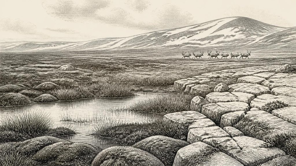
Derryvree is among the most informative sites for conditions near this horizon. Beneath later glacial deposits, excavators found freshwater silts and fine sands containing plant and animal remains. The assemblage points to a treeless, cold landscape with wet ground: a muskeg or sedge-rich fen rather than woodland. Mosses, sedges, dwarf shrubs and cold-adapted freshwater organisms provide direct evidence of local conditions at the time the sediments accumulated. They do not reveal an unbroken national landscape. Derryvree was one basin, shaped by its own drainage, geology and proximity to ice; nevertheless, it establishes that parts of Ireland retained freshwater habitats during an interval that was later overwhelmed or transformed by glaciation.
The picture is neither an empty frozen desert nor a version of modern Ireland with fewer trees. Summer growth would have been short, winters long, and exposed ground vulnerable to frost action, wind and seasonal flooding. Tree cover was absent locally. Vegetation probably formed a patchwork of herbs, grasses, sedges, mosses and low shrubs, varying with soil moisture and shelter. Such country could feed grazing mammals, but it was a precarious resource base. The next severe climate shift or ice advance could erase habitats, redirect rivers and bury the evidence beneath till. The later draped, streamlined and drumlin-rich Irish landscape owes much to those glacial processes, although most surviving forms record later phases rather than one moment in MIS 3.
Castlepook and the Animal Record
In north County Cork, Castlepook Cave near Doneraile—also historically called Mammoth Cave—offers a very different archive. Excavations conducted chiefly between 1904 and 1913 produced a large collection of Pleistocene animal bone. Only a fraction of the originally reported material survives, but it includes remains attributed to reindeer, woolly mammoth, giant deer, wolf, Arctic fox, lemming, brown bear and spotted hyaena. The combination is powerful evidence for an open, cold environment connected ecologically to north-western Europe. It demonstrates that mammals could reach and live in Ireland during parts of the last cold stage; it does not show that all species occupied the cave together or that the cave itself was a human camp.
Hyaenas matter especially because caves can preserve the accumulated traces of carnivore activity. A cave bone assemblage may include animals dragged in as food, creatures that died naturally, bones moved by water or people, and materials disturbed by later excavation. Castlepook should therefore be read taphonomically: as a place where bones acquired, lost and mixed their histories. Modern re-dating has placed important elements of its fauna securely within MIS 3 and suggests that giant deer and spotted hyaena disappeared locally before the Last Glacial Maximum, perhaps by about 40,000 cal BP. That is evidence for regional ecological change, not a precise extinction date.
People: A Possibility, Not a Population
The most consequential but least secure human question concerns a reindeer femur from Castlepook. It has been reported as bearing a deep mark interpreted by zooarchaeologist Ruth Carden as damage made by a sharp stone tool during carcass processing, and it has been publicised as evidence of human activity around 33,000 years ago. If that interpretation withstands continued scrutiny, it would indicate that people reached Ireland in the Upper Palaeolithic far earlier than the formerly accepted terminal-Pleistocene evidence. It would not prove continuous occupation, a village, a named culture or a resident population.
Caution is essential. The bone derives from an old cave collection rather than a modern, tightly excavated hearth or living floor; no associated house, stone-tool assemblage, human burial or repeated occupation surface establishes how people used the place. A 2022 excavation sought surviving Pleistocene sediments precisely because the earlier work had removed so much of the cave fill. The sensible interpretation for this period is therefore modest: perhaps occasional hunter-gatherers entered or used parts of Ireland while tracking mobile game across a broader north-west European landscape. Whether they arrived seasonally, briefly or repeatedly remains unknown.
No Polities, No Diplomacy
There is no evidence from around this date for political institutions, territorial lordship, warfare, diplomacy or organised religion in Ireland. These are not merely missing names from a record; the archaeological evidence itself is too slight to infer such structures. If people were present, they would have belonged to small, mobile Upper Palaeolithic foraging groups whose social connections, languages and identities cannot be recovered from Irish material. It is reasonable to infer practical co-operation in travel, food sharing, tool use and knowledge of seasonal animals, but not to turn that inference into a detailed social system.
Equally, there is no responsible basis for describing trade. During glacial low sea levels, the outlines of the Irish Sea basin and Celtic shelf differed greatly from those of today, and routes between Ireland, Britain and continental Europe may at times have been more practicable than later sea crossings. Yet changing coastlines do not automatically demonstrate a land bridge at this exact time, and no imported artefacts document exchange in Ireland around 33,700 cal BP. Connectivity is an environmental possibility; commerce is an unsupported claim.
Everyday Survival and Cultural Silence
If hunters visited, their economy would have depended upon wild animals and gathered plant foods, not farming. Reindeer, giant deer and other herbivores were potentially valuable sources of meat, fat, hides, sinew, antler and bone; carnivores were competitors and scavengers as well as dangers. Flint or other sharp stone flakes would have been useful for cutting hides and carcasses, though no securely associated Irish tool kit currently allows archaeologists to reconstruct techniques. Fire, clothing and temporary shelter are plausible necessities in such climates, but none is directly attested at Castlepook for this date.
Religion, art, music and formal learning are similarly beyond the Irish evidence. Human groups elsewhere in Upper Palaeolithic Europe made ornaments, images and carefully worked tools, but it is methodologically wrong to transfer those finds wholesale to Ireland. Castlepook’s importance lies in its restraint: it preserves an animal world and a possible human trace rather than a complete cultural archive. The lack of evidence is not proof that people had no beliefs or knowledge; it means that neither can responsibly be specified.
An Island Becoming Harder to Occupy
The large historical development surrounding this date was environmental deterioration and ice-sheet growth. Research on the British–Irish Ice Sheet indicates significant build-up in the Irish Sea Basin by around 30,000 years ago, followed later by rapid extension towards maximum limits in the Celtic Sea and across the Atlantic shelf. Ireland’s glaciation was asynchronous: ice did not advance everywhere at once, and local topography shaped the survival of ice-free ground, wetlands and animal corridors. Around 31,729 BCE, Ireland belonged to that long transition, not yet to the simplest image of total glacial cover.
For Ireland, then, the most meaningful history of this notional year is not a king, battle or foundation. It is the coexistence of cold freshwater basins in Fermanagh, open-animal habitats evidenced in Cork caves, possible fleeting human use, and an ice-sheet system gaining strength. Later ice would scour, transport and bury much of the earlier record. What remains is fragmentary but significant: a warning against year-by-year certainty, and a rare glimpse of Ireland as a changing Ice-Age frontier.
Primary Sources
- A reconsideration of the radiocarbon dating of the Marine Isotope Stage 3 fauna from southern Ireland
- A Middle Midlandian Freshwater Series at Derryvree, Maguiresbridge, County Fermanagh, Northern Ireland
- Irish Pleistocene Biostratigraphy
- The Last Irish Ice Sheet: Extent and Chronology
- The timing and magnitude of the British–Irish Ice Sheet between Marine Isotope Stages 5d and 2
- Maximum extent and readvance dynamics of the Irish Sea Ice Stream and Irish Sea Glacier since the Last Glacial Maximum
- Growth and retreat of the last British–Irish Ice Sheet, 31,000 to 15,000 years ago: the BRITICE-CHRONO reconstruction
- Growth, dynamics and deglaciation of the last British–Irish ice sheet: the deep-sea ice-rafted detritus record
- Radiocarbon constraints on the age of the maximum advance of the British–Irish Ice Sheet in the Celtic Sea
- Advance and retreat of the marine-terminating Irish Sea Ice Stream into the Celtic Sea during the Last Glacial: Timing and maximum extent
- Early deglaciation of the British-Irish Ice Sheet on the Atlantic shelf northwest of Ireland driven by glacioisostatic depression and high relative sea level
- Deglaciation chronology of the Donegal Ice Centre, north-west Ireland
- The IntCal20 Northern Hemisphere radiocarbon age calibration curve (0–55 cal kBP)
- New insights on the fauna of Ireland’s Younger Dryas and Early Holocene from Alice & Gwendoline Cave
- 32564 – Castlepook cave, Castlepook South, Cork
- Archaeological Heritage of County Cork
- Archaeology Research Excavation Grant 2022: Final Report
- Palaeolithic Ireland – New evidence emerges from the Emerald Isle
- Climate change and hunter gatherers in Ireland: problems, potentials and pressing research questions
- Figure 6: The subdivision of the Quaternary Period in Ireland
