
Derryvree’s Coldwater Archive31730 BCE
Around 31,730 BCE, Ireland has no recoverable annual history, only fragmentary Ice Age evidence. Derryvree, County Fermanagh, preserves freshwater silts between tills, radiocarbon dated broadly to 36,900–31,700 calibrated years before present, indicating local tundra wetlands before later glaciation. Comparable northern deposits and Crag Cave demonstrate cold but variable MIS 3 conditions. Southern caves, especially Castlepook, contain diverse fauna including mammoth, reindeer and hyaena, though bones may represent separate episodes. A cut-marked reindeer femur suggests possible Upper Palaeolithic visits, not proven settlement. Later ice erosion and sea-level change destroyed evidence. No political, agricultural, cultural or trade history can be established there.
Dateline
31,730 BCE is a modern chronological label, not a year that can be recovered from Irish evidence. It falls roughly 33,700 calendar years before AD 1950, within the later part of the Last Ice Age’s Marine Isotope Stage 3 (MIS 3). No calendar, writing, named people or recorded events existed in Ireland. At this depth of time, even radiocarbon results produce ranges rather than anniversaries. The responsible history of this point is therefore a history of deposits, animal remains and changing climates: evidence which can illuminate a broad interval, but cannot tell us what happened in one particular year.
A Date Within a Range
The closest Irish chronological guide is Derryvree, near Maguiresbridge in County Fermanagh. Roadworks there exposed organic silts and fine sands trapped between two thick till sheets: material laid down by water in an ice-free interval, later buried beneath glacial sediment. The deposit yielded the conventional radiocarbon determination Birm-166, 30,500 radiocarbon years before present, with a substantial uncertainty of +1,170 and −1,030 years. A published calibration places it broadly between about 36,900 and 31,700 calibrated years before present. The nominal date of 31,730 BCE therefore lies near the younger end of that broad calibrated span, not at a precisely identified moment within it.
This distinction matters. The date relates to organic material in a sedimentary sequence, not to a political episode, a settlement foundation or a human life. It shows that freshwater conditions existed at Derryvree before a later ice advance covered the site. It does not prove that every part of Ireland was ice-free at once, nor that the plants and animals represented there all flourished in the same decade. Radiocarbon calibration has become more sophisticated, but the method cannot turn a deep Ice Age deposit into a modern-style annual record.
Water Between the Tills
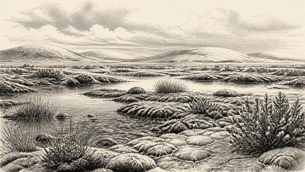
Derryvree nevertheless gives a vivid, if local, picture. Its organic layers preserved freshwater mosses and sedges, together with an insect fauna of cold northern character. The original investigators interpreted the evidence as open tundra vegetation under a periglacial climate: ground and shallow water shaped by severe cold, seasonal freezing and thawing, rather than by forest. This was not the wooded Ireland of later prehistory. It was a sparse, exposed landscape in which wetlands and pools could persist among low vegetation, with few or no trees.
Other northern deposits strengthen that broad environmental interpretation while also demonstrating how fragmentary the record is. Organic beds at Hollymount, also near Maguiresbridge, and at Greenagho near Belcoo preserve evidence of cold, open, non-forested conditions during phases of the Midlandian, the Irish term long used for the last glacial cycle. The Greenagho date is itself a minimum age and cannot be treated as a precise contemporaneous counterpart to Derryvree. Together, however, these sites show that parts of north-central Ireland experienced intervals of non-glacial, tundra-like terrain before the major late-glacial expansion of the Irish ice sheet.
Cold, But Not Unchanging
MIS 3 was cold on the long view, yet it was climatically unstable. Greenland ice cores record repeated abrupt shifts between colder stadials and relatively milder interstadials, and Irish cave evidence indicates that those North Atlantic changes affected the island. At Crag Cave in County Kerry, episodes of calcite growth during the last glacial period imply intervals when liquid water could percolate through the cave and average annual temperatures rose above freezing. Such evidence should not be read as a weather report for 31,730 BCE. It does, though, warn against imagining a single permanent Ice Age climate.
For Ireland, local geography mattered as much as the wider climatic rhythm. A sheltered limestone cave in north Cork, a wet basin beneath what became a Fermanagh drumlin, and an upland or coastal margin could have offered sharply different conditions. Ice, snow cover, meltwater and seasonally frozen ground changed the available habitat from place to place. The landscape was already moving towards the far more extensive glaciation of the Last Glacial Maximum, but that maximum came later, principally after about 27,000 calibrated years before present. No reconstruction can responsibly draw an exact Irish ice margin for this numbered BCE year.
Caves and Animal Worlds
Southern Irish caves preserve a different kind of archive. Castlepook Cave, also called Mammoth Cave, near Doneraile in County Cork, produced a remarkable collection of Late Pleistocene animal bone during excavations in the early twentieth century. The National Museum of Ireland holds material from the cave, including spotted hyaena remains. Research on Castlepook and neighbouring caves has identified a fauna that included such cold-stage animals as reindeer, woolly mammoth, giant deer, brown bear, hare and carnivores including spotted hyaena. Not all of these animals need have occupied the cave, or even Ireland, at exactly the same time.
That qualification is crucial because caves are not neat snapshots. Carnivores may drag prey inside; scavengers, water, sediment movement and early collecting practices can mix bones from separate episodes. Modern redating has shown that several older radiocarbon measurements from southern Irish caves underestimated the antiquity of the material, sometimes by thousands of radiocarbon years. Castlepook is consequently important evidence for a diverse MIS 3 fauna in southern Ireland, but it cannot supply a tidy census of animals present on the island in 31,730 BCE.
The Human Question
The most arresting claim associated with Castlepook concerns a reindeer femur bearing a deep linear mark. Zooarchaeologist Ruth Carden has interpreted the modification as consistent with a sharp stone tool used on fresh bone, perhaps during carcass processing. The bone has been reported as about 33,000 years old, making it potentially relevant to this broad period. If that interpretation is sustained, it would suggest that people reached Ireland during the Upper Palaeolithic, far earlier than the well-established post-glacial hunter-gatherer record.
But the wording must remain cautious. The dated object is animal bone, not a hearth or dwelling; no securely associated stone-tool assemblage, occupation surface or human remains establishes a settlement at Castlepook. A mark on a bone is important evidence requiring continued study, not proof of a permanent population, a hunting camp or a migration route. The National Museum of Ireland has continued to describe clear Palaeolithic human presence in Ireland as unproven, while recent research projects seek improved dating and ancient-DNA evidence from cave collections. For this year, the sound conclusion is that brief human visits are a live possibility, not an established chapter of Irish settlement history.
No Kingdoms, No Trade Network
Accordingly, the customary headings of political history have very limited application. There is no evidence for rulers, territories, diplomacy, warfare, tribes with recoverable names or institutions in Ireland at this time. Nor is there evidence for agriculture, livestock, villages, exchange networks or seaborne trade. The island’s later traditions, languages and religious landscapes belong to vastly later eras and cannot be projected backwards into the Pleistocene.
If people did enter this environment, they would have depended on knowledge, mobility and co-operation: the ability to find shelter, fuel, water and animal resources in a severe seasonal landscape. That is an inference from the practical demands of Upper Palaeolithic life elsewhere in north-west Europe, not direct evidence for a particular Irish group. There is no basis for assigning a language, belief system, artistic tradition or social hierarchy to Ireland around this date. Even the route of any possible visitors remains uncertain. Lower sea levels altered the surrounding shelves, but neither a simple land bridge nor an easy crossing should be assumed.
A Landscape Later Erased
The scarcity of evidence is partly historical and partly geological. The later British–Irish Ice Sheet overran much of Ireland, eroding older surfaces, redepositing sediment and burying selected survivals beneath till. Subsequent sea-level change drowned former coastal ground. These processes mean that the absence of a campsite is not absolute proof that nobody ever stood on Irish ground; equally, loss of evidence cannot be used to invent a vanished society. Derryvree survived precisely because its water-laid sediments were sealed between tills, while Castlepook’s caves protected bone in a landscape otherwise repeatedly remodelled.
The most defensible portrait of Ireland around 31,730 BCE is therefore narrow but compelling: portions of the island had recently supported, or still supported, cold open terrain with freshwater wetlands; large mammals and carnivores formed part of a changing Ice Age fauna; and climatic conditions varied on scales far beyond any calendar year. Derryvree’s coldwater sediments are the clearest local anchor. They reveal an Irish landscape before the last great ice advance, and they also define the limit of what can honestly be claimed about it.
Primary Sources
- A Middle Midlandian Freshwater Series at Derryvree, Maguiresbridge, County Fermanagh, Northern Ireland
- Early Midlandian–Middle Midlandian, Pleistocene, Northern Ireland
- Middle Midlandian Interstadial Deposits at Greenagho, Near Belcoo, County Fermanagh, Northern Ireland
- Quaternary Deposits and Glacial Stratigraphy in Ireland
- A Reconsideration of the Radiocarbon Dating of the Marine Isotope Stage 3 Fauna from Southern Ireland
- Spotted Hyena Skull
- Archaeology Research Excavation Grant 2022
- Episodic Speleothem Deposition Tracks the Terrestrial Impact of Millennial-Scale Last Glacial Climate Variability in SW Ireland
- Trimlines, Blockfields and the Vertical Extent of the Last Ice Sheet in Southern Ireland
- Growth and Retreat of the Last British–Irish Ice Sheet, 31,000 to 15,000 Years Ago: the BRITICE-CHRONO Reconstruction
- Maximum Extent and Dynamic Behaviour of the Last British–Irish Ice Sheet West of Ireland
- Radiocarbon Constraints on the Age of the Maximum Advance of the British-Irish Ice Sheet in the Celtic Sea
- Timing and Pace of Ice-Sheet Withdrawal Across the Marine–Terrestrial Transition West of Ireland During the Last Glaciation
- Late Pleistocene Chronostratigraphy and Ice Sheet Limits, Southern Ireland
- Pattern and Timing of Retreat of the Last British-Irish Ice Sheet
- Dimensions and Chronology of the Last Ice Sheet in Western Ireland
- Extent and Timing of the Last Glacial Maximum (LGM) in Britain and Ireland: a Review
- The IntCal20 Northern Hemisphere Radiocarbon Age Calibration Curve (0–55 cal kBP)
- Marine20—The Marine Radiocarbon Age Calibration Curve (0–55,000 cal BP)
- Gulf Stream Variability During Marine Isotope Stage 3
- European Vegetation During Marine Oxygen Isotope Stage-3
- Aghnadarragh
- Prehistoric Details
- The Mesolithic in Ireland: When Was It?
