
Derryvree’s Drumlin Window31714 BCE
Around 31,714 BCE, Ireland lay within the climatically unstable Late Pleistocene, not a dated historical moment. Evidence from Derryvree, County Fermanagh, records an ice-free freshwater wetland of open, treeless tundra-like vegetation during later MIS 3, subsequently buried by glacial deposits. Castlepook Cave, County Cork, preserves a complex, long-lived fauna including mammoth, giant deer, reindeer, bears and hyaenas, but not a single contemporary community. A possibly tool-marked reindeer bone suggests tentative Upper Palaeolithic human activity, yet no settlement, tools or other secure assemblage confirms occupation. Changing ice, sea levels and erosion shaped connections and destroyed evidence, leaving ecological and geological history.
Dateline
The label 31,714 BCE is useful for ordering a modern chronology, but it must not be mistaken for a date that could be recovered from the Irish evidence. Nobody in Ireland recorded a year, season or event by a calendar at this depth of time. In conventional archaeological terms, the label falls approximately 33,663 calendar years before AD 1950, within the Late Pleistocene and Marine Isotope Stage 3 (MIS 3), a climatically volatile portion of the last Ice Age. Radiocarbon results from this period require calibration and usually provide broad probability ranges, not a pinpoint year. The responsible subject, then, is Ireland during a wider environmental interval around the nominal date.
This was not an Ireland of settlements, chiefs, farms, monuments or securely known communities. Its history is preserved unevenly in buried silts, pollen, plant remains, insects, animal bones, cave sediments and the landforms left by ice. Those sources can establish much about habitat and animal life, and a little about possible human contact. They cannot supply a conventional political narrative. The most informative evidence comes from a freshwater deposit sealed beneath a drumlin at Derryvree near Maguiresbridge, County Fermanagh, and from the very different cave-bone archive at Castlepook near Doneraile, County Cork.
Dating an Unrecorded World
Marine Isotope Stage 3, broadly spanning about 57,000 to 29,000 years ago, was neither a single permanent freeze nor a steady march towards colder conditions. Greenland ice-core and North Atlantic records show abrupt climatic shifts on scales of centuries and millennia. Ireland, exposed to Atlantic weather and lying near the changing margins of the British–Irish Ice Sheet, would have experienced the consequences in temperature, snowfall, growing seasons, drainage patterns, vegetation and animal movement.
The specific place of ice at 31,714 BCE cannot be reconstructed with confidence for every Irish region. Recent work does show that the ice sheet was dynamic before its later maximum, with advances and retreats varying around the archipelago. The principal maximum expansion associated with the Last Glacial Maximum came later, especially between roughly 30,000 and 22,000 years ago in different sectors, rather than occurring as one simultaneous island-wide event. At the notional date considered here, parts of Ireland may have been ice-covered or close to glacial margins, while other localities supported tundra-like or wetland environments. That regional unevenness is central, not an inconvenient qualification.
It also explains why the evidence is so fragmentary. Later glaciers eroded, buried and rearranged much of the older surface. Acid soils are poor conservators of bone. Open-air camps, if any existed, were exceptionally vulnerable to destruction. A cave or a waterlogged basin could preserve material, but each is a specialised archive: cave bones may have been gathered by predators or moved by water; pollen and plant fragments describe the surroundings of a particular former pool, not every hillside in Ireland.
A Wetland Beneath the Drumlin
Derryvree provides the clearest environmental window relevant to this period. During road works in 1969, workers exposed organic silts and fine sands beneath glacial deposits near Maguiresbridge. The sequence had formed beside freshwater during an ice-free interval and was subsequently overridden and sealed by renewed glaciation. Its organic material produced a conventional radiocarbon age of about 30,500 radiocarbon years before present. Calibration places the relevant environmental interval broadly within later MIS 3; published discussions give a range extending approximately from 36,900 to 31,700 calibrated years before present. Such figures illuminate the era around 31,714 BCE, but they do not date that numbered year itself.
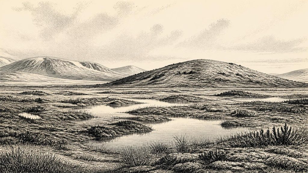
The Derryvree deposits contain pollen, plant macrofossils, mosses and insect evidence. Taken together, they support an interpretation of open, mostly treeless ground with wet, mossy and sedgy habitats, shallow freshwater and areas affected by cold, frost-dominated conditions. Herbs and low shrubs, rather than closed woodland, formed the main vegetation. The old descriptive term “muskeg” has sometimes been used for parts of this landscape: an imperfect modern analogy, but one which conveys saturated, organic-rich ground broken by pools and plant cover.
This was not necessarily a featureless snow desert. In favourable seasons, wet ground could be biologically productive. Mosses, sedges, grasses and herbs supported insects and offered forage for grazing mammals; pools and marsh edges created habitats unlike nearby exposed mineral soils. Yet it would be wrong to turn the deposit into a detailed scene of daily weather. Derryvree records one local basin over a substantial interval. It demonstrates that northern Ireland had living, freshwater-associated terrain during part of the cold stage. It does not prove that every part of the island was similarly open, habitable or ice-free at precisely the same time.
Animals and Cave Archives
Castlepook Cave, in north County Cork, offers a complementary record of animals rather than a continuous landscape sequence. This limestone maze cave, also called Mammoth Cave or Doneraile Cave, was excavated mainly between 1904 and 1918. It is Ireland’s richest known pre-Last Glacial Maximum vertebrate archive, with more than 2,000 recovered bones and directly dated remains spanning a long period, roughly 45,700 to 19,950 years before present. The breadth of that range is a warning: Castlepook is a record of many episodes, not a snapshot of one year or one animal community.
Its fauna includes woolly mammoth, giant deer, reindeer, brown bear and spotted hyaena, as well as wolf, fox, hare and, in later deposits, lemmings and Arctic fox. These finds establish that, at different times, Irish environments could support or be reached by animals typical of cold-stage north-western Europe. They do not mean that mammoths, hyaenas, reindeer and every other species formed one herd outside the cave in 31,714 BCE. Re-dating and improved collagen preparation have revised the ages of several southern Irish specimens, in some cases by many thousands of years, while water disturbance and early excavation methods have complicated the original contexts.
Spotted hyaena is especially important for interpreting the cave. Carnivores could drag carcass parts underground, chew bones and use chambers repeatedly. Water could later redistribute material. A bone in a cave is consequently not, by itself, proof that people hunted its owner, camped nearby or visited the cave. The geological and palaeontological value of Castlepook lies precisely in its capacity to preserve a long and complicated animal archive, rather than in providing a simple prehistoric scene.
The Human Question
A reported reindeer femur from Castlepook has made this era unusually significant. Zooarchaeologist Ruth Carden identified a deep mark on the bone, and public reporting in 2021 described it as a possible fresh-bone cut or chop made during processing with a stone tool. The specimen was reported to date to about 33,000 years ago, close in broad chronological terms to the nominal date here. If that interpretation is sustained, it would indicate a brief human presence or activity in Ireland during the Upper Palaeolithic, far earlier than the well-established Mesolithic settlement record.
But the appropriate conclusion remains cautious. One modified bone is evidence for a possible action upon a carcass, not for a resident population, a settlement, a named archaeological culture or a migration route. No associated hearth, securely stratified stone-tool assemblage, dwelling surface, burial or artwork has yet established an Upper Palaeolithic community at Castlepook. The National Museum of Ireland continues to state that no clear evidence has emerged for human presence in Palaeolithic Ireland, while recent Castlepook research has sought better-contexted deposits, lithics, charcoal and further modified bone. The tension between the promising individual find and the absence of a wider assemblage is the central fact, not a flaw to be concealed.
It follows that neither politics nor diplomacy can responsibly be supplied for Ireland at this point. There is no evidence for groups exercising territory, conducting warfare, exchanging goods or maintaining formal alliances on the island. Nor can religion, language, learning, art or kinship arrangements be reconstructed. If people did arrive, they may have been highly mobile foragers operating within wider north-west European networks; that is an interpretation drawn from the broader Upper Palaeolithic world, not a demonstrated Irish social history. Ireland’s own record cannot yet show whether such a visit was seasonal, singular, repeated or successful in establishing any lasting presence.
Connections, Coasts and Change
Lower global sea levels altered the geography around Ireland, exposing areas now under the Irish and Celtic Seas. It is tempting to describe this automatically as a dry land bridge to Britain or continental Europe. The reality was more complicated. The availability of a crossing depended on local sea level, glacial loading and rebound of the Earth’s crust, the relief of the sea floor, river systems and the position of marine-terminating ice. Research on Irish insularity stresses that usable land connections could have been short-lived and geographically variable. For this date, ecological connection with neighbouring regions is safer language than a confidently drawn highway of land.
The decisive development around 31,714 BCE was therefore environmental instability. Open wetland-tundra landscapes survived in some localities; large mammals and predators reached Ireland at intervals; and ice later expanded across much of the country and continental shelf. The resulting erosion helps account for the silence of the archaeological record. Derryvree’s buried organic layers and Castlepook’s bone chambers are rare survivals from a world mostly removed by later cold, water and ice.
Ireland at this nominal date was not empty of history, but its history is chiefly geological and ecological. The evidence securely reveals a changing Ice Age landscape and an intermittent, varied fauna. It permits a carefully qualified possibility of human activity in Cork. Beyond that, the honest answer is uncertainty: the absence of year-by-year precision is not ignorance that can be repaired by invention, but the defining condition of studying Ireland so far beyond written memory.
Primary Sources
- A reconsideration of the radiocarbon dating of the Marine Isotope Stage 3 fauna from southern Ireland
- Castlepook Cave: Cork County Geological Site Report
- The Irish Quaternary Fauna Project
- Irish Pleistocene Biostratigraphy
- A Middle Midlandian Freshwater Series at Derryvree, Maguiresbridge, County Fermanagh, Northern Ireland
- Freshwater Organic Deposits and Stratified Sediments Between Early and Late Midlandian (Devensian) Till Sheets, at Aghnadarragh, County Antrim, Northern Ireland
- Aghnadarragh
- Growth and Retreat of the Last British–Irish Ice Sheet, 31,000 to 15,000 Years Ago: the BRITICE-CHRONO Reconstruction
- The Timing and Magnitude of the British–Irish Ice Sheet Between Marine Isotope Stages 5d and 2
- Maximum Extent and Dynamic Behaviour of the Last British–Irish Ice Sheet West of Ireland
- Oscillating Retreat of the Last British-Irish Ice Sheet on the Continental Shelf Offshore Galway Bay, Western Ireland
- Timing and Pace of Ice-Sheet Withdrawal Across the Marine–Terrestrial Transition West of Ireland During the Last Glaciation
- Trimlines, Blockfields and the Vertical Extent of the Last Ice Sheet in Southern Ireland
- Deglaciation, Earth Crustal Behaviour and Sea-Level Changes in the Determination of Insularity: A Perspective from Ireland
- The IntCal20 Northern Hemisphere Radiocarbon Age Calibration Curve (0–55 cal kBP)
- Prehistoric Details
- Archaeology Research Excavation Grant 2022: Final Report
- 2022:564 — Castlepook Cave, Castlepook South, Cork
- Karst of Ireland
- Quaternary Geological Map of Ireland 1:500,000 Scale
- First Evidence of a Late Upper Palaeolithic Human Presence in Ireland
- Phylogeographic, Ancient DNA, Fossil and Morphometric Analyses Reveal Ancient and Modern Introductions of a Large Mammal: the Complex Case of Red Deer in Ireland
