

Mammoth Cave’s Tundra Fauna31525 BCE
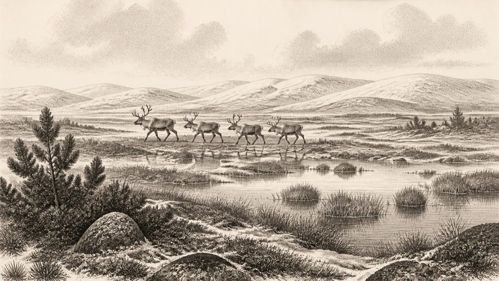
Although 31,525 BCE is only a modern chronological label, evidence from Ireland’s later Marine Isotope Stage 3 illuminates conditions around this broad period. Derryvree, County Fermanagh, preserves a freshwater tundra wetland between glacial tills, demonstrating temporarily ice-free terrain before later ice advance. Plant and insect remains indicate cold, open, waterlogged landscapes. Castlepook Cave, County Cork, yielded mammoth, reindeer, giant deer, bears, wolves, arctic foxes, lemmings and hyenas, reflecting changing tundra-like habitats. A cut-marked reindeer femur may indicate Upper Palaeolithic human activity, but cannot prove settlement. Evidence supports episodic ecological opportunity, not established communities, institutions or precise events within the island.
Dateline
The label 31,525 BCE is a modern filing device, not a date that can be attached to an event in prehistoric Ireland. No community on the island used a calendar that can be correlated with this year; there are no written records, named rulers, settlements or securely dated human lives from it. In radiocarbon convention, the point is roughly 33,475 years before AD 1950, but that conversion must not suggest false precision. Archaeologists work here with broad calibrated ranges, imperfectly preserved deposits and changing climate phases. The responsible subject is Ireland during the later part of Marine Isotope Stage 3 (MIS 3), a long, unstable interval of the last Ice Age.
The most useful Irish evidence does, however, overlap this notional date. Organic deposits at Derryvree, near Maguiresbridge in County Fermanagh, have a calibrated range of approximately 36,900–31,700 years before present, or about 34,950–29,750 BCE. Thus 31,525 BCE falls within the broad age range of the deposit, but cannot be fixed to one layer, season or generation. Further south, animal remains from Castlepook Cave—also known as Mammoth Cave—near Doneraile in north Cork document a striking Ice Age fauna. Together, the sites reveal an Ireland that was cold, open and environmentally varied, and that still supported large mammals and their predators before the fullest spread of the last Irish ice sheet.
Between the Tills at Derryvree
Derryvree is important because it preserves a landscape episode sandwiched between two tills: layers of unsorted sediment deposited by glacier ice. Roadworks in 1969 cut through a drumlin and exposed freshwater silts and fine sands between a lower and an upper till sheet. The sequence is straightforward in one vital respect. Ice had occupied the area before the freshwater sediments formed; later ice advanced over and buried them. Between those glacial episodes, water, mud, plant remains and insects accumulated in a low-lying basin.
A conventional radiocarbon determination from the organic material, Birm-166, was 30,500 radiocarbon years before present, with a substantial error range. Modern calibration translates such a measurement into a wide calendar interval rather than a single age. The evidence therefore demonstrates that north-central Ireland was ice-free long enough for a wetland environment to develop during part of MIS 3. It does not prove that every part of Ireland was ice-free at exactly the same moment, nor does it allow an annual narrative of weather, migration or human activity.
The Derryvree fossils indicate a treeless muskeg or tundra wetland: saturated, peaty ground, shallow pools, mossy margins and sparse vegetation tolerant of cold, exposure and short growing seasons. Pollen and plant macrofossils include grasses, sedges, herbs, juniper and arctic-alpine plants such as mountain avens; mosses and insect remains add detail to the picture. This was not a forested prehistoric Ireland. It was an open northern landscape in which wind, frost, standing water and seasonally frozen ground were major forces. The term ‘muskeg’ is helpful because it conveys a watery, vegetation-rich terrain rather than an empty polar desert.
Even this reconstruction needs care. A wetland basin records its immediate catchment particularly well, not the whole island equally. Plant remains may have come from nearby ground, watercourses or the basin edge; insects can indicate microhabitats. Still, the convergence of several kinds of evidence makes the central conclusion secure: at some point within the broad Derryvree interval, a cold periglacial landscape with open freshwater habitats existed in Fermanagh, before it was overridden by later ice.
An Island Before Maximum Ice
At 31,525 BCE Ireland was not yet at the maximum extent of the last British–Irish Ice Sheet. Research on the ice sheet’s growth and retreat places its greatest overall expansion later, principally during roughly 27,000–23,000 calibrated years before present, with differences between regions and ice streams. The period represented by Derryvree belongs to the long approach to that maximum: an era in which glaciers and ice caps changed in extent, while other areas could sustain ice-free ground and freshwater deposits.
This qualification matters because the familiar image of an island wholly entombed beneath ice cannot simply be projected backwards across the entire Late Pleistocene. Ireland’s topography, proximity to the Atlantic, and position between Britain and the continental shelf created local contrasts. The climate was harsh, but it was not static. Greenland ice-core chronologies show abrupt warming and cooling episodes across MIS 3; speleothems in Crag Cave, County Kerry, formed intermittently when conditions allowed liquid water to move through the cave system. Such records do not give a weather report for 31,525 BCE, but they confirm that the wider North Atlantic climate system changed sharply on timescales meaningful to ecosystems.
Sea level was much lower than today because vast quantities of water were locked in continental ice. Yet it would be reckless to describe a simple, reliable ‘land bridge’ from Ireland to Britain or mainland Europe. The Irish Sea basin had complex, changing coastlines, marine channels, ice margins and lowland routes. The fossil record proves that mammals reached Ireland during parts of the Late Pleistocene; it does not by itself reveal the exact route, season or frequency of their movements. For people, whose archaeological signal is far slighter, the problem is still more difficult.
Castlepook’s Animal World
Castlepook Cave offers the clearest southern Irish window onto this wider world. Early twentieth-century excavations, followed by later reassessment and dating of museum collections, produced evidence for woolly mammoth, reindeer, giant deer, brown bear, wolf, arctic fox, hare, lemmings and spotted hyena. Not every specimen belongs to precisely the same moment, and cave assemblages are rarely simple snapshots. Bones can be carried in by predators, washed through fissures, reworked by water or disturbed by excavation. Nevertheless, the faunal range shows that Ireland was repeatedly accessible to animals adapted to cold, open country during the pre-Last Glacial Maximum.
Spotted hyena is especially revealing. Castlepook has produced Ireland’s principal evidence for this powerful carnivore, whose dens could accumulate bones over time. Mammoth remains and carnivore-modified material should therefore not automatically be read as the debris of human hunting. Caves were not necessarily human shelters: they could be dens, traps, drainage passages and repositories in which bones from the surrounding landscape were concentrated. The animal assemblage is compelling evidence for regional ecology, but it is less dependable as a guide to a single encounter at the cave mouth.
Reindeer, mammoth and giant deer suggest extensive feeding grounds beyond the limestone cave system, while small mammals point to cold habitats and open vegetation. Predators followed herbivores, and scavengers could exploit carcasses left by winter mortality or competition. One should not picture a stable parade of species all sharing one meadow. Different animals arrived, disappeared and left remains over thousands of years. The defensible interpretation is a changing mosaic of tundra-like pasture, wet ground, exposed slopes and sheltered limestone country, capable at intervals of sustaining substantial herbivore populations.
The Reindeer Femur Question
A reindeer femur from Castlepook has made this period unusually significant for the history of people in Ireland. The bone has been reported as dating to around 33,000 years ago and bears a deep mark interpreted by zooarchaeologist Ruth Carden as having been made on fresh bone by a sharp stone tool. If that identification is upheld, it is evidence that a person processed a reindeer carcass in Ireland during the Upper Palaeolithic, vastly earlier than the formerly accepted record of post-glacial human activity.
That is an important possibility, not a licence to invent a settlement. The femur came from an old cave collection, not from a modern excavation of an intact occupation floor. No securely associated hearth, stone-tool assemblage, dwelling, burial, human bone or repeatedly used campsite of comparable age has yet been published from Ireland. A radiocarbon date concerns the death of the animal, while the interpretation of a surface mark depends on separate taphonomic analysis. Carnivore action, sediment movement, excavation damage and later handling must all be considered. The mark may be a trace of butchery; it does not identify a people, language, homeland or permanent colony.
If people did enter Ireland around this broad horizon, the most cautious model is episodic Upper Palaeolithic visitation by highly mobile foragers moving through a wider north-west European world. Reindeer could provide meat, marrow, hides, sinew and bone, but Castlepook alone cannot show whether the animal was hunted, scavenged, killed elsewhere or dragged by a carnivore into the cave. Nor can it reveal group size, family life, leadership, ritual or seasonal territory. The find establishes a research question of exceptional importance rather than a settled narrative of ‘Ireland’s first inhabitants’.
No Polities, No Proven Diplomacy
There is no evidence for political affairs, warfare, diplomacy, formal religion, art, learning or trade in Ireland at this date. It would be misleading to fill these silences with analogies from better-known Upper Palaeolithic societies in France, Britain or central Europe. Those comparisons can suggest what mobile hunter-gatherers elsewhere were capable of—complex social ties, skilled stone working, symbolic practices and long-distance movement—but they do not demonstrate such activities on the island.
Likewise, there is no securely known house, camp or village from 31,525 BCE in Ireland. The relevant ‘settlement history’ is principally environmental: wetlands formed at Derryvree; animal populations used suitable terrain; cave systems trapped and preserved fragments of that history; and advancing ice eventually erased or buried many open-air traces. Any short-lived camp on exposed ground would be exceptionally difficult to find after later glaciation, erosion and sea-level change. Absence of evidence is not proof that no person ever arrived, but it is a firm limit on what can responsibly be claimed.
A Fragile Human Horizon
The chief development around 31,525 BCE was therefore neither political nor cultural in the usual historical sense. It was the precarious availability of habitable ground in a changing Ice Age Ireland. Derryvree records cold freshwater tundra before a later glacial advance. Castlepook records a fauna that included reindeer, mammoth and hyena. The marked reindeer femur raises the serious prospect that people occasionally shared this landscape. Taken together, these records replace an older picture of uniformly lifeless, permanently ice-covered Ireland with a more exacting one: a region of temporary ecological opportunities, mobile animals, dangerous predators and climatic instability.
Modern calendar-year precision cannot be recovered from that record. The evidence is strongest for environmental conditions and animal presence; more tentative for a human visit; silent on named communities and institutions. That distinction is not a weakness in Ireland’s deep past. It is the basis for understanding it honestly.
Primary Sources
- A Middle Midlandian Fresh-Water Series at Derryvree, Maguiresbridge, County Fermanagh, Northern Ireland
- Early Midlandian–Middle Midlandian, Pleistocene, Northern Ireland
- The Irish Quaternary Fauna Project
- A Reconsideration of the Radiocarbon Dating of the Marine Isotope Stage 3 Fauna from Southern Ireland
- Episodic Speleothem Deposition Tracks the Terrestrial Impact of Millennial-Scale Last Glacial Climate Variability in SW Ireland
- Trimlines, Blockfields and the Vertical Extent of the Last Ice Sheet in Southern Ireland
- Growth and Retreat of the Last British–Irish Ice Sheet, 31,000 to 15,000 Years Ago: the BRITICE-CHRONO Reconstruction
- Early Deglaciation of the British-Irish Ice Sheet on the Atlantic Shelf Northwest of Ireland Driven by Glacioisostatic Depression and High Relative Sea Level
- Maximum Extent and Dynamic Behaviour of the Last British–Irish Ice Sheet West of Ireland
- Radiocarbon Constraints on the Age of the Maximum Advance of the British–Irish Ice Sheet in the Celtic Sea
- New Insights on the Fauna of Ireland's Younger Dryas and Early Holocene from Alice & Gwendoline Cave
- Spotted Hyena Skull
- Heritage Artefacts of County Cork
- 2022:564 – Castlepook Cave, Castlepook South, Cork
- The Irish Quaternary Fauna Project: A Review of the Evidence
- Pleistocene Chronostratigraphy and Ice Sheet Limits, Southern Ireland
- Figure 6—The Subdivision of the Quaternary Period in Ireland
- Castlepook Caves
- Reindeer Bone Found in Cork Cave Shows Human Activity in Ireland 33,000 Years Ago
- Ireland's Palaeolithic Archaeology – Fleeting Footprints in a Frozen Land