

BIRM-166’s Muskeg Basin31367 BCE
Although 31,367 BCE is a modern label, Derryvree, County Fermanagh, illuminates a broader MIS 3 interval. Organic silts between glacial tills, dated BIRM-166 to 30,500 ± 1,100 radiocarbon years BP, indicate a cold freshwater wetland amid shifting ice. Plants reveal largely treeless, tundra-like vegetation, while regional conditions varied rapidly. Castlepook Cave fauna demonstrate that reindeer, mammoth, hyaena and other Ice Age animals reached Ireland, though deposits span different times. A cut-marked reindeer bone may indicate Upper Palaeolithic human activity, but does not prove settlement. Evidence supports temporary environmental opportunity, not a permanently inhabited or historically organised Ireland during this period.
Dateline
31,367 BCE is a modern chronological label, not a year that anyone in Ireland could have recorded, named or commemorated. It corresponds only approximately to 33,300 calibrated years before AD 1950, within the Late Pleistocene and Marine Isotope Stage 3 (MIS 3), a highly variable part of the last Ice Age. No Irish deposit can responsibly be tied to this individual calendar year. The evidence instead permits a cautiously drawn picture of a broader interval, measured in centuries and millennia: a cold, largely treeless Ireland, affected by shifting ice margins, with freshwater refuges, grazing animals and perhaps fleeting human visitors.
A Date Measured in Ranges
The nearest substantial Irish environmental record is not a settlement or a grave, but a buried layer at Derryvree, near Maguiresbridge in County Fermanagh. Road works in 1969 cut through a drumlin, exposing organic freshwater silts and fine sands caught between two thick layers of till, the unsorted sediment left by separate glacier advances. The position of the organic layer is crucial. It demonstrates that, at some point between phases of glaciation, this locality supported standing or slow-moving freshwater, plants and small animals rather than being buried beneath moving ice.
A radiocarbon determination on the Derryvree deposit, BIRM-166, was reported as 30,500 ± 1,100 radiocarbon years before present. Radiocarbon years are not identical to calendar years: changing atmospheric carbon-14 levels mean that results must be calibrated. Modern calibration places the broad relevant interval at roughly 36,900–31,700 calibrated years before present. Thus 31,367 BCE falls within the general chronological world illuminated by Derryvree, but it cannot be identified as the precise date of the pond, its plants or any animal that visited it. This distinction is more than technical: deep prehistory becomes misleading when an uncertain environmental horizon is turned into a day-by-day narrative.
A Wetland in Open Country
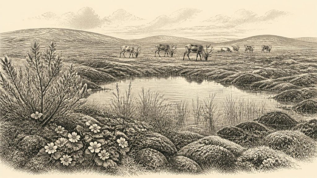
Derryvree’s fossils portray neither the green, wooded island familiar today nor a featureless wilderness of permanent snow. The deposit has yielded evidence of cold-adapted, open vegetation and freshwater conditions. Plant remains and pollen include mountain avens, Arctic willow, sedges, mosses and aquatic species such as bogbean and alternate water-milfoil. These are the traces from which researchers reconstruct a periglacial muskeg: a waterlogged, peaty or silty wetland with pools and saturated ground, set in a cold landscape affected by frost action.
“Tundra” is a useful shorthand, provided it is not mistaken for a claim that every acre of Ireland looked identical. The evidence supports sparse, largely treeless cover around this Fermanagh basin, with low plants able to tolerate short growing seasons and severe winters. It also indicates liquid water in at least part of the year. Local relief, drainage, exposure to wind and the proximity of ice could have created marked variation over short distances. Sheltered hollows may have held wetter vegetation, while stonier or wind-scoured ground carried a thinner cover. The Derryvree layer is therefore a local archive with regional importance, not a map of the entire island.
The broader climatic setting was unstable. MIS 3, conventionally extending from about 60,000 to 27,000 years ago, contained repeated abrupt shifts between colder stadials and comparatively milder interstadials across the North Atlantic world. Ireland lay on its north-western margin, where Atlantic moisture, sea ice, glaciers and changing ocean circulation mattered greatly. A relatively favourable interval did not mean a mild modern climate; it meant a temporary opening of habitable ground within a generally cold Ice Age. Such openings could contract quickly as snowfields expanded, drainage changed and ice returned.
Ice, Water and Regional Change
Older accounts often treated the last Irish glaciation as one simple advance followed by one retreat. Current research gives a more complicated picture. The British–Irish Ice Sheet grew and changed over the last cold stage, and evidence suggests dynamic advance-and-retreat phases during MIS 3 before the better-dated maximum expansion of the Last Glacial Maximum, after about 30,000 years ago. The two tills enclosing the Derryvree silts are physical evidence that glacial conditions came before and after the freshwater episode at that site.
It would nevertheless be wrong to say that all Ireland was ice-free in 31,367 BCE, or that the island was uniformly ice-covered. Directly dated glacial deposits for this earlier period remain scarce, and later ice repeatedly eroded or buried much of the evidence. The responsible conclusion is narrower: north-central Ireland included ice-free ground during the broad Derryvree interval, while the scale, timing and margins of ice elsewhere remain matters of reconstruction. Low global sea levels exposed more continental shelf than today, but local sea level was also affected by the weight of nearby ice depressing the land. Whether animals or people crossed particular routes cannot be settled by a simple land-bridge story.
Animals at the Edge of Europe
Caves in southern Ireland provide another, very different, source of evidence. Castlepook Cave near Doneraile in north Cork has produced remains attributed to a striking Late Pleistocene fauna, including reindeer, woolly mammoth, spotted hyaena, wolf, brown bear, Arctic fox, hare, lemmings and giant deer. The cave was used or entered at different times, however, and its old collections and disturbed deposits do not represent one living herd or one single landscape. Modern re-dating has also shown that some earlier radiocarbon results on Irish cave bones were seriously too young, demonstrating why each specimen and its context must be re-examined.
Even with those reservations, the animal evidence transforms the scale of the Irish story. Reindeer point to open country and mobile grazing resources; hyaenas and wolves show that large carcasses were contested by predators and scavengers; small mammals help indicate cold environmental conditions. Mammoth and giant deer are especially evocative, but their presence must not be used to create an imagined parade of Ice Age animals across every Irish valley. Fossils establish that species reached Ireland during suitable phases. They do not reveal the exact routes, seasons, population sizes or the duration of their local survival.
The Castlepook Human Question
A reindeer femur from Castlepook has given this period exceptional archaeological importance. It has been publicly described as carrying a deep mark consistent with the cutting or chopping of fresh tissue by a sharp stone implement, and as dating to roughly 33,000 years ago. If microscopic study and contextual reassessment ultimately sustain that interpretation, it would be evidence that one or more Upper Palaeolithic people processed a reindeer in Ireland during the wider interval represented here. It would push human activity on the island far earlier than the well-established evidence for later post-glacial settlement.
Yet the claim must remain precisely worded. A marked bone is not an excavated camp, a house, a burial ground or proof of a permanent population. Castlepook has not yielded a securely associated stone-tool assemblage, hearth, shelter floor or sequence from which a named cultural tradition can be assigned. Nor can one incision tell us whether visitors arrived once, seasonally or across many generations. The bone is a promising and consequential trace; it is not a licence to write a continuous human history of Ice Age Ireland.
Life Beyond the Evidence
If people did reach Ireland around this horizon, comparison with Upper Palaeolithic communities elsewhere in north-west Europe makes mobile hunting and carcass processing plausible. Such groups elsewhere made sophisticated stone tools, managed clothing and shelter in cold climates, and maintained social connections across large territories. That comparison supplies possibilities, not direct Irish facts. Ireland has no securely dated campsite from this time from which to describe meals, family structure, toolmaking routines or seasonal movements. The most defensible economic observation is that animal resources and favourable wetland margins would have mattered to any visitor, human or non-human.
There is no evidence for political communities, chiefs, territory, warfare, diplomacy, trade networks, formal religion, language or artistic traditions in Ireland at this date. This is not because people, if present, necessarily lacked social lives, beliefs or knowledge. It is because the island has not preserved evidence by which those matters can be distinguished responsibly. Cave deposits and wetland silts preserve plants, bones and sediments far more readily than spoken stories, ritual acts or relationships. The absence of proof should be reported as an evidential limit, not filled with modern assumptions.
The most important development around 31,367 BCE was therefore environmental opportunity amid instability. Derryvree records an interval when a cold freshwater wetland existed between glacial episodes. Castlepook shows that Ice Age animals reached southern Ireland, while one reindeer bone raises the serious but unresolved possibility of human activity. Together they reveal an Ireland not yet a historical society and not even securely a permanently inhabited one, but a changing northern landscape in which water, vegetation, ice and animal movement set the conditions from which the much later human history of the island would emerge.
Primary Sources
- A Middle Midlandian Freshwater Series at Derryvree, Maguiresbridge, County Fermanagh, Northern Ireland
- A Reconsideration of the Radiocarbon Dating of the Marine Isotope Stage 3 Fauna from Southern Ireland
- The Timing and Magnitude of the British–Irish Ice Sheet Between Marine Isotope Stages 5d and 2: Implications for Glacio-Isostatic Adjustment, High Relative Sea Levels and ‘Giant Erratic’ Emplacement
- The IntCal20 Northern Hemisphere Radiocarbon Age Calibration Curve (0–55 cal kBP)
- Trimlines, Blockfields and the Vertical Extent of the Last Ice Sheet in Southern Ireland
- New Insights on the Fauna of Ireland’s Younger Dryas and Early Holocene from Alice & Gwendoline Cave
- The Irish Quaternary Fauna Project
- Phylogeographic, Ancient DNA, Fossil and Morphometric Analyses Reveal Ancient and Modern Introductions of a Large Mammal: The Complex Case of Red Deer (Cervus elaphus) in Ireland
- Figure 6.— The Subdivision of the Quaternary Period in Ireland
- Quaternary History of Fermanagh
- The Island of Ireland: Drowning the Myth of an Irish Land-Bridge?
- The Problem of a Late Quaternary Landbridge Between Britain and Ireland
- The Nature of MIS 3 Stadial–Interstadial Transitions in Europe: New Insights from Model–Data Comparisons
- How Did Marine Isotope Stage 3 and Last Glacial Maximum Climates Differ? – Perspectives from Equilibrium Simulations
- BSBI: Myriophyllum alterniflorum
- BSBI: Menyanthes trifoliata
- BSBI: Salix herbacea
- Heritage Artefacts of County Cork
- Archaeological Heritage of County Cork
- 2022:564 – Castlepook Cave, Castlepook South, Cork
- Archaeology Research Excavation Grant 2022: Final Report
- The Mammoth Caves of Castlepook, Near Doneraile