Derryvree’s Mossland Clock31368 BCE
31,368 BCE is not recoverable as a specific Irish year, but falls within unstable MIS 3 during the last Ice Age. Derryvree, County Fermanagh, provides the best environmental archive: freshwater silts between glacial tills indicate an ice-free interval with cold, treeless, moss-rich wetland supporting grasses, sedges, herbs and aquatic plants. Ireland was approaching major ice-sheet expansion, amid variable climate and uncertain coastal connections. Cave evidence shows intermittent cold-stage fauna, though assemblages cannot date species precisely. Possible butchery on a Castlepook reindeer bone suggests debated early human activity, not settlement. Environmental evidence, rather than political or cultural history, defines this period.

Dateline
31,368 BCE cannot be treated as a recoverable year in Irish history. No written calendar, settlement sequence or dated event lets us say what happened in that particular year. The number is instead a modern point within deep time: approximately 33,318 years before 1950, the conventional reference point for radiocarbon chronology. It falls within the later part of the Pleistocene, during Marine Isotope Stage 3 (MIS 3), a long and climatically unstable phase of the last Ice Age. For Ireland, the responsible history of this moment is therefore not a chronicle of rulers or battles, but an account of ice, water, plants, animals and the very limited traces that may bear on human presence.
The closest useful Irish chronological anchor is not an annual record but the freshwater deposit exposed at Derryvree, near Maguiresbridge in County Fermanagh. In 1969, a road cutting through a drumlin revealed organic silts and fine sands trapped between two separate sheets of glacial till. The deposit produced the conventional radiocarbon result BIRM-166, 30,500 radiocarbon years BP, with a large uncertainty. Later calibration places it broadly at about 36,900–31,700 calibrated years BP. The modern label 31,368 BCE lies inside that wide range. This does not date the formation to the named year; it means that Derryvree is the best local archive through which to envisage a portion of Ireland’s environment around it.
A Landscape Between Ice Advances
Derryvree’s sequence has a simple but important stratigraphic message. An earlier glacier laid down the lower till. Afterwards, at least locally, ice-free ground supported standing or slow-moving freshwater, sediment accumulated, and plants and small animals lived around it. A renewed glacier later overrode or buried the deposit beneath the upper till. This is strong evidence for change through time, but it is not a complete map of the island. The Fermanagh drumlin records one protected locality, not the exact limits of every ice margin, nor a uniform climate from Cork to Donegal.
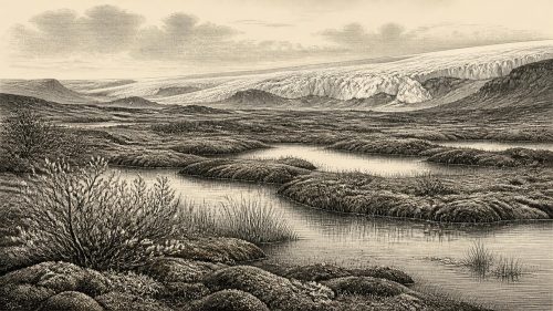
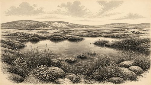
Even so, the deposit rules out an image of Ireland as continuously and wholly smothered by ice throughout this part of the last glacial cycle. Its fossil content indicates an open, treeless and cold periglacial landscape, often described as tundra or muskeg-like wetland. Grasses and sedges were important. Juniper and herbs occurred, while a rich moss flora accompanied aquatic or wet-ground plants. The preserved evidence includes bogbean (Menyanthes trifoliata), alternate water-milfoil (Myriophyllum alterniflorum), mountain avens (Dryas octopetala) and alpine clubmoss (Selaginella selaginoides). These remains establish local habitat: shallow water, wet sediment, open vegetation and seasons sufficiently favourable for plant growth. They do not establish a modern-style continuous bog, an exact temperature, or a neat annual cycle.
This cold landscape should not be mistaken for lifelessness. Freshwater organisms, mosses and vascular plants require ecological opportunity, while organic mud accumulated only where erosion and freezing did not erase every trace. Yet it was a severe world. Trees were absent locally, and the combination of frost-sensitive sediments, sparse vegetation and tundra taxa points to ground repeatedly affected by cold. The phrase ‘periglacial’ is useful here: it describes landscapes shaped by intense freezing and thawing near ice masses, rather than asserting that the Derryvree pool itself lay beside a visible glacier in 31,368 BCE.
Ice, Climate and an Uncertain Coastline
Ireland was then part of the wider British–Irish ice-sheet system, but the growth of that system was neither simultaneous nor simple. Modern reconstructions place a major phase of ice-sheet build-up between roughly 31,000 and 26,000 years BP, followed by differing regional advances, retreats and changes in flow. By about 28,000 years BP, models suggest that Ireland was almost wholly ice-covered; its most extensive and voluminous phases came later still. At the date represented by this article, therefore, the island was approaching rather than necessarily already experiencing that later near-complete ice cover. Derryvree’s inter-till freshwater archive is especially valuable precisely because evidence for these earlier phases is sparse and later glaciers destroyed much of it.
The wider North Atlantic climate changed abruptly on millennial and sometimes shorter scales during MIS 3. Greenland ice cores show repeated shifts between colder stadials and warmer interstadials, but those events are defined in Greenland; they cannot simply be pasted unchanged onto an Irish roadside exposure. Crag Cave in County Kerry provides a complementary Irish signal. There, episodes of calcite growth in the last glacial period show that liquid water could periodically move through shallow cave systems during milder intervals. Such evidence supports climatic variability across Ireland, while Derryvree supplies the more direct picture of a cold freshwater habitat in Fermanagh. Neither archive supplies weather for a chosen calendar year.
Sea level was lower globally because great quantities of water were held in northern ice sheets, and the shelves surrounding Ireland were very different from today. But no confident political-style boundary can be drawn across this changing geography. Whether a continuous land route linked Ireland and Britain at particular times has long been debated. Older work found no likely southern or central Irish Sea land bridge and allowed, at most, a discontinuous northern connection much later in the glacial cycle. More recent work stresses shifting ice, sea level and exposed shelf landscapes. The prudent conclusion for 31,368 BCE is that animal movement and perhaps human movement were conditioned by a changing maritime and glacial frontier, not that Ireland can confidently be called either securely joined to Britain or securely isolated.
Animals and the Human Question
Caves in southern Ireland, above all Castlepook Cave near Doneraile in north Cork, preserve a striking but complicated Pleistocene fauna. Redating has shown that some bones formerly assigned younger ages belong to MIS 3. The broader cave record includes reindeer, woolly mammoth, giant deer, brown bear, wolf, Arctic fox, mountain hare, lemmings and spotted hyaena. It would be wrong, however, to place every species in one herd or one moment. Cave deposits may combine remains accumulated over many thousands of years, brought in by carnivores, water, collapse, excavation disturbance and human collectors. The assemblages demonstrate that Ireland intermittently belonged to the north-western margin of a wider cold-stage European fauna; they do not yield a census for 31,368 BCE.
A newly reported sedimentary ancient-DNA study from Castlepook strengthens the case for faunal connections between Ireland and Eurasia before the Last Glacial Maximum, detecting a wider range of taxa than bone alone reveals. It is an important result, but it remains a 2026 preprint and should be treated accordingly. Its chief value is methodological as well as historical: sediments can retain biological traces where recognisable bones are scarce, yet DNA cannot by itself reconstruct a route, season or human journey.
The greatest archaeological uncertainty concerns a reindeer femur from Castlepook. Re-examination identified a mark interpreted as possible stone-tool butchery, and public reports associated the bone with an age of roughly 33,000 years ago. If that interpretation is sustained, it would indicate a remarkably early, fleeting episode of Upper Palaeolithic human activity in Ireland. It would not establish a population, village or permanent colonisation. A date on an animal bone determines when the animal lived within an uncertainty range; identifying a surface groove as a deliberate cut requires a separate taphonomic judgement. No securely contemporary house, hearth, lithic assemblage, human bone or repeated occupation surface has yet been established in Ireland for this period.
What Cannot Be Reconstructed
Political affairs, diplomacy and organised warfare are beyond the evidence. There are no named communities, chiefs, territories, alliances or conflicts. Likewise, there is no Irish evidence from this date for religious buildings, graves, figurative art, teaching places, exchange networks or managed agriculture. Reindeer and other animals could have provided meat, hide, sinew, bone and antler to any people present, as they did for Upper Palaeolithic communities elsewhere in Europe, but applying that general European pattern to Ireland would be interpretation rather than evidence. There is no basis for claiming trade in stone, regular hunting territories or seasonal camps on the island.
That absence is historically meaningful. Later Irish prehistory is rich in houses, tools, tombs, fields and monuments; 31,368 BCE belongs to a far earlier and much more fragile record. The dominant development was environmental: a cold, mostly open landscape in which water persisted at Derryvree between separate glacial episodes, while animal populations reached or survived in parts of Ireland under shifting conditions. Any human presence was, at present, no more than a plausible and intensely debated trace at the edge of the archaeological record.
For this point in time, then, Derryvree’s moss-rich mud is more informative than any imagined human story. It records an Ireland capable of supporting wetland life during the unstable last Ice Age, before later ice advanced across much of the island and remade its surface. The deposit is not a diary of 31,368 BCE. It is something rarer and more useful: physical evidence that this deep past contained intervals of water, vegetation and ecological possibility beneath the long shadow of advancing ice.
Primary Sources
- A Middle Midlandian Freshwater Series at Derryvree, Maguiresbridge, County Fermanagh, Northern Ireland
- Growth and Retreat of the Last British–Irish Ice Sheet, 31,000 to 15,000 Years Ago: the BRITICE-CHRONO Reconstruction
- Growth and Retreat of the Last British–Irish Ice Sheet, 31 000 to 15 000 Years Ago: the BRITICE-CHRONO Reconstruction
- Exploring Controls of the Early and Stepped Deglaciation on the Western Margin of the British-Irish Ice Sheet
- A Reconsideration of the Radiocarbon Dating of the Marine Isotope Stage 3 Fauna from Southern Ireland
- New Insights on the Fauna of Ireland's Younger Dryas and Early Holocene from Alice & Gwendoline Cave
- Episodic Speleothem Deposition Tracks the Terrestrial Impact of Millennial-Scale Last Glacial Climate Variability in SW Ireland
- Sedimentary Ancient DNA Reveals Late Pleistocene Faunal Connectivity Between Ireland and Eurasia
- The Problem of a Late Quaternary Landbridge Between Britain and Ireland
- Stratigraphic and Palaeo-Geomorphological Evidence for the Glacial-Deglacial History of the Last British-Irish Ice Sheet in the North-Western Irish Sea
- Character of Advance and Retreat of the Southwest Sector of the British-Irish Ice Sheet During the Last Glaciation
- Extent and Timing of the Last Glacial Maximum (LGM) in Britain and Ireland: a Review
- A Stratigraphic Framework for Abrupt Climatic Changes During the Last Glacial Period Based on Three Synchronized Greenland Ice-Core Records: Refining and Extending the INTIMATE Event Stratigraphy
- The Quaternary of South Fermanagh and North Monaghan
- The Quaternary of Ireland: a Field Guide
- Quaternary Site Descriptions
- BSBI: Menyanthes trifoliata
- BSBI: Dryas octopetala
- BSBI: Selaginella selaginoides
- BSBI: Myriophyllum alterniflorum
- Deglaciation Chronology of the Donegal Ice Centre, Northwest Ireland
- Dimensions and Chronology of the Last Ice Sheet in Western Ireland