Derryvree Seed31254 BCE
31,254 BCE is a modern label within MIS 3, not a recorded Irish year. At Derryvree, County Fermanagh, organic freshwater silts between glacial tills, radiocarbon dated broadly to 36,900–31,700 calibrated years before present, show an ice-free local basin before later glaciation. Pollen, plants, insects and a bogbean seed indicate open, treeless tundra wetland with pools, sedges, herbs, juniper and mosses. Southern cave deposits at Castlepook document mammoths, deer, reindeer, predators and cold-adapted mammals, though not contemporaneous individuals. A possibly cut-marked reindeer bone suggests transient Upper Palaeolithic human presence, but lacks secure contextual evidence. Later ice destroyed and sealed this archive.
Dateline
A Modern Date, Not an Ancient Year
“31,254 BCE” is a modern chronological label, not a year that anyone then living in Ireland could have named, counted or recorded. There were no written calendars, rulers, communities identifiable by name, or dated events from the island at this depth of time. In simple calendar arithmetic, the label lies about 33,200 years before 1950, within the later part of the Late Pleistocene and broadly within Marine Isotope Stage 3 (MIS 3), an unstable interval of the last Ice Age. Archaeology cannot responsibly reconstruct a particular spring, hunt or political occurrence for this nominal year. It can, however, assemble a careful picture of Irish environments and animal life from deposits whose broad age ranges encompass it.
The most useful evidence is not a monument or settlement but a small, waterlogged survival from County Fermanagh: organic freshwater sediments discovered at Derryvree, near Maguiresbridge. Road works in 1969 cut through a drumlin and revealed fine sands and organic silts trapped between two sheets of glacial till. Their order matters. The lower till records an earlier episode of ice cover; the organic bed records a subsequent interval in which water, plants and insects could occupy the locality; the upper till shows that ice later returned and sealed much of the evidence. This is a landscape archive, rather than a historical chronicle.
A conventional radiocarbon determination from the Derryvree organic bed, Birm-166, was reported as 30,500 radiocarbon years before present, with an uncertainty of roughly +1,170 and −1,030 years. Radiocarbon years are not calendar years: “present” is fixed at 1950, and changing atmospheric carbon means results require calibration. Discussed against modern calibration curves, the determination produces a very broad range of approximately 36,900–31,700 calibrated years before present. The numerical point represented by 31,254 BCE falls within that interval, but the range is emphatically not a date for a single event. It dates the formation of sampled organic material within a deposit accumulated over time.
Water Between the Ice Sheets
Derryvree provides strong evidence that this part of Fermanagh was ice-free when the freshwater sediments formed. It does not prove that all Ireland was similarly free of ice on the same day, decade or century. Ice cover during MIS 3 was regionally variable and repeatedly changing. The British–Irish Ice Sheet reached its best-established maximum much later, around 27,000–23,000 calibrated years before present, when Ireland and much of its continental shelf were ice-covered. At the earlier date considered here, the surviving Irish record instead points to a complex geography of local ice advances, cold ice-free terrain and wet basins.
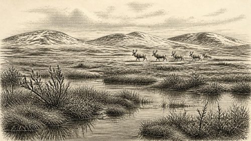
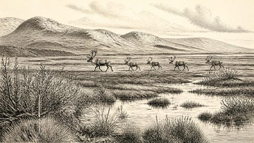
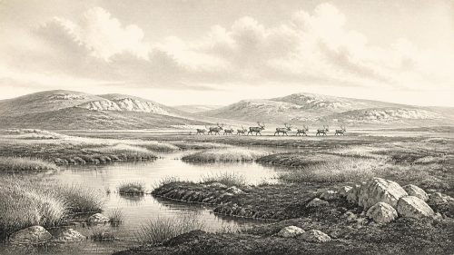
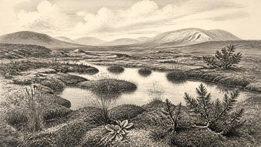
The landscape around Derryvree was not the wooded Ireland familiar today. Pollen, plant macrofossils and insect evidence indicate open, treeless ground with grasses, sedges, herbs, juniper and a specialised moss flora. Researchers have described it as tundra or a muskeg-like wetland: saturated ground, shallow pools, plant-rich margins and mossy hollows set within a cold periglacial environment. The detail is important. “Tundra” should not conjure a featureless snowfield. The organic bed records liquid freshwater, aquatic and wetland vegetation, and seasonal ecological productivity, although within a harsh climate marked by cold winters, short growing seasons and frost-affected soils.
One particularly evocative find is a seed of bogbean, Menyanthes trifoliata, a plant of pools, fens and wet margins. Its recovery confirms that suitable freshwater habitat existed locally. Other identified remains, including mountain avens and cold-adapted mosses, reinforce the picture of an open northern environment. Yet evidence must be read at its proper scale. A pollen grain can travel far on the wind or be redeposited; sparse tree pollen does not demonstrate a nearby forest. Likewise, a wetland deposit tells us most directly about its own catchment, not every Irish coast, upland or valley. The responsible reconstruction is therefore of a local cold freshwater mosaic, not of a uniform island-wide scene.
Animals on a Cold Island
Fermanagh’s plant bed is complemented by cave faunas from southern Ireland, especially Castlepook Cave, also called Mammoth Cave or Doneraile Cave, in north County Cork. Castlepook is Ireland’s richest known archive for vertebrates living before the Last Glacial Maximum. Its finds include woolly mammoth, giant deer, reindeer, brown bear, spotted hyaena, wolf, Arctic fox, red fox, mountain hare and both collared and Norwegian lemmings. Not every bone derives from precisely the same moment: cave deposits were accumulated, disturbed by water and excavated in stages during the early twentieth century. Direct dating has nevertheless demonstrated that parts of the assemblage belong to MIS 3, with individual bones spanning a long period before and into the later Ice Age.
These animals make the Derryvree landscape easier to imagine, but they should not be mechanically placed beside its pool on the exact nominal date. The evidence supports a broader conclusion: at intervals during this cold phase Ireland could sustain a varied community of large herbivores, smaller cold-adapted mammals and formidable predators. Reindeer and giant deer would have found browse and herb-rich open ground; mammoths indicate access to extensive grazing landscapes somewhere within their ranges. Hyaenas are especially significant because caves often became repositories of bones through carnivore activity as well as through natural transport. A bone in a cave is not automatically evidence of a human meal or a human home.
There is no basis for imagining farms, permanent villages or a settled population at Derryvree. No house floors, hearths, fields, burials, tool-making sites or food stores of this age have been securely identified in Ireland. Human political affairs, diplomacy, organised warfare, law and institutions are therefore beyond the evidence. So too are claims about religion, language, artistic traditions or long-distance trade. The deepest history of Ireland at this point is ecological and geological, and its protagonists are ice, water, plants and animals rather than named people.
The Castlepook Human Question
There is, however, one potentially momentous qualification. A reindeer femur from Castlepook has been interpreted as carrying a deep cut or chop made on fresh bone by a sharp stone implement. The bone has been publicly associated with an age around 33,000 years ago. If the mark is confirmed as humanly made, it would indicate that one or more Upper Palaeolithic people processed a reindeer in Ireland during a broad period relevant to 31,254 BCE. Such an act might have involved scavenging, hunting or the butchery of an animal obtained by unknown means. It would not, by itself, establish permanent occupation.
The caution is not pedantry but the heart of the issue. Castlepook’s crucial material comes from old excavations and from deposits affected by water and animal activity. There is no securely associated stone-tool assemblage, hearth, dwelling surface, human skeleton or repeated occupational sequence of comparable MIS 3 age. Dating establishes the age of the animal bone, while identifying a surface modification as a stone-tool mark is a separate taphonomic judgement. Renewed survey and excavation have located surviving Pleistocene deposits in parts of the cave, offering the possibility that future work may improve the context. For now, the femur is a serious but limited clue to transient human presence, not evidence for an Irish society.
That distinction also shapes any discussion of economy. If people did reach Ireland in this period, their subsistence would most plausibly have depended on highly mobile foraging, with animal carcasses offering meat, fat, hides, sinew and bone. But that is an inference from the possible cut-marked femur and wider Upper Palaeolithic practice, not a directly documented Irish economy. There is no evidence here for exchange networks, managed herds, cultivation, metallurgy or maritime commerce. Nor can the available record establish the route by which any visitor arrived, whether by a changing coastal corridor, a crossing from Britain, or another path through a landscape later transformed by sea-level change and glaciation.
What the Buried Wetland Preserves
Derryvree’s importance lies partly in what happened afterwards. Later ice advanced across the region, reshaping terrain and removing or burying many older land surfaces. That destructive power helps explain why Ireland’s pre-Last Glacial Maximum archaeological record is so sparse compared with Britain’s. Yet at Derryvree the upper till also acted as a seal. Beneath a drumlin in Fermanagh, the silts retained traces of pools, sedges, mosses, insects and a bogbean seed from an otherwise vanishing world.
For Ireland around this notional date, then, the most defensible account is one of cold environmental opportunity amid instability. In at least one northern basin, open wet tundra supported freshwater life between episodes of glaciation. Elsewhere, especially in the limestone caves of the south, a varied Ice Age fauna demonstrates that large mammals and predators reached the island during MIS 3. The possibility of a brief human visit at Castlepook remains important, but unproven as evidence of settlement. No ancient person could have recognised “31,254 BCE”; the date is our own grid laid over a vast span. The real testimony comes from the sediment: water lingered, bogbean grew, animals moved through open country, and later ice concealed the fragile record.
Source References
Hover over a number to see the source. Select it to open the source.

- [1] A Middle Midlandian Freshwater Series at Derryvree, Maguirebridge, County Fermanagh, Northern Ireland
- [2] A Reconsideration of the Radiocarbon Dating of the Marine Isotope Stage 3 Fauna from Southern Ireland
- [3] The Irish Quaternary Fauna Project
- [4] New Insights on the Fauna of Ireland’s Younger Dryas and Early Holocene from Alice & Gwendoline Cave
- [5] Castlepook Cave: Cork County Geological Site Report
- [6] The Exploration of Castlepook Cave, Co. Cork
- [7] Irish Pleistocene Biostratigraphy
- [8] Figure 6.— The Subdivision of the Quaternary Period in Ireland
- [9] Growth and Retreat of the Last British-Irish Ice Sheet, 31 000 to 15 000 Years Ago: The Irish Sea and Malin Sea Ice Stream Sectors
- [10] New Data for the Last Glacial Maximum in Great Britain and Ireland
- [11] Maximum Extent and Dynamic Behaviour of the Last British–Irish Ice Sheet West of Ireland
- [12] Vertical Dimensions and Age of the Wicklow Mountains Ice Dome, Eastern Ireland, and Implications for the Extent of the Last Irish Ice Sheet
- [13] Ireland: Submerged Prehistoric Sites and Landscapes
- [14] The IntCal20 Northern Hemisphere Radiocarbon Age Calibration Curve (0–55 cal kBP)
- [15] Radiocarbon Calibration
- [16] OxCal
- [17] Methods: Oxford Radiocarbon Accelerator Unit
- [18] Menyanthes trifoliata L. (Bogbean)
- [19] Dryas octopetala L. (Mountain Avens)
- [20] Deposits of the Last Glaciation
- [21] Introduction to the Glacial Sand and Gravel Landscapes of Northern Ireland
- [22] Occurrence of Mammalia Relicts at Site Castlepook Cave
- [23] 2022:564 – Castlepook Cave, Castlepook South, Cork
- [24] British–Irish Ice Sheet and Polar Front History of the Goban Spur, Offshore Southwest Ireland Over the Last 250,000 Years
Primary Sources
- A Middle Midlandian Freshwater Series at Derryvree, Maguirebridge, County Fermanagh, Northern Ireland
- A Reconsideration of the Radiocarbon Dating of the Marine Isotope Stage 3 Fauna from Southern Ireland
- The Irish Quaternary Fauna Project
- New Insights on the Fauna of Ireland’s Younger Dryas and Early Holocene from Alice & Gwendoline Cave
- Castlepook Cave: Cork County Geological Site Report
- The Exploration of Castlepook Cave, Co. Cork
- Irish Pleistocene Biostratigraphy
- Figure 6.— The Subdivision of the Quaternary Period in Ireland
- Growth and Retreat of the Last British-Irish Ice Sheet, 31 000 to 15 000 Years Ago: The Irish Sea and Malin Sea Ice Stream Sectors
- New Data for the Last Glacial Maximum in Great Britain and Ireland
- Maximum Extent and Dynamic Behaviour of the Last British–Irish Ice Sheet West of Ireland
- Vertical Dimensions and Age of the Wicklow Mountains Ice Dome, Eastern Ireland, and Implications for the Extent of the Last Irish Ice Sheet
- Ireland: Submerged Prehistoric Sites and Landscapes
- The IntCal20 Northern Hemisphere Radiocarbon Age Calibration Curve (0–55 cal kBP)
- Radiocarbon Calibration
- OxCal
- Methods: Oxford Radiocarbon Accelerator Unit
- Menyanthes trifoliata L. (Bogbean)
- Dryas octopetala L. (Mountain Avens)
- Deposits of the Last Glaciation
- Introduction to the Glacial Sand and Gravel Landscapes of Northern Ireland
- Occurrence of Mammalia Relicts at Site Castlepook Cave
- 2022:564 – Castlepook Cave, Castlepook South, Cork
- British–Irish Ice Sheet and Polar Front History of the Goban Spur, Offshore Southwest Ireland Over the Last 250,000 Years