Aquatic Mosses31211 BCE
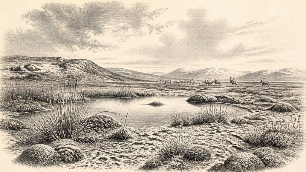
Labelled retrospectively as 31,211 BCE, this period belongs to Marine Isotope Stage 3, when Ireland’s ice-age environment changed repeatedly and cannot be reconstructed as a calendar moment. Derryvree, County Fermanagh, preserves silts between tills, revealing treeless tundra wetlands with mosses, sedges and freshwater plants before renewed glaciation. Castlepook Cave, County Cork, contains remains of reindeer, mammoth, giant deer and predators. A modified reindeer femur may indicate human carcass processing, but no settlement evidence confirms occupation. Ireland offered precarious habitats for mobile visitors, while shifting ice, sea levels and terrain restricted access. The evidence remains fragmentary, distinguishing demonstrated ecology from inference.
Dateline
31,211 BCE is a modern retrospective label, not a date that can be recovered with calendar-year precision from Irish deposits. In archaeological convention it lies about 33,160 years before AD 1950, within the Late Pleistocene and broadly within Marine Isotope Stage 3. For Ireland at this depth of time, the responsible scale is not a particular day, season or even necessarily a single human generation, but calibrated ranges and environmental phases extending across centuries or millennia. Radiocarbon ages require calibration, and calibration itself is revised as the underlying curve improves. The evidence for this part of Irish history is therefore fragmentary: cave bones, buried silts, pollen, seeds, mosses, landforms and the changing record of ice.
There was no Ireland in any political or cultural sense recognisable from later history. No names, languages, communities, territories, monuments, settlements or graves can be assigned to this point. Indeed, there is no secure archaeological settlement of this date. What can be reconstructed is a physically severe and changeable island landscape, and the narrow evidential basis for asking whether people may have visited it during an earlier phase of the last Ice Age.
A Landscape Before the Glacial Maximum
This was not yet the Last Glacial Maximum, the interval when the British-Irish Ice Sheet reached its greatest late-glacial extent, conventionally placed broadly between about 28,200 and 20,400 calibrated years before present. Yet Ireland was already part of an ice-age world in which glaciers and ice sheets repeatedly expanded and contracted. Research on the western Irish margin indicates substantial ice loading and major fluctuations before the eventual maximum. The precise outline of ice, coast and exposed land at 31,211 BCE remains uncertain, and it would be wrong to draw a single confident map of the whole island for this nominal year.
That uncertainty matters. Older accounts sometimes described Ice Age Ireland as either simply ice-covered or simply a land bridge waiting to be crossed. Neither formula is adequate. Ice margins moved; relative sea level responded both to global water storage and to the weight of nearby ice; and marine channels could remain formidable even when global sea level was low. At most, the evidence permits the cautious conclusion that movements between Ireland, Britain and the wider north-west European landmass were governed by a shifting mixture of sea, ice, exposed shelf and difficult periglacial terrain. A particular route used by people cannot presently be demonstrated.
The Derryvree Record
The most illuminating Irish evidence for the environmental world near this broad period comes from Derryvree, near Maguiresbridge in County Fermanagh. Road works in 1969 exposed a drumlin containing freshwater silts and fine sands between two tills: deposits laid down in a non-glacial interval and then sealed beneath later ice-derived sediment. The organic layer produced a conventional radiocarbon result of 30,500 +1,170/−1,030 BP. That is a radiocarbon determination rather than a calendar date, and it does not identify 31,211 BCE as an exact moment. Nonetheless, it places the deposit firmly in the late part of the Ice Age and makes it an exceptional Irish archive for conditions preceding renewed, more extensive glaciation.
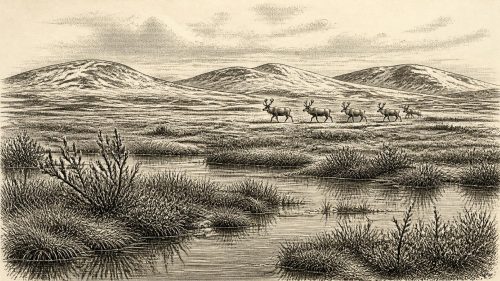
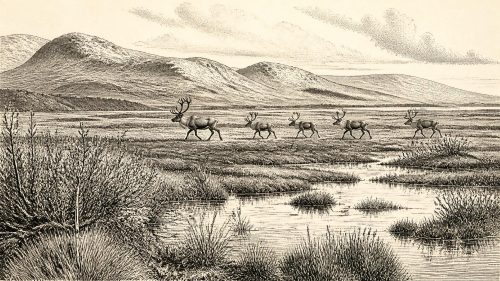
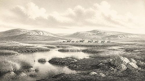
Derryvree’s pollen, plant macrofossils and small-animal evidence describe an open, treeless and periglacial landscape. Herb pollen predominates, while the plant remains include mosses adapted to cold, wet ground. A seed of bogbean, Menyanthes trifoliata, is particularly telling: it indicates freshwater or marshy conditions at the edge of a pool or wet hollow. This was not a forest, a meadow or a modern blanket bog. It was a patchy tundra wetland, with water and saturated sediment in sheltered ground but sparse vegetation over much of the surrounding terrain. Occasional tree pollen is not proof of local woodland; such grains can travel far or be redeposited.
The Derryvree sediments are evidence for a local habitat, not a weather report for every part of Ireland. Their importance lies in showing that ice-age Ireland could contain ecological mosaics: shallow freshwater, sedge-rich margins, mossy ground and open mineral soils, all within a cold climate. Such places may have offered seasonal forage for grazing animals and scavenging opportunities for predators. They also demonstrate that the later ice sheet did not erase every earlier trace. Paradoxically, the sediments survived because they were buried and sealed by the very glacial processes that transformed the landscape above them.
Cork’s Cave Fauna and the Human Question
Castlepook Cave near Doneraile in north County Cork supplies a different kind of evidence. Its collections and surviving deposits have yielded an Ice Age fauna including reindeer, woolly mammoth, giant deer, brown bear, spotted hyaena, foxes, wolves and lemmings. The list should not be treated as a census of animals living together on one day. Cave deposits can accumulate over long periods, and bones may be carried in by predators, water, gravity or people; early excavations also recorded material less precisely than modern fieldwork requires. Recent redating has shown that some earlier cave dates were substantially too young, making the Castlepook sequence both more significant and more complicated.
A reindeer femur from the cave is central to discussion of a possible much earlier human presence in Ireland. The bone has been reported as bearing a deep linear modification interpreted as a cut or chopping mark made with a sharp stone implement while the carcass was fresh. If that diagnosis is sustained, it would indicate carcass processing by people during Marine Isotope Stage 3, long before Ireland’s later, securely evidenced hunter-gatherer settlement. But a marked bone is not a campsite. No associated stone-tool assemblage, hearth, dwelling floor, grave or repeated cultural layer has yet been recovered from Castlepook to establish the size, identity, duration or regularity of any human visit.
The careful conclusion is therefore limited but important. Ireland possessed habitats capable of supporting cold-adapted animals, and there is a plausible, still scrutinised indication that people may have briefly reached the island during this earlier Ice Age phase. It does not prove permanent occupation, a population descended from later Irish communities, or an organised hunting territory. The better-established Upper Palaeolithic evidence from Alice and Gwendoline Cave, County Clare, is much later: a butchered brown-bear patella has calibrated dates of 12,810–12,590 and 12,810–12,685 cal BP. That contrast shows how extraordinary the Castlepook claim is, and why it must be held to a high evidential standard.
Life, Society and What Cannot Be Known
If visitors did reach Ireland around this broad period, they would have depended on mobility, detailed knowledge of animal behaviour and the ability to use stone, hide, wood and fire in a cold landscape. Those are reasonable inferences from Upper Palaeolithic lifeways elsewhere in north-west Europe, not observations made from an Irish camp. There is no Irish evidence at this date for houses, clothing, boats, food-sharing arrangements, family structure or seasonal rounds. Reindeer could have been hunted, scavenged or encountered as carcasses; the Castlepook femur alone cannot decide between a planned hunt and the processing of an already dead animal.
Nor can religion, art, learning or cultural affiliation be responsibly reconstructed for Ireland. Contemporary Upper Palaeolithic groups elsewhere in Europe made sophisticated tools, ornaments and images, and the Paviland burial in south Wales shows that people were present in the neighbouring region during this broad era. Such comparisons establish possibility, not Irish fact. Nothing from Derryvree or Castlepook warrants claims about ritual, beliefs, ethnic identity, diplomacy, warfare or trade across the Irish Sea. The political history of Ireland at 31,211 BCE is therefore not hidden; it is absent from the surviving evidence.
An Island of Ecological Opportunity and Risk
The most important development was environmental rather than institutional. Ireland was being shaped by repeated swings between ice advance, open tundra conditions and short-lived habitable refuges. Wetlands such as Derryvree preserved freshwater life amid a cold, largely treeless setting. Cave archives in Cork retained the remains of large herbivores and powerful predators, recording an ecosystem far richer in mammalian megafauna than later historic Ireland. These were opportunities for any mobile hunter, but they were also precarious conditions in which a worsening climate, advancing ice or altered sea routes could rapidly end access to local resources.
For that reason, the history of 31,211 BCE should not be told as the beginning of a continuous Irish population. It is better understood as a threshold within deep time: an interval illuminated by mossy silts in Fermanagh, animal bone in a Cork cave, and the expanding science of radiocarbon calibration and ice-sheet reconstruction. The record is thin, but it is valuable precisely because it places Ireland within the wider human and environmental story of Ice Age north-west Europe while preserving the distinction between what the evidence demonstrates and what remains possible.
Source References
Hover over a number to see the source. Select it to open the source.

- [1] A reconsideration of the radiocarbon dating of the Marine Isotope Stage 3 fauna from southern Ireland
- [2] The Irish Quaternary Fauna Project
- [3] Palaeoecology
- [4] The Subdivision of the Quaternary Period in Ireland
- [5] Menyanthes trifoliata
- [6] Heritage Artefacts of County Cork
- [7] 2022:564 – Castlepook Cave, Castlepook South, Cork
- [8] Prehistoric Details
- [9] Growth and retreat of the last British–Irish Ice Sheet, 31,000 to 15,000 years ago: the BRITICE-CHRONO reconstruction
- [10] Radiocarbon constraints on the history of the western Irish ice sheet prior to the Last Glacial Maximum
- [11] Timing and pace of ice-sheet withdrawal across the marine–terrestrial transition west of Ireland during the last glaciation
- [12] Stratigraphic and palaeo-geomorphological evidence for the glacial-deglacial history of the last British-Irish Ice Sheet in the north-western Irish Sea
- [13] The evolution of the terrestrial-terminating Irish Sea glacier during the last glaciation
- [14] The Island of Ireland: Drowning the Myth of an Irish Land-Bridge?
- [15] The problem of a late Quaternary landbridge between Britain and Ireland
- [16] The IntCal20 Northern Hemisphere Radiocarbon Age Calibration Curve (0–55 cal kBP)
- [17] First evidence of a Late Upper Palaeolithic human presence in Ireland
- [18] New insights on the fauna of Ireland's Younger Dryas and Early Holocene from Alice & Gwendoline Cave
- [19] The Mesolithic in Ireland: when was it?
- [20] Trimlines, blockfields and the vertical extent of the last ice sheet in southern Ireland
Primary Sources
- A reconsideration of the radiocarbon dating of the Marine Isotope Stage 3 fauna from southern Ireland
- The Irish Quaternary Fauna Project
- Palaeoecology
- The Subdivision of the Quaternary Period in Ireland
- Menyanthes trifoliata
- Heritage Artefacts of County Cork
- 2022:564 – Castlepook Cave, Castlepook South, Cork
- Prehistoric Details
- Growth and retreat of the last British–Irish Ice Sheet, 31,000 to 15,000 years ago: the BRITICE-CHRONO reconstruction
- Radiocarbon constraints on the history of the western Irish ice sheet prior to the Last Glacial Maximum
- Timing and pace of ice-sheet withdrawal across the marine–terrestrial transition west of Ireland during the last glaciation
- Stratigraphic and palaeo-geomorphological evidence for the glacial-deglacial history of the last British-Irish Ice Sheet in the north-western Irish Sea
- The evolution of the terrestrial-terminating Irish Sea glacier during the last glaciation
- The Island of Ireland: Drowning the Myth of an Irish Land-Bridge?
- The problem of a late Quaternary landbridge between Britain and Ireland
- The IntCal20 Northern Hemisphere Radiocarbon Age Calibration Curve (0–55 cal kBP)
- First evidence of a Late Upper Palaeolithic human presence in Ireland
- New insights on the fauna of Ireland's Younger Dryas and Early Holocene from Alice & Gwendoline Cave
- The Mesolithic in Ireland: when was it?
- Trimlines, blockfields and the vertical extent of the last ice sheet in southern Ireland