BIRM-166’s Tundra Mosaic31210 BCE
31,210 BCE is not a precisely recoverable Irish year, but falls near evidence from Derryvree, County Fermanagh, where freshwater organic sediments between glacial tills indicate a temporary tundra wetland during the later Pleistocene. Radiocarbon dates place this interval broadly in the mid-30,000s calibrated years BP, before the Last Glacial Maximum. Flora and invertebrates show cold, open, locally varied periglacial conditions. Castlepook Cave, County Cork, preserves time-averaged remains of mammoth, reindeer and other cold-adapted animals. A marked reindeer bone may indicate early human butchery, yet no secure settlement evidence exists. Ireland’s record is environmental, incomplete, and shaped by advancing later ice.

Dateline
“31,210 BCE” is a useful modern filing label, not a recoverable Irish year. No written calendar, named community or archaeological sequence can identify an event, season or individual generation at that precision. In archaeological terms, it falls broadly about 33,160 years before AD 1950, during the later Pleistocene and before the Last Glacial Maximum. The most responsible account must therefore use dated ranges and environmental records rather than pretend that a year-by-year political history exists. The closest important Irish evidence is a buried freshwater deposit at Derryvree near Maguiresbridge, County Fermanagh, supplemented cautiously by cave fauna from Castlepook, County Cork.
An Archive Between Ice Sheets
Derryvree was exposed accidentally during road works in 1969, when a cutting passed through a drumlin roughly two kilometres north-east of Maguiresbridge. Beneath the drumlin’s form lay an exceptional sequence: one thick glacial till, then freshwater silts and fine sands with organic material, then a second till. Till is sediment deposited directly by glacier ice. The sequence shows that ice had affected the locality, withdrew or ceased to occupy it locally long enough for water and living things to leave a record, and later returned to bury that record beneath fresh glacial debris. It is an archive of changing conditions, not a settlement layer or a snapshot of a single year.
The organic horizon, laboratory sample BIRM-166, produced a conventional radiocarbon age of 30,500 years BP, with a substantial uncertainty of +1,170/−1,030 years. Calibration is essential because radiocarbon years are not identical to calendar years; different calibration approaches express the result as a broad interval centred in the mid-30,000s calendar years BP. Published discussions place Derryvree broadly within approximately 36,900–31,700 calibrated years BP, while another synthesis gives an indicative calibrated age of about 35.9 ± 1.1 thousand years BP. Either way, 31,210 BCE falls within the wide chronological neighbourhood of this evidence, but cannot be assigned to a particular layer, day or ecological event.
Cold Water, Open Ground
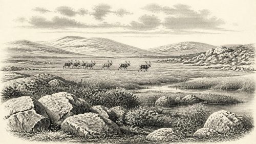
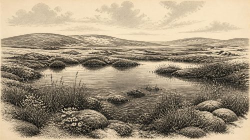
The Derryvree flora and fauna point to an open tundra environment and a periglacial climate. “Periglacial” does not simply mean icy: it describes ground and water systems repeatedly shaped by hard freezing, thawing, seasonal saturation and sparse vegetation in the vicinity of ice. The freshwater sediments preserve evidence for a wet hollow or shallow-water setting amid a broader treeless landscape. Mosses, herb pollen, aquatic plants and small invertebrate remains are especially valuable because they record conditions close to where they lived. The vegetation was not the later Irish image of oak woodland, enclosed fields or blanket bog. It was a low, exposed mosaic of wet places, sedges and herbs, with much bare or thinly vegetated ground.
This does not mean that every part of Ireland looked identical. Derryvree is in present-day Fermanagh and describes a local catchment; it cannot map the whole island. Nor should an inter-till deposit be made to prove uninterrupted ice-free conditions everywhere. Yet it decisively complicates the popular picture of an Ireland sealed continuously beneath ice. Around this broad interval, at least some areas could support freshwater habitats and tundra biota. The island’s terrain was changing through ice advance, meltwater, frost action and sediment movement, while regional differences in altitude, exposure and proximity to ice mattered greatly.
Approaching the Glacial Maximum
The date belongs to a volatile phase before the Last Glacial Maximum, rather than to the maximum itself. Research on the British–Irish Ice Sheet places its greatest overall extent later, around 27,000 years BP, with major ice coverage persisting into roughly 20,000 years BP; the precise form and timing of ice margins around Ireland remain subjects of active reconstruction. Thus the Derryvree wetland was part of an older cold-stage landscape that was eventually overwritten in many places by advancing ice. Later glaciers scoured rock, redistributed sediment and removed or disturbed much of the archaeological evidence that might once have survived.
Lower sea levels accompanied the global growth of ice sheets, but it would be careless to turn that fact into a simple claim that Ireland was joined to Britain or continental Europe by a dependable land bridge at this date. The geography of the Irish Sea region involved changing sea level, crustal adjustment, ice margins, shallow basins and routes that may have been water, ice or difficult coastal terrain at different times. Animal presence demonstrates that some species reached Ireland during the Pleistocene; it does not by itself reveal their exact route, the season of movement or whether people could have followed it easily.
The Castlepook Animal World
Castlepook Cave, also called Mammoth Cave, near Doneraile in north County Cork, provides the strongest complementary view of Irish animal life relevant to this deep period. The cave’s assemblage includes woolly mammoth, reindeer, giant deer, spotted hyaena, brown bear, wolf, Arctic fox, hare and lemmings. Direct dates from its older collections span a long interval rather than one moment: the Irish Quaternary Fauna Project documented animals there from before 45,000 BP through the approach to the Last Glacial Maximum, including reindeer and mammoth dated in the general range relevant here. These animals imply cold, open habitats capable of supporting large grazers and their predators, with sheltered caves used or entered in very different ways.
But a cave bone assemblage is not a census of a living landscape. Some animals died naturally; others may have been dragged in or scavenged by carnivores; water could move material; and much of Castlepook was excavated in the early twentieth century, before modern recording standards. The bones are therefore time-averaged and contextually uneven. It is defensible to say that cold-adapted mammals occurred in Ireland over a broad span. It is not defensible to place mammoth, hyaena, reindeer and giant deer together beside a particular Fermanagh pool in 31,210 BCE, or to reconstruct a local food web in annual detail.
A Possible Human Trace
Castlepook also raises Ireland’s most intriguing human question for this period. A reindeer femur from the old cave collection has been reported as bearing a deep mark interpreted as damage from a sharp stone implement during fresh-bone butchery, and has been publicised as approximately 33,000 years old. If that interpretation is sustained, it would be evidence that one or more Upper Palaeolithic people handled a reindeer carcass in Ireland far earlier than the island’s formerly accepted human record. The claim deserves serious attention, not least because it directs new investigation towards undisturbed cave sediments and re-examination of museum collections.
Its limits are equally important. A marked bone is evidence for a possible action on an animal, not proof of a resident population. Castlepook has not produced a securely associated hearth, stone-tool assemblage, dwelling floor, burial, human remains or repeated deposit that would demonstrate a camp in this period. The specimen’s old excavation context also makes association difficult. Accordingly, the appropriate wording is possible early human activity or possible carcass processing, not “settlement”, “colony” or “Ireland’s first community”. The better-dated butchered brown-bear patella from Alice and Gwendoline Cave, County Clare, belongs much later, around 12,810–12,590 calibrated BP, and cannot fill the enormous gap between these episodes.
What Cannot Be Written
There is no evidence from Ireland around this horizon for political institutions, rulers, diplomacy, territorial boundaries, organised warfare, religion, formal learning, language, trade networks or permanent settlement. There are no houses, graves, carvings, hearths, toolkits or human skeletal remains securely dated to 31,210 BCE. Continental Upper Palaeolithic communities certainly made sophisticated tools, images and social relationships, but importing their practices wholesale into Ireland would turn analogy into invention. Even if the Castlepook mark proves human-made, it would indicate a fleeting encounter with a carcass, not the beliefs, kinship, economy or identity of those responsible.
The economy visible in the evidence is ecological rather than social: freshwater organisms in a Fermanagh wetland; grazing animals, predators and scavengers in cold open country; and the persistent constraint imposed by climate and ice. Any people present may have moved through a difficult northern Atlantic landscape in small numbers, but that is an interpretation, not a demonstrated Irish settlement pattern. There is no basis for assigning them a named archaeological culture, migration route or relationship with groups in Britain or mainland Europe.
Deep-Time Ireland
The central development around this notional year was environmental instability. Derryvree records an ice-free or ice-distant interval in which tundra wetland life endured between glacial episodes. Castlepook records that Pleistocene mammals repeatedly reached southern Ireland over a much wider span, and perhaps preserves one tantalising sign of human intervention. Both archives survived largely because later processes buried, preserved or collected fragments of older worlds; both are also incomplete because ice, water, carnivores and antiquarian excavation altered them.
For 31,210 BCE, then, Ireland has no annalistic history. It has a buried wetland, cave bones, radiocarbon ranges and a landscape moving towards more extensive glaciation. That evidence is modest beside the historical record of later millennia, but it is powerful precisely because it fixes the limits of responsible knowledge: a cold, open and regionally varied island; animals adapted to it; and only the unresolved possibility that people briefly passed through it.
Primary Sources
- A Middle Midlandian Freshwater Series at Derryvree, Maguiresbridge, County Fermanagh, Northern Ireland
- Palaeoecology: Irish Quaternary Association Field Guide 16
- The Irish Quaternary Fauna Project
- First Evidence of a Late Upper Palaeolithic Human Presence in Ireland
- New Insights on the Fauna of Ireland’s Younger Dryas and Early Holocene from Alice & Gwendoline Cave
- Archaeology Research Excavation Grant 2022: Final Report
- Heritage Artefacts of County Cork
- Archaeological Heritage of County Cork
- Our Ancient Landscapes: Hunter-Gatherers in Ireland
- The Deglaciation of the Western Sector of the Irish Ice Sheet from the Inner Continental Shelf to its Terrestrial Margin
- Timing and Pace of Ice-Sheet Withdrawal Across the Marine–Terrestrial Transition West of Ireland During the Last Glaciation
- Dimensions and Chronology of the Last Ice Sheet in Western Ireland
- Last Glacial Maximum Cirque Glaciation in Ireland and Implications for Reconstructions of the Irish Ice Sheet
- New Data for the Last Glacial Maximum in Great Britain and Ireland
- The Last Glacial Maximum
- The IntCal20 Northern Hemisphere Radiocarbon Age Calibration Curve (0–55 cal kBP)
- Devising Quality Assurance Procedures for Assessment of Legacy Geochronological Data Relating to Deglaciation of the Last British-Irish Ice Sheet
- Freshwater Organic Deposits and Stratified Sediments Between Early and Late Midlandian (Devensian) Till Sheets, at Aghnadarragh, County Antrim, Northern Ireland
- Archaeological Excavations at Killuragh Cave, Co. Limerick
- Irish Quaternary Association: Outreach and Education Resources
- The Archaeological Survey
- Historic Environment Viewer