Herb Tundra30891 BCE
Around 30,891 BCE, Ireland lay within the unstable cold conditions of Marine Isotope Stage 3, not a precisely datable historical moment. Derryvree, County Fermanagh, preserves organic sediments indicating ice-free, open tundra-like wetlands with herbs, sedges, mosses and shallow freshwater before renewed glaciation. Castlepook Cave, County Cork, contains a mixed, long-lived fauna including mammoth, reindeer, giant deer, bear, wolf, lemmings and hyaena, evidencing varied cold-stage ecosystems. A marked reindeer bone may suggest human butchery, but cannot prove settlement. No contemporary Irish tools, hearths, art, burials, political structures or trade are securely known. Environmental change and advancing ice dominate the sparse record.
Dateline
The label 30,891 BCE is useful only as a modern reference point. It cannot identify an Irish event in the manner of a medieval annal or a later state record. No calendar, written account, named leader, settlement plan or archaeological layer allows a historian to isolate this single year. In relation to the conventional radiocarbon baseline of AD 1950, it falls roughly 32,840 calendar years before present, within the Late Pleistocene and the climatically volatile Marine Isotope Stage 3 (MIS 3). The responsible history of Ireland at this point is therefore a history of deposits, animal remains and environmental change, expressed as ranges and probabilities rather than as a dated narrative.
A Date Within a Long Interval
The closest Irish environmental sequence with a calibrated range encompassing this notional year is at Derryvree, near Maguiresbridge in County Fermanagh. Road works in 1969 exposed an extraordinary deposit: freshwater silts and fine sands preserved between two distinct sheets of glacial till within a drumlin. A radiocarbon determination from the organic sediments was 30,500 +1,170/−1,030 radiocarbon years BP. Under modern calibration, that result is best treated as a broad interval, approximately 36,900–31,700 calibrated years BP, rather than converted into a single exact calendar year. The range includes 30,891 BCE, but the deposit accumulated over time. It cannot tell us what happened in Ireland in one season, still less on one day.
Derryvree is nevertheless of exceptional importance. Its position beneath later glacial deposits shows that a biologically active, ice-free landscape existed in this part of Fermanagh before renewed ice advance sealed the evidence. The sequence has long given its name to the Derryvree Cold Phase in schemes for the Irish late Pleistocene, though modern scholarship rightly treats such named phases cautiously. The island’s surviving evidence is sparse, local and discontinuous; climate oscillated repeatedly, while advancing ice, erosion and rising seas later removed or buried many older surfaces. Derryvree is a rare window, not a complete map of Ireland.
Frost, Pools and Open Ground
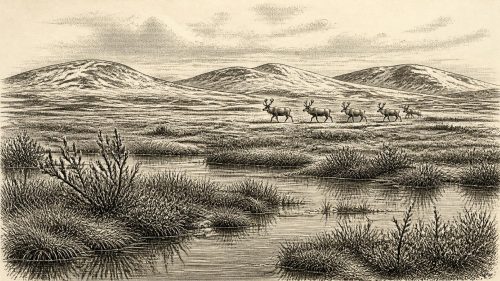
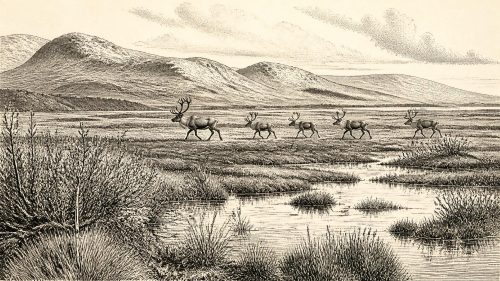
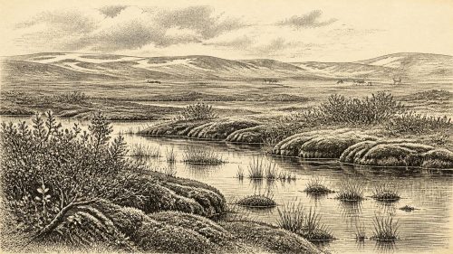
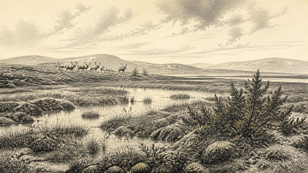
The plant and insect evidence from the Fermanagh silts offers the clearest picture of the landscape relevant to this date. Pollen was dominated by herbaceous plants. Mosses, sedges, grasses and other cold-tolerant herbs were represented, along with aquatic and wet-ground species including bogbean. Juniper was present, but there is no basis for imagining a woodland. A few grains of tree pollen can travel considerable distances; the wider evidence indicates open, largely treeless terrain. Researchers interpreted the assemblage as tundra or muskeg-like ground in a periglacial climate: a mosaic of wet, plant-rich hollows and shallow water amid sparsely vegetated mineral ground.
“Periglacial” does not simply mean a landscape of unbroken snow. It describes a cold setting shaped by freezing and thawing, short growing seasons, exposed soils and conditions near an ice margin. At Derryvree, freshwater habitats supported plants and invertebrates despite harsh winters. In warmer months, wetland margins and herb-rich patches could have been productive, though the evidence cannot establish the exact temperature, snowfall or extent of vegetation in 30,891 BCE. Nor should conditions in south Fermanagh be projected without qualification across every coast, upland and lowland of Ireland. The surviving record instead demonstrates environmental variety within a generally cold world.
This was not yet the climatic climax usually called the Last Glacial Maximum. Large-scale reconstructions of the British–Irish Ice Sheet show that its fullest late-glacial expansion came later, broadly around 27,000–19,000 years ago, with important regional differences and continuing debate over particular ice margins. Around the Derryvree interval, climatic deterioration and ice-sheet growth were part of the longer story, but the organic silts prove that ice had not made every part of Ireland lifeless or uniformly covered at once. Their later burial beneath till also reveals how fragile the available habitats were: renewed glaciation transformed drainage, scoured ground and greatly reduced the chance that campsites or soils would survive for archaeologists to find.
Castlepook’s Mixed Animal Archive
County Cork provides a second, very different source of evidence. Castlepook Cave, near Doneraile in the Blackwater valley, has yielded Ireland’s richest known assemblage of pre-Last Glacial Maximum vertebrate remains. Excavations and collecting in the early twentieth century recovered a remarkable range of Ice Age fauna, while later work has reassessed old collections and located surviving deposits in parts of the cave system. The recorded animals include woolly mammoth, reindeer, giant deer, brown bear, wolf, fox, mountain hare, collared and Norwegian lemmings, and spotted hyaena. It is a striking reminder that an Ireland familiar today for wet grasslands and temperate woodland once formed part of a wider north-west European cold-stage ecological zone.
The cave record must be read carefully. Castlepook was not a neatly sealed hunting camp. Bones accumulated through several processes: animals may have died naturally or fallen in; carnivores carried remains inside; water moved material; and early excavation disturbed contexts now impossible to reconstruct fully. The bones also span a long period. Improved radiocarbon preparation and redating have shown that several earlier determinations were too young, placing important elements of the fauna within MIS 3 and indicating that some species, notably spotted hyaena and giant deer, may have disappeared locally before the Last Glacial Maximum. Thus a mammoth or hyaena bone from the cave establishes that such animals lived in Ireland during particular broad periods; it does not prove that every listed species stood together outside Doneraile in 30,891 BCE.
Even so, Castlepook and Derryvree complement one another. Fermanagh preserves the small-scale evidence of wet tundra vegetation; Cork preserves the larger animal community able to exploit open and changing landscapes. Reindeer and hare suit cold, exposed country. Lemmings point to northerly, treeless environments. Mammoths, giant deer, wolves and hyaenas indicate food webs with large herbivores and predators, not a sterile wilderness. The distribution and seasonal movements of these animals remain uncertain, but their presence shows that routes into and through Ireland existed at least intermittently during the late Pleistocene, when sea levels were lower and the geography of the Irish Sea basin differed greatly from that of today.
The Human Question
The most consequential, and most limited, evidence concerning people is a reindeer femur from Castlepook. It has been reported as dating to about 33,000 years ago and as bearing a deep mark interpreted by zooarchaeologist Ruth Carden as a cut or chop made with a sharp stone tool while the bone was fresh. If that interpretation is sustained, it would indicate that a person processed a reindeer in Ireland during MIS 3, vastly earlier than the well-established evidence for post-glacial Mesolithic settlement.
It would not, however, establish a resident Irish population, a village or a continuing occupation. The specimen derives from an old cave collection rather than from a modern excavation of an intact living floor. A radiocarbon measurement dates the animal’s death, not automatically the making of the mark; identifying a mark as humanly made is a separate taphonomic judgement. No securely associated hearth, stone-tool assemblage, house, burial, occupation surface or series of butchered animals of comparable age has yet been recovered in Ireland. The appropriate conclusion for this date is that a brief Upper Palaeolithic human visit is possible and scientifically important, but remains unproven as a settled presence.
Comparison with contemporary continental Europe can help define possibilities but cannot fill Ireland’s silence. Elsewhere, Upper Palaeolithic people made sophisticated stone tools, hunted or scavenged large animals, travelled through seasonal landscapes and sometimes produced art. Those facts do not demonstrate that art, ritual objects, particular technologies or social groups existed in Ireland. There is no Irish cave art, engraved bone, ornament, grave, shrine or monument securely attributable to the Derryvree–Castlepook horizon. There is equally no evidence from which to infer political authority, warfare, diplomacy, language, kinship systems or religious beliefs. These are not merely missing details; they are questions the evidence cannot presently answer.
Life Without a Recorded Society
For that reason, headings familiar in later historical writing must be handled differently. There were no demonstrable political affairs, states or diplomatic relations in Ireland around this point. No conflict can responsibly be identified beyond the ecological realities of predation and survival. Economy and trade cannot be documented: there are no known Irish-made tools, exchange goods or sources of raw material securely dated to this interval. Settlement is likewise unconfirmed. If humans did reach the island, a short-lived expedition by mobile foragers is a more defensible possibility than a permanent community, but even that is interpretation rather than direct proof.
What the evidence does securely reveal is a changing regional environment. Ireland was neither the later agricultural island nor an entirely blank, frozen expanse. At least some ice-free ground carried tundra plants and freshwater wetlands; at least some southern caves accumulated the remains of a varied Ice Age fauna. These habitats were contingent on climate and vulnerable to the growth of ice. The archaeological record is correspondingly uneven, because the processes that shaped the landscape also destroyed it. At 30,891 BCE, the decisive Irish development was environmental: a cold, open, intermittently habitable country stood on the approach to more extensive glaciation, leaving only a few buried silts and cave bones to record its existence.
Source References
Hover over a number to see the source. Select it to open the source.

- [1] A Middle Midlandian Freshwater Series at Derryvree, Maguiresbridge, County Fermanagh, Northern Ireland
- [2] Palaeoecology
- [3] Figure 6.—The Subdivision of the Quaternary Period in Ireland
- [4] Irish Pleistocene Biostratigraphy
- [5] The Irish Quaternary Fauna Project
- [6] A Reconsideration of the Radiocarbon Dating of the Marine Isotope Stage 3 Fauna from Southern Ireland
- [7] Castlepook Cave
- [8] Castlepook Cave, Co. Cork, 2022:0032564
- [9] Mammoth Cave
- [10] Pleistocene Vertebrates in the British Isles
- [11] Investigating Seasonal Mobility in Irish Giant Deer Megaloceros giganteus (Blumenbach, 1799) Through Strontium Isotope (87Sr/86Sr) Analysis
- [12] New Insights on the Fauna of Ireland's Younger Dryas and Early Holocene from Alice & Gwendoline Cave
- [13] New Insights on the Fauna of Ireland's Younger Dryas and Early Holocene from Alice & Gwendoline Cave
- [14] Growth and Retreat of the Last British–Irish Ice Sheet, 31,000 to 15,000 Years Ago: The BRITICE-CHRONO Reconstruction
- [15] BRITICE-CHRONO Maps and GIS Data of the Last British-Irish Ice Sheet 31 to 15 ka
- [16] The IntCal20 Northern Hemisphere Radiocarbon Age Calibration Curve (0–55 cal kBP)
- [17] IntCal Publications
- [18] Our Ancient Landscapes: Hunter-Gatherers in Ireland
- [19] Ireland's Palaeolithic Archaeology – Fleeting Footprints in a Frozen Land
- [20] The Post-Glacial Colonisation of Ireland: A Review of the Evidence
Primary Sources
- A Middle Midlandian Freshwater Series at Derryvree, Maguiresbridge, County Fermanagh, Northern Ireland
- Palaeoecology
- Figure 6.—The Subdivision of the Quaternary Period in Ireland
- Irish Pleistocene Biostratigraphy
- The Irish Quaternary Fauna Project
- A Reconsideration of the Radiocarbon Dating of the Marine Isotope Stage 3 Fauna from Southern Ireland
- Castlepook Cave
- Castlepook Cave, Co. Cork, 2022:0032564
- Mammoth Cave
- Pleistocene Vertebrates in the British Isles
- Investigating Seasonal Mobility in Irish Giant Deer Megaloceros giganteus (Blumenbach, 1799) Through Strontium Isotope (87Sr/86Sr) Analysis
- New Insights on the Fauna of Ireland's Younger Dryas and Early Holocene from Alice & Gwendoline Cave
- New Insights on the Fauna of Ireland's Younger Dryas and Early Holocene from Alice & Gwendoline Cave
- Growth and Retreat of the Last British–Irish Ice Sheet, 31,000 to 15,000 Years Ago: The BRITICE-CHRONO Reconstruction
- BRITICE-CHRONO Maps and GIS Data of the Last British-Irish Ice Sheet 31 to 15 ka
- The IntCal20 Northern Hemisphere Radiocarbon Age Calibration Curve (0–55 cal kBP)
- IntCal Publications
- Our Ancient Landscapes: Hunter-Gatherers in Ireland
- Ireland's Palaeolithic Archaeology – Fleeting Footprints in a Frozen Land
- The Post-Glacial Colonisation of Ireland: A Review of the Evidence