
The Doneraile Bone Question30770 BCE
Thirty thousand seven hundred and seventy BCE is a modern label for an imprecisely dated MIS 3 interval, not a recoverable Irish year. Derryvree, County Fermanagh, preserves freshwater sediments between tills, showing locally ice-free, cold, treeless wetland before renewed glaciation. Castlepook Cave, County Cork, contains mammoth, giant deer, reindeer and predators, evidencing a varied cold-stage fauna but not a single contemporaneous landscape. A reindeer femur, possibly cut by a stone tool, may indicate brief Upper Palaeolithic human activity. However, no associated tools, hearths or settlements exist. Later ice erosion obscured evidence, leaving human presence and continuity of occupation still unproven.
Dateline
The label “30,770 BCE” is a modern chronological convenience, not a year that anyone in Ireland could have named, recorded or remembered. No calendar, writing system, political institution or historical tradition can be traced to this depth of time. Nor can archaeology isolate a particular event to one calendar year nearly 33,000 years ago. The responsible setting is the later part of the Late Pleistocene, broadly within Marine Isotope Stage 3 (MIS 3), an exceptionally unstable phase of the last Ice Age. In simple calendar arithmetic the requested point is about 32,700 years before AD 1950, but radiocarbon and calibrated calendar chronologies are not interchangeable.
The closest relevant Irish dates are broad. At Derryvree, near Maguiresbridge in County Fermanagh, organic freshwater sediments produced the conventional radiocarbon determination Birm-166, 30,500 +1,170/−1,030 radiocarbon years BP. Published calibration has placed that evidence approximately between 36,900 and 31,700 calendar years BP. That wide range embraces 30,770 BCE, but does not identify conditions in that one notional year. In County Cork, a reindeer femur from Castlepook Cave near Doneraile has been publicly assigned an approximate date of c. 31,000 BCE and is reported to bear a possible stone-tool mark. It is potentially momentous evidence, but it is not a dated episode of settlement.
A Landscape Between Ice Advances
Ireland was not simply a white, permanently frozen island. The later Last Glacial Maximum, when the British-Irish Ice Sheet extended over Ireland and much of its continental shelf, lay ahead: its greatest local extent is generally placed around 27,000 years ago, with regional variations. Around the broad Derryvree horizon, however, parts of the island had ice-free ground. The Derryvree sequence is important because roadworks in 1969 exposed silts, fine sands and organic sediments caught between two thick tills, deposits laid down directly by glacier ice. The lower till records an earlier glacial phase; the freshwater beds show an intervening period without ice at that place; the upper till marks renewed glaciation.
This is powerful evidence for local environmental change, not a map of all Ireland at a single moment. The sediments describe a small Fermanagh basin rather than every coast, upland or valley. Nevertheless, they disprove any easy assumption that the whole island was continuously buried under ice throughout MIS 3. They also show why the record is so fragmentary. Later glaciers eroded older land surfaces, shifted sediments and buried surviving pockets beneath till. A campsite beside a river, lakeshore or former coast may have been destroyed; evidence now beneath the Irish Sea is still harder to find. Absence of discovered settlements is therefore meaningful, but it is not proof that no person ever reached the island.
Derryvree’s Cold Wetland
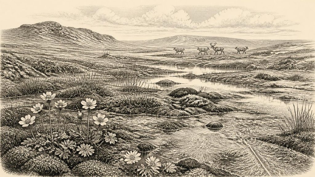
Fossils from Derryvree provide Ireland’s best local environmental picture for this broad interval. Pollen, plant macrofossils, mosses and invertebrate evidence indicate open, treeless ground: a cold muskeg or tundra wetland with sedges, grasses, herbs, low shrubs, mossy surfaces and pools or sluggish freshwater. Finds associated with the deposit include plants now strongly associated with cold, open or base-rich environments, such as mountain avens and lesser clubmoss. This was not a woodland landscape and not a modern bog transplanted into the past. It was a harsh, seasonal terrain in which wet ground, frost action and sparse vegetation shaped what could live there.
Such evidence permits a careful account of environment and daily ecological constraints. Summers could support plant growth, insects and grazing animals; winters were severe, and the productivity of the land was sharply seasonal. It does not permit precise reconstructions of the weather on a particular day in 30,770 BCE, nor does it demonstrate that every part of Ireland had the same vegetation. Long-distance pollen transport and reworked material further require caution. The secure conclusion is modest but significant: north-central Ireland contained cold, largely treeless freshwater and wetland habitats during a part of MIS 3 before a later ice advance sealed the deposits.
Castlepook and the Animal World
Castlepook Cave, also called Mammoth Cave or Doneraile Cave, in north County Cork, supplies the most striking evidence for Ireland’s pre-Last Glacial Maximum animals. Its cave deposits have yielded woolly mammoth, giant deer, reindeer, brown bear and spotted hyaena, as well as remains attributed to wolf, Arctic fox and lemmings. The site is the richest known Irish archive for vertebrate life in this deep period. Its fauna establishes that Ireland could at different times support a cold-stage community of large herbivores, scavengers and predators.
Yet Castlepook was a bone repository, not a snapshot. Carnivores carried carcass parts into caves; water disturbed deposits; successive excavations between the early twentieth century and recent decades recovered material under very different standards of recording. The animal list should therefore not be treated as a single herd grazing outside the entrance in 30,770 BCE. Reassessment of radiocarbon dates has also shown that some earlier measurements from southern Irish caves were too young, probably because of limitations in older sampling and pretreatment. Ruth Carden’s re-dating work places important Castlepook fauna more firmly in MIS 3 and suggests that giant deer and spotted hyaena may have disappeared locally before the Last Glacial Maximum.
Even so, the assemblage reveals the scale of the ecological world available to any visitors. Reindeer are particularly relevant to open, cold habitats and could have been a valuable source of meat, hide, sinew, antler and bone. Mammoth and giant deer illustrate the presence, at least intermittently, of large-bodied prey and carrion. Hyaenas and wolves warn against imagining an empty hunting ground: people, if present, would have entered a landscape already used by powerful carnivores. There is no basis, however, for calculating herd sizes, hunting territories or a regular seasonal migration route within Ireland.
The Mark on a Reindeer Femur
The direct human question rests chiefly on one object. A reindeer femur from Castlepook has been interpreted as carrying a deep mark made by a sharp stone tool while the bone was fresh. County Cork heritage publications date it broadly to c. 31,000 BCE and present it as evidence of Palaeolithic hunters processing reindeer. If that interpretation is sustained, it would push the human story of Ireland dramatically earlier than the securely dated Late Upper Palaeolithic butchered brown-bear bone from Alice and Gwendoline Cave in County Clare, dated to about 12,810–12,590 calibrated years BP.
The distinction between evidence and interpretation is essential. The femur itself is material evidence: a reindeer bone from Castlepook, of great antiquity, bearing a mark that a specialist has identified as consistent with butchery. The interpretation is that people used a stone edge to process the carcass, perhaps during a short hunting visit. What it cannot presently demonstrate is a permanent settlement, a village, a repeated seasonal camp or even that the reindeer was killed at the cave. The bone may have been moved after butchery by hyaenas, other scavengers, water or excavation disturbance. A date on a bone indicates when the animal lived, not necessarily the exact moment when any surface modification was made.
No securely associated stone-tool assemblage, hearth, occupation floor, dwelling, human burial or concentrated butchered food waste of this age has yet been identified in Ireland. Thus it would be wrong to write of a Doneraile community, name a hunter, or describe a particular chase in 30,770 BCE. The most that can responsibly be said is that the Castlepook femur raises the serious possibility of a brief Upper Palaeolithic human presence on the island within the broad period represented by the bone. Ongoing work at the cave, including renewed excavation and study of old collections and sediments, is important precisely because more securely stratified evidence could test that possibility.
Society Without a Social Record
There is no evidence from Ireland at this horizon for chiefs, states, laws, diplomacy, warfare, formal territories or organised political authority. There is likewise no Irish evidence for farming, livestock keeping, pottery, metalworking, monuments, long-distance commerce or market exchange. If people reached Ireland, they would have been mobile hunter-gatherers using perishable materials and stone technology, but that is an inference from the wider Upper Palaeolithic world rather than a demonstrated Irish toolkit. No Irish lithic industry can yet be assigned to the Castlepook episode.
The same restraint applies to culture, learning and religion. Upper Palaeolithic societies elsewhere in Europe made sophisticated tools, ornaments, images and ritual deposits, but none of those achievements can be transferred automatically to Ireland. There are no Irish cave paintings, portable artworks, graves or ceremonial places securely dated to around 30,770 BCE. People may have shared knowledge, kin connections and stories as all human groups do; archaeology here cannot recover their language, beliefs or social organisation. The island’s evidence records animals, sediments, ice and one contestedly significant bone more clearly than it records human society.
A Precarious Irish Threshold
The most important development around this notional date was environmental, not political: Ireland contained cold, shifting and locally habitable ground before the later expansion of the British-Irish Ice Sheet transformed the landscape. Derryvree preserves a rare wetland interval within that story. Castlepook preserves the animal world of southern Ireland and a possible trace of human butchery. Together they suggest opportunity as well as danger—open country, freshwater, game and sheltering caves, but severe climates, carnivores and an increasingly unstable glacial setting.
That is not the beginning of an unbroken settlement history. Later ice cover and the great chronological gap before secure Late Glacial evidence make continuity impossible to demonstrate. But it is a crucial threshold in Irish prehistory. Around 30,770 BCE, Ireland was neither historically silent because nothing happened nor historically knowable in the ordinary sense. Its past survives in calibrated ranges, buried wetlands, cave bones and the unanswered question cut into a reindeer femur.
Primary Sources
- A Middle Midlandian Freshwater Series at Derryvree, Maguiresbridge, County Fermanagh, Northern Ireland
- A Reconsideration of the Radiocarbon Dating of the Marine Isotope Stage 3 Fauna from Southern Ireland
- The Irish Quaternary Fauna Project
- First Evidence of a Late Upper Palaeolithic Human Presence in Ireland
- New Insights on the Fauna of Ireland's Younger Dryas and Early Holocene from Alice & Gwendoline Cave
- Castlepook Cave, County Geological Site Report
- Heritage Artefacts of County Cork
- The Archaeological Heritage of County Cork
- Castlepook Cave, Co. Cork: Excavation Report 2022
- Ireland: Submerged Prehistoric Sites and Landscapes
- Timing and Pace of Ice-Sheet Withdrawal Across the Marine–Terrestrial Transition West of Ireland During the Last Glaciation
- New Data for the Last Glacial Maximum in Great Britain and Ireland
- Radiocarbon Constraints on the Age of the Maximum Advance of the British-Irish Ice Sheet in the Celtic Sea
- Early Deglaciation of the British-Irish Ice Sheet on the Atlantic Shelf Northwest of Ireland Driven by Glacioisostatic Depression and High Relative Sea Level
- Trimlines, Blockfields and the Vertical Extent of the Last Ice Sheet in Southern Ireland
- Irish Association for Quaternary Research Field Guide 16
- The Subdivision of the Quaternary Period in Ireland
- Occurrence of Mammalia Relicts at Site Castlepook Cave
- Pleistocene Vertebrates in the British Isles
- Deposits of the Last Glaciation
- BSBI: Dryas octopetala in Fermanagh
- BSBI: Selaginella selaginoides in Fermanagh
- UCD School of Archaeology Research Day 2022
- A Palaeo-Glaciological Reconstruction of the British-Irish Ice Sheet
