

Hollymount’s Buried Marsh30771 BCE
Thirty thousand seven hundred and seventy-one BCE denotes an imprecise point within Ireland’s unstable Late Pleistocene, not a recorded event. Evidence from Derryvree, Hollymount and Greenagho in Fermanagh shows freshwater marshes and open, periglacial vegetation briefly developed between glacial advances. Waterford cave finds indicate deer in southern Ireland, while Castlepook Cave, Cork, preserves mixed remains of mammoth, reindeer, giant deer, bear, hyaena and other fauna accumulated over long periods. These records demonstrate changing cold landscapes and intermittent continental faunal connections. A possibly cut-marked reindeer bone may indicate human activity, but cannot prove settlement. Subsequent ice-sheet expansion buried or destroyed evidence.
Dateline
30,771 BCE is a modern calendar label, not a date that people in prehistoric Ireland could have recognised or recorded. It falls roughly 32,700 years before the radiocarbon convention’s reference year of AD 1950, within the Late Pleistocene and Marine Isotope Stage 3 (MIS 3), a long, unstable part of the last Ice Age. No event, individual, settlement or political development can responsibly be assigned to this single numbered year. Ireland’s evidence instead consists of deposits and animal remains accumulated across centuries or millennia, then dated with uncertainties which must remain visible in any reconstruction.
An Interval, Not a Recorded Year
The appropriate question is therefore not ‘what happened in 30,771 BCE?’, but what sort of country could have existed in and around this phase. The answer is qualified. Ireland was not yet the familiar wooded island of later prehistory. Climate, sea level, ice cover and animal distributions changed repeatedly. The British–Irish Ice Sheet was also dynamic rather than a single, static white mass. Recent reconstructions place major ice-sheet growth across Ireland and Britain between about 31,000 and 26,000 years ago, while stressing that regional evidence is uneven and some ice margins remain poorly dated. Around this horizon, parts of the island may have been open ground or wetland, while other districts lay under ice or were affected by its proximity.
For this reason, no island-wide weather report is possible. Nor should modern counties be imagined as coherent regions with common conditions. The most illuminating evidence comes from a small number of accidental archives: organic mud sealed beneath later glacial deposits in County Fermanagh, cave sediments and bones in Munster, and offshore records beyond the south-west coast. Each records a particular locality and environmental process. Together, they establish a broad picture of a cold, variable Ireland on the threshold of the more extensive glaciation associated with the Last Glacial Maximum, not a map of one exact year.
Fresh Water Beneath Fermanagh
The closest Irish environmental window is at Derryvree near Maguiresbridge, County Fermanagh, with comparable deposits at Hollymount and Greenagho. There, freshwater sediments lay between separate sheets of till: unsorted debris deposited by glacier ice. The sequence provides a powerful relative history. Ice had occupied the locality when the lower till was laid down; an ice-free interval then allowed ponds, marshes and sediment-laden water to accumulate organic material; later ice or renewed glacial advance covered the deposit with upper till. It is evidence for change over a very long interval, not proof that the whole island was simultaneously ice-free.
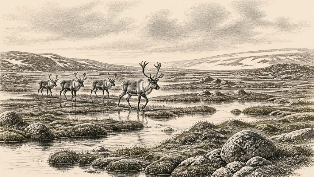
The Derryvree organic layers produced a conventional radiocarbon determination of 30,500 +1,170/−1,030 radiocarbon years BP. Such a result cannot be read directly as a calendar year: radiocarbon ages require calibration, and the uncertainty becomes substantial at this depth of time. Their plant and insect remains nevertheless show that cold did not mean lifelessness. Freshwater mosses and sedges, along with insects of northern aspect, indicate wet ground, shallow water and open vegetation in a periglacial landscape. Seasonal thaw, standing water and patches of plant cover mattered here. The imagined scene is not a forest or a settled valley, but neither is it an unbroken desert of ice.
Other Irish animal dates show why calibrated ranges are more useful than artificial precision. Two pre-Last Glacial Maximum deer specimens from Waterford caves have published calibrated ranges of 32,930–31,280 and 30,297–29,594 calendar years BP. These dates bracket rather than identify the nominal year 30,771 BCE. They demonstrate that sizeable herbivores were present in parts of southern Ireland during phases of MIS 3, but do not show that the two animals lived together, that their caves were ordinary habitat, or that every part of the island offered the same conditions.
Castlepook’s Animal Archive
Castlepook Cave, near Doneraile in north County Cork, is the other essential source. Its narrow limestone galleries have yielded Ireland’s richest known assemblage of mammal remains from the period leading towards the Last Glacial Maximum. The principal early excavations, begun by Richard J. Ussher in 1904 and reported by Robert F. Scharff, Henry J. Seymour and Edwin T. Newton in 1918, recovered bones from complex sands and stalagmite floors. Later radiocarbon work showed that the assemblage spans a very long period rather than one occupation episode. Water movement, older excavation practices and mixing of deposits all limit what can be said about association between specimens.
Even with those reservations, Castlepook establishes an extraordinary Irish fauna. Woolly mammoth, reindeer, giant deer, brown bear and spotted hyaena belong to its Ice Age record; wolf, Arctic fox and lemmings appear in later cold-stage material. Re-dating has revised several earlier results substantially older and suggests that giant deer and spotted hyaena may have disappeared locally before the Last Glacial Maximum, around 40,000 calibrated years BP. That does not mean every named animal roamed Cork in 30,771 BCE. It does show that Ireland periodically supported a diverse, continental-looking mammal community during MIS 3, and that caves could act as carnivore dens, death traps, shelters or repositories into which bones were washed.
The ecological picture is consequently one of open country with enough forage for grazing and browsing animals, rather than dense woodland. Reindeer and mammoth are especially evocative, but their presence should not be turned into a tidy ‘mammoth-steppe’ scene for every locality. Giant deer may have used more varied vegetation; bears, hyaenas and wolves had their own ranges and opportunities; caves concentrated remains in ways that open-air ground surfaces did not. The principal fact is diversity through time. Ireland was connected to wider north-west European animal populations sufficiently often for large mammals to arrive, yet its insular geography, changing seas and advancing ice made those connections precarious. A 2026 sedimentary ancient-DNA preprint from Castlepook supports such faunal connectivity, but remains preliminary research rather than a final answer.
People: A Possibility, Not a Population
This period has particular archaeological importance because one Castlepook reindeer femur has been reported to carry a deep mark consistent with cutting by a stone tool. Public discussion has linked the bone with human handling of a reindeer about 33,000 years ago. If microscopic study and contextual reassessment ultimately confirm that interpretation, it would be remarkable evidence for Upper Palaeolithic people in Ireland far earlier than the long-established post-glacial record. It would not, however, identify their language, origin, identity, group size or length of stay.
The necessary caution is considerable. The marked bone comes from a historically excavated, disturbed cave assemblage, not from a sealed living floor. There is no securely associated hearth, stone-tool assemblage, dwelling, burial, human bone or repeated concentration of butchered carcasses of equivalent age. Modern excavations at Castlepook have recovered potentially Pleistocene fauna but reported no cultural artefacts in their 2022 work. Thus the bone is best treated as a potentially important trace of human activity, not as proof of permanent settlement or a named Irish Palaeolithic culture.
Comparison with contemporary Europe can explain what is possible without filling Ireland with invented detail. Humans elsewhere in north-west Europe used stone tools, hunted and scavenged animals, made clothing, maintained social networks and, in some regions, created art and ornaments. None of these practices has yet been demonstrated for Ireland at this date. A traveller or a small seasonal party could leave very little evidence; equally, no people may have been present in the specific interval represented by this calendar label. Archaeology must leave both possibilities open.
No Polities, No Trade Routes
There is no evidence for political authority, chiefs, territories, diplomacy, warfare, formal religion, monuments, farming, markets or long-distance trade in Ireland around this horizon. These are not missing chapters awaiting recovery from written sources: writing lay tens of millennia in the future. The available record is primarily environmental and faunal. Predation and competition were real features of the landscape, but a hyaena-marked or broken bone cannot be made into a story of human conflict. Nor can a cave’s evocative later names, such as Elephant Hall or Hyenahall, tell us how Ice Age animals or any visitors understood the place.
Everyday life is similarly beyond direct recovery. If people did reach Ireland, they would have needed knowledge of cold-season movement, food, shelter, fire and dangerous animals, but this is an inference from human survival in comparable Upper Palaeolithic environments, not Irish evidence. The economy that can be securely described is ecological: plants exploiting short growing seasons, herbivores moving through usable ground, and carnivores taking advantage of prey and sheltered caves. In this prehistoric setting, environment is not mere background to history; it is the principal history preserved.
A Landscape Approaching Transformation
What makes this interval significant is its position before a major transformation. The succeeding millennia saw expansion and coalescence of the British–Irish Ice Sheet, with ice ultimately reaching its maximum volume much later, around 23,000 years ago. Earlier MIS 3 deposits such as Derryvree survived only because they were buried and sealed beneath later glacial sediments. Castlepook’s bones survived because limestone passages, mineral deposits and chance protected some fraction of a much larger vanished world.
30,771 BCE should therefore be remembered neither as the year of a known first settler nor as an empty frozen void. It represents a point within a broad, climatically unstable Late Pleistocene interval in which Ireland contained cold wetlands, open ground and, at different times and places, substantial mammals. Derryvree’s buried freshwater layers and Castlepook’s mixed cave fauna offer the responsible evidence. They reveal a changing Irish landscape and set firm limits on what cannot yet be claimed about the people who may, or may not, have crossed it.
Primary Sources
- A Middle Midlandian Fresh-Water Series at Derryvree, Maguiresbridge, County Fermanagh, Northern Ireland
- Early Midlandian–Middle Midlandian, Pleistocene, Northern Ireland
- The Irish Quaternary Fauna Project
- A Reconsideration of the Radiocarbon Dating of the Marine Isotope Stage 3 Fauna from Southern Ireland
- Castlepook Cave: County Geological Site Report
- Phylogeographic, Ancient DNA, Fossil and Morphometric Analyses Reveal Ancient and Modern Introductions of a Large Mammal: the Complex Case of Red Deer (Cervus elaphus) in Ireland
- Growth and Retreat of the Last British–Irish Ice Sheet, 31,000 to 15,000 Years Ago: the BRITICE-CHRONO Reconstruction
- Extent and Timing of the Last Glacial Maximum (LGM) in Britain and Ireland: a Review
- The Timing and Magnitude of the British–Irish Ice Sheet Between Marine Isotope Stages 5d and 2
- British–Irish Ice Sheet and Polar Front History of the Goban Spur, Offshore Southwest Ireland Over the Last 250,000 Years
- A Marine Isotope Stage 4 Age for Pleistocene Raised Beach Deposits Near Fethard, Southern Ireland
- First Evidence of a Late Upper Palaeolithic Human Presence in Ireland
- New Insights on the Fauna of Ireland's Younger Dryas and Early Holocene from Alice & Gwendoline Cave
- 2022:564 — Castlepook Cave, Castlepook South, Cork
- The Exploration of Castlepook Cave, County Cork
- The Exploration of Castlepook Cave, Co. Cork. With 3 Plates
- The Archaeological Heritage of County Cork
- The Subdivision of the Quaternary Period in Ireland
- References and Recommended Reading: Irish Quaternary Association Guide
- Sedimentary Ancient DNA Reveals Late Pleistocene Faunal Connectivity Between Ireland and Eurasia
- Mammoth Cave (Castlepook Cave)
- The Late Devensian (<22,000 BP) Irish Sea Basin: The Sedimentary Record of a Collapsed Ice Sheet Margin