Derryvree’s Sealed Fen30668 BCE
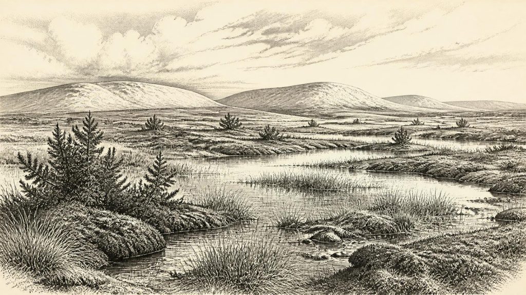
Derryvree deposit near Maguiresbridge, County Fermanagh, provides environmental evidence for a Late Pleistocene ice-free interval encompassing 30,668 BCE, though no event can be dated to that year. Freshwater silts and organic sediments, sealed between glacial tills, accumulated in a cold, treeless periglacial wetland of sedges, mosses, herbs and shallow pools. Radiocarbon results indicate a broad calibrated range of roughly 34,950–29,750 BCE. Later ice overrode the basin. Castlepook Cave fauna demonstrates episodic presence of Ice Age mammals, but not synchrony. A possibly butchered reindeer bone offers disputed evidence of people; no secure settlement or social record exists. A rare environmental archive.
Dateline
“30,668 BCE” is a modern chronological label, not a recoverable year in Ireland’s human or environmental record. No community in Ireland used a calendar from which such a date could be read, and no event, settlement, person or object can responsibly be fixed to this particular year. The closest useful framework is the Late Pleistocene, in Marine Isotope Stage 3, a highly variable part of the last Ice Age. For this point in time, the strongest Irish evidence is environmental rather than archaeological: a buried freshwater deposit at Derryvree near Maguiresbridge, County Fermanagh, and, more broadly, Ice Age animal remains from caves such as Castlepook in north County Cork.
A Date Within a Broad Window
The key Derryvree radiocarbon determination, BIRM-166, was obtained from organic freshwater silts and fine sands found between two distinct sheets of glacial till. It was reported as 30,500 radiocarbon years before present, with a substantial uncertainty of +1,170/−1,030 years. Modern radiocarbon calibration is essential: radiocarbon years are not calendar years, because atmospheric carbon-14 levels have changed through time. Using modern calibration approaches, the dated interval has been placed broadly at about 36,900–31,700 calibrated years before present, or roughly 34,950–29,750 BCE. The requested date falls within that wide span, but it cannot be assigned to a particular season, layer, or incident at Derryvree.
The Derryvree sediments did not form in a single moment. They accumulated during an environmental episode between advances of glacier ice, and their fossils represent a changing wetland and its surroundings. The safest conclusion is therefore modest but important: at some point within this broadly dated interval, part of south Fermanagh was locally ice-free, cold and treeless before later ice overrode and sealed the deposit. It is not a basis for a calendar-like account of Ireland in 30,668 BCE.
Fresh Water Between the Tills
Derryvree was exposed by road works in 1969, when an excavation cut through a drumlin about two kilometres north-east of Maguiresbridge. A drumlin is a streamlined hill of glacial sediment; at Derryvree, the road section revealed a remarkable sequence. Lower till recorded an earlier ice advance. Above it lay freshwater silts, fine sands and organic material. An upper till then showed that ice returned. This physical order matters more than any single date: it demonstrates an intervening period when water could stand or move slowly across an exposed landscape and biological remains could accumulate.
The fossil evidence describes a periglacial wetland rather than a woodland or a settled countryside. Pollen was poorly preserved, yet the surviving record was dominated by herbaceous plants. Macrofossils and mosses, together with insect evidence, point towards sedge-rich, mossy ground, shallow open pools and plant-rich water. Juniper and low-growing herbs formed part of a largely open vegetation mosaic. A few grains from trees such as pine and hazel do not demonstrate nearby forest; they may have travelled far or been redeposited from older material. The original investigators consequently described an open tundra environment under a harsh climate, with cold winters.
This was not necessarily a uniform, featureless plain. In summer, thawed ground around pools, streamlets and wet hollows could support different plants from drier, wind-exposed patches. In winter, frost, snow cover and frozen soils would have sharply restricted plant growth and surface water. The word “muskeg”, used in earlier descriptions of the Derryvree setting, conveys waterlogged, mossy ground, but should not be imagined as a modern Irish bog. Peat bogs belong chiefly to later conditions; this was an Ice Age freshwater and tundra system shaped by cold, sediment and recurring freeze-thaw processes.
An Island in Climatic Transition
At this time Ireland was approaching, but had not yet reached, the Last Glacial Maximum. Later in the last glaciation, the British-Irish Ice Sheet became much more extensive, with maximum ice-sheet conditions conventionally placed around 26,000–20,000 years ago, although timings varied between regions and are continually refined. The Derryvree archive is valuable precisely because it preserves evidence of an earlier ice-free interval before that major expansion. It does not prove that every part of Ireland was free of ice simultaneously. Ireland’s mountains, coasts, lowlands and offshore basins responded differently to changing snowfall, temperature and ice flow.
Regional change was therefore profound. In Fermanagh, freshwater sediment accumulated in a basin later engulfed by glacial deposits. Far to the south, limestone caves near Doneraile intermittently trapped bones brought in by carnivores, water, natural deaths and excavation disturbance. Such sites show that animals could reach and live in Ireland during parts of Marine Isotope Stage 3, but they do not combine into one perfectly synchronous map. A bone dated in a Cork cave and a plant-bearing silt in Fermanagh may belong to different centuries or millennia within a cold, unstable age.
Mammals and Predators
Castlepook Cave, also called Mammoth Cave, is Ireland’s most important known repository of pre-Last Glacial Maximum vertebrate remains. Its Ice Age fauna includes woolly mammoth, giant deer, reindeer, brown bear and spotted hyaena; other material includes wolves, Arctic foxes, hares and lemmings. These animals imply links, at intervals, with wider British and continental European faunas and indicate that cold-stage Ireland could support large herbivores as well as predators and scavengers. They do not establish that all these species were present together at 30,668 BCE, or that each lived in the same local habitat.
The cave record also warns against overconfident reconstruction. Castlepook’s deposits have been disturbed by water and by more than a century of collecting and investigation. The remains accumulated over long periods, not as the waste of one hunting camp or the inventory of one season. Spotted hyaenas may themselves have helped bring carcass parts into the cave, while carnivore activity, geological movement and later human excavation mixed material from different horizons. The best-supported picture is of episodic animal occupation and bone accumulation in a changing cold landscape.
People: A Possibility, Not a Population
The human history of Ireland at this depth remains exceptionally uncertain. A reindeer femur from Castlepook has been interpreted as bearing a deep stone-tool mark consistent with butchery and has been presented as possible evidence of human activity around 33,000 years ago. If that reading is upheld, it would suggest that people reached Ireland before the Last Glacial Maximum and processed at least one animal carcass. It would be an important finding, but it is not proof of permanent occupation, a village, a named culture or an ancestral population continuous with later inhabitants.
For 30,668 BCE specifically, there is no securely associated hearth, stone-tool assemblage, dwelling floor, human burial, artwork, food store or cemetery in Ireland. Nor can the Castlepook femur be treated as a dated diary entry: a date on bone identifies the animal’s age, while the interpretation of a surface mark and its archaeological context require separate scrutiny. If humans did visit the island during this broad period, they were likely highly mobile Upper Palaeolithic foragers operating at the far north-western edge of the European world. That is an inference from the wider European context and a single disputed Irish signal, not an established description of Irish society.
What Cannot Be Written
There is no evidence from Ireland for political institutions, rulers, territories, warfare, diplomacy or formal trade at this date. There is equally no direct Irish evidence for religion, ritual monuments, burial custom, cave art, writing, formal learning or a settled domestic economy. Reindeer, mammoth and other animal remains make it reasonable to discuss the ecological resources that mobile people elsewhere could have used—meat, hide, sinew, bone and antler—but they do not show that such exploitation occurred routinely in Ireland, still less that goods circulated through trade networks here. Absence of evidence is not proof that no person ever came; it is a limit on what responsible history can claim.
Derryvree’s importance lies in making that limit productive. Its sealed wetland preserves real traces of plants, insects, water and cold climate from a landscape otherwise heavily remodelled by later ice. Rather than inventing a year-specific drama, the evidence allows a more compelling truth: around the broad span that includes 30,668 BCE, Ireland contained fragile ice-free pockets where tundra vegetation fringed freshwater pools, while the climatic trajectory was towards renewed and far more extensive glaciation. The buried fen is not a record of a single year. It is a rare environmental witness to an Ireland on the threshold of ice.
Primary Sources
- A Middle Midlandian Freshwater Series at Derryvree, Maguiresbridge, County Fermanagh, Northern Ireland
- Palaeoecology: Irish Quaternary Association Field Guide 16
- Quaternary Deposits and Glacial Stratigraphy in Ireland
- The Irish Quaternary Fauna Project
- Irish Quaternary Vertebrates
- Castlepook Cave: Cork County Geological Site Report
- Mammoth Cave, Castlepook South, Cork
- Heritage Artefacts of County Cork
- Castlepook Cave, Castlepook South: Excavations 2022
- The IntCal20 Northern Hemisphere Radiocarbon Age Calibration Curve (0–55 cal kBP)
- Growth and Retreat of the Last British–Irish Ice Sheet, 31,000 to 15,000 Years Ago: the BRITICE-CHRONO Reconstruction
- Exploring Controls of the Early and Stepped Deglaciation of the Western Margin of the British-Irish Ice Sheet
- Early Deglaciation of the British-Irish Ice Sheet on the Atlantic Shelf Northwest of Ireland Driven by Glacioisostatic Depression and High Relative Sea Level
- Stratigraphic and Palaeo-Geomorphological Evidence for the Glacial-Deglacial History of the Last British-Irish Ice Sheet in the North-Western Irish Sea
- The Last Eurasian Ice Sheets – a Chronological Database and Time-Slice Reconstruction, DATED-1
- Irish Pleistocene Biostratigraphy
- Midlandian Cold Stage Deposits at Loop Head, Southern County Clare
- Soils of County Waterford
- New Insights on the Fauna of Ireland’s Younger Dryas and Early Holocene from Alice & Gwendoline Cave
- First Evidence of a Late Upper Palaeolithic Human Presence in Ireland
- Outreach and Education Resources
- Ireland’s Palaeolithic Archaeology – Fleeting Footprints in a Frozen Land
