
Hollymount’s Intertill Freshwater30559 BCE
Around 30,559 BCE, Ireland lay within the unstable Late Pleistocene cold stage, not a precisely recoverable historical year. Intertill freshwater deposits at Derryvree and Hollymount, County Fermanagh, show that local ice-free intervals supported pools, marshes, tundra plants and insects before later glaciers buried them. Related sites demonstrate regional climatic variation, not an island-wide landscape. Castlepook Cave, County Cork, preserves diverse pre-Last Glacial Maximum fauna, including mammoth, reindeer, giant deer, predators and scavengers. A possibly cut-marked reindeer bone suggests, but cannot prove, Upper Palaeolithic human presence. The evidence records changing ecosystems, sedimentation and ice advance rather than societies, events or dates.
Dateline
“30,559 BCE” is a modern chronological label, not a year that can be recovered from an Irish annal, settlement sequence or living memory. It falls roughly 32,500 calendar years before AD 1950, the conventional reference point for radiocarbon dating. At this depth in time, modern calendar-year precision is unavailable. The responsible history is therefore one of calibrated ranges, sediment layers and fossil assemblages rather than an event assigned to a single winter, leader or generation.
In archaeological terms, the date belongs to the Late Pleistocene, broadly Marine Isotope Stage 3, during the Midlandian cold stage in Ireland. It preceded the fullest expansion of the last British–Irish Ice Sheet, but it was not a uniformly mild pause before ice. Climate, ice margins, vegetation and animal habitats changed repeatedly over millennia. Ireland was a severe, unstable north-west European landscape whose surviving evidence has been reduced, displaced or sealed by later glaciers.
Dating a Lost Landscape
The nearest exceptionally informative evidence comes from County Fermanagh. In 1969, roadworks through a drumlin at Derryvree, near Maguiresbridge, exposed fine sands, silts and organic sediments lying between two thick sheets of glacial till. The sequence is decisive in one limited but important respect: ice had occupied the site, an interval without local glacier cover allowed freshwater deposits and organic matter to accumulate, and ice later returned to bury the landscape.
Organic material from Derryvree produced the radiocarbon determination BIRM-166: 30,500 radiocarbon years before present, with an uncertainty of +1,170 and −1,030 years. Radiocarbon years are not calendar years. Because atmospheric carbon-14 has varied through time, the measurement requires calibration and produces a broad calendar range rather than a dateable moment. Modern calibrations place the relevant horizon approximately between 36,900 and 31,700 calibrated years BP, or about 34,950–29,750 BCE. Thus 30,559 BCE lies within a useful chronological window, but cannot be tied to a particular pool, herd, storm or human action.
Nearby Hollymount, also close to Maguiresbridge, preserved another freshwater deposit between tills, while Greenagho near Belcoo and Aghnadarragh beside Lough Neagh provide related evidence of climatic oscillation and changing depositional environments. Such sites are not interchangeable snapshots of a single Irish countryside. Each is a local archive, with its own sequence, preservation conditions and dating problems. Taken together, however, they overturn the old picture of an island simply and continuously locked beneath ice throughout the late Ice Age.
Ponds Beneath Later Ice
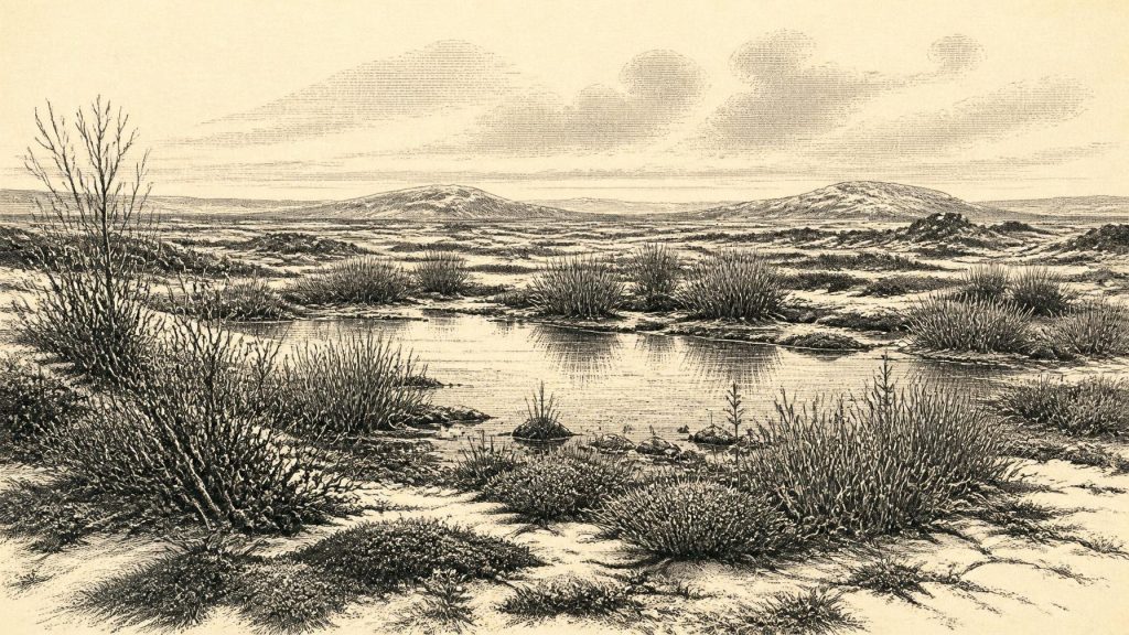
Derryvree gives the clearest environmental picture for this broad period. Plant macrofossils, pollen and insect remains point to open tundra vegetation and a periglacial regime: ground subject to intense cold, frost action and brief growing seasons, but not necessarily smothered by an ice sheet at that locality. The freshwater deposit records standing or slow-moving water fringed by wetland plants. Sedges, mosses and cold-adapted herbs and dwarf shrubs formed a low, patchy cover rather than woodland.
Among the plants reported from the sequence are taxa comparable with bogbean, water-milfoil, dwarf willow, mountain-avens and lesser clubmoss. These remains establish that a biologically active freshwater margin existed in the basin. They do not offer a complete botanical map of Ireland. A seed or pollen grain tells us that a species, or close relative, was represented locally; it cannot demonstrate that every county had the same vegetation or that the countryside looked identical in every season.
The insect record reinforces the interpretation of exposed, cold ground with damp, vegetated margins. Insects are especially helpful because many have narrow ecological tolerances. Yet they too demand restraint: their presence can indicate a combination of moisture, available plants and seasonal warmth, not an exact temperature on a named day. The strongest conclusion is modest but vivid. Parts of north-central Ireland contained pools, marshy edges and tundra vegetation during an interval later overwritten by ice.
An Island of Regional Contrasts
At the scale of the island, the evidence supports variation rather than a single climatic verdict. Subsequent glacial erosion removed much of the older land surface, and later sediments conceal what survived. Fermanagh’s intertill deposits show local ice-free conditions at one stage; they cannot prove that Cork, the western seaboard, the Midlands and the east coast were all open at the same moment. Nor should the evidence be made to support a familiar green Ireland. Trees were absent or extremely restricted in the landscapes represented at Derryvree, while wind, frost, seasonal snow and waterlogged ground shaped the terrain.
At about this time the wider British–Irish Ice Sheet system was growing more significant, though its timing and limits differed from sector to sector. Recent reconstructions stress that Ireland’s last ice sheet developed dynamically rather than as a single simple advance. The major maximum came later, conventionally in the range of roughly 27,000–21,000 calibrated years BP in Irish sectors, with important differences between regions. Around 30,559 BCE, then, the key historical development was not a kingdom or battle but the gathering climatic conditions that would transform and, in many places, erase the landscapes then available to plants and animals.
Sea level was lower than today during the glacial world, but no secure Irish evidence permits a confident reconstruction of a particular route by which people or animals crossed the Irish Sea at this date. Coastlines, ice margins and marine passages changed substantially. It is safer to place Ireland within a wider north-west European environmental zone than to claim a particular land bridge or voyage.
Castlepook’s Animal World
The limestone caves of north County Cork provide a second, very different archive. Castlepook Cave, near Doneraile and the Awbeg valley, has yielded one of Ireland’s richest collections of pre-Last Glacial Maximum animal remains. Its fauna includes woolly mammoth, reindeer, giant deer, brown bear, wolf, Arctic fox, mountain hare, lemmings and the only well-established Irish occurrence of spotted hyaena. The cave was a place where bones accumulated through predation, scavenging, death and geological disturbance, not a straightforward census of animals roaming together on one day.
Improved radiocarbon methods have altered the chronology of this material. Re-dating has shown that a number of older measurements from southern Irish caves were appreciably too young, and it indicates that some Castlepook animals belonged to Marine Isotope Stage 3, well before the Last Glacial Maximum. This supports the broader conclusion that Ireland intermittently sustained a more varied cold-stage mammal community than the later, post-glacial record alone would suggest.
Reindeer and mammoth imply open habitats with enough forage, while hyaenas, wolves and bears indicate a functioning predator and scavenger community. That does not mean Ireland was an easy or continuously habitable refuge. Animal populations could have shifted rapidly as climate altered, and cave assemblages may mix remains accumulated over long periods. Nonetheless, the fossils show that this was not a sterile landscape: food webs extended from tundra plants and small mammals to large herbivores and carnivores.
The Human Question
A reindeer femur from Castlepook has made this period central to a major archaeological question. It bears a deep mark interpreted by palaeozoologist Ruth Carden and County Cork heritage researchers as damage made by a sharp stone tool during butchery. The bone has been presented as dating to around 33,000 years ago. If that interpretation is sustained, it would indicate that people reached Ireland during the Upper Palaeolithic, far earlier than the formerly accepted record of human activity on the island.
The claim must nevertheless remain carefully qualified for 30,559 BCE. The specimen is one bone from an antiquarian cave collection, without an associated stone-tool assemblage, hearth, dwelling floor or securely excavated kill site. Castlepook’s cave deposits also involved carnivores and later disturbance. A cut-marked bone can be important evidence for brief human contact; by itself it cannot demonstrate a resident population, a seasonal camp, a migration route or a settled hunting territory. Nor can it establish that a person was present in the particular calendar year represented by this article.
Accordingly, no political affairs, diplomacy, warfare, named communities or religious institutions can responsibly be described. There is no evidence for farms, fields, livestock, pottery, houses, monuments, trade networks, writing or formal learning. If humans did visit, they would have belonged to mobile Upper Palaeolithic hunter-gatherer worlds known elsewhere in north-west Europe, likely interested in animal carcasses, hides, marrow and stone resources. That is an informed comparison, not a demonstrated Irish social history.
History Before History
The economic processes securely visible around this horizon were chiefly ecological and geological: vegetation colonising wet ground, herbivores grazing, predators and scavengers using carcasses, sediment washing into pools, organic material building up, and glaciers later advancing across the terrain. In this sense, the most consequential regional change was environmental. The freshwater basin at Hollymount and the tundra pool at Derryvree belonged to a world that later ice buried, compressed and partly preserved.
For Ireland around 30,559 BCE, the evidence does not yield an annual narrative. It yields something both narrower and more remarkable: proof that, amid a volatile cold stage, life persisted in local freshwater wetlands and open tundra; that large mammals moved through parts of the island; and that a single marked reindeer bone raises, but does not settle, the possibility of human presence. The Irish past at this depth is not silent. It speaks in mosses, insects, silts, bones and the intervals between ice sheets.
Primary Sources
- Middle Midlandian Freshwater Series at Derryvree, Maguiresbridge, County Fermanagh, Northern Ireland
- An Inter-Till Fresh-Water Deposit at Hollymount, Maguiresbridge, Co. Fermanagh
- Middle Midlandian Interstadial Deposits at Greenagho, Near Belcoo, County Fermanagh, Northern Ireland
- Freshwater Organic Deposits and Stratified Sediments Between Early and Late Midlandian (Devensian) Till Sheets, at Aghnadarragh, County Antrim, Northern Ireland
- Aghnadarragh
- Early Midlandian–Middle Midlandian, Pleistocene, Northern Ireland
- The Irish Quaternary Fauna Project
- A Reconsideration of the Radiocarbon Dating of the Marine Isotope Stage 3 Fauna from Southern Ireland
- Mammoth and Musk Ox ESR-Dated to the Early Midlandian at Aghnadarragh, County Antrim, Northern Ireland, and the Age of the Fermanagh Stadial
- The Exploration of Castlepook Cave, County Cork, Being the Third Report from the Committee Appointed to Explore Irish Caves
- Occurrence of Mammalia Relicts at Site Castlepook Cave
- Heritage Artefacts of County Cork
- Prehistoric Details: Mell Flint Flake
- The Colonization of Ireland: A Human Ecology Perspective
- Late Pleistocene Chronostratigraphy and Ice Sheet Limits, Southern Ireland
- Radiocarbon Constraints on the Age of the Maximum Advance of the British-Irish Ice Sheet in the Celtic Sea
- Last Glacial Maximum Cirque Glaciation in Ireland and Implications for Reconstructions of the Irish Ice Sheet
- Growth and Retreat of the Last British–Irish Ice Sheet, 31,000 to 15,000 Years Ago: The BRITICE-CHRONO Reconstruction
- The Timing and Magnitude of the British–Irish Ice Sheet Between Marine Isotope Stages 5d and 2: Implications for Glacio-Isostatic Adjustment, High Relative Sea Levels and ‘Giant Erratic’ Emplacement
- Sedimentology and Chronology of the Advance and Retreat of the Last British-Irish Ice Sheet on the Continental Shelf West of Ireland
- New Data for the Last Glacial Maximum in Great Britain and Ireland
- Figure 6: The Subdivision of the Quaternary Period in Ireland
