Willow Waterline30432 BCE
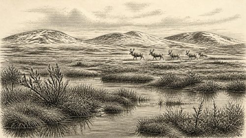
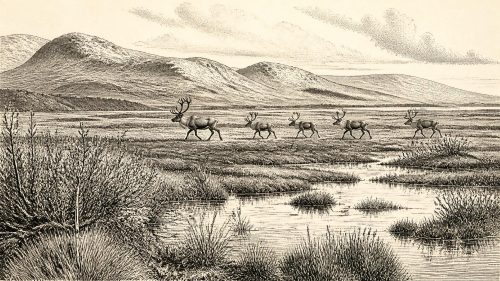
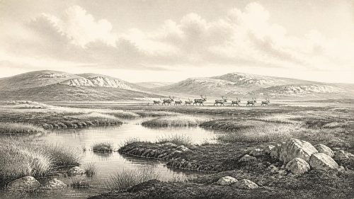
Around 30,432 BCE, Ireland lay in a fluctuating Late Pleistocene cold phase, not a historically dated year. At Derryvree, County Fermanagh, freshwater silts containing organic remains lay between glacial tills, showing an ice-free wetland interval before renewed glaciation. Radiocarbon evidence provides a broad, uncertain age range. Fossils indicate treeless tundra vegetation, including sedges, mosses, dwarf willow, bogbean and water-milfoil, around shallow fresh water. Ice, frost and changing sea levels shaped an unstable landscape. Cave faunas suggest large mammals reached Ireland, while a possible cut-marked reindeer bone may indicate brief human activity. No evidence demonstrates permanent settlement, society, farming or trade.
Dateline
30,432 BCE is a modern chronological label, not a year recorded or recognised by anybody in Ireland. At this depth of time, modern calendar-year precision is unavailable. In archaeological convention it falls about 32,381 years before AD 1950, within the Late Pleistocene and Marine Isotope Stage 3, long before written history, farming or demonstrable permanent settlement on the island. The responsible evidence consists of radiocarbon ranges, layers of sediment, fossil plants, animal bones and the traces left by moving ice. These illuminate a broad period, not an event on a particular day or in a particular year.
The best Irish evidence relevant to this notional date comes from Derryvree, near Maguiresbridge in County Fermanagh. There, road works in 1969 exposed an exceptional sequence in a drumlin: glacial till beneath freshwater silts and fine sands, with a further till above. Till is the unsorted mixture of clay, stones and other debris deposited directly by glacier ice. The order of these layers establishes a powerful sequence. Ice covered the ground; an interval followed in which open water and wetland sediments accumulated; then ice returned and sealed the deposit. It is a rare survival from a landscape which later glaciation repeatedly scoured, buried and remodelled.
A Broad Date, Not an Anniversary
Organic material from the Derryvree freshwater bed produced the radiocarbon determination BIRM-166: 30,500 radiocarbon years before present, with a notably large uncertainty, conventionally reported as +1,170 and −1,030 years. That measurement should not be mechanically turned into an exact BCE date. Radiocarbon years are not calendar years, because the proportion of radioactive carbon in the atmosphere has varied through time. Calibration is therefore essential, and at ages above 30,000 years the resulting ranges are inherently broad. Published treatment has placed Derryvree’s dated interval broadly within the later part of Marine Isotope Stage 3; it is useful for understanding the world around 30,432 BCE, but cannot prove that its wetland existed in that individual calendar year.
This qualification is not pedantry. It determines what can honestly be said. There was no Irish state, no border, king, treaty, army or named community whose affairs can be recovered from this time. There are no written sources, monuments, houses, burials, hearths or securely excavated tool assemblages that establish a settled human population in Ireland around this date. Political history and diplomacy therefore have no evidence-based content here. The history is instead environmental: an island at the edge of the north-west European world, subject to abrupt climatic change and increasingly powerful ice.
Fresh Water Between Glaciers
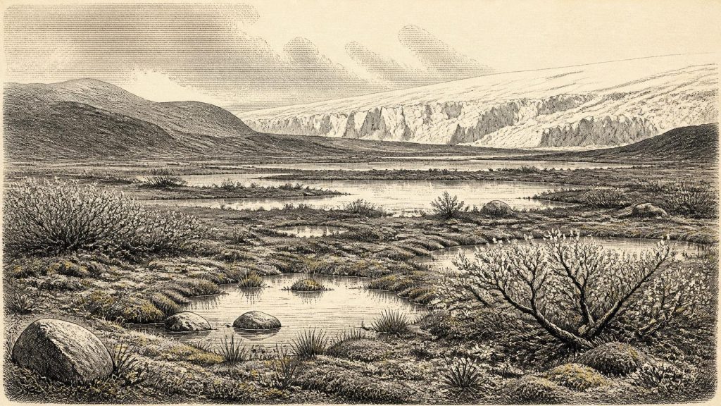
Derryvree does, however, show that this was not simply a featureless, permanently ice-covered Ireland. Its fossil assemblage was described as having a full-glacial aspect, yet it formed in a freshwater setting during an ice-free interval at the site. Poorly preserved pollen, plant macrofossils, mosses and small-animal remains point to open, treeless vegetation and a periglacial climate. “Periglacial” means a landscape profoundly shaped by cold, frost and seasonal thaw, often near glacier margins, rather than necessarily beneath ice. The implication is of damp hollows, shallow pools, sedgy margins and exposed mineral ground, set within a harsh climate of long winters and short growing seasons.
The individual plants make that reconstruction more tangible. The Derryvree deposits included evidence for grasses and sedges, mosses, juniper, dwarf willow, lesser clubmoss, mountain avens, bogbean and water-milfoil. Bogbean and water-milfoil particularly matter because they indicate standing or slow-moving fresh water locally; they prevent the landscape from being reduced to an undifferentiated snowy wilderness. Mosses and sedges suggest wet ground and waterlogged margins, while the arctic-alpine and low-growing plants indicate that woodland was absent. These remains do not mean that every Irish valley contained the same mixture, or that all species flowered together beside one pond. Fossils accumulate from particular microhabitats and over time. But collectively they support an open tundra or tundra-like wetland mosaic in south Fermanagh.
For everyday ecological life, such places would have been disproportionately important. Water concentrates vegetation, insects and animal activity; sheltered hollows could briefly become productive during the summer thaw. Yet this was not the wooded lake country of modern Fermanagh. Trees need repeated favourable growing seasons and time to mature. The absence of woodland is therefore a major climatic fact. The available evidence instead suggests sparse ground cover, cold soils, frost disturbance and a landscape in which local wetness coexisted with exposure.
Ice, Land and Changing Coasts
Ireland at this time lay within the long Midlandian cold stage, before the Last Glacial Maximum. The later maximum expansion of the British–Irish Ice Sheet is generally placed around 27,000 to 23,000 years ago, depending on region and method. Derryvree’s paired tills and intervening organic bed demonstrate that the growth of ice was neither simple nor uniform: advances, retreats and local ice-free episodes occurred over very long spans. It would be misleading to project the maximum ice sheet back unchanged onto 30,432 BCE. The evidence supports an unstable cold-world setting, with regional variation in ice cover and exposed ground, rather than a single fixed map.
Lower global sea levels also altered the setting of Ireland. The modern coastlines and sea crossings cannot be assumed. Wider coastal plains may have existed where shallow seas now lie, while ice, rivers, wind and frost continually altered the ground. This did not make Ireland automatically joined to Britain or continental Europe by a simple, reliable land bridge. The exact routes available to animals or people depended on changing sea level, topography, glacier margins and local conditions. For this period, mobility is better understood as a possibility shaped by a changing north-west European landscape than as proof of an established route or migration.
Animals and the Human Question
Irish cave deposits show that large mammals and predators occupied, or at least reached, the island during parts of the pre-maximum glacial period. Castlepook Cave, also called Mammoth Cave, near Doneraile in north County Cork, is especially significant. Antiquarian excavations there recovered a rich collection of animal remains, including evidence associated with reindeer, woolly mammoth, brown bear and spotted hyaena. Such animals testify to ecological connections with the wider Pleistocene world, although cave assemblages must be read carefully: carnivores, natural deaths, water movement and older excavation methods can all mix or disturb bones.
A reindeer femur from Castlepook has attracted particular attention because zooarchaeologist Ruth Carden interpreted a deep linear mark as damage made by a sharp stone tool during fresh-carcass butchery. Public heritage material describes the bone as about 33,000 years old. If the identification and chronological association are sustained, it is potentially the earliest indication that people handled an animal in Ireland, vastly earlier than the well-established terminal-Pleistocene evidence. But its evidential limits are crucial. The bone came from an old cave collection, not a modernly excavated occupation floor; no securely associated hearth, stone-tool assemblage, dwelling, burial, art or human bone of comparable age has been published from Castlepook. The bone may indicate a brief episode of carcass processing, not a permanent settlement, a hunting territory or an uninterrupted population.
Accordingly, society cannot responsibly be reconstructed in detail. There is no basis for naming a people, assigning language, describing kinship systems or claiming a local culture comparable to later Mesolithic communities. If humans did visit, they would have faced problems familiar from Upper Palaeolithic settings elsewhere in Europe: obtaining food and fuel, finding shelter, moving safely through severe weather and negotiating the presence of predators. Those are reasonable general inferences, not discoveries made at Derryvree. No evidence from Ireland at this date establishes farming, livestock keeping, trade, craft specialisation, formal ritual, art, religious institutions or organised learning.
Economy Before Economy
The economy visible in the evidence is ecological rather than commercial. Plants grew in shallow water and wet ground; herbivores fed across open country; carnivores exploited prey and carcasses; frost, meltwater and ice shifted sediment. Reindeer, if present locally, would have been an important source of meat, hide, bone and fat to any human group able to obtain one, but Castlepook does not demonstrate a managed hunt, seasonal camp or exchange network. There are no imported goods, coins, boats, fields or storehouses. “Trade” and “settlement” would be inventions if applied as facts to Ireland in 30,432 BCE.
There is likewise no direct evidence for conflict or diplomacy. Predation and competition among animals were real features of the landscape, and human groups elsewhere in Ice Age Europe may have travelled in small, highly mobile bands, but no Irish deposit of this age records violence between people, territorial boundaries or alliances. The most revealing historical contrast is with later Ireland: the familiar island of farms, forests, parishes, roads and towns lay tens of millennia in the future.
A Fragile Archive
The importance of Derryvree lies partly in what it teaches about absence. Glaciers destroy and redistribute evidence. Their later advance sealed the Fermanagh freshwater bed, preserving a small window on an earlier cold landscape; elsewhere, the same processes may have erased soils, camps and animal traces. This means that absence of a settlement is not conclusive proof that no person ever entered Ireland. Yet it also cannot be used to manufacture an inhabited island where evidence is lacking. The most defensible picture is an environmentally dynamic, largely treeless Ireland, with local fresh water surviving between episodes of glaciation and a faunal world capable of supporting occasional human movement, but no demonstrated lasting human society.
For 30,432 BCE, then, the central development was neither a battle nor a ruler’s accession. It was the making of landscapes: freshwater collecting in a Fermanagh hollow, hardy plants occupying a brief ecological refuge, and ice eventually returning to bury the evidence. The Derryvree moss horizon gives Ireland a rare, precise kind of prehistoric history—not a calendar entry, but a scientifically recoverable glimpse of life at the cold edge of Europe.
Source References
Hover over a number to see the source. Select it to open the source.

- [1] Palaeoecology
- [2] Exploring Controls of the Early and Stepped Deglaciation on the Western Margin of the British-Irish Ice Sheet
- [3] Pattern and Timing of Retreat of the Last British-Irish Ice Sheet
- [4] Pleistocene Glaciations in Ireland
- [5] Maximum Extent and Dynamic Behaviour of the Last British–Irish Ice Sheet West of Ireland
- [6] Stratigraphic and Palaeo-Geomorphological Evidence for the Glacial-Deglacial History of the Last British-Irish Ice Sheet in the North-Western Irish Sea
- [7] The IntCal20 Northern Hemisphere Radiocarbon Age Calibration Curve (0–55 cal kBP)
- [8] IntCal Publications
- [9] Menyanthes trifoliata
- [10] Selaginella selaginoides
- [11] Irish Pleistocene Biostratigraphy
- [12] The Irish Quaternary Fauna Project
- [13] Quaternary Faunal Remains in Ireland
- [14] New Insights on the Fauna of Ireland’s Younger Dryas and Early Holocene from Alice & Gwendoline Cave
- [15] First Evidence of a Late Upper Palaeolithic Human Presence in Ireland
- [16] The Colonization of Ireland: A Human Ecology Perspective
- [17] The Mesolithic in Ireland: When Was It?
- [18] Heritage Artefacts of County Cork
- [19] 2022:564 - Castlepook Cave, Castlepook South, Cork
- [20] Extent, Timing and Nature of Retreat of the British-Irish Ice Sheet Offshore of North-Western Ireland During and Following the Last Glacial Maximum
Primary Sources
- Palaeoecology
- Exploring Controls of the Early and Stepped Deglaciation on the Western Margin of the British-Irish Ice Sheet
- Pattern and Timing of Retreat of the Last British-Irish Ice Sheet
- Pleistocene Glaciations in Ireland
- Maximum Extent and Dynamic Behaviour of the Last British–Irish Ice Sheet West of Ireland
- Stratigraphic and Palaeo-Geomorphological Evidence for the Glacial-Deglacial History of the Last British-Irish Ice Sheet in the North-Western Irish Sea
- The IntCal20 Northern Hemisphere Radiocarbon Age Calibration Curve (0–55 cal kBP)
- IntCal Publications
- Menyanthes trifoliata
- Selaginella selaginoides
- Irish Pleistocene Biostratigraphy
- The Irish Quaternary Fauna Project
- Quaternary Faunal Remains in Ireland
- New Insights on the Fauna of Ireland’s Younger Dryas and Early Holocene from Alice & Gwendoline Cave
- First Evidence of a Late Upper Palaeolithic Human Presence in Ireland
- The Colonization of Ireland: A Human Ecology Perspective
- The Mesolithic in Ireland: When Was It?
- Heritage Artefacts of County Cork
- 2022:564 – Castlepook Cave, Castlepook South, Cork
- Extent, Timing and Nature of Retreat of the British-Irish Ice Sheet Offshore of North-Western Ireland During and Following the Last Glacial Maximum