

Castlepook’s Striated Femur30251 BCE
About 30,251 BCE, Ireland lay within the climatically unstable later Marine Isotope Stage 3, rather than a precisely recoverable year. Derryvree, County Fermanagh, preserves freshwater sediments between glacial tills, indicating an ice-free interval with open, treeless, wet periglacial vegetation. Castlepook Cave, County Cork, contains a diverse fauna including mammoth, reindeer, giant deer, hyaena and Arctic fox, accumulated across complex periods. A striated reindeer femur may record stone-tool butchery around 33,000 years ago, but disturbed deposits and lack of tools prevent secure proof of human presence. No evidence supports settlement or institutions; environmental change and advancing ice define the period here.
Dateline
30,251 BCE is a modern calendar label, not a date that can be recovered from Ireland’s archaeological record with year-by-year precision. In the conventional “before present” system, whose present is AD 1950, it falls roughly 32,200 calendar years ago. At that depth of time, radiocarbon results must be calibrated and expressed as wide ranges, while sediments and fossils often record episodes lasting generations or longer. The responsible subject is therefore not an event in a particular year, but Ireland during the later part of Marine Isotope Stage 3: a fluctuating interval of the last Ice Age, before the fullest expansion of the British–Irish Ice Sheet.
A Date Inside a Wide Window
The closest securely dated Irish environmental archive is at Derryvree townland, near Maguiresbridge in County Fermanagh. Roadworks in 1969 cut through a drumlin and exposed freshwater silts and fine sands trapped between two thick sheets of glacial till. Organic material from the middle layer produced the conventional radiocarbon determination BIRM-166 of 30,500 radiocarbon years before present, with a substantial uncertainty of +1,170 and −1,030 years. That is not a calendar age. Modern calibration places the deposit broadly within the mid-to-late 30,000s calibrated years before present; published summaries give a range extending approximately from 36,900 to 31,700 cal BP, or roughly 34,950–29,750 BCE.
30,251 BCE therefore lies within the broad chronological horizon illuminated by Derryvree, but cannot be assigned to a particular layer, season, community or occurrence. The deposit is especially valuable because it lies between tills. The lower till proves that ice had previously affected the locality; the upper till shows that ice later returned or overran the site. Between those episodes, water accumulated locally and a cold-adapted wetland existed. This is evidence for a changing Fermanagh landscape, not a complete map of conditions across the island on one imagined day.
Derryvree’s Open Wetland
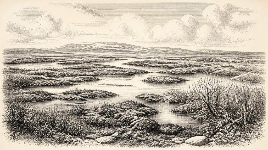
The Derryvree fossils offer Ireland’s clearest local view of this period. Plant pollen was poorly preserved, but the surviving macrofossils, mosses and insect evidence indicate an open, treeless and periglacial environment. Grasses, sedges and herbs grew around wet ground. Finds attributed to bogbean (Menyanthes trifoliata) and water-milfoil indicate shallow freshwater or saturated margins, while dwarf willow, mountain avens and lesser clubmoss point to cold-tolerant vegetation. Moss-rich ground, shallow pools and sedge margins have led researchers to describe the setting as tundra or muskeg: wet, peaty country rather than a frozen desert.
Such terms need careful handling. “Tundra” is a useful ecological comparison, not a claim that every Irish valley resembled one modern Arctic landscape. The Derryvree sequence records a particular lowland basin, and plants spread unevenly across exposed ground, stream margins and sheltered hollows. The pollen of pine or hazel cannot automatically be used to reconstruct local woodland, because light pollen may have travelled far. What the deposit securely supports is a landscape without nearby forest, with persistent water and vegetation able to exploit a short growing season despite severe winter conditions.
This was not yet the Last Glacial Maximum, conventionally dated in Ireland and Britain to a later phase centred broadly on 28,000–20,000 calibrated years before present. Yet the final British–Irish Ice Sheet was growing and its margins shifted through a climatically unstable North Atlantic world. Recent syntheses place important expansion of the last ice sheet around 32,000–31,000 years ago, though the pace, extent and timing differed between regions. Derryvree’s position between till sheets is a physical reminder that an ice-free interval could be temporary. Ice, meltwater, frost action and sediment movement repeatedly remade the ground and destroyed or buried older traces.
Animals in a Cold Landscape
Caves in the limestone country of southern Ireland preserve another, necessarily patchier, source of evidence. Castlepook Cave near Doneraile in north County Cork, also called Mammoth Cave, has yielded remains of woolly mammoth, reindeer, giant deer, brown bear, wolf, Arctic fox, hare, lemmings and spotted hyaena. This is an impressive Ice Age fauna, but it must not be converted into a single herd photographed in time. Much of the material was recovered in antiquarian excavations between 1904 and 1914; a great deal has since been lost, and surviving bones derive from deposits accumulated over long and complex intervals.
Modern redating has strengthened the case that some Castlepook animals belong to Marine Isotope Stage 3, while also revealing that several older radiocarbon measurements were unreliable or require reinterpretation. The fauna demonstrates that Ireland could at times sustain, or be reached by, sizeable herbivores and predators in open environments. Reindeer were adapted to grazing and browsing over sparse ground; mammoths and giant deer signal a much richer Late Pleistocene animal world than historic Ireland possessed. Hyaena remains and coprolites show that caves were also carnivore places: dens, scavenging sites or natural traps, rather than straightforward human camps.
These animals tell us about ecology, movement and food webs, but not political boundaries or human economies. There is no evidence for farming, herding, permanent villages, fields, metalworking, pottery, trade networks or seaborne commerce in Ireland at this horizon. Nor can animal distributions establish a land bridge at a particular time. Lower global sea level enlarged continental shelves and altered routes between Ireland, Britain and north-western Europe, but waterways, ice margins and seasonal hazards remained significant barriers whose precise configuration changed over time.
The Human Question
The most provocative object relevant to this era is a reindeer femur from Castlepook. Re-examination of the National Museum of Ireland collection identified a deep linear mark that zooarchaeologist Ruth Carden has interpreted as damage made by a sharp stone implement during fresh-bone butchery. The bone has been publicised as dating to about 33,000 years ago. If the mark is confirmed as anthropogenic and demonstrably belongs to the same episode as the bone’s deposition, it would indicate that people processed a reindeer in Ireland far earlier than the previously accepted Late Upper Palaeolithic evidence.
That possibility must remain distinct from established fact. A radiocarbon date determines the age of sampled bone collagen, not the exact moment at which a surface mark was made. Castlepook’s early excavation history, disturbed deposits and absence of an associated stone-tool assemblage all limit what can be inferred. A single modified bone would not prove a settlement, a named population, a route of migration, continuous occupation or an “Irish” society in any later cultural sense. It might record a brief visit by mobile hunter-gatherers; it might instead require a different taphonomic explanation. Further work in undisturbed cave deposits is needed.
For comparison, the more fully published early evidence for human activity in Ireland is a cut-marked brown-bear patella from Alice and Gwendoline Cave in County Clare, directly dated to 12,810–12,590 cal BP. That evidence is almost twenty millennia later than 30,251 BCE. It establishes that people reached or visited Ireland in the Late Glacial, but it cannot be projected backwards to fill the much earlier gap. At the date considered here, human presence is possible but not securely demonstrated by a conventional archaeological site.
No Polities, Only Evidence
Accordingly, there were no recoverable political affairs, rulers, diplomatic ties, wars, religions, languages, artistic traditions or systems of learning to narrate for this year. Their absence from the record is not evidence that people, if present, lacked beliefs or social relationships; it means that Irish evidence cannot responsibly describe them. Even the word “Ireland” is geographical shorthand. The modern island, its counties and its later historical communities did not exist as political entities.
The principal development was environmental rather than institutional: parts of the island experienced cold, open and locally wet conditions during an unstable stage of the last glacial cycle, while advancing ice would eventually erase or conceal much of that world. Derryvree’s freshwater silts and Castlepook’s animal bones survive because of unusual preservation. They are fragments, but important ones. Together they show that long before the familiar wooded and maritime Ireland of later prehistory, the island contained periglacial wetlands, roaming Ice Age mammals and, perhaps, the faintest unresolved trace of human contact.
Primary Sources
- A Middle Midlandian Freshwater Series at Derryvree, Maguiresbridge, County Fermanagh, Northern Ireland
- Middle Midlandian Freshwater Series at Derryvree, Maguiresbridge, County Fermanagh, Northern Ireland
- Palaeoecology
- Figure 6.— The Subdivision of the Quaternary Period in Ireland
- Exploring the Celtic Sea's last glaciation: the Irish Sea Glacier, the Celtic Sea Ice Stream and their contribution to the British–Irish Ice Sheet
- Growth and Retreat of the Last British–Irish Ice Sheet, 31,000 to 15,000 Years Ago
- Radiocarbon Constraints on the Age of the Maximum Advance of the British–Irish Ice Sheet in the Celtic Sea
- The Timing and Magnitude of the British–Irish Ice Sheet Between Marine Isotope Stages 5d and 2
- A Reconsideration of the Radiocarbon Dating of the Marine Isotope Stage 3 Fauna from Southern Ireland
- The Irish Quaternary Fauna Project
- Occurrence of Mammalia Relicts at Site Castlepook Cave
- Archaeological Heritage of County Cork
- Heritage Artefacts of County Cork
- Ireland's Palaeolithic Archaeology – Fleeting Footprints in a Frozen Land
- First Evidence of a Late Upper Palaeolithic Human Presence in Ireland
- New Insights on the Fauna of Ireland's Younger Dryas and Early Holocene from Alice & Gwendoline Cave
- The Archaeology of Caves in Ireland
- Mammoth Cave
- Menyanthes trifoliata
- Composition and Consequences of the IntCal20 Radiocarbon Calibration Curve
- The IntCal20 Approach to Radiocarbon Calibration Curve Construction
- Guide to the National Museum of Ireland – Natural History





