

Cork Bones, Fermanagh Silts30200 BCE
Around 30,200 BCE, Ireland lay within the unstable MIS 3 phase of the last Ice Age, and no precise event or island-wide conditions can be identified. Derryvree, County Fermanagh, preserves freshwater silts between glacial tills, indicating a locally ice-free, treeless periglacial wetland during a broad Late Pleistocene interval. Castlepook Cave, County Cork, yielded mixed deposits containing mammoth, reindeer, giant deer, hyaena, wolf and other cold-adapted fauna, demonstrating intermittent ecological connections with Britain and Europe. A possibly cut-marked reindeer bone may indicate early human butchery, but lacks secure context. Evidence depicts shifting ice, wetlands, open ground and uncertain human presence overall.
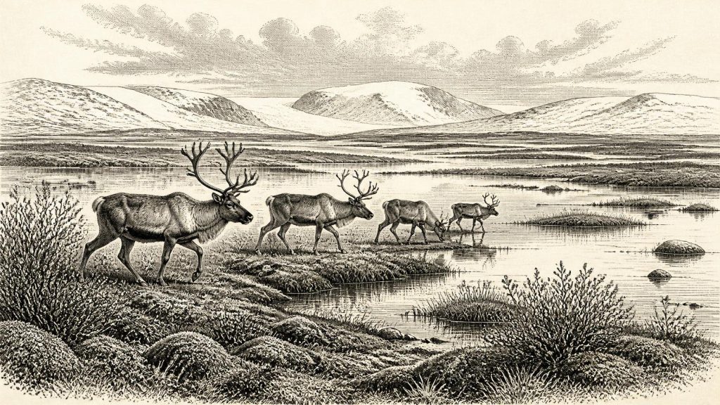
Dateline
Modern calendar-year precision is not available for Ireland around 30,200 BCE. The numbered year is a useful point of reference, but it cannot be attached to a recorded event, a ruler, or even a precisely dated archaeological horizon. In radiocarbon and environmental scholarship, it lies broadly within Marine Isotope Stage 3 (MIS 3), an unstable middle phase of the last Ice Age. The most responsible account is therefore regional and comparative: it asks what deposits, animal remains and glacial landforms can tell us about Ireland during a wide interval centred on roughly 32,150 years before AD 1950, rather than claiming knowledge of one particular year.
An Island in a Changing Ice Age
Ireland at this time was not the familiar green, temperate island of later history. It lay on the north-western edge of Europe during a cold stage marked by abrupt climatic swings. The term “Ice Age” should not suggest one unchanging sheet of ice covering every valley throughout the period. Ice masses expanded and retreated repeatedly, while the surrounding seas, coastlines and routes between Ireland, Britain and continental Europe changed with climate and sea level. What can be said confidently is that the great Last Glacial Maximum, when the British–Irish Ice Sheet reached its best-established maximum extent, lay later: broadly after 30,000 years ago and especially around 27,000–19,000 years before present in the wider British–Irish record.
The position of ice in Ireland during MIS 3 remains debated. Recent synthesis finds evidence that the British–Irish Ice Sheet had earlier phases of growth and dynamic advance and retreat before the Last Glacial Maximum, but also stresses that their dates and exact extent are much less secure than those of the later ice sheet. That uncertainty matters. It prevents a simple island-wide map for 30,200 BCE. Some places may have been under or close to glacier ice at different times; elsewhere, cold terrestrial or freshwater environments existed between advances. The landscape was changing over millennia, not frozen into a single condition.
Derryvree’s Buried Wetland
The clearest Irish environmental evidence close to this broad period comes from Derryvree near Maguiresbridge, County Fermanagh. Roadworks in 1969 cut through a drumlin and exposed an extraordinary sequence: a lower till laid down by ice, freshwater silts and fine sands with organic material, and a later upper till. This order is the fundamental observation. Glacier ice had occupied the locality; an interval then allowed water and wetland sediment to accumulate; subsequently, ice again crossed or reached the site and sealed that record beneath glacial debris.
The organic layer produced the conventional radiocarbon determination BIRM-166, 30,500 radiocarbon years before present, with a substantial uncertainty of plus 1,170 and minus 1,030 years. “Before present” here means before AD 1950, not before today. Nor is a conventional radiocarbon age the same thing as a calendar age: past atmospheric radiocarbon concentrations varied, so calibration produces ranges, not a single exact date. Later reviews place the result broadly within a calibrated range of about 36,900–31,700 calendar years before present. That span overlaps the general era in which 30,200 BCE falls, but it does not prove that the Derryvree wetland existed in that exact nominal year.
The plants and small animal remains in the Derryvree silts indicate a treeless, periglacial wetland or muskeg. Mosses, sedges and cold-adapted plants, including dwarf willow, mountain avens, bogbean and water-milfoil, point to shallow water, damp margins and open ground rather than forest. Insect evidence likewise supports cold conditions. This was not necessarily a uniform tundra plain extending across the whole island. It was a local freshwater environment, preserved unusually well because later ice buried it. Yet it demonstrates an important possibility: at least part of north-central Ireland could sustain open water, wetland vegetation and animal life during a cold interval between glacial episodes.
What the Ice Record Can and Cannot Say
Derryvree is powerful evidence, but it has limits. A deposit beneath till is excellent evidence for sequence: wetland conditions came after one ice advance and before another. It is weaker evidence for the shape of Ireland’s coastline, the extent of all contemporary glaciers, or the exact duration of ice-free conditions. Its radiocarbon sample was bulk organic material rather than a perfectly sealed annual layer, and the error range is large. Accordingly, the evidence supports a cold, locally ice-free Fermanagh landscape sometime within a broad Late Pleistocene interval; it cannot yield a weather report for 30,200 BCE.
The wider glacial record adds another caution. Marine sediments, raised beaches, erratic boulders, cave deposits and landforms each preserve different aspects of past environments and are dated with different methods. Some interpretations favour substantial early glaciation over parts of Ireland during MIS 3; other evidence records ice-free settings before the major later advance. The most defensible picture is a mosaic of shifting ice margins, exposed ground, freshwater basins and changing sea connections. Ireland’s physical geography was being remade by processes that would eventually carve valleys, spread till and help form many of the drumlin landscapes visible today.
Castlepook’s Animal World
County Cork provides the principal faunal complement to Fermanagh’s wetland record. Castlepook Cave, also called Mammoth Cave or Doneraile Cave, lies on limestone farmland north of Doneraile. Excavations from the early twentieth century recovered more than 2,000 bones, while subsequent radiocarbon work showed that its deposits accumulated over a long and complicated period, from roughly 45,700 to 19,950 years before present. The cave was not a single moment preserved intact. Water movement, carnivore activity, early excavation practices and the reworking of sediments mixed material from different episodes.
Nevertheless, Castlepook establishes that Ireland supported a striking Late Pleistocene fauna before and during the build-up to the Last Glacial Maximum. Its dated assemblage includes woolly mammoth, reindeer, giant deer, brown bear, spotted hyaena, wolf, Arctic fox and lemmings. Different species and individual bones belong to different dates, so they should not be imagined as one simultaneous herd crossing a Cork hillside. Together, however, they show that suitable habitats and routes existed intermittently for large grazers, predators and small cold-adapted mammals.
For a date around 30,200 BCE, reindeer are especially evocative but should not be romanticised. They were wild animals, part of an open cold-climate ecosystem. Their presence implies forage and seasonal movement across a wider north-west European landscape, while hyaena and wolf remains reveal scavenging and predation as well as natural death and transport into caves. Mammoth and giant deer testify to the capacity of some Irish environments to support very large herbivores. Cave bones do not by themselves reconstruct population numbers, migration routes or a stable “mammoth steppe” covering all Ireland. They provide direct evidence of species, not a complete landscape painting.
The Uncertain Human Trace
The most consequential archaeological question is whether people were present. A reindeer femur from Castlepook has been reported as approximately 33,000 years old and as bearing an incision interpreted by zooarchaeologist Ruth Carden as a sharp stone-tool mark made during carcass processing. If that interpretation is confirmed, it would be Ireland’s earliest evidence of human activity by a very large margin and would place people on the island before the Last Glacial Maximum.
Yet the appropriate language remains conditional. The bone comes from an old cave collection rather than a modern, tightly recorded excavation layer. No securely associated stone-tool assemblage, hearth, dwelling floor, burial, human skeleton or art of comparable age has been published from Ireland. Natural breakage, carnivore damage, sediment movement and the difficulties of recovering context from antiquarian excavation all demand care. The femur is best understood as a serious and important claim for human butchery, not proof of a permanent settlement or a known community in 30,200 BCE.
If people did reach Ireland during this wider interval, they would have been mobile hunter-gatherers travelling through a demanding, thinly populated world. Their political organisation, language, kinship rules, religious beliefs and artistic traditions are unknown. There is no evidence for chiefs, territories, diplomacy, warfare, farming, livestock, metalworking, monuments or formal trade within Ireland at this date. Nor can foodways be reconstructed beyond the plausible inference that a cut-marked reindeer bone, if genuinely humanly modified, represents the practical division of an animal carcass for meat, marrow, hide or sinew.
Connections Without States
“Economy” and “trade” must therefore be used carefully. There were no Irish markets, ports or political frontiers. But animals and any human visitors were connected to a wider ecological zone extending through Britain and continental Europe. Lower sea levels often altered the breadth and character of sea crossings, although they did not automatically create a walkable land bridge between Ireland and Britain. Routes varied with ice, coastlines and sea conditions. The movement of mammals into Ireland demonstrates connectivity at some stages; it does not reveal how regularly humans travelled, nor whether they came by land, ice, boat or a combination of shifting coastal routes.
The deepest history of Ireland at this point is thus environmental rather than political. Beneath a Fermanagh drumlin, silt preserves a brief record of cold freshwater life between ice advances. In Cork, cave bones preserve evidence of a changing animal community and a possible encounter between humans and reindeer. Together they show that Ireland was neither simply empty nor uniformly ice-covered throughout the later Pleistocene. It was a fluctuating frontier of wetland, open ground, caves, ice and animal movement—one whose sparse records reward precision, but forbid invention.
Primary Sources
- A Middle Midlandian Freshwater Series at Derryvree, Maguiresbridge, County Fermanagh, Northern Ireland
- The Irish Quaternary Fauna Project
- A Reconsideration of the Radiocarbon Dating of the Marine Isotope Stage 3 Fauna from Southern Ireland
- Castlepook Cave, County Geological Site Report CK032
- Growth and Retreat of the Last British–Irish Ice Sheet, 31,000 to 15,000 Years Ago: the BRITICE-CHRONO Reconstruction
- The Timing and Magnitude of the British–Irish Ice Sheet Between Marine Isotope Stages 5d and 2
- Pattern and Timing of Retreat of the Last British-Irish Ice Sheet
- Radiocarbon Constraints on the Age of the Maximum Advance of the British–Irish Ice Sheet in the Celtic Sea
- Pleistocene Glaciations in Ireland
- Quaternary Deposits and Glacial Stratigraphy in Ireland
- Dimensions and Chronology of the Last Ice Sheet in Western Ireland
- Last Glacial Maximum Cirque Glaciation in Ireland and Implications for the Extent of the Irish Ice Sheet
- Advance and Retreat of the Marine-Terminating Irish Sea Ice Stream into the Celtic Sea During the Last Glacial: Timing and Maximum Extent
- Growth, Dynamics, and Deglaciation of the Last British-Irish Ice Sheet: the Deep-Sea Ice-Rafted Detritus Record
- A Marine Isotope Stage 4 Age for Pleistocene Raised Beach Deposits Near Fethard, Southern Ireland
- New Insights on the Fauna of Ireland's Younger Dryas and Early Holocene from Alice & Gwendoline Cave
- Ireland's Palaeolithic Archaeology – Fleeting Footprints in a Frozen Land
- The Subdivision of the Quaternary Period in Ireland
- Dryas octopetala in Fermanagh
- Castlepook Cave, Co. Cork, 2022 Excavation Report




