

Derryvree’s Aquatic Plant Remains30193 BCE
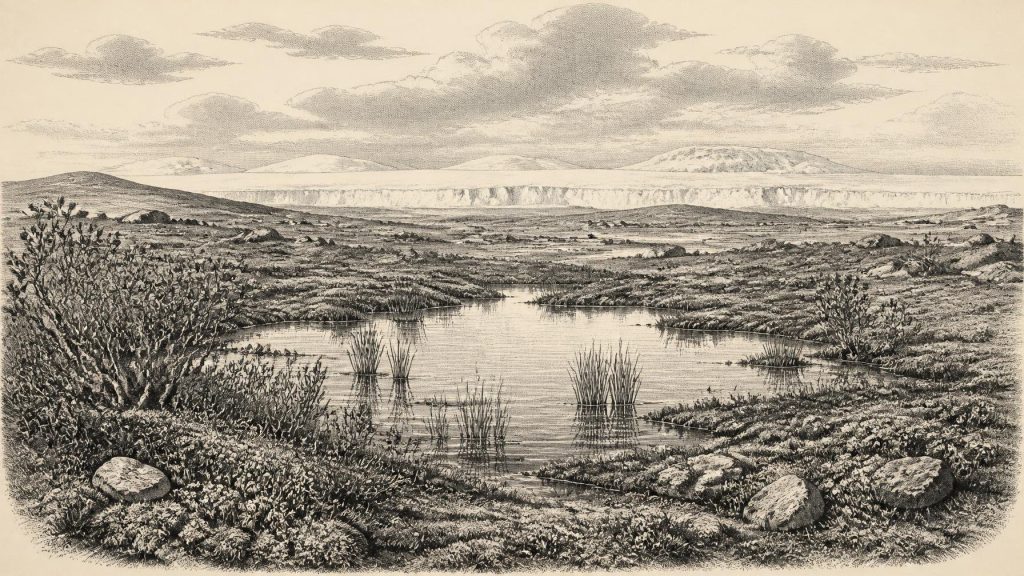
At roughly 30,193 BCE, Ireland lay within a climatically unstable Late Pleistocene interval, not a precisely datable historical moment. Derryvree, County Fermanagh, preserves freshwater sediments between glacial tills, indicating a temporary wetland landscape of cold-adapted, largely treeless vegetation, including aquatic plants, mosses, sedges and dwarf shrubs. Radiocarbon evidence places the deposit within a broad range, while later ice sealed it. Ireland experienced changing ice margins, periglacial conditions and shrinking habitats rather than uniform glaciation. Castlepook Cave fauna demonstrate wider cold-stage animal presence, but not coexistence at this date. A modified reindeer bone suggests unconfirmed human activity; no settlement evidence survives.
Dateline
Modern calendar-year precision is not available for Ireland in 30,193 BCE. The number is a useful point on a retrospective timeline, roughly 32,142 years before the conventional radiocarbon reference year of AD 1950, but it cannot identify an event, season, community or individual. Ireland was in the Late Pleistocene, within the long and climatically volatile last glacial cycle. The responsible evidence consists not of written records or settlements, but of sediments, fossil plants, insects and animal bones. Its chronological ranges are broad, and its geographical coverage is patchy.
The closest Irish environmental archive is the Derryvree sequence near Maguiresbridge, County Fermanagh. Roadworks in 1969 cut through a drumlin and revealed freshwater silts and fine sands, including organic-rich mud, lying between two thick tills: stony debris deposited directly by glacier ice. This stratigraphy establishes a sequence rather than a date in the modern sense. Ice affected the locality; a freshwater and wetland interval followed; later ice advanced and sealed the deposits. Organic material, BIRM-166, produced a conventional radiocarbon result of 30,500 +1,170/−1,030 radiocarbon years BP. A published calibrated expression of that large measurement spans approximately 36,900–31,700 calibrated years BP, or roughly 34,950–29,750 BCE. Thus 30,193 BCE lies close to the youngest end of a relevant range, not at a demonstrable moment within the sediment.
A Wetland Between Ice Advances
Derryvree is unusually valuable because later glaciers removed, rearranged or buried much of Ireland’s older ground surface. Here, moss-rich mud, sand and silt preserved a small ecological archive. Pollen was poorly preserved, so it cannot bear the reconstruction alone. Yet plant macrofossils, mosses and invertebrate remains, considered with the deposits’ freshwater setting, support the interpretation of a cold, open, largely treeless landscape. The evidence is direct for standing or slow-moving fresh water and for plants growing in or close to it; the wider picture of a tundra-like, muskeg-like mosaic is an informed interpretation rather than a photograph of the entire island.
That mosaic was not an empty snowfield. Fossil evidence includes wetland and aquatic plants, notably bogbean and water-milfoil, alongside cold-adapted taxa such as mountain avens, dwarf willow and lesser clubmoss. Mosses, sedges, grasses and herbs suggest shallow pools, saturated margins and low vegetation on adjacent ground. Such species indicate that short growing seasons could sustain life around water even in a severe climate. They do not prove that every ridge and valley in Ireland looked alike. Derryvree was one sheltered lowland basin in Fermanagh, and local water, snow cover, aspect and proximity to ice would have produced sharply differing habitats over comparatively short distances.
Everyday life, in the only sense securely recoverable here, was ecological. Freeze–thaw action would have disturbed exposed ground; meltwater and seasonal runoff fed pools and silty margins; low plants colonised damp patches during the brief favourable season. The absence of a forest is important. This was not the wooded, Atlantic island familiar today. Trees were absent or extremely sparse around Derryvree, while wind, frost and a short summer constrained plant growth. The term ‘tundra’ is useful shorthand for these open, cold-adapted conditions, but it should not be taken to mean an exact modern Arctic analogue. The Atlantic setting, local relief and changing ice margins made Pleistocene Ireland distinctive.
An Island in Climatic Transition
The broader setting was unstable. The British–Irish Ice Sheet was growing through the opening part of Marine Isotope Stage 2, although its precise extent before the Last Glacial Maximum remains debated. Recent syntheses reconstruct rapid ice-sheet development after about 32,000 calibrated years BP, while also stressing uneven evidence and differing timings in individual sectors. For western Ireland, the best-constrained outward advance to the shelf edge belongs later, during the global Last Glacial Maximum, conventionally dated about 26,500–19,000 years BP. At the notional date of 30,193 BCE, the safest conclusion is therefore not that all Ireland lay under a uniform ice cap, nor that it was all open ground, but that local ice-free basins, advancing ice and periglacial landscapes formed parts of a changing regional system.
This distinction matters for regional change. Derryvree’s lower and upper tills show that glaciation was not a single uninterrupted condition at that spot. The freshwater interlude records an interval without overriding ice, but cannot establish the simultaneous state of Cork, the western seaboard or the Irish Sea basin. Lower global sea levels altered coasts and exposed areas of continental shelf, yet no evidence permits a confidently mapped shoreline, dry route or land bridge for this precise year. Animal and human movement must therefore be discussed with restraint. Connectivity across north-west Europe may have changed, but the surviving Irish record does not document a particular crossing, migration or journey in 30,193 BCE.
Caves, Animals and a Human Question
Late Pleistocene caves in the south provide a different kind of evidence. Castlepook Cave, near Doneraile in County Cork and long known as Mammoth Cave, yielded Ireland’s richest preglacial faunal collection during antiquarian and later excavations. It includes remains attributed to reindeer, woolly mammoth, giant deer, brown bear, wolf, foxes, spotted hyaena, hares and lemmings. These finds establish that a varied cold-stage fauna reached Ireland over a long span. They cannot responsibly be compressed into one herd or one food web living together in 30,193 BCE: many were excavated from disturbed deposits, and direct dates show that individual bones and species represent different episodes.
One Castlepook object gives this period exceptional interest but requires particular caution. A reindeer femur has been publicly reported as dating to about 33,000 radiocarbon years BP and as bearing a deep modification interpreted by zooarchaeologist Ruth Carden as a sharp-tool mark made during carcass processing. If sustained by microscopic analysis, secure direct dating and new excavated context, it could indicate a brief human presence in Ireland far earlier than the accepted terminal-Pleistocene evidence. It is not, however, a basis for describing a settled population at Derryvree’s horizon. Ireland has produced no human bone, unequivocal contemporary stone-tool assemblage, hearth, dwelling floor or securely excavated camp belonging to this broad period. The marked femur is a significant research question, not proof of an Irish Upper Palaeolithic society.
Accordingly, there is no evidence here for political affairs, rulers, warfare, diplomacy, formal religion, literacy, trade institutions or permanent settlement. Nor can the presence of large mammals be turned automatically into an economy of hunting. If people did make a short visit, they may have followed or encountered animal resources, but that remains an inference unsupported by a camp, tool kit or repeated occupation surface. Culture and learning are likewise archaeologically invisible at this scale. The only defensible social conclusion is negative but important: the record is too slight to reconstruct a community.
What This Date Can Mean
For Ireland, 30,193 BCE is best understood as a point within a broad environmental window. Derryvree shows that freshwater and cold-tolerant plant life existed in at least one Fermanagh basin between episodes of glaciation. Castlepook shows that large mammals and predators occupied Ireland during the wider Late Pleistocene, though not necessarily at precisely the same time or in the same place. Ice-sheet research shows that the island’s landscapes were approaching a phase of major glacial expansion. Together, these records replace the misleading image of a timeless, uniformly frozen Ireland with one of local wetlands, open vegetation, changing habitats and advancing ice.
The greatest historical development was therefore environmental rather than political: the gradual narrowing and reorganisation of habitable landscapes as cold conditions intensified. These places were not yet the Ireland of farms, monuments, languages or named peoples. They were landscapes whose sediments became archives. The moss-rich mud at Derryvree, protected beneath later till, preserves a rare witness to that world—valuable precisely because it tells us both how much could live in a cold Irish interval and how firmly the limits of the evidence must be respected.
Primary Sources
- A Middle Midlandian Freshwater Series at Derryvree, Maguiresbridge, County Fermanagh, Northern Ireland
- Palaeoecology
- The subdivision of the Quaternary Period in Ireland
- Exploring controls of the early and stepped deglaciation on the western sector of the British-Irish Ice Sheet
- The deglaciation of the western sector of the Irish Ice Sheet from the inner continental shelf to its terrestrial margin
- Growth and retreat of the last British–Irish Ice Sheet, 31,000 to 15,000 years ago: the BRITICE-CHRONO reconstruction
- The timing and magnitude of the British–Irish Ice Sheet between Marine Isotope Stages 5d and 2: implications for glacio-isostatic adjustment, high relative sea levels and ‘giant erratic’ emplacement
- Pattern, style and timing of British–Irish Ice Sheet advance and retreat over the last 45,000 years: evidence from NW Scotland and the adjacent continental shelf
- Pattern, style and timing of British–Irish Ice Sheet advance and retreat over the last 45,000 years: evidence from NW Scotland and the adjacent continental shelf
- The Irish Quaternary Fauna Project
- Radiocarbon Dates from the Oxford AMS System: Archaeometry Datelist 31
- New insights on the fauna of Ireland's Younger Dryas and Early Holocene from Alice & Gwendoline Cave
- Archaeological Heritage of County Cork
- Castlepook Caves
- Menyanthes trifoliata L.
- Dryas octopetala L.
- The IntCal20 Northern Hemisphere Radiocarbon Age Calibration Curve (0–55 cal kBP)
- Radiocarbon Dating and Chronological Modelling: Guidelines and Best Practice
- Pleistocene glaciations in Ireland
- Phylogeographic, ancient DNA, fossil and morphometric analyses reveal ancient and modern introductions of a large mammal: the complex case of red deer (Cervus elaphus) in Ireland
- New insights on the fauna of Ireland’s Younger Dryas and Early Holocene from Alice & Gwendoline Cave
- Reindeer bone found in Cork cave shows human activity in Ireland 33,000 years ago


