
Archived: 26 September 2026
Abstract
In 1167 Ruaidrí Ua Conchobair consolidated a precarious high-kingship through military campaigning, hostage-taking, assemblies and church patronage. Leading a broad coalition into Tír Eoghain, he secured submissions, divided authority among northern rivals and demonstrated coordination by land and sea. At Athboy and Tailtiu, he projected island-wide rule, promoted peace, protected churches and regulated political obligations. Ireland’s pastoral economy, port towns and ecclesiastical centres underpinned these networks. Diarmait Mac Murchada returned to Leinster with a small overseas force, regained territory, then submitted to Ruaidrí while retaining future foreign support. Deaths, violence and church building revealed continuing instability beneath Ruaidrí’s temporary ascendancy.
Read Article

Archived: 26 September 2026
Abstract
In 1164, Ireland remained politically divided yet interconnected by kingship, churches and Irish Sea networks. High-king Muirchertach Mac Lochlainn sustained authority through alliances, tribute and ecclesiastical patronage, despite northern raids and rebellion. Rival Ruaidrí Ua Conchobair built a major fortified residence at Tuam, while Munster and Leinster saw raids, dynastic killings and blinding. At Derry, royal and clerical resources created an exceptionally large Columban church, amid wider links with Iona and the Isles. Fires damaged several religious centres. Somerled’s Scottish expedition included Dublin forces. Agriculture, livestock, skilled labour and learning underpinned society, although conflict and disaster exposed persistent deep instability.
Read Article

Archived: 26 September 2026
Abstract
In 1160, Ruaidrí Ua Conchobair exploited the assassination of Meath’s king, installing Diarmait Ua Máel Sechlainn and securing hostages from Meath and Tethbae. His subsequent Shannon expedition compelled Thomond’s rulers to acknowledge his authority, marking Connacht’s recovery against high-king claimant Muirchertach Mac Lochlainn. Rival armies confronted one another without settlement, while Mac Lochlainn’s instigated killings and broken guarantees fostered northern instability. Dublin’s king Brodar was slain amid conflict. Clerical and scholarly deaths reflected reform and learned culture, while institutions including Jerpoint emerged. Burnings, warfare and cattle exactions burdened communities. Ireland remained divided, but rivalry centred upon Ruaidrí and Mac Lochlainn.
Read Article
Archived: 26 September 2026
Abstract
In 1159, Muirchertach Mac Lochlainn, Ireland’s leading overking, contested Ruaidrí Ua Conchobair’s power through shifting alliances across Meath, Bréifne, Airgíalla and Thomond. After reshaping Meath’s kingship, Mac Lochlainn faced Ruaidrí’s Connacht-Bréifne coalition, whose campaign was marked by Áed Ua Conchobair’s death at Athlone’s wicker bridge. At Ardee, northern and Airgíalla forces routed Ruaidrí’s army, killing numerous regional leaders. Mac Lochlainn subsequently ravaged Connacht and pressured Meath and Leinster, but gained neither Ruaidrí’s submission nor lasting control. Local raids, church deaths and rural military burdens reflected wider instability. Ardee confirmed his supremacy temporarily, yet preserved rivals and left Ireland’s kingship unresolved.
Read Article

Archived: 26 September 2026
Abstract
In 1156, the death of Toirdelbach Ua Conchobair ended a career of contested island-wide authority and prompted succession struggles. Ruaidrí Ua Conchobair secured Connacht through hostage-taking and blinding rivals, while Muirchertach Mac Lochlainn expanded northern power by compelling submissions in Ulaid, Leinster and Osraige. Warfare and shifting alliances destabilised Mide, involving Leinster, Bréifne and Dublin forces. Power depended on hostages, tribute, raids and military expeditions, despite ecclesiastical protections. Toirdelbach’s burial at Clonmacnoise and gifts affirmed royal patronage. Fires damaged churches, religious reform continued, and learning suffered losses. A plentiful harvest was followed by severe frost, underscoring the year’s political uncertainty.
Read Article

Archived: 26 September 2026
Abstract
In 1150 Ireland remained divided among competing provincial and lesser kings, with Muirchertach Mac Lochlainn strengthening his high-kingship through hostages, alliances and the partition of Mide. Tairdelbach Ua Conchobair retained Connacht, while Tairdelbach Ua Briain raided Mide, gained Dublin’s submission and campaigned in Leinster. Warfare, cattle raiding, killings and dynastic punishments accompanied short-lived negotiated peace. Clergy at Armagh and Derry legitimised rulers, mediated settlements and collected substantial livestock tribute. Church reform advanced alongside older monastic networks; Bishop Muiredach Ua Dubthaig died. Fires damaged religious settlements. Cattle, horses and urban trade underpinned power, exposing warfare’s burden on ordinary households throughout Ireland.
Read Article

Archived: 26 September 2026
Abstract
In 1149, competing Irish rulers pursued authority through raids, alliances, hostages and ceremonial submission. Toirdelbach Ua Conchobair maintained Connacht, while Muirchertach Mac Lochlainn expanded northern influence, receiving hostages from Tigernán Ua Ruairc, Diarmait Mac Murchada and Ulaid leaders, and mediating at Dublin. Warfare devastated Ulaid, Brega and ecclesiastical settlements, bringing cattle, captives and damage to churches. Munster forces under Toirdelbach Ua Briain raided Connacht and destroyed Dún Gaillimhe. Fires affected Clonmacnoise, Derry and Inis Mic Dairen; churchmen also died. Annals reveal pastoral wealth, displacement and the vulnerability of communities sustaining contested kingship. No ruler commanded uncontested authority across the island.
Read Article

Archived: 26 September 2026
Abstract
In 1148, Irish politics combined rivalry, raiding and shifting alliances with major ecclesiastical reform. Tairdelbach Ua Conchobair, king of Ireland with opposition, campaigned in Mide, while Muirchertach Mac Lochlainn intervened in Ulaid, where changing rulers, hostages and a relic-sanctioned peace reflected unstable power. Tigernán Ua Ruairc survived an assassination attempt, and Dublin’s Hiberno-Norse king Óttar was killed. At Inispatrick, Malachy Ua Morgair gathered bishops and clergy, advancing diocesan reform and plans for papal pallia. He consecrated Cnoc na Seangan, while Baltinglass Abbey was founded. Malachy died at Clairvaux, but his reforms helped shape the 1152 settlement at Kells-Mellifont in Ireland.
Read Article
Archived: 26 September 2026
Abstract
In 1147, Ireland remained politically fragmented despite Tairdelbach Ua Conchobair’s contested high-kingship. Muirchertach Mac Lochlainn, allied with Donnchad Ua Cerbaill, defeated Ulaid at Dundrum, devastated Lecale and took hostages, signalling northern expansion. At Athlone, Tethba forces defeated Ua Conchobair’s son and Uí Maine, while local killings exposed wider instability. Murchad Ua Máelsechlainn founded Bective Abbey, Mellifont’s first Cistercian daughter house, linking reform, patronage and royal politics. Malachy and other bishops mediated Tadc Ua Briain’s release; churches suffered fire and storm damage. Chronicles also noted the Second Crusade, clerical deaths and an exceptional nationwide harvest, contrasting abundance with warfare and plunder.
Read Article
Archived: 26 September 2026
Abstract
In 1144, Conchobar Ua Conchobair, Tairdelbach of Connacht’s son and king of Meath, was assassinated by Meath conspirators after six months’ rule. Tairdelbach invaded, inflicted heavy losses, accepted 400 cows in compensation, and reorganised Meath between Ua Mael Sechlainn rulers and neighbouring powers. Epidemic claimed his son Tadc and others, while clergy secured the conditional release of imprisoned Ruaidrí Ua Conchobair and mediated peace with Munster. Annals also record aristocratic deaths, kindred violence, Kells burning three times, and losses at Clonard. Events exposed high-kingship’s dependence on local dynasties, hostages, wealth, negotiation and ecclesiastical authority during a year of widespread disruption.
Read Article

Archived: 26 September 2026
Abstract
In 1143 Tairdelbach Ua Conchobair, Connacht’s dominant king, deposed Murchad Ua Máelshechlainn of Mide despite sacred guarantees, installed his son Conchobar, and provoked clerical condemnation. His authority was equally strained by the imprisonment of another son, Ruaidrí, despite ecclesiastical sureties, and by Munster’s contested incursion into south Connacht. In the north, Muirchertach Mac Lochlainn was temporarily expelled. Annals also record raids, destructive fires at major settlements, and church land transactions. The year revealed intertwined kingship, ecclesiastical power and local economies, while highlighting unreliable chronologies and conflicting annalistic accounts. Religious reform advanced through Mellifont and St Malachy alongside older sacred customs.
Read Article
Archived: 26 September 2026
Abstract
In 1141, Ireland remained a polity where Tairdelbach Ua Conchobair exercised contested high-kingship through raids, fortifications, hostages and submissions. His campaign in the midlands coincided with dynastic killings in Meath and lordships. Leinster’s Diarmait Mac Murchada ordered, or authorised, a purge that killed or blinded leading nobles, securing power but weakening provincial cohesion; he was defeated while raiding Laois. Conchobar Ua Briain gained Dublin, then his forces raided Connacht and destroyed Dún Gaillimhe. Church communities suffered and received protection, while monastic penance and burial bound elites to religious institutions. Cattle-raiding, provisioning, Dublin trade and rivalries underpinned an unstable political order.
Read Article
Archived: 26 September 2026
Abstract
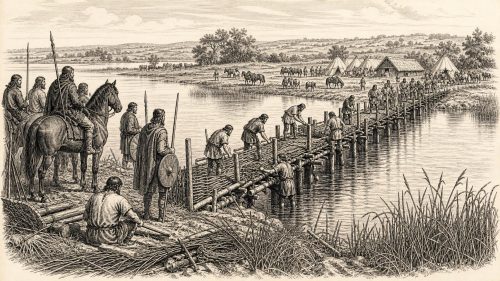
Ireland in 1140 saw contests for political control and ecclesiastical reform. Toirdhealbhach Ua Conchobhair of Connacht sought dominance through Shannon bridges, campaigns, raids and negotiated settlements, but faced resistance from Meath, Bréifne and local peoples. Murchadh Ua Maeleachlainn strengthened his Meath kingship, while Tighearnán Ua Ruairc briefly lost and regained leadership. Gelasius of Armagh visited Connacht, asserting Patrician primacy with royal support. Malachy Ua Morgair pursued papal recognition and continental monastic links, preparing for Cistercian expansion. Dublin defeated Waterford's Hiberno-Norse forces. Warfare, cattle-raiding, church offices, learning and urban trade reflected a politically fragmented yet increasingly connected Ireland during that year.
Read Article
Archived: 26 September 2026
Abstract
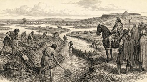
In 1139, Ireland remained politically fragmented, with Tairdelbach Ua Conchobair’s high-kingship dependent on force, alliances and hostages. He demonstrated authority by diverting the River Suck through marshes, strengthening Connacht’s eastern frontier, and by blinding a rival. Across Ireland, dynastic feuds brought killings, church burnings, plundering and violated sanctuary, while Munster’s Uí Briain exploited Cormac Mac Carthaig’s recent death. Church leaders negotiated peace between Munster and Leinster, and Malachy began his journey towards Rome, linking reformers with continental Christianity. Dublin’s religious life developed, poets and clerics died, and ordinary people directly bore warfare, tribute and labour demands during the troubled year.
Read Article

Archived: 26 September 2026
Abstract
In 1138, Ireland’s contested political order produced both stalemate and upheaval. Toirdelbach Ua Conchobair’s coalition confronted Meath, Leinster and Dublin without battle, confirming his reach but not supremacy. In Munster, Cormac Mac Carthaig, royal patron of reform and Cashel’s Romanesque chapel, was murdered through an Uí Briain-backed conspiracy, restoring their over-kingship while preserving Mac Carthaig resistance in Desmond. Raids, killings and crop destruction exposed local rivalries and contributed to famine. Armagh’s new primate, Gilla Meic Liac, visited Munster, while clerical deaths and fires affected churches. At Armagh, Máel Brigte completed a Gospel manuscript, demonstrating enduring scholarship amid conflict and instability.
Read Article

Archived: 26 September 2026
Abstract
Ireland in 1137 remained politically fragmented, as Tairdelbach Ua Conchobair of Connacht asserted contested overlordship through warfare and naval power on the Shannon. Rivalries involved Bréifne, Mide, Leinster, Munster and Hiberno-Norse towns. An allied fleet from Leinster, Dál Cais, Dublin and Wexford besieged Waterford, gaining hostages but not conclusively conquering it. Dynastic killing and raids destabilised Mide and Connacht. In the church, Malachy yielded Armagh to reformer Gilla meic Liac. A severe storm and widespread fires damaged communities. Despite violence, trade, maritime capacity, scholarship, artistic patronage and ecclesiastical reform demonstrated a dynamic, connected society within a rapidly changing medieval world.
Read Article

Archived: 26 September 2026
Abstract
In 1136 Ireland remained divided among kings, church jurisdictions and raiding forces. Tairdelbach Ua Conchobair, pre-eminent king of Connacht, faced dynastic threats, imprisoning Ruaidrí despite clerical guarantees, while another son, Áed, was blinded and a rival claimant killed. In the north, Conchobar Ua Lochlainn’s murder enabled Muirchertach Mac Lochlainn’s accession. Conflict devastated Mide and Bréifne, where cattle raids and attacks included Clonard’s plundering. Leinster, Dublin and Munster saw disputed campaigns. Malachy of Armagh advanced church reform and relinquished office amid succession. Clerics, monasteries and men remained vulnerable yet influential. Annals reveal power founded on kinship, livestock, violence, authority and memory.
Read Article

Archived: 26 September 2026
Abstract
In 1135, Ireland remained politically fragmented despite Toirdelbach Ua Conchobair’s strong, contested overlordship. Murchad Ua Máelshechlainn asserted Mide’s strategic river power by receiving hostages on the Shannon. Connacht endured dynastic killings, battles, raids and the destruction of Roscommon, while northern Uí Néill rivals, Munster factions and smaller kingdoms pursued warfare and shifting alliances. Malachy strengthened his disputed authority at Armagh by acquiring the Bachall Ísu, advancing church reform. Deaths of leading bishops and clerics, notably at Lismore, marked generational change. Fires damaged ecclesiastical centres, lightning struck towers, and plentiful mast harvest supported food supplies amid rural, maritime and market-based society.
Read Article

Archived: 26 September 2026
Abstract
In 1134, Tairdelbach Ua Conchobair’s dominance faced a broad southern challenge led by Cormac Mac Carthaig of Desmond, though church mediation prevented renewed invasion of Connacht. Cormac’s alliance with Uí Briain collapsed into Munster conflict, while Diarmait Mac Murchada pursued campaigns in Osraige with Dublin’s support against rivals including Waterford. Cormac also consecrated the Romanesque chapel at Cashel, asserting royal and ecclesiastical prestige. At Armagh, Saint Malachy’s accession advanced reform against hereditary control. Deaths of clerics reflected monastic institutions and wider Christian connections. Cattle disease, destructive weather, killings and warfare impoverished rural communities, revealing Ireland’s political ambition and social fragility.
Read Article

Archived: 26 September 2026
Abstract
In 1133, Toirdelbach Ua Conchobair’s disputed high-kingship faced a Munster invasion of Connacht, which killed an heir but secured no submission. He later agreed a year’s truce with Conchobar Ua Briain, while Mide and Bréifne destroyed his Athlone bridge and fort. Feuds in Mide, Leinster and Fine Gall brought assassinations, reprisals, raids and the burning of Lusk church. Regional conflicts, deaths and accidents continued. Armagh’s succession remained divided between reformer Malachy and Muirchertach mac Domnaill. Clerical visits, learned figures and burnings featured in the annals. A devastating cattle and pig murrain damaged Ireland’s economy; an August solar eclipse was recorded.
Read Article

Archived: 26 September 2026
Abstract
In 1132, Toirdelbach Ua Conchobair’s high-kingship faced coordinated resistance from Munster, Meath, Bréifne, Conmaicne and northern rivals. Using fleets and fortified crossings, he raided Munster, installed Muirchertach Ua Maelsechlainn in Meath and repelled attacks on Athlone. However, Munster forces destroyed Bun Gaillimhe, defeated Iar Connacht and killed leading western nobles, exposing Connacht’s vulnerability. Raiding devastated communities and cattle wealth. In Leinster, Uí Chennselaig attacked Kildare, burning its church, killing many and abducting its female leader. Malachy Ua Morgair was consecrated for Armagh amid reform conflict. The year demonstrated interconnected warfare, dynastic competition, ecclesiastical rivalry and the limits of Toirdelbach’s authority.
Read Article

Archived: 26 September 2026
Abstract
In 1131, Toirdelbach Ua Conchobair’s contested high-kingship faced coordinated pressure from Munster, northern rulers and midland rivals. Connacht forces raided Uí Conaill Gabra and Desmond, possibly using a fleet to reach Rosscarbery, while Conchobar Ua Briain campaigned through Leinster and Mide, defeated Connacht cavalry, and took hostages. A northern coalition invaded Connacht but was repelled; subsequent raids exposed its fragility. Conflict continued within Munster, and Clonard was plundered twice. Church leadership and reform remained unsettled, while genealogical scholarship may have advanced. Warfare disrupted communities through demands for cattle, transport, provisions and service, without producing permanent territorial change across the island.
Read Article

Archived: 26 September 2026
Abstract
In 1130, Ireland remained politically fragmented, as provincial kings used alliances, hostages, tribute and warfare to extend authority. Toirdelbach Ua Conchobair of Connacht mounted naval raids to Tory Island, Ros Guill and Desmond, demonstrating reach without securing conquest. Conchobar Ua Lochlainn defeated Ulaid, plundered its lands and obtained hostages through a peace at Armagh. Tigernán Ua Ruairc defeated Mide forces, advancing Bréifne's interests. Swords was burned, while Clonmacnoise treasures were recovered in Limerick. Church reform remained contested at Armagh. Warfare damaged communities through captivity and livestock seizure, though annals record an abundant fruit harvest and poet Gilla Pátraic Ua hAireachtaigh.
Read Article

Archived: 26 September 2026
Abstract
In 1129, Toirdelbach Ua Conchobair strengthened his contested high-kingship by building a timber-and-earth castle, and probably a bridge, at Athlone, commanding the Shannon crossing into Meath. Northern politics remained unstable as Magnus Mac Lochlainn briefly displaced Conchobar before being killed, while raids and killings marked wider local conflicts. A severe summer drought caused animal deaths and threatened livestock wealth. Cellach of Armagh died, prompting a prolonged succession dispute between Muirchertach mac Domnaill and reformers backing Malachy. Robbery of Clonmacnoise's rich altar treasures highlighted monastic wealth and vulnerability. These events intertwined royal ambition, warfare, environmental strain, ecclesiastical reform, and regional authority.
Read Article

Archived: 26 September 2026
Abstract
In 1128 Ireland was marked by warfare, shifting alliances and ecclesiastical intervention. Toirdelbach Ua Conchobair raided Leinster, Wexford and Dublin, reaffirming Connacht’s reach after resistance to his rule. Tigernán Ua Ruairc suffered defeats amid northern and midland conflicts, while attacks on Cellach of Armagh’s entourage brought moral condemnation. Conchobar Mac Lochlainn expanded power through hostages and victories but was censured for burning Trim’s churches. Local rulers also faced violent succession struggles. Cellach negotiated a temporary Connacht–Munster peace, demonstrating Armagh’s diplomatic influence. Church offices remained politically contested, while ports, cattle wealth, monasteries and the Cross of Cong reflected Ireland’s connected culture.
Read Article

Archived: 26 September 2026
Abstract
In 1127, Tairdelbach Ua Conchobair, king of Connacht, invaded Munster by land and sea, plundered Cork, displaced Cormac Mac Carthaig and partitioned the province. Cormac’s restoration from Lismore, backed by Ua Briain allies, quickly overturned this settlement, while hostage threats and naval conflict exposed its brutality. Tairdelbach’s son was expelled from Dublin and Leinster, and disputes in Kildare and Ulaid demonstrated persistent regional autonomy. Churchmen mediated politics, religious centres remained influential, and sacred objects expressed power. Warfare burdened ordinary communities, despite continuing trade, scholarship and artistic patronage, confirming limits to Tairdelbach’s high-kingship across Ireland during the unstable and contested year.
Read Article

Archived: 26 September 2026
Abstract
In 1125 Tairdelbach Ua Conchobair, king of Connacht, extended his supremacy across central and southern Ireland through campaigns, tribute and political appointments. After southern revolts, warfare affected Limerick, Lismore and coastal Munster. He exacted compensation at Aghaboe, asserted influence over Leinster and Dublin, then invaded Meath after Murchad Ua Mael Sechlainn destroyed Shannon bridges. Tairdelbach expelled Murchad and partitioned Meath among dependent rivals, provoking immediate killings and continued instability. Fighting also affected Brega, Airgialla and Connacht. Meanwhile Armagh’s church received a new roof, prominent clerics died, and warfare burdened farming, trade and local communities. His authority remained powerful but insecure.
Read Article

Archived: 26 September 2026
Abstract
In 1124 Tairdelbach Ua Conchobair, Connacht’s dominant king, faced a broad alliance led by rulers of Desmond, Leinster, Meath and Bréifne. He transported a fleet around Doonass, campaigned along the Shannon, established a longphort, raided rebellious territories and executed Desmond hostages, forcing opponents to disperse. Connachtmen built fortifications at Galway, Cúl Maile and Dún Leodha, strengthening strategic routes. Regional killings, raids and an accident involving Tara’s king reflected continuing instability. Church reform advanced through Malachy’s consecration as bishop of Connor, Bangor’s church and Clonmacnoise’s tower. Limerick suffered a devastating fire. Tairdelbach retained supremacy, but required constant warfare, negotiation and infrastructure.
Read Article

Archived: 26 September 2026
Abstract
In 1122, Tairdelbach Ua Conchobair of Connacht emerged as Ireland’s foremost overking, exploiting northern weakness after Domnall Ua Lochlainn’s death. He secured Munster’s division through submission, capture and installation of rival rulers, campaigned in Mide and towards Lough Erne, and received Leinster-Dublin recognition. Nevertheless, northern raids, Ulaid dynastic conflict and midlands warfare showed authority remained contested. Annals also record cattle raiding’s human and economic burden, revealing rural wealth and royal logistics. Ecclesiastical life saw relic discovery at Lann, prominent clerical deaths, pilgrimage, learning and gradual reform alongside older offices. Connacht’s ascendancy was influential, but Ireland remained politically fragmented in practice.
Read Article

Archived: 26 September 2026
Abstract
In 1121, Domnall Ua Lochlainn’s death ended the northern overking’s role as Connacht’s principal counterweight, strengthening his son-in-law Toirdelbach Ua Conchobair’s claim to wider supremacy. Toirdelbach invaded Munster, devastating territories, churches and Lismore’s protected lands, taking cattle and hostages, and attempting to balance Mac Cárthaigh and Uí Briain interests. His forces nevertheless suffered notable losses. Church politics saw Armagh’s Cellach temporarily assume Dublin’s bishopric amid reform and Canterbury connections. Regional feuds killed several rulers, including one at Bangor cemetery. Fires and storms damaged ecclesiastical settlements at Telach Inmainne and Armagh, revealing communities vulnerable to warfare, disaster, tribute and shifting lordship.
Read Article

