

Waterbound Ireland
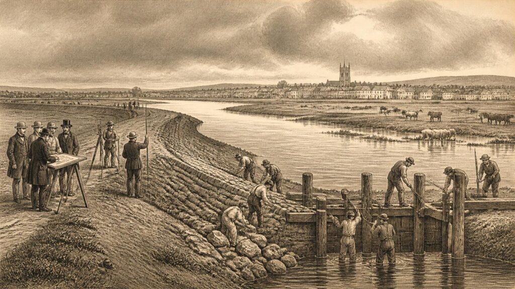
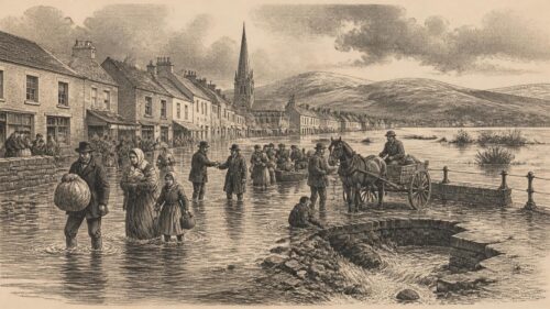
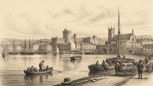
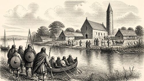
AI generated historical illustration, not a contemporary photograph.
At a Glance
Flood defence in Ireland has never been merely a technical matter. It is a history of where people chose to live, cultivate, trade and build; of what they expected rivers and tides to do; and of the recurring effort to make a wet, low lying and Atlantic facing island more predictable. Channels, embankments, bridges, quays, drainage cuts, harbour walls and sea banks form part of that history. So too do flooded streets, saturated fields, washed out roads and remembered winters. Climate risk gives these inheritances a new urgency, but it does not make them new.
Living Waters
Ireland’s flood history begins with geography rather than with a single disaster. The island’s western maritime position brings regular Atlantic weather systems, while many rivers cross relatively gentle terrain before reaching the sea. Lakes, broad floodplains, peatlands, estuaries and tidal reaches slow, spread and store water. Those features have long sustained fisheries, grazing, navigation, milling and wetland habitats. They have also made absolute control of water an unattainable ambition.
The Shannon offers the clearest example. Its great length, its linked loughs and its extensive lowlands made it a route of communication and commerce, but also a river whose seasonal behaviour could inconvenience or ruin those settled beside it. Elsewhere, the Corrib, Lee, Blackwater, Suir, Barrow, Boyne, Moy and their tributaries each joined local economic life to particular flood regimes. In coastal districts, heavy rain could meet high tide, storm surge or a blocked outfall. The distinction between river and sea was therefore often less firm in practice than it appears on a map.
It is important not to project modern engineering categories too casually into earlier Ireland. Medieval and early modern communities certainly altered watercourses, constructed mills, maintained crossings, reclaimed selected saltmarshes and used raised ground or defended sites. Yet the documentary record is uneven, and surviving structures do not always disclose their original purpose. A wall beside a river may have been a quay, a property boundary, a retaining feature or a flood barrier; sometimes it served more than one function. Archaeology can illuminate changing landscapes, but it cannot turn every earthwork into a proven flood defence.
Folklore nonetheless preserves an important historical truth: floods were experienced socially. Stories of roads disappearing, cattle stranded, churchyards engulfed or rivers taking an unexpected course belong to local memory across Ireland. Such accounts cannot by themselves establish dates, water heights or causes. They should not be treated as measurements. But they indicate how communities understood vulnerability, identified dangerous places and passed practical knowledge between generations. Modern flood mapping gains precision from surveys and models; older memory often supplies the names, landmarks and warnings that explain why a place mattered.
Recorded Weather
The transition from remembered weather to systematically recorded weather was gradual. Organised observations in Ireland reach back to the late eighteenth century, with observatories at Dunsink and Armagh, followed during the nineteenth century by observations at places including Birr Castle, Markree Castle, the Phoenix Park and Trinity College Dublin. These records were not created primarily for present day climate adaptation. They were products of scientific curiosity, estate administration, public service and international meteorological standardisation. Their later value lies precisely in the fact that they preserve observations no one can repeat.
Rainfall evidence must be handled carefully. A very wet day at one station is not proof that an entire catchment flooded, and a flood can occur after moderate rain if soils are already saturated, drains obstructed, rivers high or tides unfavourable. Conversely, a large rainfall total may cause limited damage where storage, land use and settlement patterns differ. Historical climate evidence becomes most useful when it is read alongside river levels, newspapers, engineering reports, insurance records, photographs, local authority files and physical traces.
Documented extreme events reveal both continuity and change. Met Éireann’s historical material records major Irish floods in the nineteenth and twentieth centuries and a long sequence of serious events in more recent decades. The widespread floods of December 1954 demonstrate the familiar interaction of antecedent wetness and further intense rain. In Dublin, collapse of the Tolka railway bridge at Fairview worsened inundation by creating an obstruction in the river, while flooding also affected the Camac corridor. The episode is a reminder that infrastructure can be a victim of floodwater and an influence upon its path.
The Night of the Big Wind, on 6 and 7 January 1839, occupies a large place in Irish popular memory. It was principally a violent windstorm rather than a convenient all purpose symbol for every weather hazard. Its enduring cultural significance should not obscure that flood risk has many drivers: prolonged frontal rain, sudden convective downpours, snowmelt, high groundwater, wave action, tidal surge and the coincidence of several of these forces. The historical record teaches complexity, not a single recurring script.
Interpretation is needed when using early data. Instrument sites changed, observing practices were not always uniform, and long series require careful checking and homogenisation before broad climatic conclusions are drawn. That is why modern climate science values archives but does not simply assemble isolated old readings into a trend. The historical evidence is strongest when it establishes that Ireland has always known damaging weather, while modern analysis assesses how the probabilities and intensity of particular hazards are changing.
Colonial Improvement
During the eighteenth and nineteenth centuries, drainage came to be associated with “improvement”: the conversion of land judged unproductive, wet or unhealthy into land capable of rent, grazing or tillage. That language expressed an economic and political programme rather than a neutral physical fact. Bogs, marshes, flood meadows and estuarine flats were valued differently by different people. They might be regarded by proprietors and engineers as land awaiting reclamation, while also providing turf, hay, fish, wildfowl, seasonal pasture or common access to neighbouring communities.
Printed manuals and parliamentary attention show that the drainage of Irish bogs and lowlands was a well developed nineteenth century concern. Robert Monteath’s 1829 volume on draining and reclaiming Irish bogs and marshes stands as evidence of the period’s confidence that waterlogged ground could be transformed by surveying, cutting and capital. It should be read as an improvement text, not as a neutral description of what drainage ought to achieve. Its very existence shows how thoroughly the language of reclamation had entered debates about Ireland’s landscape.
The Board of Works, later known as the Office of Public Works, became central to the administrative history of drainage. Nineteenth century legislation gave public authorities expanding roles in surveying land, promoting schemes, arranging finance and supervising works. Drainage was connected to navigation, mill power and road building as well as agriculture. River interventions could promise several benefits at once, yet those benefits did not necessarily coincide. A channel deepened for navigation might alter water levels; a sluice designed for one interest might concern another; a drainage outfall could rearrange the distribution of risk.
The Great Famine placed public works, including drainage, within a tragic setting. Drainage employment schemes were used in the late 1840s as part of relief policy, but they should not be romanticised as a solution to famine. Work schemes were shaped by administrative constraint, local power, hunger and emigration. Nor did they instantly remake Irish hydrology. Their historical importance lies in demonstrating how engineering, labour relief and land policy became entwined during a national catastrophe.
Famine era drainage also warns against a simple story in which larger channels equal social progress. A project could create work, serve a landlord’s estate strategy, improve a particular road or field, and still leave structural poverty untouched. The historical question is not whether drainage was wholly beneficial or wholly destructive. It is who made decisions, who paid, whose land was protected, whose use of a wet landscape was displaced, and what long term obligations were created once an engineered watercourse existed.
River Engineering
The nineteenth century changed Irish rivers materially. Engineers straightened selected reaches, removed obstructions, built weirs and bridges, excavated channels and pursued drainage alongside navigation. Such schemes made rivers legible to administration through plans, estimates, valuations and reports. They also made them dependent upon maintenance. A channel is not a one time achievement. Sediment returns, banks erode, vegetation grows, structures age and settlement expands around works designed for an earlier landscape.
The Shannon illustrates the tension between flood relief, navigation and local property. Severe flooding of lands beside the river in 1861 helped stimulate renewed efforts to address the problem. The Shannon Act of 1874 provided for survey and valuation, but landowner assent proved difficult to obtain for the larger proposal. A reduced public scheme followed in the early 1880s. This is documented evidence of a persistent issue, but it also reveals that flood engineering required agreement about cost and benefit. The river’s waters were shared; the political burden of altering them was not easily shared.
In the Shannon estuary, reclamation took a related but distinctive form. Intertidal flats, commonly called sloblands, were enclosed behind embankments and drained. Scholarly work on the Clare Slobland Reclamation Company shows both the ambition of late nineteenth century reclamation and the possibility of failure despite extensive expenditure. The episode matters because it complicates any assumption that engineering projects are inevitably permanent. Sea banks and drainage systems depend on design, finance, maintenance, ground conditions and the force of tides. They are historical arrangements, not final victories over the estuary.
The physical inheritance of this era remains visible in places: straightened drains, embanked fields, altered tidal margins, sluices, cut channels and river crossings. Yet survival should not be mistaken for unchanged function. Land that was once marginal may now stand beside homes, roads, industrial estates or heritage sites. A defence built to protect farmland can become part of the background condition enabling later development. When such infrastructure is reassessed, its original purpose, standard and environmental setting must be understood before present expectations are imposed upon it.
There is also a cultural dimension. Navigation works, quays and canal embankments belong to Ireland’s engineering heritage. They are records of transport, trade and state making. But historic character cannot justify ignoring danger, and hazard reduction need not require indifference to historic fabric. The difficult task is to establish which elements possess heritage significance, how they behave during flood conditions, and whether adaptation can preserve evidence of the past while reducing risk to people and property.
Postwar Drainage
The Arterial Drainage Act of 1945 marked a decisive phase in the Irish state’s approach. Its principal purpose was agricultural improvement through catchment scale drainage, and implementation began in the late 1940s. The language of arterial drainage is revealing: watercourses were treated as main channels within a larger system, expected to carry water efficiently from smaller drains and tributaries. This was a programme of national development in a largely rural state, shaped by the belief that agricultural land should be made more productive and less vulnerable to prolonged inundation.
The scale was considerable. Over subsequent decades the Office of Public Works completed major schemes in catchments including the Brosna, Feale, Corrib Clare, Inny, Moy, Boyne, Maigue and Corrib Mask Robe. The named schemes cover extensive areas and show that postwar drainage was not a collection of isolated local ditches. It was systematic intervention in rivers, banks, bridges, sluices and embankments across wide areas of the country.
Documented state records describe a substantial maintenance legacy: thousands of kilometres of channel, hundreds of kilometres of embankment, and a very large number of bridges and ancillary structures. That legacy is one reason Irish flood policy cannot begin with a blank sheet. Every maintenance decision takes place in landscapes already shaped by earlier works and legal responsibilities. Restoring a bank, clearing a channel or repairing a culvert can have consequences for habitats, adjacent land, water levels and downstream communities.
It would be inaccurate to say that arterial drainage was simply a flood defence programme in the modern urban sense. Its historical focus was agricultural land drainage. It could reduce or rearrange flooding in certain locations, but its design assumptions and benefit calculations were formed in a different policy world. Later urban expansion, changes in property values, environmental law and climate science have altered the questions asked of it. A scheme designed to drain fields cannot automatically be expected to offer present day protection to every settlement within its catchment.
Environmental consequences became increasingly important to public debate and regulation. Drainage can alter wetland extent, river morphology, floodplain connectivity and ecological conditions. That does not mean all maintenance should cease; it means maintenance must be assessed in relation to specific objectives and protected environments. The later requirement for environmental assessment reflects a major change in public understanding. Watercourses are not only conduits for unwanted water. They are habitats, heritage landscapes and parts of catchments whose natural storage may itself reduce risk.
Changing Doctrine
By the late twentieth century, the limitations of a defence only approach were clearer. Flooding could not be eliminated by building ever higher walls or cutting ever deeper channels. Development in flood prone places could create new exposure faster than works could reduce it. A local protection measure might transfer water or risk elsewhere. The policy response increasingly turned towards risk management: understanding probability, limiting inappropriate development, warning communities, preparing for emergencies and combining structural measures with planning.
The 1995 amendment to the Arterial Drainage Act allowed the Office of Public Works to implement localised flood relief schemes for cities, towns and villages. This legal change is important because it signals a shift from catchment wide agricultural improvement to the protection of established settlements and property. Modern schemes may include walls, embankments, culverts, pumping arrangements, storage areas, bridges, channel works and demountable defences. Their aim is normally specified by a design standard, rather than a promise that no future flood will occur.
A phrase such as “one in one hundred year flood” can mislead if read as a timetable. In the usual engineering usage, it refers to an event with a one per cent chance of occurring in any year, not an event that happens only once each century. Historical experience has repeatedly shown why this distinction matters. Several severe events can occur within a short period, and a defended location can still be exposed to a larger event, mechanical failure, blocked drainage, overtopping or a different flood source.
Irish policy after the 2004 Flood Policy Review Group increasingly articulated three connected ideas: prevention, protection and preparedness. Prevention concerns avoiding or reducing development in places liable to flood. Protection concerns practicable measures to lessen hazard. Preparedness includes forecasting, warnings, emergency plans and public awareness. The approach is more historically mature than the older faith in a single engineered cure because it accepts that rivers, tides, land use and settlement must be managed together.
Catchment based assessment and mapping have strengthened that approach. Flood maps, records of past events and real time river monitoring make hazard visible beyond individual memories. Yet mapping is not infallible or finished. It depends upon topographic data, rainfall and flow estimates, assumptions about defences and the treatment of future climate conditions. A map is best understood as evidence for decisions, not a guarantee. It can show where attention is needed; it cannot absolve communities or authorities from reviewing new information after each event.
Climate Evidence
Climate change changes the context in which this inherited infrastructure must operate. The historical record establishes that Ireland has always experienced heavy rain, storms and floods. It does not follow that every modern flood is caused by climate change, nor that each event can be explained by one factor. Attribution requires specific analysis. Nevertheless, the direction of risk identified by Irish scientific and public bodies is clear: heavier rainfall events, changes in rainfall patterns, rising sea levels and increased coastal flood risk demand adaptation.
Met Éireann’s climate material notes that warming is already associated with more frequent and intense heatwaves, heavy rainfall, droughts and rising sea levels. This combination matters. Flood risk is not simply annual rainfall added up over twelve months. A warmer climate can contribute to more intense downpours, while dry periods may harden soils or change land management, and wetter spells can leave catchments saturated before a further storm arrives. The practical effect depends on season, terrain, drainage, tide and local exposure.
Recent attribution studies have added detail to the wider picture. Met Éireann reported that human induced climate change made the heavy storm downpours associated with flooding across Ireland and the United Kingdom between October 2023 and March 2024 more intense. Such findings concern defined events and methods; they should not be inflated into claims that history has ended or that all uncertainty has disappeared. Their significance is that old defences and old planning assumptions are being tested in a climate that is no longer stationary.
The National Climate Change Risk Assessment published by the Environmental Protection Agency in 2025 identifies extensive risks to buildings, transport, communications and water services from extreme precipitation, flooding, coastal erosion and coastal flooding. It also stresses cascading effects. A flooded road can delay emergency response; power failure can affect pumps and communications; damaged bridges can isolate communities; contaminated water can create public health consequences. Flood defence is therefore not only about keeping water outside an individual building. It concerns the resilience of connected systems.
Interpretation has a necessary role here. It is reasonable to infer that infrastructure designed around past records may need reassessment as future rainfall and sea level conditions change. It is not reasonable to assert, without site evidence, that every existing embankment or wall is inadequate. Risk varies sharply between catchments and neighbourhoods. Responsible adaptation combines national projections with local surveys, hydraulic modelling, maintenance histories and community knowledge.
Coastal Exposure
Coastal Ireland faces a distinct but overlapping problem. Storm surge, wave action, high tide, sea level rise and river discharge can combine at estuaries and low lying urban waterfronts. This is sometimes described as compound flooding. The term is modern, but the underlying circumstance is old: water arriving from land may be unable to escape when the sea is high, while water from the sea can move inland through river mouths, drains and low ground.
Many Irish towns and cities developed at coastal or estuarine sites because those locations offered harbours, trade routes, fisheries and communications. Dublin, Cork, Limerick, Galway, Waterford and numerous smaller ports gained their historical importance from water. Their vulnerability cannot be separated from that advantage. Quays, docklands, reclaimed ground, culverted streams and tidal rivers often contain layered evidence of commercial growth as well as exposure to flooding.
Sea level rise adds a chronic pressure to episodic storms. The issue is not only the dramatic wave overtopping a promenade. Higher average sea levels can make lesser surges more consequential, complicate drainage, undermine foundations, accelerate erosion and narrow the margin of safety for existing defences. The EPA’s national assessment identifies coastal flooding and erosion as urgent risks for infrastructure and built areas. Its projections demonstrate why adaptation must look beyond the lifespan of a single construction project.
Historic reclamation deserves particular attention. Land gained from estuary or shore has often supported agriculture, transport and industry, and may now host houses or services. It is not inherently doomed, nor is abandonment always possible or desirable. But its history should be made visible in planning and design. Reclaimed land commonly relies on drainage, pumping, walls or embankments; its protection is an active arrangement. The past is physically present beneath modern streets and fields.
Historic Fabric
Flood adaptation can place heritage at risk, but heritage can also aid adaptation. Old flood marks, plans, maps, photographs, harbour records and local chronicles may reveal the reach of past events. Historic bridges and quays can constrain water flow, while also forming valued elements of a townscape. Archaeological deposits may lie beneath proposed embankments, channels or pumping stations. A well designed scheme therefore begins not with an assumption that heritage is an obstacle, but with early investigation of what survives and how it relates to the flood problem.
The challenge is practical. A historic wall may be visually important yet structurally unsuitable as a modern defence. Raising it may change its character; leaving it unchanged may leave properties exposed. In some cases, a set back defence, discreet barrier, flood gate or landscape measure may reduce the conflict. In others, change will be unavoidable. The sound historical principle is not preservation at any cost, but evidence led decision making that records significance, considers alternatives and explains the choices made.
Folklore again has a place, provided its limits are respected. A story that a river once flowed through a particular lane may lead researchers to an old map, culvert or drainage record. It is a prompt for investigation, not proof. Likewise, the assertion that an area “never flooded before” may mean that no one living remembers it flooding, that houses are recent, or that a rare event lies outside oral memory. Documentary and scientific evidence should test such claims without dismissing the experience behind them.
For Emerald Archives, the wider lesson is that flood history is archive history. It lies in legislation, engineering drawings, meteorological registers, local newspapers, estate papers, oral testimony, aerial photographs and the built landscape. These sources have different strengths. A dated rainfall register may establish precipitation; an engineer’s plan may establish proposed works; a photograph may show an inundated street; a resident’s account may convey disruption and response. None alone tells the entire story.
Future Memory
Ireland’s historical relationship with water does not yield a simple moral. Earlier engineers were not ignorant because they drained land; they worked within the economic priorities, technical knowledge and legal frameworks of their time. Present communities are not foolish because they value protection; homes, livelihoods, public services and heritage places need it. The error would be to suppose that inherited structures, inherited maps or inherited ideas can settle a changing problem without revision.
The strongest contemporary approach joins several forms of action. It protects existing communities where feasible, prevents avoidable new exposure, maintains essential assets, restores or safeguards natural storage where appropriate, prepares for emergencies, and reviews design assumptions against climate evidence. It also recognises distribution. Flood risk is experienced differently by tenants and owners, farmers and urban residents, businesses and households, people with insurance and people without it, those who can leave quickly and those who cannot.
Historical evidence supplies humility. Rivers have overtopped banks despite plans; reclamation projects have failed despite investment; bridges and embankments have changed the course of floods; communities have remembered events imperfectly but usefully. Climate science supplies a further warning: the past remains indispensable, but it is no longer a complete guide to future probabilities. The task is not to choose between history and projection. It is to use both honestly.
Flood defences are, in the end, civic promises written into earth, stone, concrete, steel and planning policy. They promise mitigation, not invulnerability. Their history in Ireland reaches from reclaimed sloblands and nineteenth century drainage surveys to postwar arterial schemes, town walls, forecast systems and climate risk assessments. Reading that history closely makes one point unavoidable: water will remain part of Ireland’s inheritance. The question is whether the country’s future defences will acknowledge the full complexity of that inheritance before the next flood forces the lesson again.


The article highlights how Ireland’s flood infrastructure carries inherited purposes: channels and embankments designed for agricultural improvement may now underpin settlements facing river, surface-water and coastal hazards. This raises a tension between preserving engineering heritage, maintaining existing works, restoring wetlands, and avoiding the transfer of risk downstream. Its account of folklore alongside archival and scientific evidence also suggests that local memory can enrich, but not replace, technical assessment. As climate change alters probabilities, how should Irish communities and policymakers decide when to adapt historic drainage systems, when to restore natural water storage, and whose experiences and interests should shape choices?