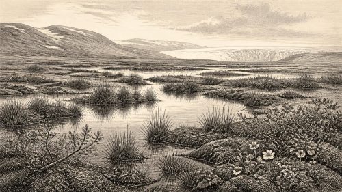
Greenagho Ice-Free Deposits31946 BCE
About 34,000 years before present, Ireland experienced cold, unstable Marine Isotope Stage 3 conditions as the British–Irish Ice Sheet began expanding. Deposits at Derryvree and Greenagho indicate north-central areas remained ice-free until roughly this period, although local glaciers and periglacial processes occurred. Open tundra-like habitats supported reindeer, giant deer, spotted hyaenas, bears and other fauna, evidenced especially at Castlepook Cave. A marked reindeer bone may indicate brief Upper Palaeolithic butchery, but cannot prove permanent human occupation. No settled communities or political institutions are evidenced. Changing coastlines, glaciation and disturbed deposits obscure evidence, leaving animal life and possible mobile human visits.
Dateline
The label 31,946 BCE creates a false impression of precision. No event in Ireland can be assigned to that single modern calendar year, and no contemporary people used such a calendar. In archaeological terms, this point lies roughly 34,000 calendar years before present (where “present” conventionally means 1950), in the Late Pleistocene and Marine Isotope Stage 3. Radiocarbon measurements from this depth of time must be calibrated and normally produce ranges rather than anniversaries. The responsible question is therefore not what happened in Ireland in one exact year, but what the evidence can reveal about the island during the millennia around it.
An Uncertain Moment in a Cold Age
Ireland then stood on the threshold of the last great expansion of the British–Irish Ice Sheet. It was not yet simply the ice-covered island of popular imagination. Geological evidence from beneath later glacial deposits at Derryvree and Greenagho in County Fermanagh indicates ice-free conditions in north-central Ireland until at least about 34,000 years ago. The calibrated ranges are broad: organic material at Derryvree falls within c. 36,900–31,700 cal BP, while material at Greenagho falls within c. 37,200–35,700 cal BP. They establish an environmental sequence, not the weather or shoreline of a particular year.
This matters because the date in question lies close to the edge of that evidence. It is reasonable to describe parts of Ireland as probably still ice-free, or only beginning to experience the build-up of the last ice sheet; it would not be responsible to map a fixed ice margin across the whole island. Later evidence shows the bulk of the Irish Ice Sheet expanded from conditions that had been substantially more open at around 34,000 years ago, and eventually reached a far greater extent during the Last Glacial Maximum. Across the wider British–Irish system, ice advance and maximum extent were asynchronous: different sectors advanced, thickened and retreated at different times.
The climate was cold and unstable rather than uniformly frozen. Marine Isotope Stage 3 contained abrupt northern climatic oscillations, recorded especially clearly in Greenland ice cores. Ireland’s exposed position at the Atlantic edge of north-west Europe made it sensitive to such shifts. Local glaciers may have occupied uplands, snowfields may have lasted long into the year, and periglacial processes would have repeatedly frozen, heaved and disturbed exposed ground. Yet ice-free ground, lakes, rivers, caves and coastal margins could still support plants and animals during milder intervals. The landscape was one of changing opportunities and hazards, not a static white wilderness.
What the Land May Have Looked Like
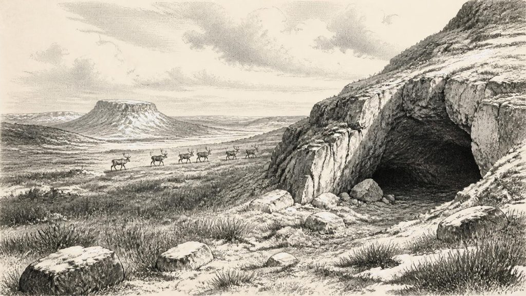
There is no pollen diagram that permits a detailed reconstruction of every Irish valley at this date. Nevertheless, the cold-climate fauna recovered from southern Irish caves shows that open environments existed in at least some regions during Marine Isotope Stage 3. Such habitats are more likely to have resembled tundra, herb-rich grassland and sparsely vegetated ground than the dense temperate woodland that would cover much of Ireland after the Ice Age. Shrubs, grasses, sedges, mosses and hardy flowering plants would have formed patchy communities shaped by altitude, drainage, exposure and rapid climate change.
The most informative archive is Castlepook Cave, near Doneraile in north County Cork. Its old collections and later re-dating have shown that Irish cave deposits can preserve evidence of animals living long before the Last Glacial Maximum. The material includes species associated with cold or open conditions, notably reindeer, giant deer and spotted hyaena. Brown bear and other mammals also belonged to Ireland’s shifting Pleistocene fauna. These animals should not be imagined as a single herd or community photographed at one moment: cave assemblages accumulated over long periods and may include bones brought in by carnivores, water movement or other natural processes.
Spotted hyaenas are especially important to interpretation. Caves could be dens or places where scavengers dragged carcass parts, rather than shelters occupied by people. Reindeer remains point to a mobile grazing animal well adapted to cold landscapes; giant deer indicate that substantial herbivores also used parts of the island. Their presence demonstrates ecological possibility, but it does not tell us how numerous they were, whether they migrated seasonally, or precisely which habitats lay outside the cave entrance at any one time.
A Possible Human Footprint
Castlepook also supplies the most provocative evidence relevant to people. A reindeer femur from the cave has been reported as bearing deep marks consistent with cutting or chopping by a sharp stone tool, and it has been presented in Irish heritage research as dating to about 33,000 years ago, broadly near the period under discussion. If that interpretation is accepted, it would show a brief episode of human handling or butchery of a reindeer in Ireland during the Upper Palaeolithic.
Its importance should not be exaggerated. The bone was recovered during early twentieth-century cave excavation, not from a modern, intact living floor with a precisely recorded position. No securely associated hearth, stone-tool assemblage, shelter, burial, human bone, engraved object or repeated occupation surface has yet demonstrated a settled Irish community at this time. The date is the age of the animal bone, not automatically the date of the mark, the kill, a visit to the cave or a human arrival. Taphonomic study must distinguish deliberate tool damage from carnivore activity, trampling, breakage and post-depositional alteration.
Accordingly, the Castlepook bone is best understood as possible evidence for a fleeting human presence or carcass-processing episode, not proof of permanent population. That distinction is central to this period. Archaeology can support the suggestion that Upper Palaeolithic people reached, or occasionally used, parts of Ireland; it cannot yet support a history of villages, continuous ancestry or organised occupation in the 31940s BCE.
Society Beyond the Evidence
There is no direct Irish evidence from around this date for named groups, rulers, territories, laws, diplomacy or warfare. Political history, in the conventional sense, does not begin here. Nor is there evidence for farming, metalworking, pottery, monuments, writing or formal religious places in Ireland. The silence is not proof that people lacked social lives or beliefs; rather, it reflects the very small and disturbed archaeological record surviving from such an early phase.
Comparison with north-western Europe is useful only when its limits are kept clear. Groups elsewhere in Britain and continental Europe were mobile hunter-gatherers using carefully made stone tools, exploiting animal and plant resources, maintaining social ties over substantial distances, and sometimes making personal ornaments, images or formal burials. At Paviland Cave in south Wales, for example, an Upper Palaeolithic burial dates broadly to 33,000–34,000 years ago. Such sites show what contemporary Homo sapiens groups could do; they are not evidence that the same rituals, identities or artistic traditions existed in Ireland.
If people did reach Ireland, their economy would have depended on knowledge rather than infrastructure: the ability to move through cold country, choose stone suitable for sharp edges, read animal behaviour, process hides and meat, manage fire, and share practical information within a small travelling group. Reindeer would have offered meat, fat, hide, sinew, bone and antler. But even this is a conditional inference from one disputed or limited line of evidence, not a recovered Irish camp economy.
Water, Distance and Insularity
Lower global sea levels altered the geography of the north-west European shelf, but they did not automatically provide an easy land route into Ireland. Britain was at times part of a wider European landmass, while the Irish Sea basin and its glacial history created a more complicated barrier between Ireland and Britain. The precise routes, coastlines and sea crossings relevant to Marine Isotope Stage 3 remain uncertain. Later research strongly indicates that Ireland was already an island by the time substantial post-glacial settlement is visible, but that does not settle every earlier palaeogeographical question.
The apparent scarcity of evidence is therefore meaningful but not conclusive. Later glaciers scoured landscapes and redistributed sediments; rivers and slopes reworked deposits; rising seas drowned former coastal plains; and nineteenth- and early twentieth-century excavations removed or mixed material before modern recording standards existed. Caves have preserved rare fragments, but they are selective archives. A lack of known camps cannot prove that no short-lived camps ever existed on open ground now destroyed, buried or submerged.
The Long View
Around 31,946 BCE, Ireland’s story is principally environmental. The island was entering the build-up to a glacial maximum that would profoundly reshape its terrain and interrupt or erase much earlier evidence. Fauna in places such as County Cork demonstrates that Ice Age ecosystems existed here before the maximum cold. The Fermanagh deposits show that the advance of the later ice sheet had not yet turned every region into an ice-covered landscape. Castlepook offers a tantalising, carefully qualified possibility that people briefly entered this world and butchered a reindeer.
That is enough to make the period significant. It pushes Irish history far beyond the older assumption that human activity began only after the retreat of the ice. But it also requires restraint. No Irish polity, battle, chief, ritual centre or settled culture can be placed in this year. The most accurate portrait is of a changing cold landscape, inhabited certainly by Pleistocene animals and perhaps visited by highly mobile people whose traces are almost vanishingly slight. Future excavation, improved bone dating and renewed study of old cave collections may refine that picture; for now, uncertainty is part of the history.
Primary Sources
- The IntCal20 Northern Hemisphere Radiocarbon Age Calibration Curve (0–55 cal kBP)
- IntCal Publications
- A Reconsideration of the Radiocarbon Dating of the Marine Isotope Stage 3 Fauna from Southern Ireland
- New Insights on the Fauna of Ireland’s Younger Dryas and Early Holocene from Alice & Gwendoline Cave
- Trimlines, Blockfields and the Vertical Extent of the Last Ice Sheet in Southern Ireland
- Growth and Retreat of the Last British–Irish Ice Sheet, 31,000 to 15,000 Years Ago: the BRITICE-CHRONO Reconstruction
- Pattern and Timing of Retreat of the Last British-Irish Ice Sheet
- Dimensions and Chronology of the Last Ice Sheet in Western Ireland
- Maximum Extent and Dynamic Behaviour of the Last British–Irish Ice Sheet West of Ireland
- Timing and Pace of Ice-Sheet Withdrawal Across the Marine–Terrestrial Transition West of Ireland During the Last Glaciation
- Deglaciation Chronology of the Donegal Ice Centre, North-West Ireland
- The Timing and Magnitude of the British–Irish Ice Sheet Between Marine Isotope Stages 5d and 2
- The Problem of a Late Quaternary Landbridge Between Britain and Ireland
- The Island of Ireland: Drowning the Myth of an Irish Land-Bridge?
- Ireland: Submerged Prehistoric Sites and Landscapes
- The Mesolithic in Ireland: When Was It?
- Heritage Artefacts of County Cork
- The Antiquity of Man in Ireland
- Climate Change and Hunter Gatherers in Ireland: Problems, Potentials and Pressing Research Questions
- Terra Incognita: The Palaeolithic Record of Northwest Europe and the Information Potential of the Southern North Sea
- The Southern North Sea and the Human Occupation of Northwest Europe After the Last Glacial Maximum
- The Early Upper Palaeolithic in British Caves: Problems and Potential
- Paviland Cave: Contextualizing the ‘Red Lady’
- The ‘Red Lady’ of Paviland
- The Age and Context of the KC4 Maxilla, Kent’s Cavern, UK