Birm-166 and the Drumlin31765 BCE
At 31,765 BCE, Ireland cannot be described through events or calendar dates, but through fragmentary environmental evidence from Marine Isotope Stage 3. Derryvree, County Fermanagh, preserves freshwater silts between glacial tills, demonstrating an ice-free tundra interval within a shifting climate and later glaciation. Mosses, sedges and pollen indicate exposed periglacial wetlands, not forest. Castlepook Cave, County Cork, contains a chronologically complex fauna of mammoth, reindeer, giant deer and predators, evidencing cold open habitats. A possibly tool-marked reindeer bone may signal brief human activity, but proves neither settlement nor society. Ireland remained climatically dynamic, ecologically connected intermittently, and therefore archaeologically elusive.
Dateline
A modern date such as 31,765 BCE gives a useful point of reference, but it must not be mistaken for a date that prehistoric Ireland can meet with calendar precision. No Irish document, settlement layer or event can be assigned to this individual year. In scientific terms, it falls roughly 33,700 years before 1950, within Marine Isotope Stage 3, a long and climatically unstable phase of the last Ice Age. The responsible history of Ireland at this point is therefore not a chronicle of rulers, battles or anniversaries. It is a reconstruction from sediments, fossil plants and animals, cave deposits, changing ice margins, and the limits of radiocarbon dating.
The closest major Irish archive is Derryvree, near Maguiresbridge in County Fermanagh. There, roadworks in 1969 exposed freshwater silts and fine sands trapped between two thick layers of glacial till within a drumlin. Organic material from the deposit produced the radiocarbon determination Birm-166: 30,500 radiocarbon years before present, with a substantial uncertainty. Later calibration places the relevant interval broadly at about 36,900–31,700 calibrated years before present. The nominal year 31,765 BCE lies within that wide range, but cannot be isolated as a moment in the sequence. Derryvree is evidence for conditions over an interval, not a diary entry for one year.
A Freshwater Interval Beneath Ice
The physical order of the Derryvree deposits is its great importance. An earlier glacial episode left the lower till. Later, when ice was absent locally, water laid down fine sand and silt and preserved organic remains. A subsequent advance buried the freshwater bed beneath another mass of till. The sequence establishes a striking pattern: glaciation, an ice-free interval, then renewed glaciation. It also warns against an easy picture of an island continuously frozen from coast to coast throughout the Ice Age.
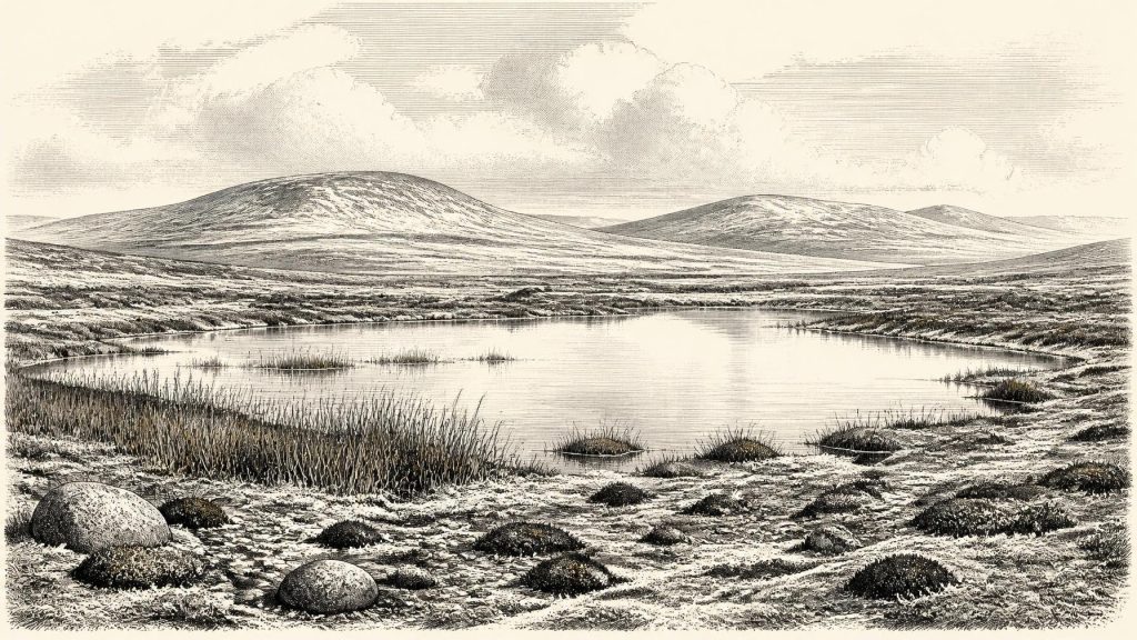
The plants and small animals preserved in the freshwater material indicate open tundra and periglacial conditions: ground affected by severe cold, repeated freezing and thawing, and a short growing season. Mosses, sedges and herbaceous pollen are more securely supported than any vision of dense woodland. A few grains of tree pollen were detected, but the original investigators stressed their poor preservation and the likelihood that trees, if represented at all, were not forming a local forest. Around the Derryvree waterbody, the landscape was probably sparse, low and exposed, with wet ground providing a refuge for vegetation even as the wider terrain remained cold.
This was not necessarily a scene of uniform white snow. Tundra environments can include shallow pools, sedge margins, patches of moss, bare mineral soil, gravelly slopes and seasonally productive vegetation. Yet it would have been an exacting country. Frost action disturbed soils; strong winds crossed open ground; and snow cover, surface water and the availability of forage varied sharply through the year. The evidence permits that broad environmental picture. It does not allow the weather on a particular day in 31,765 BCE to be reconstructed.
Ireland During Marine Isotope Stage 3
Marine Isotope Stage 3, conventionally dated to roughly 57,000–29,000 years ago, was neither a single cold spell nor a simple prelude to the Last Glacial Maximum. Across the North Atlantic world, temperatures and ice margins changed abruptly more than once. Ireland’s terrestrial record is fragmentary, because later glaciers eroded, reworked or buried much of what had survived from earlier phases. Consequently, local evidence matters greatly, but must not be inflated into an all-island map.
Derryvree demonstrates that north-central Ireland was ice-free during part of this stage. Organic material from lacustrine deposits beneath till at Greenagho, also in Fermanagh, points to an earlier ice-free episode, while shells and sediments around the western coast offer further evidence that ice did not occupy every Irish sector continuously before the final major expansion. Syntheses of onshore, offshore and deep-sea evidence indicate that the last Irish Ice Sheet grew substantially after about 34,000 years ago and reached its greatest overall extent much later, around 26,000–24,000 calibrated years before present. The pace, timing and geographical pattern of that build-up remain subjects of research.
For the date in question, the safest conclusion is regional rather than absolute: at least some parts of Ireland had recently supported, or still supported, ice-free periglacial environments, while the climatic and glaciological system was moving towards a far more extensive glaciation. It would be misleading to say simply that Ireland was either wholly habitable or wholly ice-covered. The island’s position on the Atlantic edge, with high ground, basins, coastlines and changing sea ice, ensured a varied and shifting geography.
Animals, Caves and a Sparse Record
County Cork’s Castlepook Cave system, near Doneraile in the Awbeg valley, gives the clearest sense of the larger animals associated with Ireland during the wider late Pleistocene. Its old excavations recovered an exceptional cave assemblage including woolly mammoth, reindeer, giant deer, brown bear, wolf, Arctic fox, mountain hare, lemmings and spotted hyaena. Such finds establish that cold-adapted and open-country animals reached Ireland during parts of the Ice Age. They do not prove that every listed species lived together at Castlepook, or anywhere else, at 31,765 BCE.
That distinction is essential. Cave deposits can contain material accumulated over many millennia by carnivores, water, collapse and human excavation. Castlepook was extensively excavated in the early twentieth century, before modern standards of stratigraphic recovery and recording. Recent re-dating has shown that several older Irish cave radiocarbon results need reconsideration, with some specimens proving appreciably older than previously believed. The fauna is invaluable evidence, but it is not a neatly sealed settlement deposit.
Nonetheless, its ecological implications are substantial. Reindeer and hares point towards open, cold environments; lemmings reinforce the northern, tundra-like character of at least some habitats; mammoth and giant deer indicate that large herbivores could exploit Irish landscapes in suitable periods. Predators and scavengers, notably wolf and spotted hyaena, reveal a fuller food web than Ireland’s modern fauna suggests. Caves were not necessarily homes for these animals. They could be dens, temporary refuges, places into which bones were dragged, or traps in the landscape. Each bone needs its own taphonomic history.
The Human Question
There is no securely documented community, dwelling, hearth, tool scatter or burial in Ireland that can be confidently dated to 31,765 BCE. Therefore there is no basis for describing a resident population, family structure, named cultural group, language or territory. Nor is there evidence for political authority, warfare, diplomacy, formal religion, monuments, farming, exchange networks or organised trade on the island at this point. These absences are not evidence that such things were impossible in principle; they are the limits of the present Irish record.
A reindeer femur from Castlepook has nevertheless made the question more intriguing. It has been reported as carrying a deep mark interpreted as damage made on fresh bone by a sharp stone tool, and the bone has been publicised as dating to about 33,000 years ago. If that interpretation is sustained, it would suggest that one or more people processed a reindeer carcass in Ireland during the wider later MIS 3 period. It would be a remarkable early trace of human activity, not proof of permanent settlement.
Even in that favourable reading, much remains unknown. A marked limb bone cannot establish whether people killed the animal, scavenged it, removed hide or sinew, took meat or marrow, or processed it outside the cave before the bone entered its final deposit. It cannot identify the number of visitors or demonstrate that they returned. Nor can the radiocarbon age of the animal be converted uncritically into the exact date of the mark. The cautious phrase is therefore possible human activity, not an Ice-Age Irish society.
Movement, Resources and Connections
If people did reach Ireland during this broad period, their practical world would have revolved around movement through an unstable cold landscape and the use of animal and plant resources. Across north-west Europe, Upper Palaeolithic hunter-gatherers made sophisticated stone tools, used animal materials, and followed seasonal opportunities. That continental context makes a brief Irish visit conceivable, but it should not be projected automatically across the Irish Sea. Ireland’s separated, changing geography was a real constraint, and the evidence does not yet reveal the route, technology or frequency of any crossing.
For non-human animals, dispersal was evidently possible in favourable phases. Lower sea levels altered the outlines of the Irish Sea basin, while glacial, coastal and marine conditions changed repeatedly. But lowered sea level did not automatically create a dependable dry-land bridge from continental Europe to Ireland. The precise accessibility of the island varied with water depth, ice extent, sea ice and the configuration of Britain and western European coastlines. The animal record shows connectivity at some times; it does not supply a simple migration map.
There was no economy in the later historical sense: no fields, livestock, markets, coinage or ports. The economy visible in the evidence is ecological. Plants captured a brief growing season; herbivores converted sparse vegetation into mobile food; carnivores and scavengers followed them; and, if people were present, animal carcasses may have supplied calories, hides, bone, sinew and antler. This is an inference from the kinds of material preserved, not direct evidence for a camp or a routine.
What This Date Can Mean
31,765 BCE is best understood as a waypoint inside a much larger interval of Irish prehistory. Derryvree supplies the strongest directly relevant environmental evidence: a freshwater tundra setting, preserved between glacial advances, dated broadly enough to encompass this nominal year. Castlepook broadens the view with a remarkable but chronologically complex animal archive and a debated indication of human bone-working. Together they replace the old image of an empty, featureless Ireland before the last great ice-sheet maximum with a more dynamic picture of cold wetlands, open ground, mobile animals and changing ice.
Yet the deeper lesson is one of restraint. The Ireland of this date has no recorded kings, no known wars and no recoverable calendar. Its history survives as silt under a drumlin, pollen and moss remains in a former pool, and bones in limestone caves. Those traces are sparse, but they are enough to show that long before the first farms, tombs and written names, the Irish landscape was already being remade by climate, ice and life.
Primary Sources
- Middle Midlandian Freshwater Series at Derryvree, Maguiresbridge, County Fermanagh, Northern Ireland
- Palaeoecology: Irish Quaternary Association Field Guide
- Trimlines, Blockfields and the Vertical Extent of the Last Ice Sheet in Southern Ireland
- A Reconsideration of the Radiocarbon Dating of the Marine Isotope Stage 3 Fauna from Southern Ireland
- The Irish Quaternary Fauna Project
- Castlepook Cave: County Geological Site Report
- Areas of Scientific Interest in County Cork
- Castlepook Cave, Castlepook South, County Cork: Excavations 2022
- New Insights on the Fauna of Ireland's Younger Dryas and Early Holocene from Alice & Gwendoline Cave
- Growth and Retreat of the Last British–Irish Ice Sheet, 31,000 to 15,000 Years Ago: The BRITICE-CHRONO Reconstruction
- Growth, Dynamics and Deglaciation of the Last British-Irish Ice Sheet: The Deep-Sea Ice-Rafted Detritus Record
- Pattern and Timing of Retreat of the Last British-Irish Ice Sheet
- Early Deglaciation of the British-Irish Ice Sheet on the Atlantic Shelf Northwest of Ireland
- The Deglaciation of the Western Sector of the Irish Ice Sheet from the Inner Continental Shelf to its Terrestrial Margin
- Stratigraphic and Palaeo-Geomorphological Evidence for the Glacial-Deglacial History of the Last British-Irish Ice Sheet in the North-Western Irish Sea
- Radiocarbon Constraints on the Age of the Maximum Advance of the British–Irish Ice Sheet in the Celtic Sea
- New Data for the Last Glacial Maximum in Great Britain and Ireland
- Stoats (Mustela erminea) Provide Evidence of Natural Overland Colonization of Ireland
- The Last Glacial Maximum
- The IntCal20 Northern Hemisphere Radiocarbon Age Calibration Curve (0–55 cal kBP)
- Dynamic Cycles, Ice Streams and Their Impact on the Extent, Chronology and Deglaciation of the British-Irish Ice Sheet
- Stratigraphic and Palaeo-Geomorphological Evidence for the Glacial-Deglacial History of the Last British-Irish Ice Sheet in the North-Western Irish Sea
- Reindeer Bone Found in Cork Cave Shows Human Activity in Ireland 33,000 Years Ago
- Heritage Artefacts of County Cork
