
Birm-166, Reindeer, and Ice31771 BCE
Around 31,771 BCE, Ireland lay within the unstable Late Pleistocene MIS 3, before maximum Last Glacial ice cover. Derryvree, County Fermanagh, preserves organic silts dated broadly to this period, demonstrating a cold, treeless freshwater wetland with sedges, mosses, pools and open ground between glacial advances. Castlepook Cave, County Cork, contained reindeer, mammoth, giant deer, horse, predators and other fauna, indicating varied open-country habitats. A cut-marked reindeer femur may suggest human carcass processing and an early Upper Palaeolithic visit, but proves neither settlement nor sustained occupation. Later ice erosion and rising seas destroyed evidence; environmental records remain firmer than human history.
Dateline
The modern label “31,771 BCE” cannot identify an event in Ireland with anything like calendar-year precision. No written calendar existed, and the scientific evidence is dated in ranges rather than years. In archaeological terms, this notional point falls about 33,720 years before AD 1950, within the Late Pleistocene and Marine Isotope Stage 3 (MIS 3), a long, unstable phase of the last Ice Age. The responsible history of Ireland at this moment is therefore not a chronicle of rulers, battles or settlements. It is a reconstruction from buried wetland sediments, cave bones, mineral deposits and the changing margins of ice.
The strongest chronological anchor relevant to this point is not a human camp but a radiocarbon determination, Birm-166, from organic silts at Derryvree near Maguiresbridge in County Fermanagh. The original result of 30,500 ± 1,100 radiocarbon years BP calibrates broadly to about 36,900–31,700 calendar years BP. “31,771 BCE” lies at the younger end of that wide calibrated interval. This does not mean that the Derryvree mud was formed in that particular year, or even that conditions stayed constant throughout the range. It means that a living, ice-free freshwater environment existed there during part of the wider interval.
A Landscape Between Ice Advances
Ireland was not yet the familiar island of later prehistory. Sea level was substantially lower because so much water was locked in northern ice sheets, exposing extensive parts of the continental shelf. Yet lowered seas did not automatically provide an easy, continuous land bridge from Ireland to Britain or continental Europe. Glaciers, icy seas, river systems and shifting coastlines mattered as much as distance. Any movement by animals or people depended on the conditions of a particular season and route, not on a simple map of dry land.
MIS 3 was marked by abrupt climatic oscillations across the North Atlantic world. During relatively milder episodes, parts of Ireland supported vegetation, freshwater pools and animal populations; during colder episodes, ice expanded or conditions became increasingly severe. The maximum expansion of the last British-Irish Ice Sheet came later, principally during the global Last Glacial Maximum, conventionally dated to about 26,500–19,000 years ago. At around 31,771 BCE, Ireland was approaching rather than living within that fullest late-glacial ice cover.
This distinction is important. It would be misleading to picture the entire island as a single, unbroken white wilderness, but equally wrong to imagine modern green fields or woodland. Evidence from places such as Derryvree, Greenagho, Hollymount and Aghnadarragh shows that the survival of organic deposits was highly local and that conditions varied through time. Some regions may have been under ice, others affected by periglacial cold, while sheltered lowlands or basins preserved water and plant remains. Later glacier movement also eroded enormous amounts of evidence, leaving a fragmentary archive.
Derryvree’s Cold Wetland
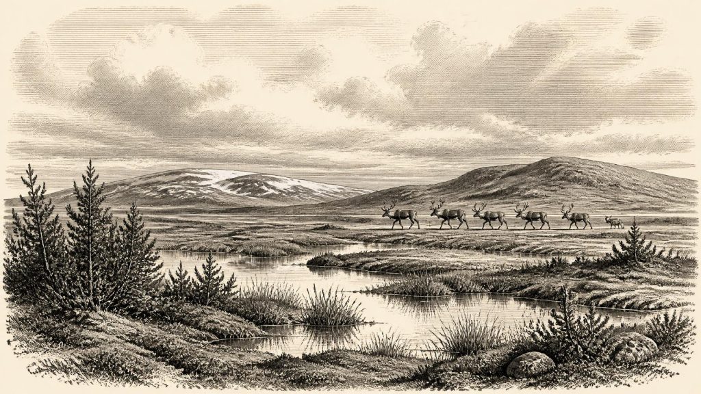
At Derryvree, organic-rich silt and fine sand were trapped between two substantial sheets of glacial till in a road cutting through a drumlin. That stratigraphic position is the key fact: the wetland developed after one phase of glaciation and before a later ice advance buried it. Pollen, plant macrofossils, mosses and insect remains indicate a cold, open and largely treeless environment. Grasses, sedges, juniper and herbaceous plants were important; a fossil seed of bogbean points to freshwater conditions. Insect evidence suggests mossy ground, plant-rich pools and open water rather than a sterile frozen surface.
The term “muskeg” has often been used for this setting: wet, mossy, sedge-rich ground with shallow pools and accumulating organic matter. It evokes a landscape that could be biologically productive in summer but harsh in winter, with strong seasonal contrasts. Derryvree is not a complete portrait of all Ireland. It is a narrowly preserved local record. Nevertheless, it decisively demonstrates that at least part of the north-central island was not continuously smothered by ice throughout the relevant part of MIS 3.
That evidence also sets limits on confident storytelling. No hearth, dwelling, human footprint, stone tool workshop or grave has been securely excavated from Derryvree for this period. The silts illuminate weather, water and vegetation, not social organisation. They allow us to say that freshwater habitats and plant communities existed; they cannot tell us whether people watched the pools, travelled through the area, or named the land.
Cork Caves and Open-Country Animals
Far to the south, limestone caves around Doneraile in north County Cork preserve another part of the picture. Castlepook Cave produced a remarkable assemblage of Late Pleistocene animal bones during antiquarian excavations. Modern re-evaluation and improved radiocarbon procedures have shown that elements of the assemblage are older than once thought and belong within MIS 3. The fauna associated with the cave includes reindeer, woolly mammoth, giant deer, horse, brown bear, wolf, foxes, mountain hare, collared lemming and spotted hyaena.
These animals should not be treated as a single herd seen on one day. Cave collections can mix material accumulated at different times, and carnivores, natural deaths, water movement, excavation methods and later curatorial history all affect what survives. Even so, the species establish an unfamiliar Irish ecological world. Reindeer and lemmings indicate cold, open habitats; mammoth, horse and giant deer suggest grass- and herb-rich country capable of sustaining large herbivores; wolves and hyaenas were predators or scavengers within that food web.
Spotted hyaena is especially revealing. Now associated in popular imagination with African savannas, it ranged across Pleistocene Europe and could live in cold, seasonal environments. Caves may have served as dens, refuges or places where bones accumulated after scavenging. Castlepook should therefore be understood first as a complicated palaeontological archive, not automatically as a human hunting station. Its animal remains demonstrate that Ireland formed part of a wider north-west European ecological zone, even if the routes between its different regions changed repeatedly.
The Reindeer Femur Question
A reindeer hind-leg bone from Castlepook has made this period unusually significant for Irish archaeology. The specimen bears a deep linear modification which zooarchaeologist Ruth Carden has interpreted as a mark made by a sharp stone tool during carcass processing. Public heritage material in County Cork has placed the bone at about 31,000 BCE, and the claim has been widely presented as evidence that people were active in Ireland roughly 33,000 years ago.
The interpretation deserves attention, but also care. If the mark was made by a tool on fresh bone, it is potentially Ireland’s earliest evidence for human activity by more than twenty millennia. It would indicate a brief Upper Palaeolithic presence or incursion during MIS 3, rather than the later and much better evidenced Mesolithic colonisation. Yet the bone’s radiocarbon age dates the animal’s death, not independently the moment of marking, the place where it was killed, or the length of any human visit. A single modified bone cannot prove a permanent settlement, establish the size or identity of a group, or identify a particular stone-tool tradition.
There is, crucially, no securely associated Upper Palaeolithic assemblage of tools, hearths, structures or human remains from Castlepook. Recent investigation of the cave has added valuable geological and faunal information but has not produced a stratified camp that resolves these questions. The most defensible conclusion for around 31,771 BCE is modest but important: human presence in Ireland is possible and perhaps suggested by the reindeer femur; sustained occupation remains unproven.
Life, Exchange and Belief: What Cannot Yet Be Known
If people did reach Ireland in this interval, comparison with Upper Palaeolithic communities elsewhere in north-west Europe makes mobile hunter-gatherer lifeways plausible. Reindeer and other large mammals could have supplied meat, hides, sinew, bone, antler and fat; stone tools would have been essential for cutting and working materials. Small, seasonally moving groups might have used caves or temporary shelters and followed animal movements across open terrain. These are reasonable analogies, however, not direct observations from an Irish settlement. Ireland has not yielded the evidence needed to describe household routines, clothing, diet, language or kinship for this date.
For the same reason, political affairs, diplomacy, warfare, religion, art, formal learning and trade cannot responsibly be reconstructed. There were no known Irish polities, monuments, cemeteries, written records or exchange networks from which to infer them. Animals may have crossed the exposed shelf, and any human visitors may have come through connections with Britain or farther east, but there is no evidence for organised Irish trade. Nor can a cave bone tell us what its handlers believed, whether they made images or music, or how they understood death and landscape.
The absence of evidence is not proof that no person ever entered Ireland. It is partly a consequence of preservation. Subsequent ice advances scoured landscapes, sea-level rise drowned former coastal plains, and nineteenth- and early twentieth-century cave excavations did not record deposits to modern standards. Nonetheless, archaeology must distinguish a possibility from a demonstrated history. At this date the environmental record is firmer than the human story.
Before the Great Freeze
Thus, the Ireland illuminated by 31,771 BCE was a changing cold-stage land rather than a settled country. Derryvree shows sedges, mosses, pools and open ground in a northern wetland during a broad interval embracing this date. Castlepook’s bones show that large herbivores and formidable carnivores occupied or reached southern Ireland during MIS 3. Together, they reveal habitats sufficiently varied to sustain life at the edge of an unstable glacial world.
What followed was not steady development towards later Irish society. Ice-sheet growth would transform, cover and erode much of the landscape; any early visitors, if they came, left no known continuous descendant community. The better documented human history of the island begins far later, after climatic recovery, with Late Upper Palaeolithic and Mesolithic evidence. Around this remote point in time, Ireland’s most secure history is written in sediment layers and bones: a cold wetland in Fermanagh, a cave fauna in Cork, and one disputed-looking incision with the power to enlarge the island’s human past.
Primary Sources
- A reconsideration of the radiocarbon dating of the Marine Isotope Stage 3 fauna from southern Ireland
- First evidence of a Late Upper Palaeolithic human presence in Ireland
- The subdivision of the Quaternary Period in Ireland
- Irish Pleistocene biostratigraphy
- Episodic speleothem deposition tracks the terrestrial impact of millennial-scale climate change during Marine Isotope Stage 3
- Trimlines, blockfields and the vertical extent of the last ice sheet in southern Ireland
- Exploring the evolution of the Celtic Sea Ice Stream of the British-Irish Ice Sheet
- Timing and pace of ice-sheet withdrawal across the marine-terrestrial transition west of Ireland during the last glaciation
- Last Glacial Maximum cirque glaciation in Ireland and implications for reconstructions of the Irish Ice Sheet
- Dimensions and chronology of the last ice sheet in Western Ireland
- The Irish Quaternary Fauna Project
- On the Cave of Castlepook, Near Doneraile, Co. Cork
- Archaeological excavations at Castlepook Cave, Co. Cork, 2022
- Heritage Artefacts of County Cork
- Palaeolithic Ireland: New evidence emerges from the Emerald Isle
- The colonization of Ireland: A human ecology perspective
- Ireland: Submerged Prehistoric Sites and Landscapes
- The Mesolithic in Ireland: when was it?
- Making Yourself at Home on an Island: The First 1000 Years (+?) of the Irish Mesolithic
- The Antiquity of Man in Ireland
- New insights on the fauna of Ireland's Younger Dryas and Early Holocene from Alice & Gwendoline Cave
- The Exploration of the Caves of County Clare
