
Elephant Hall’s Incised Femur30118 BCE
Labelled 30,118 BCE, this horizon represents an uncertain Late Pleistocene interval, not a precise Irish date. During Marine Isotope Stage 3, Ireland contained shifting ice, periglacial terrain, wetlands and open grazing country as the British–Irish Ice Sheet expanded towards its later maximum. Derryvree sediments indicate local ice-free freshwater environments, while Castlepook Cave preserves cold-adapted fauna including mammoth, reindeer, giant deer, hyaena and wolf. An incised reindeer femur may indicate early human butchery, but its insecure context and lack of associated tools prevent firm conclusions. Later glaciation destroyed much evidence, requiring cautious interpretations based on dated deposits, animal remains and landforms.
Dateline
What is labelled 30,118 BCE cannot be treated as a date in the modern historical sense. No Irish person recorded an event, named a leader or marked a season in that year. The label is a backwards conversion from a modern calendar, whereas the evidence available for this part of the Ice Age comes from radiocarbon determinations, sediment layers, animal remains and reconstructions with wide margins of error. At best, it directs us to a broad horizon roughly 32,000 years before AD 1950, within Marine Isotope Stage 3 (MIS 3), a climatically unstable interval of the Late Pleistocene.
For Ireland, the responsible picture is therefore regional and probabilistic. Around this notional date, parts of the island may have supported cold, open habitats and substantial herds or visiting populations of large mammals, while other districts were affected by growing local ice or lay in the path of advancing ice masses. The island was moving towards the much fuller glaciation of the Last Glacial Maximum, but that maximum came later. The best evidence does not yield a single Irish landscape, much less a single Irish year.
A Date With a Wide Margin
Radiocarbon dating does not translate straightforwardly into BC years. Atmospheric carbon levels changed through time, so measurements must be calibrated, and older measurements can carry particularly broad statistical uncertainty. A useful nearby environmental reference is the Derryvree deposit near Maguiresbridge, County Fermanagh. There, organic freshwater sediments between glacial tills produced the determination BIRM-166: 30,500 radiocarbon years BP, with an uncertainty of +1,170/−1,030 years. It represents material from an ice-free interval, not a diary entry and not a date for all Ireland.
Later modelling has placed the relevant Derryvree interval broadly around 33.5 ± 1.2 thousand calibrated years BP. That range is informative because it shows that fresh water, plants and small wetland communities existed locally before later ice overran and sealed the deposits. It is not precise enough to attach conditions at the pool to 30,118 BCE. Nor can it establish whether a comparable wetland existed simultaneously in Cork, Clare, Dublin or Donegal. The physical record is powerful, but it is patchy, local and time-averaged.
Before the Full Ice Advance
The broader setting was a changing British–Irish Ice Sheet. Modern reconstructions indicate that its expansion was neither simple nor simultaneous in every region. Ice was growing and reorganising across Ireland, Britain and the adjoining seas during the later part of MIS 3. Shelf-edge evidence west and north-west of Ireland suggests major advance there around 29,000–27,000 calibrated years BP; the extensive Irish Sea Ice Stream reached its maximum farther south later, around 27,000 years ago. Other reconstructions place an earlier phase of growth near 30,000 years ago, while stressing the limited direct dating control for several sectors.
The implication for the horizon represented by 30,118 BCE is important. Ireland was not yet uniformly the ice-covered land familiar from descriptions of the Last Glacial Maximum. Equally, it was not a temperate, wooded island. Ice centres, mountain glaciers, periglacial ground and open lowlands could coexist over an area whose coastlines and sea passages differed greatly from those of today. Falling sea level exposed parts of the continental shelf, but the exact practical routes between Ireland, Britain and mainland Europe varied with topography, water depth, ice and season. It is unsafe to imagine an uninterrupted road or a fixed land bridge.
The advance of ice was the decisive political force only in a metaphorical sense: it reshaped the territory available to animals and any people. It eroded older ground, diverted drainage, carried debris across the landscape and later buried fragile deposits beneath till. This explains why evidence for the period is so rare. The lack of sites is not proof that nothing occurred; it reflects the destructive reach of later glaciation as well as the limited number of caves, buried sediments and exposed sections that have been investigated.
Animals of the Open Country
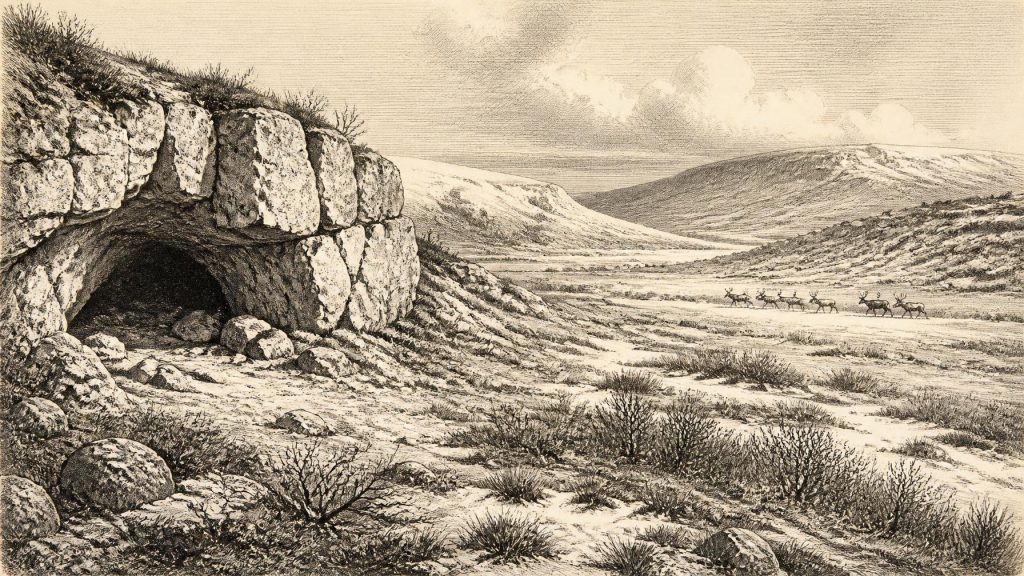
South Irish caves preserve the clearest glimpse of the fauna associated with this world. Castlepook Cave, near Doneraile in north County Cork, is especially important. Excavated largely in the late nineteenth and early twentieth centuries, its chambers acquired names such as Elephant Hall and Hyaena Hall because of their spectacular bone assemblages. The cave has produced remains attributed to woolly mammoth, reindeer, giant deer, brown bear, wolf, Arctic fox, mountain hare, lemmings and spotted hyaena. This is not a complete census of animals living together on one day; cave deposits often combine material accumulated by carnivores, water, collapse and human excavation over long spans.
Even so, the species list indicates an open, cold-adapted environment rather than dense forest. Reindeer and lemmings point towards tundra or steppe-tundra conditions; mammoth and giant deer evoke broad grazing landscapes; hyaenas and wolves indicate a food web with large predators and scavengers. The National Museum of Ireland’s Ice Age collections retain much of the material on which such reconstructions depend. Reassessment has also shown why old collections need continual study: improved chemical pretreatment has made several radiocarbon results from the 1990s obsolete or substantially too young.
At Castlepook, newer dating has pushed some faunal evidence deeper into MIS 3. A 2020 reassessment concluded that giant deer and spotted hyaena may have disappeared locally before the Last Glacial Maximum, around 40,000 calibrated years ago, rather than surviving into its coldest phase. That conclusion does not mean that every dated bone describes exactly the conditions of 30,118 BCE. It does, however, make it reasonable to place the notional year within a longer interval when southern Ireland could support a varied cold-stage fauna before the later ice sheet transformed the island.
The Reindeer Bone Question
The most arresting possible human clue is a reindeer femur from Castlepook. Ruth Carden identified a linear modification on the bone which she interpreted as consistent with cutting fresh bone using a stone tool. The reported date, popularly described as about 33,000 years ago, has been presented as evidence for a very early human presence in Ireland. If the interpretation is correct, it would suggest that hunter-gatherers reached this far-western edge of Europe long before the better-attested terminal Pleistocene visitors to Ireland.
That proposition needs careful wording. The femur is an important object, not proof of a settled population, a named culture or continuous occupation. It came from an old cave collection with imperfect original context, and a single modified bone cannot reveal the size, language, beliefs, kinship arrangements or duration of a visiting group. A fresh-bone cut is compatible with butchery, but direct, stratified archaeological corroboration remains essential. Recent licensed excavations at Castlepook have sought undisturbed Pleistocene deposits precisely because the cave’s older archive raises questions that only secure context, modern dating and repeated finds can answer.
Consequently, one should not turn this evidence into a story of an Irish tribe hunting mammoth in a particular year. The defensible inference is narrower: during the broad MIS 3 period, people may have entered a landscape used by reindeer and other large mammals, and may have processed an animal at or near Castlepook. Whether that was a brief expedition, a recurrent seasonal practice or an isolated episode remains unknown.
No Kingdoms, No Recorded Exchange
There is no evidence for political institutions, warfare, diplomacy, formal religion, monuments, farming, villages or trade networks in Ireland at this horizon. Such categories belong to later prehistoric and historic societies, and applying them here would manufacture certainty. If people did visit, their likely social world would have been that of highly mobile Upper Palaeolithic hunter-gatherers known elsewhere in north-west Europe: small groups relying on practical knowledge of animals, weather, raw materials and safe routes. That is a comparative model, not a direct description of an Irish community.
Likewise, no Irish artefacts securely dated to this point demonstrate exchange or specialist manufacture. Stone tools would be the most obvious evidence for hunting and carcass processing, yet the crucial Castlepook claim currently rests on a bone modification rather than an associated tool assemblage. Caves may have offered shelter, carnivore dens, traps for sediment and occasional working spaces; they were not necessarily homes. Everyday life, if humans were present at all, would have been dominated by mobility, fire, clothing, food preservation and the management of acute cold, but Ireland has not yet supplied the material evidence needed to reconstruct those practices directly.
A Landscape of Evidence and Absence
The most meaningful development around 30,118 BCE was environmental instability. Freshwater plants preserved at Derryvree, cold-adapted mammals in southern caves and the expanding British–Irish Ice Sheet all show that Ireland contained changing ecological pockets rather than a uniform frozen wasteland. Wetlands could sustain mosses, sedges and aquatic plants; open terrain could feed grazing animals; limestone caves could preserve bones that later ice and erosion might otherwise erase. Yet these refuges were vulnerable. Subsequent glaciation covered or destroyed much of their record.
This is therefore a chapter in Irish history without rulers or chronicles, but not without evidence. Its principal witnesses are a sealed Fermanagh wetland, the bone-rich chambers of Castlepook and the landforms of a growing ice sheet. They reveal a harsh, dynamic Ireland on the threshold of more extensive glaciation. They also impose a discipline: calibrated ranges, not imagined anniversaries; traces, not tales of certainty; and a sharp line between what the deposits demonstrate and what historians can only cautiously infer.
Primary Sources
- A reconsideration of the radiocarbon dating of the Marine Isotope Stage 3 fauna from southern Ireland
- The Irish Quaternary Fauna Project
- Growth and retreat of the last British–Irish Ice Sheet, 31,000 to 15,000 years ago: the BRITICE-CHRONO reconstruction
- Stratigraphic and palaeo-geomorphological evidence for the glacial-deglacial history of the last British-Irish Ice Sheet in the north-western Irish Sea
- Marine geophysical evidence for Late Pleistocene ice sheet extent and recession off northwest Ireland
- Timing and pace of ice-sheet withdrawal across the marine–terrestrial transition west of Ireland during the last glaciation
- Exploring the chronology of the last British-Irish Ice Sheet
- 2022:564 – Castlepook Cave, Castlepook South, Cork
- Archaeology Research Excavation Grant 2022
- Quaternary Site Descriptions
- Exhibition Galleries
- The Mesolithic in Ireland: when was it?
- New insights on the fauna of Ireland's Younger Dryas and Early Holocene from Alice & Gwendoline Cave
- New insights on the fauna of Ireland's Younger Dryas and Early Holocene from Alice & Gwendoline Cave
- The Last Scottish Ice Sheet
- Trimlines, blockfields and the vertical extent of the last ice sheet in southern Ireland
- Phylogeographic, ancient DNA, fossil and morphometric analyses reveal ancient and modern introductions of a large mammal: the complex case of red deer (Cervus elaphus) in Ireland
- Preliminary assessment of the archive of faunal remains from excavated Irish cave sites
- The Dungarvan Valley Caves Project: Second Interim Report
- Archaeological excavations at Killuragh Cave, Co. Limerick: a persistent place in the landscape from the Early Mesolithic to the Late Bronze Age
- Drumlins and Pleistocene Ice Flow over the Ards Peninsula/Strangford Lough Area, County Down, Ireland
- The Late Quaternary history of east-central Ireland