
Derryvree’s Silted Pool31670 BCE
Although 31,670 BCE is a modern label rather than a precise Irish date, Derryvree, County Fermanagh, preserves organic freshwater sediments dated broadly to 36,900–31,700 cal BP. Trapped between glacial tills, they record a cold, treeless wetland landscape with pools, mosses, plants and insects during Marine Isotope Stage 3. Cave fossils elsewhere show that mammoth, reindeer and predators reached Ireland, but cannot be assigned to Derryvree or one moment. Ireland was increasingly affected by expanding ice, while lower sea levels did not guarantee easy migration routes. No secure human evidence exists until much later. Derryvree documents environmental change, not human history.
Dateline
“31,670 BCE” is a modern chronological label, not a date at which an event can be placed in Ireland. No written record, named individual, settlement, artefact assemblage or calendar-year occurrence survives from this point. At this depth of time, precision rests on scientific estimates with substantial ranges. The label corresponds very approximately to 33,620 years before AD 1950, but the best Irish evidence is dated in broad calibrated intervals rather than single years. The crucial environmental sequence at Derryvree, near Maguiresbridge in County Fermanagh, has produced calibrated ages of roughly 36,900–31,700 cal BP. It can therefore illuminate the world around this nominal year, but cannot identify conditions on one particular season, let alone one particular day.
An Interval Beneath a Drumlin
Derryvree is important because a road cutting exposed organic silts and fine sands trapped between two thick sheets of glacial till. The deposits were later incorporated into a drumlin: one of the elongated hills that now gives much of Fermanagh and neighbouring counties their characteristic form. The lower till records an earlier glacial episode, while the upper till belongs to a later expansion of the Irish ice sheet. Between them lies evidence of a period when water, plants and small animals occupied a low-lying hollow.
That evidence is more dependable than any picturesque reconstruction. Sediments tell archaeologists and geologists that there was standing or slow-moving freshwater; plant remains, pollen and insect evidence indicate vegetation; the enclosing tills show that this brief environmental archive was eventually overridden or sealed by ice-related deposits. The Derryvree sequence has traditionally lent its name to a “Derryvree Cold Phase”, but such labels are working subdivisions of Irish Quaternary stratigraphy, not proof that every part of Ireland experienced identical conditions at the same moment.
The date range also matters. Radiocarbon years are not calendar years, because atmospheric carbon-14 concentrations changed through time. Calibration curves convert laboratory measurements into calendar estimates, but at around 34,000 years ago the resulting ranges remain broad. The responsible conclusion is that Derryvree records part of Marine Isotope Stage 3, during the last glacial period, at or near the time represented by 31,670 BCE. It does not provide an annual chronicle.
Cold Water, Open Ground
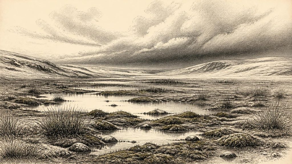
The Derryvree organic beds point to a treeless, cold landscape with wet ground, pools and moss-rich vegetation: what earlier investigators described as muskeg-like terrain. This was not the wooded, hedge-divided Ireland familiar today. Trees were absent or extremely scarce locally, and the plant community was adapted to short growing seasons, frost, saturated soils and exposure. Insects from the sequence reinforce the impression of open, cold conditions around shallow water and abundant plant debris.
Such evidence should not be turned into a claim that Ireland was a single uniform tundra. Relief, drainage, distance from the sea, snow cover and the position of ice margins could all create regional variation. The Derryvree hollow was one particular environment in the north of the island. Yet it provides a powerful corrective to any assumption that every Ice Age scene was a barren desert of snow. Even in a harsh climatic phase, lowland waterbodies and their margins could sustain plant life and invertebrate communities.
South-western Irish cave records add another perspective. At Crag Cave in County Kerry, episodes of speleothem growth during Marine Isotope Stage 3 indicate intervals when liquid water could percolate through the limestone and annual conditions were less persistently frozen. The timings broadly echo the abrupt warm and cold oscillations recognised in Greenland ice cores. This does not mean that Ireland experienced Greenland’s climate directly or uniformly. It means that Irish records, however fragmentary, preserve signs of a rapidly changing North Atlantic world rather than an unbroken, simple descent into maximum glaciation.
The Faunal Evidence
At Castlepook Cave, also known as Mammoth Cave or Doneraile Cave, in north Cork, fossils establish that an impressive cold-stage fauna reached Ireland during the wider Marine Isotope Stage 3 interval. The assemblage includes woolly mammoth, reindeer, giant deer, brown bear, wolf, fox, Arctic fox, mountain hare, lemmings and spotted hyaena. Aghnadarragh near Lough Neagh has also yielded woolly mammoth remains and Ireland’s only known musk ox material. These finds demonstrate that the island, or the landmass that later became the island, could support and receive large mammals during phases of the last glacial cycle.
They must nevertheless be handled with care. Cave deposits often accumulated over long periods. Bones can be moved by water, carnivores, roof collapse, excavation and later disturbance; fossils from differing ages may be close together in the same cave chamber. Modern redating has shown that several older radiocarbon determinations from southern Irish caves were too young, sometimes by many thousands of radiocarbon years. The revised work places important Castlepook fauna earlier in Marine Isotope Stage 3 and suggests that giant deer and spotted hyaena may have disappeared locally before the Last Glacial Maximum.
It is therefore sound to say that reindeer, mammoth and carnivores belonged to the wider Irish late-Pleistocene record relevant to this era. It is not sound to place a particular herd at Derryvree in 31,670 BCE, or to imagine mammoths wading through its particular pool. The environmental sequence and the cave fauna complement one another; they do not form a photograph of a single landscape at a single instant.
Ice Sheet in Formation
The period falls before the full Last Glacial Maximum, when the Irish component of the British–Irish Ice Sheet attained its greatest extent. Recent synthesis of terrestrial and offshore evidence indicates that Ireland was largely ice-free until about 32,000 years ago, after which the last Irish ice sheet thickened and expanded. Its growth was not a single island-wide switch from green land to total ice cover. Different sectors advanced at different times, and the maximum extent in some offshore areas came substantially later, between roughly 30,000 and 22,000 years ago.
For people living far in the future, this ice would create many familiar Irish landforms: streamlined rock, tills, drumlins, eskers, moraines and meltwater channels. Around the nominal date in question, however, those forms were processes in motion or deposits yet to be laid down. The upper till at Derryvree is material testimony that the freshwater interval ended under renewed glacial conditions. Its burial is as historically significant as its biological content: it shows that the habitat was vulnerable to major environmental reorganisation.
Sea level was much lower than today, exposing broad areas of the continental shelf. Ireland was not yet isolated in the modern sense; later work places the final creation of an island between approximately 20,600 and 18,100 cal BP. But a lower sea level should not be simplified into an easy, continuous route from continental Europe. The routes across the Irish Sea basin, through Britain and across exposed shelves were shaped by watercourses, cold terrain, sea ice and shifting glaciers. Animal movement into Ireland was possible during suitable intervals, but its exact pathways remain an inference rather than an observed fact.
No Demonstrated Human Community
There is no secure evidence for people in Ireland around 31,670 BCE. No accepted stone-tool industry, hearth, dwelling, human bone, deliberate burial, rock art, ornament or unequivocally butchered animal bone belongs to this pre-Last Glacial Maximum horizon. That absence is central to the history of the period. Political affairs, diplomacy, warfare, religion, learning, trade and social institutions cannot responsibly be described, because none is evidenced for Ireland at this time.
It is possible that Upper Palaeolithic hunters occasionally moved through regions of Britain and north-west Europe occupied by the same broad range of cold-adapted mammals. The existence of fauna in Ireland makes a human visit conceivable, especially before sea-level rise separated the island. Conceivable is not demonstrated. Older claims for Irish Palaeolithic occupation have repeatedly failed to produce secure associations between artefacts or cut marks and securely dated deposits. The earliest presently accepted direct evidence of human activity in Ireland is much later: cut marks on a brown-bear patella from Alice and Gwendoline Cave in County Clare, dated to about 12,810–12,590 cal BP.
That long gap should discourage a familiar historical temptation: importing the social world of later hunter-gatherers into a period without people. There were no known camps, families, territories, leaders or ritual places here in 31,670 BCE. If people did make an unrecorded incursion, its scale, duration, technology and outcome are unknown. Ice-sheet erosion, subsequent sediment movement and the limited survival of very old archaeological deposits may partly explain the silence, but explanation of the gap is not evidence that fills it.
A History Written Indirectly
The Ireland of this period is thus best understood as a changing ecological frontier, not as a society awaiting named history. Its “economy” was the transfer of energy through wetland plants, insects, herbivores and predators; its regional connections were movements of fauna across landscapes now altered or drowned; its decisive conflicts were climatic shifts, freezing, thawing, erosion and advancing ice. Cave bones and a buried Fermanagh freshwater bed are modest survivals, but they reveal a country repeatedly made habitable, difficult and uninhabitable again by Ice Age change.
Derryvree’s value lies precisely in its restraint. Beneath later glacial sediment, it preserves evidence that an open, cold wetland briefly existed between episodes of ice advance. Around the modern label 31,670 BCE, that is the clearest historically responsible picture: not kings or monuments, but silts, water, plants, insects, wandering mammals and an unstable climate on the verge of profound transformation.
Primary Sources
- A Middle Midlandian Freshwater Series at Derryvree, Maguiresbridge, County Fermanagh, Northern Ireland
- The Irish Quaternary Fauna Project
- A Reconsideration of the Radiocarbon Dating of the Marine Isotope Stage 3 Fauna from Southern Ireland
- The Last Irish Ice Sheet: Extent and Chronology
- Growth and Retreat of the Last British–Irish Ice Sheet, 31,000 to 15,000 Years Ago: the BRITICE-CHRONO Reconstruction
- Pattern and Timing of Retreat of the Last British-Irish Ice Sheet
- Episodic Speleothem Deposition Tracks the Terrestrial Impact of Millennial-Scale Last Glacial Climate Variability in SW Ireland
- The IntCal20 Northern Hemisphere Radiocarbon Age Calibration Curve (0–55 cal kBP)
- A Stratigraphic Framework for Abrupt Climatic Changes During the Last Glacial Period Based on Three Synchronized Greenland Ice-Core Records
- First Evidence of a Late Upper Palaeolithic Human Presence in Ireland
- New Insights on the Fauna of Ireland's Younger Dryas and Early Holocene from Alice & Gwendoline Cave
- Pleistocene Vertebrates in the British Isles
- Occurrence of Mammalia Relicts at Site Castlepook Cave
- Mammoth Cave
- Aghnadarragh
- Mammoth and Musk Ox ESR-Dated to the Early Midlandian at Aghnadarragh, County Antrim, Northern Ireland, and the Age of the Fermanagh Stadial
- Quaternary
- Ireland Through Geological Time
- An All-Ireland Quaternary Map
- Quaternary Site Descriptions
- Figure 6.— The Subdivision of the Quaternary Period in Ireland
- Maximum Extent and Dynamic Behaviour of the Last British–Irish Ice Sheet West of Ireland
- Trimlines, Blockfields and the Vertical Extent of the Last Ice Sheet in Southern Ireland
- The Glacial Deposits of the Maguires-Bridge Area, County Fermanagh, Northern Ireland
