
Derryvree’s Tundra Lens30229 BCE
Around 30,229 BCE, Ireland lay within the unstable Late Pleistocene, not a documented historical year. Derryvree, County Fermanagh, preserves freshwater sediments indicating an ice-free tundra wetland during a broadly comparable interval, with mosses, sedges, herbs and sparse woody plants. Crag Cave records climatic fluctuations, while Castlepook Cave’s mixed faunal deposits show mammoth, reindeer, giant deer, predators and other cold-adapted animals. A possibly stone-tool-marked reindeer bone suggests occasional Upper Palaeolithic human activity, but permanent settlement remains unproven. Lower sea levels altered access routes. Later glaciation reshaped landscapes and limited surviving evidence, leaving environmental traces rather than records of communities or events.
Dateline
30,229 BCE is a modern chronological label, not a year that can be recovered from an Irish record. There was no writing, calendar, named polity or securely dated settlement from which to build an annal. In the archaeological convention of years before present, counted from AD 1950, the label falls about 32,200 calibrated years ago. It belongs to the Late Pleistocene, within Marine Isotope Stage 3: a long, unstable interval of the last Ice Age, well before the fullest expansion of the last British–Irish Ice Sheet.
The evidence nearest to this point is environmental rather than historical in the ordinary sense. It consists of sediment layers, pollen and plant remains, insects, animal bones, cave deposits, glacial landforms and scientific dates with wide margins of uncertainty. These sources can show that parts of Ireland supported cold-climate life during relevant intervals. They cannot identify what occurred in one particular year, name a community, or demonstrate that conditions in one locality prevailed across the whole island.
A Date Within a Wide Range
The best local chronological anchor is Derryvree, near Maguiresbridge in County Fermanagh. Road-cutting through a drumlin in 1969 exposed freshwater silts and fine sands between two distinct sheets of glacial till. Organic material from this deposit produced radiocarbon determination BIRM-166: 30,500 radiocarbon years before present, with a substantial uncertainty of +1,170 and −1,030 years. Radiocarbon years are not calendar years. Because atmospheric carbon-14 has varied through time, determinations must be calibrated, and the conversion becomes especially broad at this depth in the past.
Published calibrations place the Derryvree material broadly around 36,900–31,700 calibrated years before present, approximately 34,950–29,750 BCE. Thus 30,229 BCE lies within the broad interval represented by the deposit, but it does not date a single layer, season or generation. The sediment accumulated over time; the radiocarbon result belongs to the organic material tested; and later glacier ice covered the site. Its value is therefore precise in one important respect and limited in others: it demonstrates an ice-free freshwater environment in this part of Fermanagh during a relevant cold-stage interval, not an island-wide snapshot.
Water, Moss and Open Ground
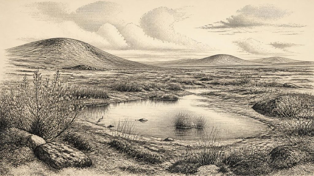
Derryvree’s freshwater lens is the clearest evidence for the landscape closest to this nominal date. The plant and animal remains indicated open tundra vegetation and a periglacial regime. In practical terms, the area was not a forested countryside, a settled lake district or a blank white ice sheet. It included shallow freshwater, wet ground, fine mineral sediment and short growing seasons amid severe cold. Mosses, sedges and cold-tolerant herbs could exploit margins kept moist by pools or slow water, while low woody plants such as dwarf willow and juniper occurred in the wider assemblage.
This was a living landscape, but a fragile one. Periglacial does not mean permanently frozen ground everywhere or at every moment; it indicates a climate in which frost action, seasonal thaw and cold-adapted vegetation strongly shaped the environment. Plants could flower and set seed in summer, insects could complete short life cycles, and freshwater habitats could persist. Yet prolonged winter cold, exposed soils and abrupt climatic reversals constrained biomass. A tundra wetland was not empty country. It was a patchwork of water, mud, moss, sparse vegetation and open mineral ground, changing with the season and with longer climatic shifts.
Crag Cave in County Kerry offers a complementary, though less local, clue. Uranium-thorium dates from its broken and reworked speleothems show episodic calcite growth through the last glacial period. In a shallow cave system, flowstone formation requires liquid water and conditions generally above freezing for enough of the year to allow seepage and calcite deposition. The record supports a picture of marked millennial-scale fluctuations in south-west Ireland rather than one unchanging age of ice. It should not be turned into an annual weather report for Fermanagh, but it reinforces the conclusion that Ireland’s cold-stage environments were regionally varied and climatically dynamic.
Animals Before the Maximum Ice
County Cork provides the most substantial Irish archive of Late Pleistocene animals. Castlepook Cave, also called Mammoth Cave, near Doneraile, has yielded more than 2,000 bones from deposits accumulated over a very long span, rather than from one occupation horizon. Its Ice-Age fauna includes woolly mammoth, giant deer, reindeer, brown bear and spotted hyena; later material includes arctic fox, wolf and lemmings. Revised radiocarbon work has shown that some older cave dates underestimated the antiquity of the fauna, underlining the importance of renewed testing and careful pretreatment of bone.
These animals cannot all be placed at Derryvree in 30,229 BCE, and the cave assemblage must not be imagined as a single simultaneous menagerie. Water movement, carnivore activity, antiquarian excavation and the long duration of deposition have mixed or obscured contexts. Even so, Castlepook establishes that Ireland formed part of the wider north-west European world in which large herbivores and predators used cold, open landscapes during Marine Isotope Stage 3. Reindeer are especially compatible with tundra and open grass-herb environments; hyena remains also warn that caves could be carnivore dens and bone repositories, not simply shelters for people.
The Human Question
There is no securely excavated settlement, hearth, house, burial, tool assemblage or occupation surface in Ireland that can be assigned to 30,229 BCE. Consequently, there is no responsible basis for describing Irish households, food-sharing rules, kin groups, ritual practices, political leadership, warfare, diplomacy, trade routes or teaching at this date. There were no known Irish monuments, farms, fields, pottery traditions or metalworking communities. Claims about an organised Palaeolithic population on the island would go beyond the evidence.
One find nevertheless makes the question of human presence important. A reindeer femur from Castlepook Cave has a deep linear mark interpreted by zooarchaeologist Ruth Carden as damage made by a sharp stone tool while a fresh carcass was processed. If that interpretation and the bone’s age are sustained, it would provide evidence that a person handled a reindeer in Ireland during the Upper Palaeolithic, much earlier than the formerly accepted record of human activity. It would not prove a permanent population. A cut-marked bone cannot tell us whether the animal was hunted or scavenged, whether one visitor or a party was involved, or whether people lived nearby.
The distinction matters. Across north-west Europe, mobile Upper Palaeolithic groups possessed sophisticated stone technologies, social networks and symbolic traditions. That wider context makes a brief visit to Ireland conceivable, particularly when sea levels were lower and the geography of the Irish Sea basin differed from today. But analogy is not direct evidence. For Ireland around this date, the most defensible wording is that human activity is possible and perhaps signalled by the Castlepook bone, while enduring occupation remains unproven.
Ice, Coast and Regional Change
Ireland’s physical geography was also in transition. The final major expansion of the British–Irish Ice Sheet occurred thousands of years later, with many reconstructions placing its maximum extent broadly between about 27,000 and 23,000 calibrated years before present. Derryvree’s freshwater sediments, sealed beneath a later till, show that north-central Ireland had an ice-free interval before that subsequent advance. They do not establish that all of Ireland was free of glacier ice at the same time. Ice margins can advance, thin and retreat unevenly, while uplands, lowlands and marine sectors respond differently.
Lower global sea levels exposed more of the continental shelf than exists today, altering coastlines and the distances between land areas. Yet a lower sea is not automatically a usable land bridge. Local ice, rivers, saltwater channels, unstable sediments and changing shorelines all mattered. The question of routes between Ireland, Britain and the continent therefore remains geological as well as archaeological. For animals, and perhaps occasional people, access depended on shifting environmental corridors rather than on a simple map line.
What This Moment Means
The principal development illuminated around 30,229 BCE is not a battle, migration or ruler’s decision, but the survival of evidence from an Irish interlude before later glaciation remade much of the landscape. Derryvree records wet tundra in Fermanagh; Castlepook preserves a long, complicated faunal archive in Cork; Crag Cave records climatic pulses in Kerry. Together they show an Ireland of regional contrasts, freshwater refuges, open cold-country vegetation and periodically available animal habitat.
Later ice advance, erosion, changing sea levels and the rarity of protected deposits have narrowed the archive drastically. That scarcity is itself part of the history. The absence of towns, graves and tools is not proof that no human ever crossed the landscape, but neither is it licence to populate it with invented tribes. Around this point in deep time, Ireland is known most clearly through the shallow water at Derryvree, the bones in Castlepook and the mineral growth of a Kerry cave: traces sufficient to reconstruct a demanding Ice-Age environment, but not a calendar year of human affairs.
Primary Sources
- Middle Midlandian Freshwater Series at Derryvree, Maguiresbridge, County Fermanagh, Northern Ireland
- Middle Midlandian Freshwater Series at Derryvree, Maguiresbridge, County Fermanagh, Northern Ireland
- Castlepook Cave: Cork County Geological Site Report
- A Reconsideration of the Radiocarbon Dating of the Marine Isotope Stage 3 Fauna from Southern Ireland
- The Irish Quaternary Fauna Project
- New Insights on the Fauna of Ireland’s Younger Dryas and Early Holocene from Alice & Gwendoline Cave
- Episodic Speleothem Deposition Tracks the Terrestrial Impact of Millennial-Scale Last Glacial Climate Variability in SW Ireland
- Episodic Speleothem Deposition Tracks the Terrestrial Impact of Millennial-Scale Last Glacial Climate Variability in SW Ireland
- Spatio-Temporal Dynamics of Speleothem Growth and Glaciation in the British Isles
- Trimlines, Blockfields and the Vertical Extent of the Last Ice Sheet in Southern Ireland
- Growth and Retreat of the Last British–Irish Ice Sheet, 31,000 to 15,000 Years Ago
- The Last Eurasian Ice Sheets – a Chronological Database and Time-Slice Reconstruction, DATED-1
- New Data for the Last Glacial Maximum in Great Britain and Ireland
- Radiocarbon Constraints on the Age of the Maximum Advance of the British–Irish Ice Sheet in the Celtic Sea
- Early Deglaciation of the British–Irish Ice Sheet on the Atlantic Margin
- The Deglaciation of the Western Sector of the Irish Ice Sheet
- First Evidence of a Late Upper Palaeolithic Human Presence in Ireland
- The Colonization of Ireland: A Human Ecology Perspective
- Heritage Artefacts of County Cork
- Karst of Ireland
- The IntCal20 Northern Hemisphere Radiocarbon Age Calibration Curve (0–55 cal kBP)
- The IntCal20 Northern Hemisphere Radiocarbon Age Calibration Curve (0–55 cal kBP)
- The Subdivision of the Quaternary Period in Ireland
