

Maguirebridge’s Buried Waters31535 BCE
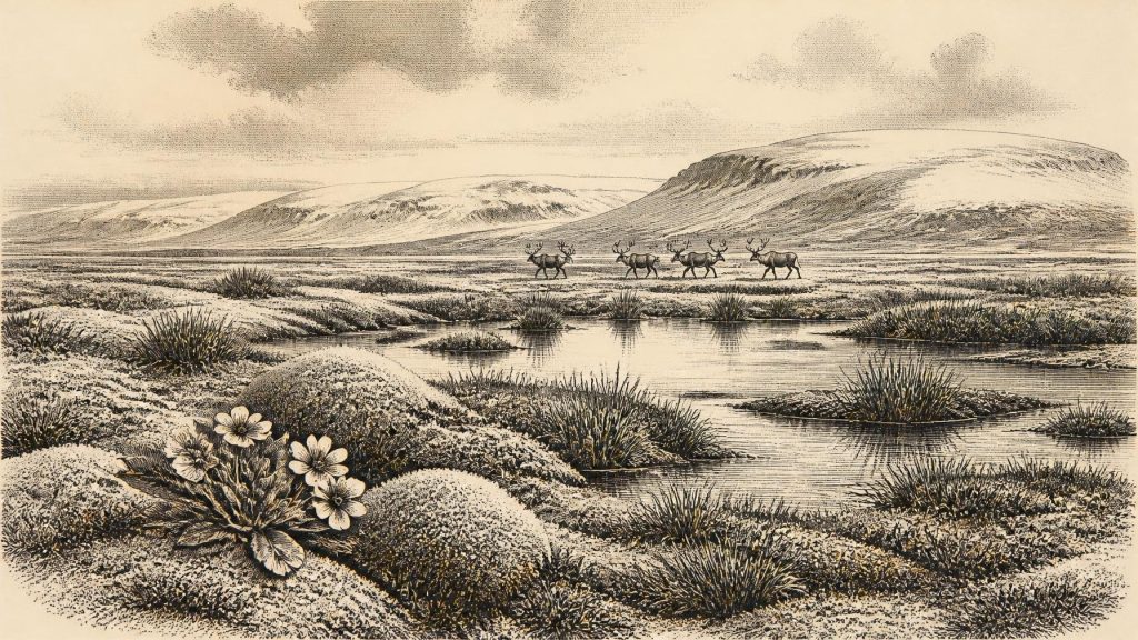
Around 31,535 BCE, Ireland cannot be described through a precise event or recognised calendar date, but environmental evidence illuminates Late Pleistocene conditions. At Derryvree near Maguiresbridge, freshwater organic sediments between glacial tills show an ice-free interval, dated broadly to 36,900–31,700 calibrated years BP. They indicate cold, treeless, wet tundra with grasses, sedges, mosses, mountain avens and bogbean. Ice-sheet advance and retreat created varied regional environments. Castlepook Cave preserves remains of mammoth, reindeer and other cold-adapted fauna. A possibly cut-marked reindeer femur suggests, but cannot prove, an early human visit. No secure evidence supports settlement, culture, politics or routes into Ireland.
Dateline
The label 31,535 BCE gives a useful position on a modern timeline, but it must not be mistaken for a date that anyone in prehistoric Ireland could have recognised, or for a year in which a recoverable event occurred. No calendar, chronicle, named individual or settlement can be assigned to it. The responsible evidence works on a much broader scale: calibrated radiocarbon ranges, layers of sediment, fossil plants and animals, cave deposits, and reconstructions of ice movement. Together they show an Ireland in the Late Pleistocene, within the unstable climatic world conventionally called Marine Isotope Stage 3, rather than an Ireland that can be narrated year by year.
A Date Within a Range
The best local chronological anchor is Derryvree, near Maguiresbridge in County Fermanagh. In 1969 road-cutting through a drumlin exposed fine sands, freshwater silts and organic sediment enclosed between two thick tills: unsorted debris laid down by glacier ice. The sequence is important because it records an interval when the site was ice-free, after one glacial episode and before another. Organic material from it gave the conventional radiocarbon determination Birm-166, 30,500 radiocarbon years before present, with a substantial laboratory uncertainty of +1,170 and −1,030 years.
Radiocarbon years are not identical to calendar years. Calibration and later chronological modelling place Derryvree broadly around 33.5 ± 1.2 thousand calibrated years before present, and one published calibrated expression spans roughly 36,900–31,700 cal BP. “Before present” conventionally means before AD 1950. The modern date 31,535 BCE falls within the broad chronological neighbourhood illuminated by this evidence, not at a point that can be isolated within it. Derryvree therefore offers a window onto conditions around this horizon, not a weather report, a political history or an event-record for one precise year.
A Freshwater Refuge Between Ice Advances
The Derryvree sediments give rare texture to an otherwise fragmentary Irish Ice Age record. They accumulated in freshwater and wet ground, perhaps in shallow pools and sluggish channels among mossy, saturated hollows. Plant remains, pollen and small animal evidence led the original investigators to identify a full-glacial flora and fauna and an open tundra landscape under a periglacial climatic regime. Periglacial does not mean that the place lay beneath ice. It means that severe cold, seasonal freezing and thawing, frost-shattered ground and short growing seasons shaped a landscape close to the margins or influence of glaciers.
This was not an empty white wilderness. The evidence supports low, open vegetation: grasses, sedges, herbs, mosses and small cold-adapted plants, with wetter patches around freshwater. Macrofossils include mountain avens (Dryas octopetala) and bogbean (Menyanthes trifoliata), species well suited to cold or wet settings. Such finds are direct evidence that these plants, or plant communities containing them, grew near the depositional environment. They do not demonstrate a uniform vegetation cover across the island. Nor do the few grains of tree pollen justify an image of local woodland: long-distance transport and redeposition are plausible explanations, whereas the wider assemblage points firmly towards treeless, exposed country.
An Island Being Remade by Ice
Ireland’s physical geography was in transition. The British–Irish Ice Sheet did not expand as one simple, simultaneous blanket. Different sectors grew and retreated at different times, and uplands could carry local ice while other districts remained open. The Derryvree deposit proves that its Fermanagh locality was free of overriding ice during the period in which the sediment formed; the upper till proves that glacier ice later returned and sealed the record beneath the drumlin. Recent modelling of the Donegal Bay sector treats Birm-166 as a significant constraint on the timing of subsequent ice build-up, while recognising the wide uncertainties inherent in an old radiocarbon measurement.
At this horizon, it is safer to speak of a mosaic than of one Irish climate. Cold open ground, freshwater basins, mountain glaciers or ice caps, and changing coastal and marine margins may all have existed in different places and at different moments. The later Last Glacial Maximum, when ice covered most or all of Ireland, lay ahead rather than being a single instant already achieved everywhere. Later glaciers also scoured, buried and reworked older deposits. That destructive history is a major reason why the evidence for this period is so sparse and why each surviving wetland layer or cave bone carries unusual weight.
Castlepook’s Animal Archive
County Cork provides the other principal Irish line of evidence. Castlepook Cave, near Doneraile and sometimes called Mammoth Cave, yielded a remarkable assemblage during early twentieth-century excavation, with later investigations reopening the search for undisturbed deposits. The cave records a richer Pleistocene fauna than the modern island possesses: woolly mammoth, reindeer, giant deer, brown bear, wolf, Arctic fox, mountain hare, lemmings and spotted hyaena are among animals identified from its deposits or historic collections. Their presence demonstrates that Ireland could sustain, or at least receive, cold-adapted and open-country mammals during parts of the Late Pleistocene.
It would be misleading, however, to turn that list into a scene fixed to 31,535 BCE. Cave assemblages are formed over time. Predators may drag in prey or scavenged parts; animals can die naturally; water can move bones; and early excavations often removed material before modern stratigraphic recording was possible. Direct dating has also shown that some earlier chronological assumptions about Irish cave fauna require revision. Castlepook is compelling evidence for a long and changing Ice Age animal world in southern Ireland, but it is not a census of a single valley, season or human hunting party.
The Reindeer Femur Question
One Castlepook object is especially relevant: a reindeer femur fragment, held in the National Museum of Ireland’s natural-history collections, which has been publicly presented as dating to about 31,000 BCE. Palaeozoologist Ruth Carden identified a deep mark on the bone as consistent with fresh-bone processing by a sharp stone implement. If that interpretation is sustained, it would be extraordinarily early evidence that people handled a reindeer carcass in Ireland, perhaps during a brief Upper Palaeolithic incursion.
Its importance demands caution, not celebration by assertion. The bone’s date is the age of the animal bone; it does not itself timestamp the making of the mark to an exact moment. Nor is there yet a securely associated hearth, stone-tool assemblage, occupation floor, dwelling, burial, human bone, food store or repeated butchery area of comparable age in Ireland. The specimen also derives from an old cave collection whose original context is limited. A single possible cut-mark can establish a question of human agency worth testing; it cannot establish a permanent population, a named culture, a settlement at Castlepook, or continuous habitation of the island.
What Cannot Be Recovered
There is no evidence from Ireland around this broad horizon for kings, chiefs, territories, assemblies, diplomacy, warfare, laws or political institutions. Equally, archaeology cannot identify a language, ethnicity or tribal name. There are no demonstrated farms, fields, domestic livestock, metal objects, monuments, formal cemeteries, shrines, writing or market places. It follows that political affairs, organised conflict and diplomacy should not be invented merely because this article occupies a place in a chronological series. The major development was environmental: life and movement were constrained by a volatile Ice Age landscape and the advance of ice.
Religion, culture and learning are similarly beyond the Irish evidence. No ritual object, artwork, musical instrument or symbolic site of this age has been securely recovered from the island. If people did visit, comparison with Upper Palaeolithic communities elsewhere in north-west Europe suggests that survival would have required detailed knowledge of animal movement, weather, stone-working, fire, clothing and co-operation. But that is a comparative inference, not a discovery from Derryvree or Castlepook. It must not be converted into claims about Irish beliefs, technologies or social organisation.
Resources, Movement and Uncertainty
The available environmental record nevertheless indicates the resources that made temporary use of parts of Ireland conceivable. Wetland plants and freshwater would have sustained insects and small animals; open vegetation could support grazing mammals; caves offered dens to carnivores and, potentially, shelter to people. Reindeer are particularly evocative because their seasonal mobility and suitability for open terrain make them plausible targets for mobile hunters. Yet even if the marked femur records butchery, it cannot reveal whether the animal was hunted, scavenged after a predator kill, processed nearby or carried into the cave later.
Routes into Ireland are also unresolved. Lower global sea levels and changing ice margins altered the geography of the surrounding seas, but the existence, location and duration of any usable land connection are matters of continuing palaeogeographical debate. No Irish evidence presently identifies a crossing route, a boat, a camp or a source community. The prudent conclusion for 31,535 BCE is therefore both modest and significant: a cold, treeless, wet and open Ireland existed in parts of the island; mammal communities adapted to such conditions were present over the wider period; and one reindeer bone raises the serious but still unconfirmed possibility of a human visit. The buried waters of Maguiresbridge remain the firmer witness.
Primary Sources
- A Middle Midlandian Freshwater Series at Derryvree, Maguiresbridge, County Fermanagh, Northern Ireland
- Exploring Controls of the Early and Stepped Deglaciation on the Western Margin of the British-Irish Ice Sheet
- Growth and Retreat of the Last British–Irish Ice Sheet, 31,000 to 15,000 Years Ago: The BRITICE-CHRONO Reconstruction
- The Deglaciation of the Western Sector of the Irish Ice Sheet From the Inner Continental Shelf to Its Terrestrial Margin
- Spatio-Temporal Dynamics of Speleothem Growth and Glaciation in the British Isles
- A Critical Review and Re-Investigation of the Pleistocene Deposits Between Cranfield Point and Kilkeel, Northern Ireland: Implications for Regional Sea-Level Models and Glacial Reconstructions of the Northern Irish Sea Basin
- Irish Pleistocene Biostratigraphy
- Palaeoecology
- BSBI: Dryas octopetala
- BSBI: Menyanthes trifoliata
- Heritage Artefacts of County Cork
- 2022:564 – Castlepook Cave, Castlepook South, Cork
- Prehistoric Details
- New Insights on the Fauna of Ireland’s Younger Dryas and the Mesolithic-Neolithic Transition
- The Irish Quaternary Fauna Project
- The Irish Elk: When and Why Did This Giant Deer Go Extinct and What Did It Look Like?
- Stoats (Mustela erminea) Provide Evidence of Natural Overland Colonization of Ireland
- The Problem of a Late Quaternary Landbridge Between Britain and Ireland
- Deglaciation, Earth Crustal Behaviour and Sea-Level Changes in the Determination of Insularity: A Perspective From Ireland
- Ireland: Submerged Prehistoric Sites and Landscapes
- Plant Macrofossil