

Sedges Beneath Maguiresbridge31128 BCE
Around 31,128 BCE, a retrospective and imprecise date, Ireland’s history is reconstructed from environmental evidence rather than written records. Organic sediments at Derryvree, County Fermanagh, indicate an unfrozen freshwater hollow between glacial advances, supporting sedges, mosses, bogbean, insects and open tundra vegetation. Ireland was nearing major ice-sheet expansion, but was not uniformly ice-covered. Castlepook Cave, County Cork, preserves remains of cold-adapted animals, although its disturbed deposits cannot prove contemporaneous communities. A marked reindeer bone may suggest brief Upper Palaeolithic human activity, yet remains inconclusive. No evidence supports permanent settlement, political societies, farming, trade, monuments or identifiable cultural traditions at all.
Dateline
Modern calendar-year precision is not available for Ireland in 31,128 BCE. The label is a retrospective convenience, roughly 33,077 calendar years before AD 1950, the conventional archaeological “present”; it is not a contemporary Irish date, and it cannot identify anything that happened in one particular year. No written record, named person, settlement, ruler or annual sequence survives from this depth of time. The responsible subject is instead a broad Late Pleistocene interval, within Marine Isotope Stage 3, reconstructed from sediments, fossil plants, animal bones and the changing history of ice.
The closest Irish evidence is measured in wide ranges. At Derryvree near Maguiresbridge, County Fermanagh, organic freshwater sediments produced a conventional radiocarbon determination of 30,500 ± 1,100 radiocarbon years BP. Calibration converts a radiocarbon measurement into a calendar-age probability range rather than a single date; published treatments place the deposit broadly at about 36,900–31,700 calibrated years BP. Thus 31,128 BCE falls within the general environmental horizon illuminated by Derryvree, not at a known beginning or end of it. At such antiquity, even carefully measured dates must be read with their uncertainties, sample histories and later revisions in view.
Evidence Between Two Ice Sheets
Derryvree became important in 1969, when roadworks cut through a drumlin, exposing fine sands, silts and organic material caught between two thick sheets of till. Till is the unsorted mixture of rock, clay and debris laid down by glacier ice. The sequence therefore preserves a compelling local history: an earlier glacial advance, an interval in which water and organic matter accumulated, and a later advance that buried the record beneath fresh ice-borne sediment.
This does not mean that all Ireland was ice-free on the same day, or that the Derryvree hollow was continuously open throughout the interval. It does, however, disprove the simple image of an island uniformly entombed beneath permanent ice. The sediments record a time when this part of Fermanagh supported an unfrozen freshwater environment. Other northern deposits, including material at Greenagho near Belcoo, contribute to the case that north-central Ireland retained ice-free ground until at least about 34,000 years ago, before the major build-up of the last Irish Ice Sheet. The precise limits and timing remain debated because later glaciers eroded, mixed and covered much of the earlier evidence.
That debate matters particularly around this notional year. The British–Irish Ice Sheet did not grow as a single, evenly advancing white blanket. Its sectors responded differently to snowfall, temperature, terrain, marine margins and the changing North Atlantic. Modern reconstructions place the large-scale growth phase after roughly 35,000–32,000 years ago and the overall maximum much later, around 27,000–21,000 years ago. Around 31,128 BCE, Ireland was approaching a decisive glacial expansion, but evidence does not support treating the whole island as already locked beneath its maximum ice cover.
A Cold Freshwater Landscape
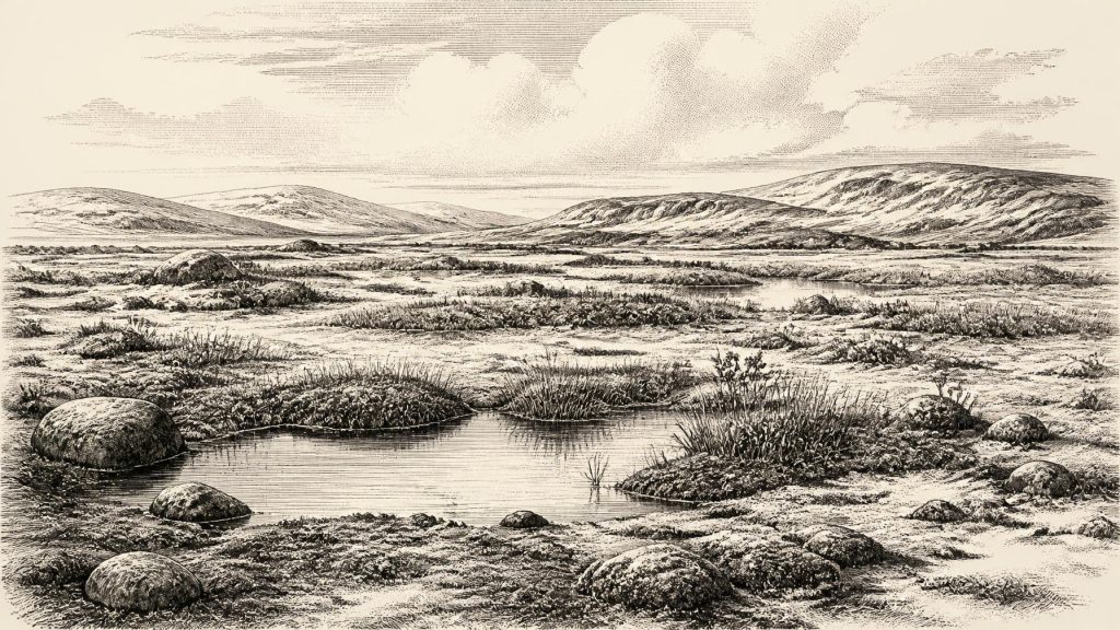
The biological evidence at Derryvree gives this remote interval texture. Fossil pollen, plant remains, mosses and insects point to open tundra or periglacial wetland rather than the wooded island familiar today. Sedges and freshwater mosses grew where shallow, slow-moving or standing water persisted. A fossil seed of bogbean, Menyanthes trifoliata, is especially vivid proof that wet ground and open water existed despite the cold. The wider assemblage includes plants associated with Arctic and alpine settings, while insects indicate northern climatic conditions.
“Tundra” should not be imagined as a featureless expanse of snow. The Fermanagh evidence suggests a mosaic of sedge margins, moss-rich saturated ground, shallow pools, exposed mineral soil and sparsely vegetated drier patches. Summers may have been brief, but they were sufficient for freshwater plants, insects and organic sediments to accumulate. Long winters, frost heave and seasonal thaw would have shaped the ground. Any river channels, pools and vegetated hollows would have been crucial concentrations of water and forage in an otherwise exposed country.
Nor should one small basin be promoted into a complete map of Ireland. Derryvree provides compelling evidence for its own locality and a valuable window onto comparable cold-stage environments; it does not tell us the weather at every coast, upland or valley. Low global sea levels altered shorelines and exposed areas of continental shelf, but the geography between Ireland, Britain and continental Europe was conditioned by changing sea levels, ice margins and local land deformation. It is unsafe to claim a simple, permanent land bridge or a known overland route at this date.
Animals in a Changing Island
Castlepook Cave near Doneraile in north Cork offers the most important southern Irish archive for the animal world of the broader period. Its collections include remains of reindeer, woolly mammoth, giant deer, brown bear, wolf, Arctic fox, mountain hare, lemmings and spotted hyaena. These finds demonstrate that Irish habitats could support a cold-adapted fauna and, at times, large grazers and their predators. They do not establish that every listed species shared one landscape at one moment. Cave deposits accumulated over long spans, and bones may have entered through carnivore activity, natural deaths, water movement and disturbance.
That qualification is essential. Castlepook was extensively excavated in the late nineteenth and early twentieth centuries, when recording methods did not meet modern archaeological standards; many bones were removed and context was often lost. The Irish Quaternary Fauna Project later used radiocarbon dating to show that mammals had reached Ireland across a broad period from at least about 45,000 to 20,000 radiocarbon years ago. More recent work has also shown that some older determinations require reassessment because improved collagen pretreatment and ultrafiltration can produce substantially older results. A cave bone’s printed date is therefore evidence under review, not a fixed timestamp for a single Irish scene.
Even with these limits, the faunal record corrects an older assumption that Pleistocene Ireland was simply empty before the final ice advance. Open vegetation and wetlands could provide forage for herbivores; carcasses would in turn attract scavengers and predators. Animal movement was not trade, nor was it evidence for human settlement, but it shows Ireland as part of a wider north-west European ecological zone rather than an isolated void.
The Reindeer Femur Question
The period has unusual archaeological importance because a reindeer femur from Castlepook has been reported as bearing a deep mark interpreted by zooarchaeologist Ruth Carden as damage caused by a sharp stone tool while the bone was fresh. Public heritage accounts have associated the specimen with an age of roughly 33,000 years and have suggested carcass processing by Upper Palaeolithic people. If the mark is confirmed as human-made and contemporaneous with the animal’s death, it would indicate a remarkably early human visit to Ireland.
It cannot, however, bear the weight of an invented settlement history. The bone derives from an old cave collection rather than a modernly excavated occupation floor. A date on bone principally dates the animal’s death; deciding whether a surface mark was made by a stone tool is a separate taphonomic judgement. Carnivore teeth, trampling, sediment abrasion, excavation damage and later handling can all complicate interpretation. No securely associated stone-tool assemblage, hearth, dwelling, burial, artwork or human remains demonstrates a resident community in Ireland at this time. Renewed excavation at Castlepook has sought surviving Pleistocene deposits precisely because securely stratified evidence is needed.
The prudent conclusion is consequential but narrow. Brief human presence is possible, perhaps involving mobile people exploiting or processing an animal; permanent occupation is unproven. Such visitors, if they came, cannot responsibly be called Irish in an ethnic, linguistic or political sense. Nothing identifies their language, social identity, route of arrival or relationship to later populations. Comparisons with hunter-gatherers elsewhere in Upper Palaeolithic Europe may suggest possibilities, but they cannot supply facts absent from Ireland.
No Kings, Markets or Monuments
For political affairs, conflict and diplomacy, the evidence is silence. There are no Irish rulers, tribes, alliances, territorial boundaries, battles or laws to describe in 31,128 BCE. Terms such as kingdom, chiefdom and nation would impose much later social forms on a fragmentary environmental record. Likewise, there is no evidence for farming, domestic animals, cultivated crops, villages, mines, markets or organised long-distance trade. The economy visible in the evidence is ecological: water, vegetation, grazing animals, predators and the seasonal constraints of a cold landscape.
Religion, culture and learning must be treated with the same restraint. Ireland has no demonstrated shrine, burial rite, cave art, musical instrument, monument or formal tradition from this horizon. If people visited, they certainly possessed knowledge needed to survive in a demanding Ice Age world, but that knowledge has not been recovered archaeologically in Ireland. The absence of evidence does not prove an absence of belief or social life; it establishes only what present evidence can and cannot support.
A Buried Ecological History
The chief development illuminated around 31,128 BCE was environmental. In parts of Ireland, cold but productive ground included freshwater hollows and treeless vegetation, while the great ice advance that would later reshape the island was gathering force. Derryvree preserves that world beneath a drumlin: mosses, sedges, aquatic plants and insects sealed between glacial deposits. Castlepook adds an animal record of exceptional richness and an unresolved question about the earliest human contact.
This is not a lesser history because it lacks named actors. It is the deep history of conditions: a changing climate, mobile fauna, intermittent habitable ground and the destructive power of later ice. Its proper narrative is not an annual chronicle, but a carefully bounded reconstruction in which the sediments and bones say much about Ice Age Ireland, while refusing to say more than they can sustain.
Primary Sources
- A Middle Midlandian Freshwater Series at Derryvree, Maguiresbridge, County Fermanagh, Northern Ireland
- Middle Midlandian Interstadial Deposits at Greenagho, Near Belcoo, County Fermanagh, Northern Ireland
- Early Midlandian–Middle Midlandian, Pleistocene, Northern Ireland
- Palaeoecology
- The Irish Quaternary Fauna Project
- New Insights on the Fauna of Ireland's Younger Dryas and Early Holocene from Alice & Gwendoline Cave
- The IntCal20 Northern Hemisphere Radiocarbon Age Calibration Curve (0–55 cal kBP)
- IntCal Publications
- Extent and Timing of the Last Glacial Maximum (LGM) in Britain and Ireland: A Review
- Growth and Retreat of the Last British–Irish Ice Sheet, 31,000 to 15,000 Years Ago: the BRITICE-CHRONO Reconstruction
- BRITICE-CHRONO Maps and GIS Data of the Last British-Irish Ice Sheet 31 to 15 ka
- The Evolution of the Terrestrial-Terminating Irish Sea Glacier During the Last Glaciation
- Exploring Controls of the Early and Stepped Deglaciation on the Western Margin of the British Irish Ice Sheet
- Trimlines, Blockfields and the Vertical Extent of the Last Ice Sheet in Southern Ireland
- British–Irish Ice Sheet and Polar Front History of the Goban Spur, Offshore Southwest Ireland Over the Last 250,000 Years
- Timing and Pace of Ice-Sheet Withdrawal Across the Marine–Terrestrial Transition West of Ireland During the Last Glaciation
- Radiocarbon Constraints on the Age of the Maximum Advance of the British–Irish Ice Sheet in the Celtic Sea
- Quaternary Site Descriptions
- Ireland's Palaeolithic Archaeology – Fleeting Footprints in a Frozen Land
- 2022:564 – Castlepook Cave, Castlepook South, Cork
- Heritage Artefacts of County Cork
- The Castlepook Cave Project
- BSBI: Menyanthes trifoliata
- Outreach and Education Resources: What Is the Quaternary?