Maguiresbridge Plant Bed31522 BCE
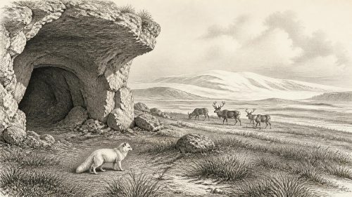
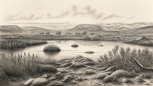
31,522 BCE is a modern label within the climatically unstable Late Pleistocene, not a datable Irish event. At Derryvree near Maguiresbridge, Fermanagh, organic sediments between glacial tills indicate a cold, ice-free interval, dated broadly to 34,950–29,750 BCE. Pollen and insects reveal treeless, wet tundra or muskeg. Castlepook Cave in Cork preserves MIS 3 fauna, including reindeer, mammoth, giant deer, bears and hyenas, although its mixed deposits cannot prove coexistence. A scored reindeer femur may record stone-tool butchery, suggesting fleeting Upper Palaeolithic human presence. No associated settlement evidence exists; Ireland remained a fragmented, changing landscape before the later major ice-sheet expansion.

Dateline
31,522 BCE is a modern chronological label, not a year that anyone in Ireland could have named or counted. No written record, calendar, settlement sequence or annual environmental archive permits events to be assigned to this particular point. In radiocarbon terms it lies roughly 33,471 years before AD 1950, the conventional “present” of radiocarbon dating. The responsible setting is the Late Pleistocene, within Marine Isotope Stage 3 (MIS 3), a long, climatically unstable part of the last Ice Age. Evidence can illuminate broad intervals around this date; it cannot supply an Irish annal for it.
That distinction matters especially in Ireland, where the record is sparse, much of it was gathered in early cave excavations, and later glaciation destroyed or buried extensive landscapes. Around this notional date, the island was not the familiar green and wooded Ireland of later millennia. It was a changing northern landscape of cold open ground, wetlands, caves and mobile animal populations, on the threshold of the major growth of the last Irish Ice Sheet. The best evidence concerns environments and fauna, with one much-debated possible trace of people.
Dating a Vanished Landscape
The most valuable environmental evidence comes from Derryvree, near Maguiresbridge in County Fermanagh. A road cutting exposed organic freshwater silts and fine sands trapped between two tills: deposits left respectively before and after separate incursions of glacier ice. The stratigraphy establishes a clear sequence. Ice had deposited the lower till; a non-glacial interval then allowed water, sediment and organic material to accumulate; a later ice advance sealed the deposits beneath another till.
Organic material from the Derryvree deposit produced a conventional radiocarbon determination of about 30,500 ± 1,170 radiocarbon years BP. Published calibration has placed that broad result at roughly 36,900–31,700 calibrated years BP, equivalent to approximately 34,950–29,750 BCE. The label 31,522 BCE therefore falls within the possible span, but it cannot be attached to a particular season, pool, animal or human action. Modern calibration curves are essential because atmospheric radiocarbon levels have varied through time; at such depths in time their ranges remain necessarily wide.
Derryvree is consequently evidence for a cold, ice-free phase in north-central Ireland, rather than proof that the whole island shared identical conditions. It also shows why archaeological shorthand can mislead. “Interstadial” does not mean balmy, and “ice-free” does not mean easy to inhabit. The deposit belongs to a cold but non-glacial interval within the Midlandian sequence, before the last ice sheet expanded across much of Ireland during the later Last Glacial Maximum.
Wet Ground and Open Country
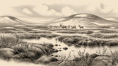
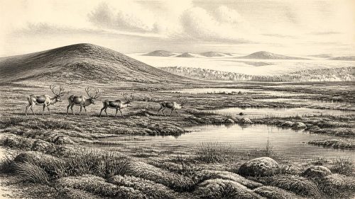
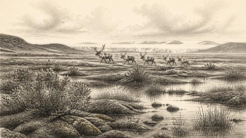
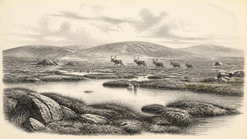
Pollen, plant macrofossils, mosses and insect evidence from Derryvree point towards a treeless tundra or muskeg environment: saturated, peaty ground with shallow freshwater, sedge-rich margins and low-growing vegetation. Such a setting need not have been monotonous. Small pools, marshy hollows, mineral-soil ridges, stream margins and exposed slopes would have offered sharply different conditions over short distances. Yet no closed forest is indicated. Trees that define later Irish landscapes were absent or exceptionally scarce in the local record.
For people or animals moving through it, this was a landscape governed by frost, wind, wet ground and seasonal scarcity. The physical map was unlike the modern island’s. Global sea level was lower than today during much of the glacial cycle, exposing parts of the continental shelves, but the precise availability and continuity of routes between Ireland and Britain varied with sea level, ice margins and local topography. It is not responsible to picture a simple, permanent land bridge or an effortless migration corridor. Faunal arrivals demonstrate that connections were possible at intervals; they do not show exactly which route an animal, still less a person, took.
Regional contrast is crucial. The Fermanagh sedimentary record demonstrates water and vegetation in one northern interior basin. In the south, limestone caves later preserved a very different kind of evidence: animal bones accumulated over long spans of time. Offshore and upland research shows that the British–Irish Ice Sheet was dynamic, with its maximum expansion still ahead. Ireland about 31,522 BCE was thus an island—or near-island landscape—of shifting opportunities and constraints, not a single frozen scene.
Castlepook’s Animal Archive
Castlepook Cave, also known as Mammoth Cave, near Doneraile in north County Cork, is the principal faunal archive relevant to this period. Excavated chiefly in the early twentieth century under Richard J. Ussher’s direction, its passages yielded a large and complicated collection of bones. Subsequent study and radiocarbon dating have made it Ireland’s richest known site for vertebrate remains from the middle to late part of the Ice Age. Its significance is exceptional, but its limitations are equally important: the cave accumulated material over a very long period, and excavators removed much of the original sedimentary context.
The wider Castlepook record includes reindeer, woolly mammoth, giant deer, brown bear and spotted hyaena, alongside other cold-stage animals in the broader Irish cave record. Redating has demonstrated that important elements of southern Ireland’s fauna belong in MIS 3, while also suggesting that some species, including giant deer and spotted hyaena, disappeared locally before the Last Glacial Maximum. These finds establish that Ireland was periodically part of a wider north-west European ecological world, not a biologically empty outpost.
They do not, however, demonstrate that every listed species shared the Awbeg valley at the same moment. A cave assemblage is a time-depth record. Carnivores may have dragged in carcass parts, scavengers may have disturbed bones, water and sediment may have moved them, and collections may combine material from different galleries and episodes. Spotted hyaena remains are particularly suggestive of denning or carcass accumulation, but they are not proof of a permanent local hyena population at the exact date considered here. Evidence permits a dynamic faunal mosaic, not a single crowded tableau.
The Reindeer Femur Question
A reindeer femur from Castlepook gives this period its greatest archaeological importance. The bone bears a deep linear modification that zooarchaeologist Ruth Carden has interpreted as a cut or chop made by a sharp stone edge while fresh bone was being processed. County Cork heritage material places the reindeer at around 31,000 BCE. If the mark is indeed anthropogenic, it is evidence that people handled a reindeer carcass in Ireland during the Upper Palaeolithic, far earlier than the previously accepted evidence for human activity on the island.
The claim must nevertheless be expressed as evidence and interpretation, not as settled biography. The evidence is a modified bone from a cave fauna whose deposits are complex. The interpretation is that the form and position of the incision are best explained by a stone tool. There is no securely associated stone-tool assemblage, hearth, dwelling, burial, human skeleton or repeatedly occupied floor of comparable age in Ireland. Nor does one possible butchery trace establish whether people hunted the animal, found it already dead, visited once, lived nearby, travelled in a larger group, or returned in successive generations.
Accordingly, no political community, leader, territory, diplomacy, warfare or organised religion can responsibly be described for Ireland in this notional year. There are no names, monuments, ritual deposits, artworks, houses or graves from which to reconstruct them. There is also no evidence for farming, domestic animals, pottery, metalworking, formal trade networks or long-term villages. If people were present, the reasonable inference is of highly mobile hunter-gatherers using perishable equipment and stone-edged tools, adapting to an open, cold environment and the movements of large mammals. That is an inference from the tool-mark interpretation and wider Upper Palaeolithic practice, not a directly excavated Irish camp.
Life at the Edge of Evidence
Even the strongest imaginable interpretation of the femur would describe a fleeting human connection, rather than a continuous origin story. Later ice expansion would remodel the land, while millennia separated any MIS 3 visitors from the better documented post-glacial populations of Ireland. Continuity of population, language, culture or belief across that gulf cannot be assumed. The key historical development is therefore not an invented episode in 31,522 BCE, but the possibility that Ireland was entered during a difficult warm-cold oscillating interval of the last Ice Age.
Maguiresbridge supplies the environmental frame: freshwater and muskeg existed between ice advances in Fermanagh. Castlepook supplies the animal world: reindeer and other large mammals reached southern Ireland in the wider MIS 3 interval. The scored reindeer femur supplies a cautious human question. Together they replace the old image of a wholly uninhabitable, uniformly ice-bound Ireland with something more compelling and more accurate: a fragmented cold landscape in which life persisted, animals moved, and a brief human presence may have left one surviving mark.
Primary Sources
- A Middle Midlandian freshwater series at Derryvree, Maguiresbridge, County Fermanagh, Northern Ireland
- Figure 6.— The subdivision of the Quaternary Period in Ireland
- A reconsideration of the radiocarbon dating of the Marine Isotope Stage 3 fauna from southern Ireland
- Castlepook Cave
- The Irish Quaternary Fauna Project
- The Irish Quaternary Fauna Project
- Heritage Artefacts of County Cork
- Spotted Hyena Skull
- The mammoth caves of Castlepook, near Doneraile
- On the discovery of hyaena, mammoth and other extinct mammals in a carboniferous cavern in County Cork
- Trimlines, blockfields and the vertical extent of the last ice sheet in southern Ireland
- Quaternary deposits and glacial stratigraphy in Ireland
- Dimensions and chronology of the last ice sheet in Western Ireland
- Deglaciation chronology of the Donegal Ice Centre, north-west Ireland
- Maximum extent and dynamic behaviour of the last British–Irish Ice Sheet west of Ireland
- The problem of a late quaternary landbridge between Britain and Ireland
- The Island of Ireland: Drowning the Myth of an Irish Land-bridge?
- The IntCal20 Northern Hemisphere Radiocarbon Age Calibration Curve (0–55 cal kBP)
- Marine20—The Marine Radiocarbon Age Calibration Curve (0–55,000 cal BP)
- Modes of Global Climate Variability during Marine Isotope Stage 3 (60–26 ka)
- Dansgaard–Oeschger events in climate models: review and baseline Marine Isotope Stage 3 (MIS3) protocol
- New insights on the fauna of Ireland’s Younger Dryas and Early Holocene from Alice & Gwendoline Cave
- Irish Cave Exploration