Derryvree Shrubs31521 BCE
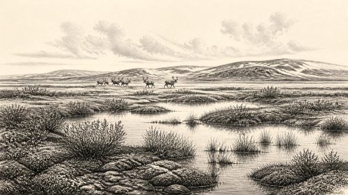
31,521 BCE is an imprecise modern label within Marine Isotope Stage 3, not a datable Irish event. At Derryvree, County Fermanagh, freshwater organic silts between glacial tills, dated broadly to 36,900–31,700 calibrated years BP, show an earlier ice-free interval before renewed glaciation. Plants indicate a cold, treeless wetland of mosses, sedges, dwarf shrubs and freshwater pools. Cave fauna demonstrate that parts of Ireland supported diverse cold-adapted animals, though records are uneven. No secure human settlement exists. A possibly cut-marked reindeer bone suggests transient Upper Palaeolithic visitors, but remains inconclusive. Ireland experienced shifting ice margins, open habitats and changing land connections.
Dateline
31,521 BCE is a modern calendar label, not a date that can be located precisely in Ireland’s archaeological record. No written chronology, settlement sequence or event can be assigned to this individual year. The responsible approach is to place it within the later part of Marine Isotope Stage 3, during the last glacial period, using broad calibrated ranges rather than pretending to annual accuracy. In calendar terms, 31,521 BCE is about 33,470 years before AD 1950, the conventional ‘present’ used in calibrated radiocarbon reporting. It falls within a period when parts of Ireland were capable of supporting cold-adapted plants and animals, while glaciers were expanding and contracting across a highly changeable northern landscape.
Freshwater Between the Tills
The most important Irish evidence near this notional date comes not from a camp or burial but from Derryvree townland, near Maguiresbridge in County Fermanagh. Roadworks in 1969 exposed a drumlin cut through by a remarkable sequence: a lower till, laid down by glacier ice; organic freshwater silts and fine sands; then an upper till from a later ice advance. The organic horizon, laboratory sample BIRM-166, produced a conventional radiocarbon age of 30,500 ± 1,100 radiocarbon years BP. Calibrated with modern methods, the determination has been discussed as broadly c. 36,900–31,700 calibrated years BP, approximately 34,950–29,750 BCE.
That range includes 31,521 BCE, but it does not prove that the exposed wetland existed on that exact year, nor that every part of Ireland shared its conditions. It does, however, securely establish the sequence of events at Derryvree: before the final ice cover that formed the drumlin, there was an interval in which open freshwater accumulated sediment and preserved organic remains. The upper till is therefore evidence of later glaciation; the silts beneath it are evidence that the locality had earlier been ice-free. This is a powerful, if geographically limited, glimpse of Irish environmental history.
A Treeless Wetland World
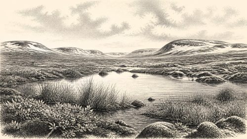
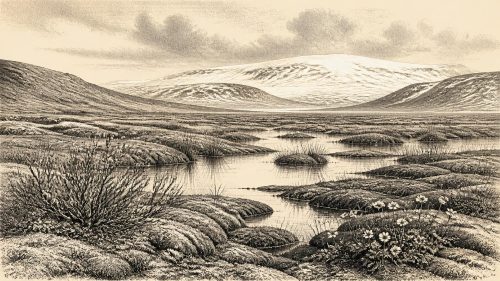
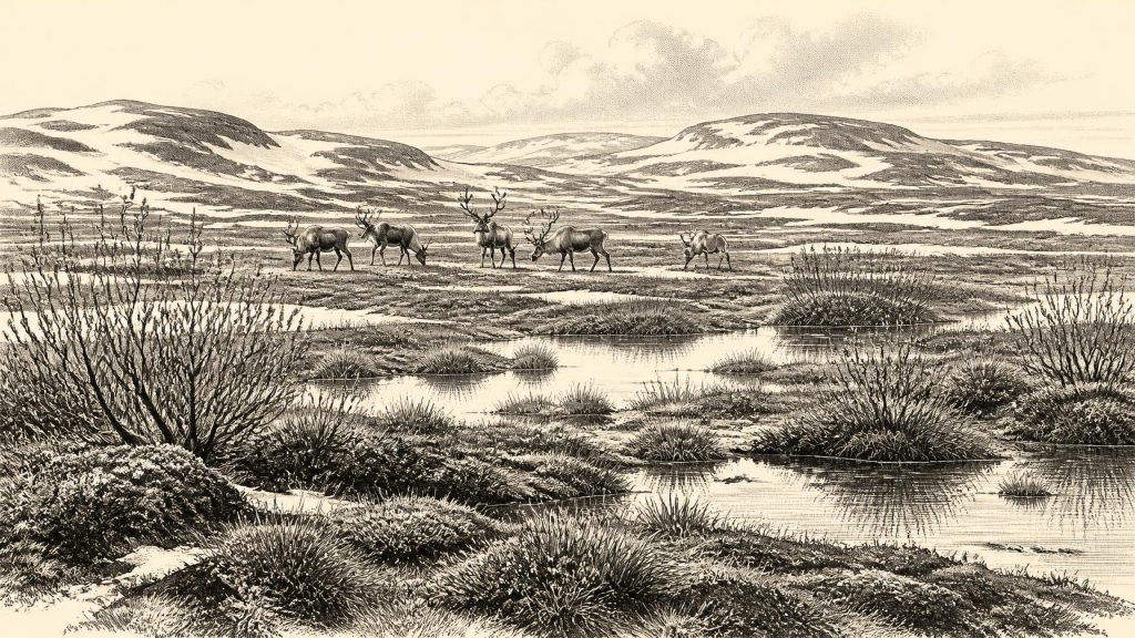
The Derryvree deposits indicate a cold, largely treeless landscape rather than a forested Ireland. Plant remains and pollen point to a tundra or muskeg-like setting of mosses, sedges, dwarf shrubs and hardy flowering plants able to survive short growing seasons, frost action and waterlogged ground. Finds reported from the deposit include bogbean, water-milfoil, mountain avens, dwarf willow, juniper and arctic-alpine mosses. Freshwater plants matter because they show that, despite severe regional climate, pools or slow-moving water existed locally and were not permanently sealed beneath ice.
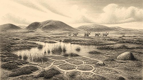
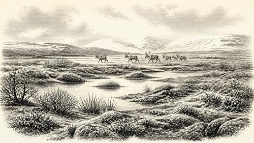
Such a landscape should not be imagined as uniformly barren. It was a mosaic: shallow ponds, sedge-rich margins, gravelly ground, exposed soils, patches of low vegetation and perhaps seasonally productive wet places. Summer light could encourage a brief burst of plant growth, while winter conditions were long and severe. Permafrost or seasonally frozen ground would have affected drainage, and wind, snow and freeze-thaw processes continually reshaped the surface. The evidence supports an open cold environment at Derryvree; it does not support a claim that all of Ireland was identical, or that every listed plant grew together at one moment.
Animals in a Changing Ireland
Caves in southern Ireland, especially Castlepook Cave near Doneraile in north County Cork, preserve a separate and uneven archive of Ice Age fauna. Re-dating programmes have shown that some animal remains previously thought to be much younger are substantially older, belonging to Marine Isotope Stage 3. Across Irish cave collections, reindeer, woolly mammoth, giant deer, brown bear, wolf, fox, mountain hare, spotted hyaena and small cold-adapted mammals have been identified. Taken together, these finds demonstrate that Ireland could support a more varied Pleistocene animal community than its later island fauna might suggest.
They must nevertheless be handled carefully. Many were recovered during nineteenth- and early twentieth-century cave excavations, before modern stratigraphic standards, and bones from different deposits may have become mixed through animal activity, water movement, collapse or excavation. A cave assemblage is not a photograph of one valley on one day. Nor should the presence of a species at Castlepook automatically be projected onto Fermanagh, or vice versa. The robust conclusion is broader: portions of Ireland offered open habitats suitable for large herbivores and their predators during parts of MIS 3, before the fullest expansion of the last Irish Ice Sheet.
The Human Question
Political affairs, diplomacy, institutions, named communities and religion are beyond recovery for Ireland at this depth of time. There are no known houses, hearths, stone-tool assemblages, graves, ornaments, art works or human remains securely dated to around 31,521 BCE. Consequently, there is no basis for describing an Irish people, language, territory, chiefdom, trade network or ritual system in this year. The absence is not merely a gap in storytelling: it is a central fact of the evidence.
Castlepook Cave has made the question of human presence more intriguing, but not settled. A reindeer femur from the old collection has been reported as bearing a deep mark interpreted as consistent with cutting by a stone tool, and the animal bone has been publicised as around 33,000 years old. If the mark is genuinely anthropogenic, it may indicate that one or more Upper Palaeolithic people processed a reindeer carcass in Ireland during this broad period. That would be exceptionally important. Yet the bone is not from a newly excavated, undisturbed occupation floor, and no associated tools or hearth have been found. The date is on the animal bone; it cannot identify who marked it, establish a permanent population, or turn one possible encounter into continuous settlement.
Mobility Rather Than Settlement
If people did reach Ireland in this period, the evidence would fit only the most cautious model: small, mobile groups crossing or travelling through a landscape that was often connected to Britain and continental north-west Europe by lowered sea levels and changing coastal plains. Such visitors might have followed herds, scavenged or hunted large animals, and used sharp stone edges for butchery. They would have required detailed ecological knowledge, flexible movement and protection from bitter weather. Those are reasonable inferences from Upper Palaeolithic lifeways elsewhere in Europe, not directly demonstrated social facts for Ireland.
Economy and exchange must be treated in the same restrained way. An animal carcass could have supplied meat, marrow, fat, hide, sinew and bone, but there is no Irish assemblage of this age from which to reconstruct a local subsistence system. There is no evidence for farming, domestic animals, pottery, metalworking, long-distance commerce or built villages. Likewise, spiritual beliefs and learning cannot be read from cold-climate plants or cave bones. The archaeological record preserves environments and animals far more clearly than it preserves human meaning.
Ice, Land and Regional Change
The larger development was environmental instability. Evidence from Derryvree and Greenagho in Fermanagh indicates ice-free intervals in north-central Ireland before the principal late-glacial build-up. Geological modelling and dated deposits suggest that the last Irish Ice Sheet expanded substantially after about 34,000 years ago and reached its maximum southern extent much later, around 24,000–23,000 years ago. At 31,521 BCE, therefore, Ireland was neither simply ‘under ice’ nor securely a wholly open land. It was a region of changing ice margins, cold wetlands, open ground and ecological corridors whose extent altered over millennia.
The BIRM-166 horizon gives this otherwise remote period an Irish texture: freshwater resting between glacial deposits, plants rooted in a treeless wetland, and an island landscape not yet reduced to its later glacial maximum. Its lesson is methodological as well as historical. Around 31,521 BCE, Ireland can be described through calibrated ranges, sediments, pollen and animal bone. It cannot responsibly be supplied with a dated battle, ruler, village or calendar-day event.
Source References
Hover over a number to see the source. Select it to open the source.

- [1] A Middle Midlandian Freshwater Series at Derryvree, Maguiresbridge, County Fermanagh, Northern Ireland
- [2] Middle Midlandian Interstadial Deposits at Greenagho, Near Belcoo, County Fermanagh, Northern Ireland
- [3] A Reconsideration of the Radiocarbon Dating of the Marine Isotope Stage 3 Fauna from Southern Ireland
- [4] The Irish Quaternary Fauna Project
- [5] Trimlines, Blockfields and the Vertical Extent of the Last Ice Sheet in Southern Ireland
- [6] Exploring Controls of the Early and Stepped Deglaciation on the Western Margin of the British Irish Ice Sheet
- [7] New Insights on the Fauna of Ireland’s Younger Dryas and Early Holocene from Alice & Gwendoline Cave
- [8] The Exploration of Castlepook Cave, County Cork, Being the Third Report from the Committee Appointed to Explore Irish Caves
- [9] The Exploration of Castlepook Cave, Co. Cork. With 3 Plates
- [10] 2022:564 – Castlepook Cave, Castlepook South, Cork
- [11] Prehistoric Details
- [12] The Mesolithic in Ireland: When Was It?
- [13] Archaeological Heritage of County Cork
- [14] Figure 6—The Subdivision of the Quaternary Period in Ireland
- [15] Ireland Through Geological Time
- [16] Geology Publications: The Last Glacial Termination in Northern Ireland
- [17] The IntCal20 Northern Hemisphere Radiocarbon Age Calibration Curve (0–55 cal kBP)
- [18] IntCal Publications
- [19] The IntCal20 Approach to Radiocarbon Calibration Curve Construction: A New Methodology Using Bayesian Splines and Errors-in-Variables
- [20] Quaternary Science Reviews 339 (2024) 108827
Primary Sources
- A Middle Midlandian Freshwater Series at Derryvree, Maguiresbridge, County Fermanagh, Northern Ireland
- Middle Midlandian Interstadial Deposits at Greenagho, Near Belcoo, County Fermanagh, Northern Ireland
- A Reconsideration of the Radiocarbon Dating of the Marine Isotope Stage 3 Fauna from Southern Ireland
- The Irish Quaternary Fauna Project
- Trimlines, Blockfields and the Vertical Extent of the Last Ice Sheet in Southern Ireland
- Exploring Controls of the Early and Stepped Deglaciation on the Western Margin of the British Irish Ice Sheet
- New Insights on the Fauna of Ireland’s Younger Dryas and Early Holocene from Alice & Gwendoline Cave
- The Exploration of Castlepook Cave, County Cork, Being the Third Report from the Committee Appointed to Explore Irish Caves
- The Exploration of Castlepook Cave, Co. Cork. With 3 Plates
- 2022:564 – Castlepook Cave, Castlepook South, Cork
- Prehistoric Details
- The Mesolithic in Ireland: When Was It?
- Archaeological Heritage of County Cork
- Figure 6—The Subdivision of the Quaternary Period in Ireland
- Ireland Through Geological Time
- Geology Publications: The Last Glacial Termination in Northern Ireland
- The IntCal20 Northern Hemisphere Radiocarbon Age Calibration Curve (0–55 cal kBP)
- IntCal Publications
- The IntCal20 Approach to Radiocarbon Calibration Curve Construction: A New Methodology Using Bayesian Splines and Errors-in-Variables
- Quaternary Science Reviews 339 (2024) 108827