
The North Channel Advance31549 BCE
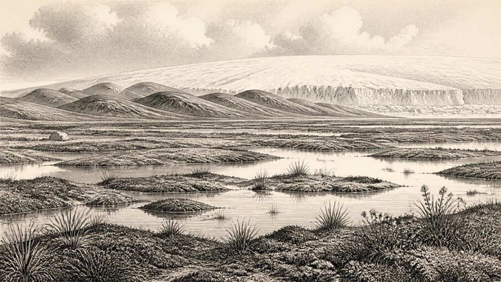
At 31,549 BCE, Ireland had no recorded human history and no secure evidence of occupation. The island formed part of a changing Late Pleistocene glacial environment, preceding the Last Glacial Maximum. Ice within the growing British–Irish Ice Sheet advanced unevenly, with Scottish and Irish centres interacting around the North Channel. At Derryvree, County Fermanagh, freshwater sediments between till layers preserve a temporary ice-free or marginal landscape of wet, treeless tundra, sedges, mosses and cold-adapted plants. Cave remains suggest reindeer, mammoth and hyena occurred during broadly comparable intervals. Glacial processes reshaped drainage, soils, coasts and landforms, establishing conditions inherited by settlers.
Dateline
31,549 BCE is not a date at which Ireland can be assigned a recorded event, ruler, battle or settlement. It is a modern calendar label imposed on a far deeper past. In archaeological terms it falls roughly 33,500 years before AD 1950, within the Late Pleistocene and the long cold interval conventionally called the Midlandian in Ireland, part of the wider Last Glacial cycle. Neither radiocarbon dating nor ice-sheet reconstruction can identify conditions in one numbered calendar year. The responsible view is therefore regional and approximate: Ireland around this point belonged to a changing north-west European glacial world, with evidence expressed in calibrated ranges, deposits and landforms rather than chronicles.
Dating a Moving Landscape
The period should not be confused with the global Last Glacial Maximum, usually dated to about 26,500–19,000 years ago. Around 33,500 calibrated years ago, that maximum still lay in the future. Yet the British–Irish Ice Sheet was already growing and reorganising. The timing of its expansion was not uniform: mountain ice, Scottish-sourced ice, Irish ice centres and marine outlets developed at different rates. Reconstructions now treat the ice sheet as dynamic rather than as a single frozen cap that appeared everywhere at once. This matters greatly for Ireland, where the difference between an ice-covered district, a periglacial plain and an offshore ice margin could be only a few generations or a few tens of kilometres, while the available dates may carry much wider uncertainty.
The most useful contemporary Irish chronology comes from radiocarbon determinations, whose original ages must be calibrated against changing atmospheric carbon levels. A famous determination from Derryvree near Maguiresbridge, County Fermanagh, was reported as 30,500 radiocarbon years before present, with a large uncertainty range. Calibration places it broadly in the mid-30,000s of calendar years before present, close enough to illuminate the world represented by 31,549 BCE but not to certify that the sediments formed in that particular year. It is better understood as a time-window: evidence for an interval of cold, open ground before later ice overrode the locality.
Derryvree Beneath the Drumlin
Derryvree is central because roadworks in 1969 exposed a drumlin containing freshwater silts and fine sands between two thick, distinct layers of till. Till is debris laid down by glacier ice; the organic-bearing freshwater bed records conditions when ice did not occupy that precise site. The sequence is unusually valuable because it combines stratigraphy with biological remains. It does not provide a picture of all Ireland, nor a perfectly continuous climate diary. It does show that northern Ireland contained wet, ice-free or ice-marginal terrain during part of this late Middle Midlandian phase, before a later glacial advance sealed the deposit beneath another till sheet.
Plant macrofossils, spores, pollen and small animal evidence from the Derryvree freshwater bed indicate treeless tundra-like vegetation and a periglacial climate. Sedges and mosses occupied wet ground, while bogbean, mountain avens and lesser clubmoss attest to plants capable of surviving exposed, cold conditions. Shallow freshwater pools and waterlogged sediments mean that this was not simply an empty, wind-scoured expanse: summer melting and seasonal biological productivity sustained marshy habitats. The evidence is strongest for the presence of these plants and the nature of the sedimentary environment. Reconstructing the exact look of the landscape—how continuous the vegetation was, or how long snow lay each year—remains interpretation, constrained by the patchiness of fossil preservation.
Ice Building Across Ireland
At the scale of the island, the principal development was the growth of the British–Irish Ice Sheet. Evidence from landforms, marine geophysics, erratic stones, striations and sediment cores demonstrates that ice later flowed across and beyond much of Ireland. Northern Ireland was particularly important in the early configuration: research on its eskers describes an initial stage, around 35,000 years ago, in which ice moving from western Scotland entered from the north-east and subsumed local upland ice caps. As Irish and Scottish ice coalesced, centres of flow and ice divides shifted. Around 31,549 BCE, then, the North Channel was not a political frontier or a seaway known to people; it was part of a developing glacial system whose geometry was being determined by snowfall, topography, ice flow and the sea floor.
This process left foundations that would eventually shape familiar Irish landscapes. Drumlins, streamlined ridges formed beneath moving ice, dominate broad lowland belts; moraines mark former ice-margin positions; meltwater channels, eskers and glacial lake deposits record the water released as ice later stagnated or retreated. Their visible forms mostly cannot be assigned to 31,549 BCE itself. They are the accumulated outcome of advances, reconfigurations and retreat over many millennia. Geological Survey Ireland’s mapping records these features at national scale, but even detailed mapping does not turn them into a precise annual map. The appropriate conclusion is that landscape formation was underway, not that every modern drumlin or valley was created at this moment.
Open Country and Animal Ranges
Other Irish sites supply a complementary, though less securely localised, record of animal life. Cave deposits at Castlepook near Doneraile, County Cork have produced remains of reindeer, mammoth, cave hyena and other cold-stage fauna. Scholarly summaries place important parts of this assemblage in the broad 34,000–35,000-year range. Such finds demonstrate that, at least during suitable intervals, southern Irish landscapes could support or receive large mammals associated with open, cold environments. They do not prove that all those species shared one herd, one season or one exact date. Cave deposits can mix material accumulated by carnivores, water, sediment movement and repeated use over long spans.
Nevertheless, the animal record makes ecological sense alongside Derryvree’s open vegetation. Forest was not the dominant cover; resources were dispersed across grassland, herb-rich ground, wet hollows and river corridors. Reindeer in particular could move over very large ranges, while predators and scavengers followed prey and opportunities. Low global sea level exposed more continental shelf than today, changing the position of coasts and river mouths. But lowered water is not evidence of a dependable land bridge for Ireland. The island’s separation, and the difficulty of crossing the Irish Sea, are important reasons why archaeologists remain cautious about importing patterns of human occupation from Britain or continental Europe.
No Demonstrable Irish Community
There is no secure evidence for people in Ireland around 31,549 BCE. No excavated camp, hearth, stone-tool assemblage, burial, dwelling, artwork or worked animal bone can responsibly be dated to this time. It follows that there is no evidential basis for Irish political affairs, diplomacy, warfare, leaders, tribes, languages, religious rites, exchange networks or formal learning. Nor can daily life, family organisation or food procurement be reconstructed for an Irish population that has not been demonstrated to have existed. This absence is not proof that a person could never have reached the island; archaeology rarely proves universal negatives. It is a clear boundary on what an annual historical account may claim.
Later evidence reinforces that caution. Ireland’s earliest published indication of human activity is a cut-marked brown-bear kneecap from Alice and Gwendoline Cave in County Clare, dated to approximately 10,800–10,500 BCE—more than twenty millennia after the date considered here. It may represent small-scale Late Upper Palaeolithic activity, while substantial evidence for sustained Mesolithic settlement appears only from about 8000 BCE. The long gap warns against treating the rich Upper Palaeolithic record of Britain and mainland Europe as if it automatically belonged to Ireland.
An Environmental History
The history of Ireland at this point is therefore environmental rather than human, but it is not insignificant. It concerns the advance of ice across northern approaches, the persistence of wet tundra habitats in Fermanagh, the movement of cold-adapted animals through favourable landscapes, and the repeated transformation of drainage, soils and shorelines. These processes conditioned every later possibility of settlement. Glacial erosion altered rock surfaces and valleys; sediment deposition created varied ground conditions; later melting would establish many of the basins, waterways and raw-material distributions inherited by post-glacial communities.
For 31,549 BCE, the most defensible image is not a named nation waiting for history to begin. It is a region of unstable climatic thresholds. Parts of Ireland may have remained exposed and biologically active while ice was expanding elsewhere; other areas were already within the orbit of a growing, interconnected British–Irish Ice Sheet. Derryvree’s freshwater deposit preserves a fleeting ecological interval, and the North Channel records the approach and interaction of ice masses. Together they offer a disciplined answer to a date that cannot yield an event: Ireland was being remade by cold, water, vegetation and ice, in a landscape where no securely evidenced human society can yet be placed.
Primary Sources
- A Middle Midlandian Freshwater Series at Derryvree, Maguiresbridge, County Fermanagh, Northern Ireland
- Growth and Retreat of the Last British–Irish Ice Sheet, 31,000 to 15,000 Years Ago: the BRITICE-CHRONO Reconstruction
- Growth and Retreat of the Last British–Irish Ice Sheet, 31,000 to 15,000 Years Ago: the BRITICE-CHRONO Reconstruction
- Deglaciation Chronology of the Donegal Ice Centre, North-west Ireland
- Dimensions and Chronology of the Last Ice Sheet in Western Ireland
- Pattern and Timing of Retreat of the Last British-Irish Ice Sheet
- Pattern and Timing of Retreat of the Last British-Irish Ice Sheet
- Oscillating Retreat of the Last British-Irish Ice Sheet on the Continental Shelf Offshore Galway Bay, Western Ireland
- The Last Scottish Ice Sheet
- Variations in Esker Morphology and Internal Architecture Record Time-transgressive Deposition During Ice Margin Retreat in Northern Ireland
- Quaternary
- The Mesolithic in Ireland: When Was It?
- Revisiting Alice and Gwendoline Cave, Co. Clare: New Light on the 1902 Excavations
- 2019:148 – Alice & Gwendoline Cave, Clare
- Palaeoecology
- Figure 6.— The Subdivision of the Quaternary Period in Ireland
- Dryas octopetala
- Menyanthes trifoliata
- Selaginella selaginoides
- The Late Quaternary History of East-central Ireland
- The Antiquity of Man in Ireland
- Dating Constraints on the Last British-Irish Ice Sheet: A Map and Database