Derryvree’s Middle Midlandian31287 BCE
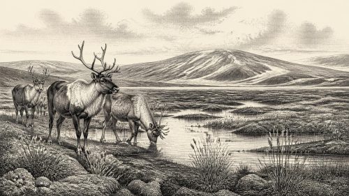
At the notional date of 31,287 BCE, Ireland lacked annual historical evidence; reconstruction relies on Late Pleistocene deposits. Derryvree, County Fermanagh, records a broadly dated, locally ice-free MIS 3 interval between glacial advances, with freshwater sediments, tundra vegetation, wetlands and periglacial conditions. Castlepook Cave, County Cork, preserves time-averaged remains of mammoth, reindeer, giant deer, bear and hyaena, demonstrating varied cold-stage fauna. A marked reindeer femur may indicate Upper Palaeolithic carcass processing, but remains contested and cannot prove settlement. Ireland faced climatic instability and impending wider glaciation, while evidence reveals neither polities nor established economy or human population at this time.
Dateline
Modern calendar-year precision is not available for Ireland in 31,287 BCE. No community on the island left writing, a calendar or a historical record that can identify a particular year, season, person or event at this depth in time. The date is best treated as a modern reference point—roughly 33,200 years before AD 1950—within the Late Pleistocene and Marine Isotope Stage 3 (MIS 3), a long and climatically unstable phase of the last Ice Age. What can responsibly be reconstructed is an environmental interval, from fragmentary deposits, fossils, landforms and laboratory dates, rather than an annual chronicle.
A Date Within Broad Ranges
The closest securely relevant Irish archive is Derryvree, near Maguiresbridge in County Fermanagh. Road construction in 1969 cut through a drumlin and revealed a sequence of freshwater silts, fine sands and organic material lying between two thick layers of till, the unsorted debris deposited by glacier ice. The sequence is important because its order is clear: ice affected the ground, a period followed in which freshwater and organic sediments accumulated, and glacier ice later returned to bury the evidence.
Organic material from the intervening deposit produced the radiocarbon determination Birm-166, conventionally reported as 30,500 radiocarbon years before present, with a substantial uncertainty. A radiocarbon age is not a calendar age. Atmospheric carbon-14 levels changed through time, and calibration converts a laboratory measurement into a probability range rather than a single historical date. Published calibrations have placed the Derryvree material broadly at about 36,900–31,700 calibrated years before present. The modern label 31,287 BCE falls within that wide range, but it does not date a particular pool, animal, human visit or phase of vegetation at Derryvree.
This distinction matters. The evidence says that part of north-central Ireland was ice-free when the freshwater deposit formed; it does not demonstrate that every region of the island shared precisely the same conditions at the same moment. Nor should an old radiocarbon determination be treated as a stopwatch. The changing calibration curve, the original measurement error, and the fact that sediments may accumulate over time all argue against false precision. “Around this horizon” is sounder language than “in this year”.
Freshwater Beneath a Drumlin
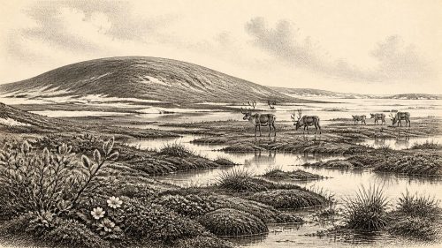
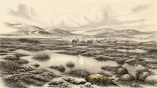
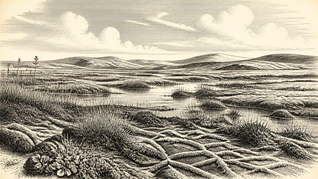
Derryvree nevertheless gives an unusually vivid glimpse of an Irish landscape later overridden and reshaped by ice. Pollen, plant macrofossils, mosses and insect remains indicate open tundra vegetation and a periglacial climate: a cold environment affected by repeated freezing and thawing, but not one continuously buried beneath glacier ice. The local setting included wet ground and shallow freshwater, with silts and sands settling in calm water and organic matter surviving in waterlogged sediment.
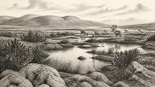
The plant evidence points away from a wooded landscape. Herbaceous pollen and hardy mosses indicate exposed ground, while the wetland flora included species associated with cold, open habitats and pool margins. Sparse tree pollen does not prove a nearby forest; pollen can travel long distances, especially where local vegetation is thin. The most responsible reconstruction is therefore a treeless or near-treeless mosaic: damp hollows, sedge-rich margins, mossy patches, shallow pools and more exposed mineral ground beyond them. Summer growth could be brief but productive, while winter frost, snow cover and frozen soils constrained the living season.
Such a scene should not be imagined as a uniform, lifeless white wilderness. Periglacial landscapes can contain varied microhabitats. Water, sheltered depressions, snowmelt and differences in drainage created local contrasts that plants, insects and small animals could exploit. Yet it was emphatically not later Ireland’s green, wooded and farmed countryside. There were no fields, hedges, villages, roads, peat-cuttings or managed grazing lands. The drumlin itself, so characteristic of the modern Irish landscape, would later be given its familiar form or modified further by glacial action; at the time represented by the buried deposits, it was part of a changing terrain rather than a settled landmark.
Ice Was Growing, Unevenly
At this point in MIS 3, the island lay within the wider North Atlantic climate system, where abrupt shifts between colder stadials and relatively milder interstadials occurred on millennial and shorter timescales. Greenland ice-core records show that these fluctuations could be large and rapid in the northern hemisphere. Ireland’s weather and ecosystems did not simply copy Greenland’s sequence, but its Atlantic setting made it sensitive to changes in temperature, sea ice, storm tracks and the growth of neighbouring ice masses.
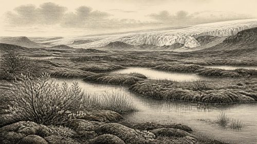
Derryvree’s freshwater layer is evidence that northern Ireland was locally ice-free during part of this broader interval. Other pre-Last Glacial Maximum evidence, including deposits at Greenagho in Fermanagh and marine records around the western seaboard, likewise cautions against assuming that Ireland was already wholly ice-covered. The great expansion of the last British–Irish Ice Sheet came later. Reconstructions place its extensive maximum on the Irish Atlantic shelf and around the island broadly in the period after about 27,000 calibrated years before present, with regional advances and retreats differing in timing.
The future was therefore present only as a geological tendency, not a completed event. Ice was capable of advancing across the region, as the enclosing tills at Derryvree show, but the deposit preserves an interval between glacial episodes. Later ice erosion destroyed or disturbed vast amounts of earlier evidence. This is one reason why Irish knowledge of the period is so patchy: much of the landscape that might once have held campsites, shorelines, soils and animal tracks was scoured, buried or reworked.
Animals in the Southern Caves
County Cork offers a different kind of evidence. Castlepook Cave, near Doneraile, long known as Mammoth Cave, has yielded remains of Ice Age animals including woolly mammoth, reindeer, giant deer, brown bear and spotted hyaena. Modern redating has shown that parts of this fauna belong to MIS 3 and that some earlier radiocarbon results from Irish cave collections underestimated their true age. Castlepook confirms that Ireland, or at least suitable districts within it, could support a more varied cold-stage fauna than the sparse surviving record once suggested.
These bones do not form a census of one landscape in one year. Cave deposits commonly combine material accumulated over long periods. Carnivores may drag prey or carrion into caves; animals may die naturally in or near entrances; water, gravity and early excavators can mix deposits. Spotted hyaena is particularly significant because it suggests the presence of a large scavenging predator and because dens can concentrate bones from many episodes. Mammoth and reindeer indicate open-country grazing habitats, but neither species proves that a herd stood at Castlepook in 31,287 BCE.
Even so, the faunal record gives scale to the Derryvree environmental evidence. Open, cold habitats could sustain large herbivores and the predators or scavengers associated with them. Their movements would have followed seasonal food, shelter, terrain and snow conditions. In this sense, Ireland was part of a north-west European Ice Age ecological world, although its sea crossings, shifting coastlines and advancing ice margins made it a geographically difficult western margin rather than an easy extension of the continent.
The Reindeer Bone Question
Castlepook also raises the most consequential archaeological question for this date. A reindeer femur from the cave has been reported as bearing a deep mark interpreted as stone-tool damage made while the bone was fresh. The animal bone has been associated with an age of roughly 33,000 years ago. If the modification is confirmed as human-made and contemporary with the bone, it would indicate an Upper Palaeolithic episode of carcass processing in Ireland vastly earlier than the island’s well-established Mesolithic settlement record.
That possibility must not be inflated into a story of a permanent Irish population. The femur derives from an old cave collection, rather than a modern excavation of a sealed occupation floor. No securely associated stone-tool assemblage, hearth, dwelling, human burial, repeated butchery area or settlement of comparable age has yet been recovered from Ireland. The radiocarbon result dates the death of the reindeer, not automatically the making of the mark; distinguishing a cut made by a stone tool from damage caused by carnivores, sediment movement, breakage or excavation requires careful microscopic and comparative work.
The evidence therefore permits a limited interpretation: people may have reached Ireland during this cold-stage interval and may have processed a reindeer. It does not yet establish where they came from, how they crossed, whether they hunted the animal, how long they stayed, or whether they returned. At most, the marked bone hints at a fleeting connection with the Upper Palaeolithic societies known elsewhere in north-west Europe. Their technologies, social practices and art cannot simply be transferred across the sea to Ireland without direct local evidence.
No Polities, No Proven Trade
There is no evidence for political institutions, named groups, chiefs, warfare, diplomacy, religion, formal learning or trade networks in Ireland at this date. There are no known houses, cemeteries, monuments or symbolic objects that can be securely assigned to this horizon. Nor can social organisation be inferred from a wetland deposit or a cave bone. If people visited, they may have travelled in small, mobile groups, as many Upper Palaeolithic communities elsewhere did, but that is a contextual possibility rather than an Irish fact.
Likewise, “economy” can only be discussed conditionally. Reindeer, mammoth and other animals represented potential food, hides, bone and antler resources to human groups, while wetland plants and freshwater habitats supported broader food webs. But no Irish evidence from around 31,287 BCE demonstrates a settled hunting territory, seasonal camp cycle, exchange route or organised production. The responsible history is one of potential resources in a demanding environment, not an established economy.
A Landscape Known Indirectly
Ireland around the notional year 31,287 BCE was neither a blank nor a documented society. Derryvree preserves strong evidence for a cold, locally ice-free freshwater tundra landscape in a broad late-MIS-3 interval. Castlepook preserves a valuable but time-averaged record of Ice Age fauna, and one contested reindeer bone raises the possibility of very early human activity. Together they reveal an island undergoing profound environmental change before the later maximum of the British–Irish Ice Sheet.
The central lesson is methodological as much as historical. Sediments record water and vegetation; animal bones record species and, sometimes, the actions of predators or people; tills record ice. None alone can yield a calendar-year narrative. But read together, and with their limits kept visible, they allow a compelling picture: open ground and cold pools in Fermanagh, large grazing animals and carnivores in Cork, uncertain human traces, and an Irish landscape on the threshold of far more extensive glaciation.
Primary Sources
- A Middle Midlandian Freshwater Series at Derryvree, Maguiresbridge, County Fermanagh, Northern Ireland
- IQUA Field Guide 16: Fermanagh
- Trimlines, Blockfields and the Vertical Extent of the Last Ice Sheet in Southern Ireland
- Deglacial Rates and Controls for the British-Irish Ice Sheet Western Margin
- Deglaciation Chronology of the Donegal Ice Centre, North-West Ireland
- Early Deglaciation of the British-Irish Ice Sheet on the Atlantic Shelf Northwest of Ireland Driven by Glacioisostatic Depression and High Relative Sea Level
- Maximum Extent and Dynamic Behaviour of the Last British-Irish Ice Sheet West of Ireland
- Timing and Pace of Ice-Sheet Withdrawal Across the Marine–Terrestrial Transition West of Ireland During the Last Glaciation
- Growth and Retreat of the Last British–Irish Ice Sheet, 31,000 to 15,000 Years Ago: the BRITICE-CHRONO Reconstruction
- A Reconsideration of the Radiocarbon Dating of the Marine Isotope Stage 3 Fauna from Southern Ireland
- The Irish Quaternary Fauna Project
- The Archaeological Heritage of County Cork
- New Insights on the Fauna of Ireland's Younger Dryas and Early Holocene from Alice & Gwendoline Cave
- Our Ancient Landscapes: Hunter-Gatherers in Ireland
- The IntCal20 Northern Hemisphere Radiocarbon Age Calibration Curve (0–55 cal kBP)
- IntCal Publications
- IntCal Data
- Dansgaard–Oeschger Events in Climate Models: Review and Baseline Marine Isotope Stage 3 Protocol
- Fast and Slow Components of Interstadial Warming in the North Atlantic During the Last Glacial
- Geology of Ireland
- Quaternary Geology and Geomorphology Data
- Ireland Through Geological Time
- The Last Glacial Maximum in Great Britain and Ireland