
The Castlepook Reindeer Fragment31245 BCE
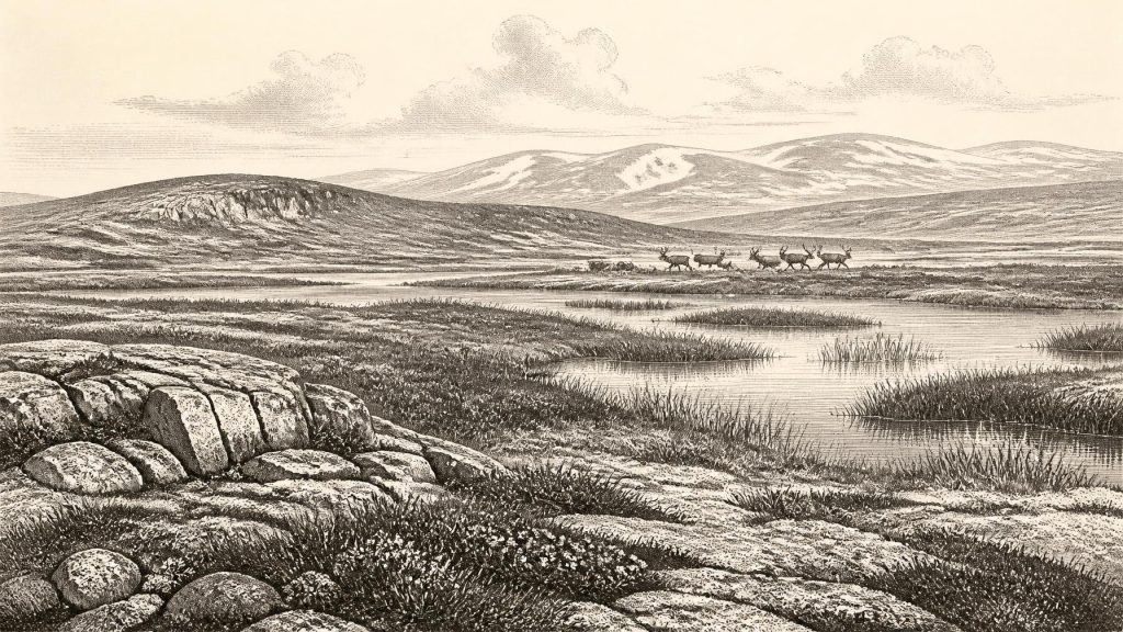
Around 31,245 BCE, Ireland was an unstable MIS 3 Ice Age landscape, not a datable historical year. Open tundra, wetlands and intermittent ice supported reindeer, mammoth, giant deer, predators and other fauna, while changing sea levels and ice margins affected access. Castlepook Cave in County Cork preserves varied Pleistocene remains, including a reindeer femur fragment dated to about 33,000 years ago with a possible stone-tool cut mark. If confirmed, it may indicate an early human visit, but not settlement or continuous population. Environmental deposits at Derryvree and Aghnadarragh show cold, treeless habitats. Evidence remains fragmentary, requiring cautious interpretation by researchers.
Dateline
The label “31,245 BCE” offers a useful point on a modern timeline, but it cannot identify an event in Ireland in the way a medieval annal can. No writing, named communities, calendar systems or year-by-year archaeological sequence exists for the island at this depth of time. In radiocarbon terms, the date falls roughly 33,200 calendar years before AD 1950, within Marine Isotope Stage 3 (MIS 3), a long and climatically unstable part of the Last Glacial Period. The responsible history of Ireland at this point is therefore a history of deposits, bones, pollen, insects, landforms and dating ranges—not of a demonstrable occurrence on one particular day or in one particular year.
It was an Ireland unlike the familiar green island. Conditions varied sharply across centuries and millennia, and the pattern of advancing ice, open ground, water and frozen soils differed by region. At about 31,245 BCE, the Last Glacial Maximum lay in the future: the British–Irish Ice Sheet reached its greatest known extent much later, broadly after c. 26,000 years ago and before c. 20,000 years ago. Yet this was already an Ice Age world, and the evidence indicates that Irish landscapes and animal populations were repeatedly transformed as ice margins expanded or retreated.
A Date Measured in Ranges
Archaeologists and Quaternary scientists cannot presently assign a securely excavated Irish occupation surface to 31,245 BCE. Radiocarbon dating produces estimates with statistical uncertainty; calibration converts radiocarbon years into calendar ranges by comparison with independently dated records, rather than supplying a precise ancient calendar date. Old cave collections add a further difficulty. Many bones were recovered in nineteenth- and early twentieth-century excavations, when recording standards differed profoundly from those used today. Cave sediment was often disturbed by animals, water, collapse and previous digging. A bone can be dated directly, but its find-place may not represent an intact living floor or a single episode.
This distinction matters especially at Castlepook Cave—also called Mammoth Cave—near Doneraile in north County Cork. The limestone cave system has produced one of Ireland’s richest assemblages of Pleistocene vertebrate remains. Its collections include reindeer, woolly mammoth, giant deer, brown bear, wolf, Arctic fox, hare, lemmings and spotted hyaena. Those animals did not necessarily live together, and the deposits do not describe one stable ecosystem. Direct dates show that different specimens belong to widely separated phases of the late Pleistocene. Castlepook is a deep archive, not a frozen instant.
The Reindeer Bone and Its Limits
The closest evidence to this notional year is a reindeer femur fragment from Castlepook that has been reported as roughly 33,000 years old and bearing a linear modification interpreted as a stone-tool cut mark. If that interpretation withstands continuing taphonomic scrutiny, it would be evidence that people processed a reindeer in Ireland during the Upper Palaeolithic, far earlier than the formerly accepted terminal-Pleistocene evidence for human activity. It is potentially a major discovery.
Potential is not proof of a settlement. The dated object is an animal bone, not a house, hearth, stone-tool assemblage, burial or occupation layer. A cut mark may show butchery, but it cannot reveal how many people were present, whether they camped in the cave, how long they remained, or whether their visit was part of a recurring pattern. It also cannot establish uninterrupted population. The safest conclusion for around 31,245 BCE is that a human incursion into southern Ireland is possible, perhaps even likely if the mark is confirmed as anthropogenic; a permanent Irish population at this date is not demonstrated.
This caution is strengthened by the later history of the evidence. Ireland’s first widely accepted direct indication of human activity comes from Alice and Gwendoline Cave, near Ennis in County Clare: a brown-bear patella bearing cut marks, dated by two laboratories to approximately 12,810–12,590 and 12,810–12,685 calibrated years before present. That terminal-Pleistocene find is much later than the Castlepook reindeer fragment, but it illustrates both the value and the rarity of securely dated traces. There is still no known Irish Upper Palaeolithic settlement comparable to the excavated camps, structured hearths and rich lithic scatters known in parts of Britain and continental Europe.
An Open, Severe Landscape
The animal record makes clear that Ireland could support substantial life in parts of MIS 3, even though its climates were severe by modern standards. Reindeer were adapted to treeless or sparsely wooded northern environments and could range across open country. Woolly mammoth, giant deer and horse-like steppe fauna elsewhere in north-west Europe depended on extensive vegetation; carnivores such as wolf and spotted hyaena followed opportunities created by prey, carrion and shelter. Their presence in Irish cave deposits shows that routes of colonisation existed at various times and that suitable habitats formed, but it does not permit a single, complete reconstruction for 31,245 BCE.
In northern Ireland, sites such as Derryvree near Maguiresbridge in County Fermanagh and Aghnadarragh near Lough Neagh preserve environmental evidence between layers of glacial till. Their sequences have been interpreted as recording intervals when ice had withdrawn or was absent locally, allowing ponds, marshes and open ground to develop before later ice overrode the landscape. Organic silts at Derryvree yielded remains of mosses, sedges, bogbean, Arctic-alpine herbs and freshwater organisms, alongside insects. The assemblage has been read as a treeless muskeg or wet tundra mosaic: shallow pools and sedge-rich margins within a cold, exposed terrain.
These northern records should not be treated as a weather report for County Cork or for one calendar year. They are nonetheless vital because they show the kinds of environments available in Ireland during the broader Middle Midlandian phase. Vegetation was low, discontinuous and responsive to abrupt climate shifts. In sheltered places there may have been dwarf shrubs, herbs and wetland plants; on better-drained surfaces, wind, frost and seasonal thaw would have restricted soil development. Forest was not the dominant cover. The rich grasslands, enclosed fields, peat bogs and mature woodland of later Ireland belonged to a very different world.
Ice, Water and Changing Connections
Regional change was the dominant political fact of this era—although “political” must be used metaphorically. There were no states, chieftaincies, borders, diplomatic agreements or recorded wars to recover. Instead, shifting ice and sea determined access, safety and resources. Geological work suggests that much of north-central Ireland remained ice-free until at least about 34,000 years ago, before the major build-up of the last Irish ice sheet. Southern and western areas also preserve evidence of pre-Last Glacial Maximum fauna and landscapes. But the configuration of ice and water was not static, and reconstructions remain debated in detail.
Lower global sea level exposed land now drowned beneath surrounding seas, but low sea level did not automatically create a straightforward walk from Britain into Ireland. The Irish Sea basin had deep and complex topography, while crustal movement, glaciers, river systems and local water bodies altered possible routes. Research on later periods has challenged simple assumptions of a broad, enduring Irish land bridge. For 31,245 BCE, it is more accurate to say that animal and, conceivably, human movement required changing coastal and marine corridors whose precise form is not yet securely known.
Caves were important to this landscape not as proven homes, but as traps and repositories. Carnivores could drag in prey; animals could die in fissures; flowing water and sediment could rearrange bones. Castlepook’s spotted-hyaena remains are especially significant because hyaenas often accumulated bone assemblages in dens. A reindeer femur with a possible human modification must therefore be assessed against natural marks made by teeth, trampling, sediment movement and excavation damage. Modern re-examination, direct dating, microscopic analysis and carefully recorded new excavation are more informative than simply repeating old identifications.
Society Beyond the Evidence
If people did reach Ireland in this period, they were Upper Palaeolithic hunter-gatherers, not farmers. Their survival would have depended on close knowledge of animal movement, seasonality, stone, fuel, shelter and clothing. Reindeer carcasses could provide meat, fat, hide, sinew, bone and antler; a single butchery trace is therefore consistent with a highly mobile subsistence economy. Yet consistency is not evidence of the specific practices of an Irish group. No securely associated tools, hearths, dwellings, ornaments, art or graves permit a detailed account of language, kinship, ritual, learning or social hierarchy.
Nor can trade or diplomacy be reconstructed. A visitor may have crossed from Britain or from another part of north-west Europe, perhaps following game through a changing landscape, but no source identifies an exchange network or a route. The absence of evidence may partly reflect later glaciation, erosion, rising seas and the difficulty of finding ephemeral camps. It must not, however, be converted into a confident story of a vanished Irish people. Archaeology can identify possibilities and probabilities; it cannot supply invented chiefs, migrations or ceremonies.
What This Year Can Mean
Around 31,245 BCE, Ireland stood within a fluctuating Ice Age frontier. The most important development was environmental rather than institutional: open and often cold landscapes supported a Pleistocene fauna while ice-sheet growth, sea-level change and climatic instability continually reshaped the island’s habitability. Castlepook Cave offers the most evocative clue, a reindeer fragment whose reported cut mark may eventually extend Ireland’s human story dramatically backwards. Derryvree and Aghnadarragh provide the wider environmental setting of wetlands, tundra vegetation, freshwater life and successive glacial advances.
For now, the year should be understood as a calibrated horizon rather than a dated chapter in human affairs. The evidence supports Ice Age animals in Ireland and supports the possibility of a very early human encounter with them. It does not support a named society, a permanent settlement, a political order or an exact event in 31,245 BCE. That restraint is not a weakness in Ireland’s earliest history. It is the essential discipline that allows a small bone, a buried seed and a layer of silt to remain meaningful evidence rather than become a prehistoric fiction.
Primary Sources
- The Irish Quaternary Fauna Project
- A Reconsideration of the Radiocarbon Dating of the Marine Isotope Stage 3 Fauna from Southern Ireland
- First Evidence of a Late Upper Palaeolithic Human Presence in Ireland
- New Insights on the Fauna of Ireland's Younger Dryas and Early Holocene from Alice & Gwendoline Cave
- Trimlines, Blockfields and the Vertical Extent of the Last Ice Sheet in Southern Ireland
- Growth and Retreat of the Last British–Irish Ice Sheet, 31,000 to 15,000 Years Ago: the BRITICE-CHRONO Reconstruction
- Dimensions and Chronology of the Last Ice Sheet in Western Ireland
- Freshwater Organic Deposits and Stratified Sediments Between Early and Late Midlandian (Devensian) Till Sheets, at Aghnadarragh, County Antrim, Northern Ireland
- Figure 6—The Subdivision of the Quaternary Period in Ireland
- Castlepook Cave: County Geological Site Report
- Aghnadarragh
- Prehistoric Details
- Quaternary Site Descriptions
- 32564: Castlepook Cave, Castlepook South, Cork
- The Archaeological Heritage of County Cork
- Palaeolithic Ireland—New Evidence Emerges from the Emerald Isle
- The Mesolithic in Ireland: When Was It?
- The Island of Ireland: Drowning the Myth of an Irish Land-Bridge?
- The Problem of a Late Quaternary Landbridge Between Britain and Ireland
- The IntCal20 Northern Hemisphere Radiocarbon Age Calibration Curve (0–55 cal kBP)