Fermanagh’s Buried Pond31244 BCE
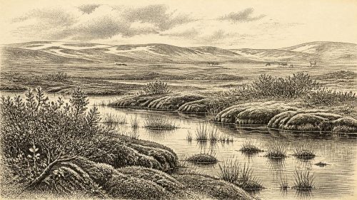
Around 31,244 BCE, Ireland was a climatically unstable glacial frontier, not a historically observable society. Organic sediments at Derryvree, County Fermanagh, dated broadly to later Marine Isotope Stage 3, preserve evidence of cold freshwater wetlands, open vegetation and arctic-alpine species between glacial advances. Kerry speleothems indicate intermittent above-freezing conditions, while cave finds demonstrate occasional presence of reindeer, mammoth, horse, giant deer, bear and hyena. A cut-marked reindeer bone from Castlepook Cave may indicate human butchery, but no secure settlement evidence exists. Falling sea levels altered access routes before expanding ice sheets reshaped landscapes and destroyed much earlier evidence across Ireland.
Dateline
31,244 BCE is a modern calendar label, not a date at which Ireland’s past can be observed year by year. No people on the island are known to have counted years in this way, and neither archaeology nor palaeoenvironmental science can isolate an event to a particular season, let alone a particular year, more than 33,000 years ago. Expressed in the convention used by Quaternary scientists, the notional date falls at roughly 33,200 calibrated years before present (cal BP, where “present” is 1950). It belongs to the later part of Marine Isotope Stage 3, or MIS 3: a long, climatically unstable interval of the last Ice Age.
The responsible subject for Ireland at this point is therefore not an annual chronicle of rulers, battles or settlements, but a landscape reconstructed from exceptional scraps of evidence. These include plant-rich sediments buried beneath later glacial deposits in County Fermanagh; cave minerals in County Kerry; animal bones from Irish caves; and the wider record of changing ice, sea and climate around north-west Europe. They reveal portions of an island that could, at different times, support tundra wetlands and large mammals. They do not establish a continuous human population, a named people, or a single island-wide environment.
A Date Within a Range
The closest important Irish environmental sequence is at Derryvree, near Maguiresbridge in County Fermanagh. There, organic freshwater silts were found between two tills: unsorted sediments deposited by ice. The deposits contained plant remains, pollen and insects, providing a rare glimpse of conditions between phases of glaciation. A legacy radiocarbon determination from the sequence has been calibrated to a broad range of about 36,900–31,700 cal BP. The modern date of 31,244 BCE lies within that range, but it must not be mistaken for a precisely dated layer of mud, plant, animal or human activity. The range shows that an ice-free freshwater environment existed in that part of north-central Ireland during later MIS 3; it cannot show that every part of Ireland was ice-free at once.
This distinction matters because the Irish record is fragmentary and regional. Ice sheets and glaciers later eroded, buried and rearranged older ground. The evidence surviving beneath a drumlin in Fermanagh is valuable precisely because it escaped complete destruction, not because it offers a representative cross-section of the whole island. Geologists can trace the effects of ice through landforms, tills and striations, while dated sediments provide particular chronological anchors. Yet the timing, thickness and extent of ice during the build-up to the Last Glacial Maximum remain subjects of reconstruction rather than a settled map for every millennium.
Cold Water and Open Ground
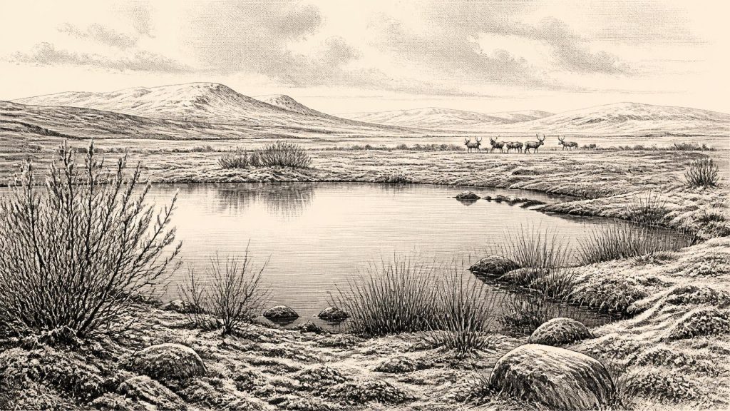
Derryvree’s biological remains indicate a harsh but not lifeless setting. The freshwater deposits included mosses, sedges and aquatic or wet-ground plants, among them bogbean and water-milfoil, as well as arctic-alpine taxa such as mountain-avens. Insect evidence similarly points to cold, open conditions. The resulting picture is not of the forested Ireland familiar from later prehistory or the present day. It is a periglacial mosaic: shallow pools and wet hollows, mossy and sedgy margins, sparse herbaceous vegetation and expanses exposed to wind, frost and seasonal change. Dwarf willow or other low shrubs may have occurred in sheltered places, but there is no basis for imagining continuous woodland.
Such a landscape had practical consequences for every living creature. Plant growth would have been strongly seasonal. Wetlands offered water and vegetation in summer, while winter cold and frozen ground constrained movement and food supply. The sediment record cannot tell us the weather on a day in 31,244 BCE, but it does support the broader interpretation of an environment in which liquid water was available at least intermittently and biological communities endured severe cold. It also demonstrates why Ireland should not be reduced to a simple image of an island entirely sealed beneath ice throughout the whole Ice Age.
Crag Cave near Castleisland, County Kerry provides a different kind of evidence. Uranium-thorium dating of ancient speleothems there shows episodic calcite growth through much of the last glacial period, including later MIS 3. Stalagmite growth requires water to move through the limestone system and normally indicates conditions above the freezing point at least often enough for infiltration and deposition. This does not mean that south-west Ireland was warm, wooded or permanently ice-free. It does, however, independently reinforce the conclusion that climatic ameliorations punctuated the glacial regime, and that conditions varied sharply through time and between regions.
Mammals on a Changing Margin
Irish cave collections preserve another narrow but significant line of evidence. Reindeer, woolly mammoth, giant deer, horse, brown bear and spotted hyena are among the animals recorded from Late Pleistocene Irish contexts, especially caves in the south and south-east. Direct dating and reassessment of old collections have shown that some of this fauna belongs to MIS 3, before the fullest expansion of the last ice sheet. Caves are not straightforward snapshots of a living landscape: bones can be moved by water, carnivores, scavenging, excavation and later disturbance. Still, the dated fauna establishes that Ireland was accessible to changing populations of large mammals during parts of this period.
The precise combinations of animals need careful handling. A bone dated from a cave proves that the animal, or its remains, reached that location; it does not automatically prove a stable local herd, an unbroken food web or simultaneous coexistence with every species recovered from the same cave. Nevertheless, reindeer and other grazing or browsing animals fit the evidence for open, cold country. Predators and scavengers, including spotted hyena, point to a more complicated ecological world than an empty polar desert. Limestone caves could serve as shelters, dens or traps for accumulating bone, but the archaeological deposits known in Ireland have rarely survived in undisturbed form.
The Human Question
Human presence around this notional date remains possible but unproven as a matter of settlement history. A reindeer femur from Castlepook Cave near Doneraile, County Cork, has been publicised as bearing a deep mark interpreted as a stone-tool cut made during butchery; work on the associated fauna places the bone broadly around 33,000 years old. If that interpretation is correct, it would show that Upper Palaeolithic people handled a reindeer carcass in Ireland during MIS 3. It would be an important early trace of human activity on the island.
But the limits of that claim are as important as its promise. Castlepook has not yielded a securely excavated, stratified camp with hearths, stone-tool assemblages, repeated occupation surfaces or human remains of this age. One marked bone cannot identify who made the mark, whether they killed the animal or scavenged it, how long they stayed, or whether others accompanied them. Nor can it demonstrate a permanent population. The most responsible description is that a possible episode of human butchery has been proposed, requiring corroboration from better-contextualised finds.
Accordingly, political affairs, diplomacy and organised conflict cannot be recovered for Ireland in 31,244 BCE. There are no states, chiefs, boundaries, treaties or communities identifiable in the evidence. If people did visit, they were almost certainly highly mobile hunter-gatherers operating within wider north-west European networks, but that is an inference from Upper Palaeolithic lifeways elsewhere, not a demonstrated Irish social order. No Irish ritual site, art, burial, language, teaching tradition or formal exchange network can responsibly be assigned to this date. Portable tools, hides, wooden objects and camps would have had poor survival prospects even without the destructive force of later ice.
Ice, Sea and Access
Lower global sea level changed the outlines of the surrounding seas, exposing areas now submerged on the continental shelf. Yet low sea level does not licence the easy statement that Ireland was joined to Britain by a simple, reliable land bridge at this time. The geography of the Irish Sea basin, shifting coastlines, rivers, estuaries, ice margins and possible marine barriers was complex. Any human or animal movement towards Ireland may have involved routes that appeared and disappeared as climate and sea level changed. The fauna proves access on some occasions; it does not reveal the exact route.
During the following millennia, the British–Irish Ice Sheet expanded dramatically. Syntheses of dated evidence indicate growth from largely ice-free conditions in parts of Ireland at about 34,000 years ago towards much more extensive ice by the Last Glacial Maximum, conventionally centred around 26,000–20,000 years ago. The later ice sheet reshaped valleys and lowlands, deposited tills, formed drumlins and erased or concealed much of the evidence that might once have recorded earlier visits. The silence of the archaeological record is therefore not proof that nobody ever arrived, but neither is it evidence for an established Ice Age society.
A Landscape Before the Advance
Ireland around 31,244 BCE was thus a changing glacial frontier rather than the settled island of later history. The best evidence supports cold freshwater habitats in Fermanagh during a broad dated interval, episodic milder conditions capable of sustaining cave-water flow in Kerry, and the presence of large mammals in landscapes intermittently available to them. A possible cut-marked reindeer bone raises the prospect of a human encounter. Beyond that, certainty gives way to interpretation. The period’s real historical significance lies in this fragile archive: sediments, calcite and bone preserving evidence of life just before later ice transformed the ground on which that life unfolded.
Primary Sources
- A Middle Midlandian Freshwater Series at Derryvree, Maguiresbridge, County Fermanagh, Northern Ireland
- Trimlines, blockfields and the vertical extent of the last ice sheet in southern Ireland
- Growth and retreat of the last British–Irish Ice Sheet, 31,000 to 15,000 years ago: the BRITICE-CHRONO reconstruction
- Episodic speleothem deposition tracks the terrestrial impact of millennial-scale last glacial climate variability in SW Ireland
- Spatio-temporal dynamics of speleothem growth and glaciation in the British Isles
- A reconsideration of the radiocarbon dating of the Marine Isotope Stage 3 fauna from southern Ireland
- The Irish Quaternary Fauna Project
- Spotted Hyena Skull
- Heritage Artefacts of County Cork
- On the discovery of hyaena, mammoth and other extinct mammals in a carboniferous cavern in County Cork
- Figure 6.— The subdivision of the Quaternary Period in Ireland
- Quaternary deposits and glacial stratigraphy in Ireland
- Reconstructing the last Irish Ice Sheet 2: a geomorphologically-driven model of ice sheet growth, retreat and dynamics
- Dimensions and chronology of the last ice sheet in Western Ireland
- Last Glacial Maximum cirque glaciation in Ireland and implications for reconstructions of the Irish Ice Sheet
- Late Pleistocene chronostratigraphy and ice sheet limits, southern Ireland
- The IntCal20 Northern Hemisphere Radiocarbon Age Calibration Curve (0–55 cal kBP)
- New insights on the fauna of Ireland's Younger Dryas and Early Holocene from Alice & Gwendoline Cave
- Quaternary
- An All-Ireland Quaternary map