
BIRM-166’s Closing Waters31162 BCE
Around 31,162 BCE, Ireland lay within the variable late Marine Isotope Stage 3, approaching major glaciation. Derryvree, County Fermanagh, preserves freshwater organic sediments between two glacial tills, indicating a temporary ice-free tundra wetland with pools, mosses, sedges and cold-adapted plants. Its radiocarbon date covers millennia, not a precise year. Ice margins, drainage and habitats changed regionally, while cave remains show intermittent cold-stage mammal communities but cannot date individual species to this time. No evidence confirms human settlement, political communities or cultural activity. The period is therefore understood chiefly through fragmentary environmental archives, documenting changing ice, vegetation, wetlands and animal possibilities.
Dateline
The label 31,162 BCE gives a useful place in a modern chronology, but it cannot identify an event in Ireland on a particular year, season or day. Expressed approximately in the archaeological convention of years before AD 1950, it falls around 33,111 cal BP. That lies within the broad calibrated range associated with a rare Fermanagh deposit, not within an annual record. Ireland at this depth of time belongs to the later part of Marine Isotope Stage 3, a highly variable interval of the last Ice Age. Its history must be assembled from sediment, fossil pollen and plants, insects, animal bones, cave deposits and the landforms left by moving ice—not from written testimony, named peoples or dated monuments.
The Derryvree Window
The most informative Irish evidence is from Derryvree townland near Maguiresbridge, County Fermanagh. Road-cutting in 1969 exposed a drumlin containing two thick and distinct sheets of glacial till, separated by freshwater silts and fine sands rich in organic material. This order of layers is the essential fact: glacier ice deposited the lower till; an ice-free interval then permitted freshwater sediments, plants and animals to accumulate; later ice overrode or sealed the deposit beneath the upper till. The deposit is consequently a window onto conditions in north-central Ireland between major glacial episodes, rather than proof that all parts of the island looked alike at once.
The Derryvree organic horizon, BIRM-166, returned a conventional radiocarbon age of 30,500 radiocarbon years BP, with a sizeable uncertainty. Subsequent calibration has commonly placed it broadly between about 36,900 and 31,700 calibrated years BP. The nominal modern date in question therefore falls inside the range, but very near neither a securely identifiable beginning nor a known ending. Calibration is not a device for manufacturing exactness: it converts a radiocarbon measurement into a probability range by comparison with changing atmospheric carbon records. The responsible conclusion is that Derryvree illuminates a span of millennia around this date, not that a particular pool, animal or plant can be assigned to 31,162 BCE.
An Open Tundra Wetland
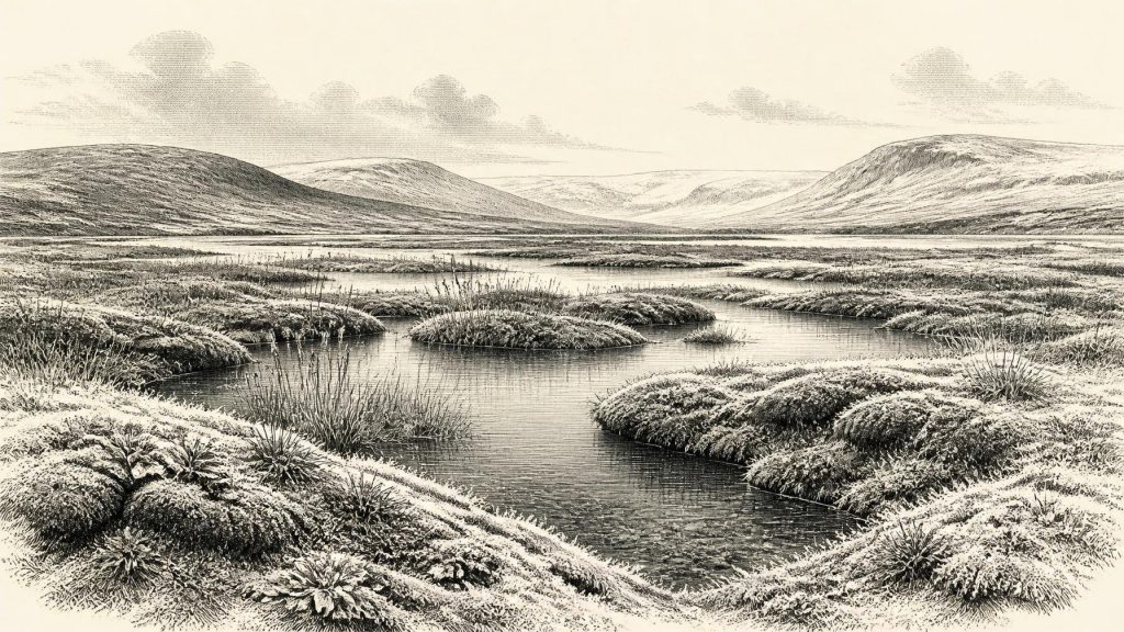
Within that window, the evidence points to an open, treeless tundra landscape under a periglacial regime. “Periglacial” does not simply mean frozen: it describes terrain subject to severe seasonal cold, repeated freezing and thawing, unstable wet ground and short growing seasons at the margin of glacial conditions. Derryvree’s freshwater deposits contained a flora and fauna described by their excavators as having a full-glacial aspect. Later syntheses identify an environment resembling muskeg: mossy, organic-rich wetland with open pools, shallow water and abundant plant matter.
That was not a forested Ireland, nor a uniformly sterile polar desert. Sedges, grasses and mosses could colonise damp hollows and the margins of pools. Cold-adapted wetland plants recorded from the wider Fermanagh evidence include bogbean, mountain-avens and lesser clubmoss. Such species indicate local habitats—waterlogged ground, exposed mineral soils, wet margins and tundra vegetation—rather than a simple national climate reading. Beetles, plant macrofossils and pollen are especially valuable because they preserve the small-scale texture of a landscape that later ice largely erased. They suggest life concentrated where meltwater, springs or shallow basins created refuge from the driest and most exposed ground.
In practical terms, the seasons would have imposed the strongest rhythm. Winters were severe; the ground could remain frozen for long periods; and summer productivity was brief but potentially intense in sheltered wetland patches. There is no basis for assigning temperatures to this one nominal year, because Derryvree is not a high-resolution thermometer and MIS 3 climate shifted abruptly on millennial and shorter scales. Yet the combined biological evidence supports a landscape in which water, snow, frost and sparse vegetation structured every available ecological opportunity. This is the proper setting for the date: not a settled countryside, but a cold mosaic of pools, mossy ground, sedge margins and open tundra.
Ice in Motion, Not a Fixed Boundary
At roughly 33,000 calibrated years ago, Ireland was moving towards the major expansion of the British–Irish Ice Sheet, but neither the onset nor the maximum of glaciation can responsibly be compressed into one island-wide moment. A widely used working model places ice-sheet build-up after about 35–32 ka, its maximum extent broadly between 27 and 21 ka, and later readvances after 19 ka. Other studies stress regional differences, uncertain offshore limits and ice margins that advanced or paused at different times. Thus, Derryvree’s locally ice-free wetland should not be mistaken for evidence that the whole island was simultaneously free of ice.
Greenagho, also in County Fermanagh, supplies a related but older signal: organic material from beneath till has been calibrated to approximately 37,200–35,700 years BP. Together, such sites show that parts of northern Ireland preserved freshwater or terrestrial conditions before later glaciation. Crag Cave in County Kerry adds a different kind of archive. Uranium-thorium dates from reworked speleothems demonstrate episodes of calcite formation during the last glacial period, evidence that subterranean water regimes responded to wider climatic fluctuations. Neither site gives a travel diary of ice, but both warn against imagining an unchanging frozen island.
The resulting regional picture is dynamic. Ice, meltwater, wind-blown sediment and frost action continually altered drainage and land surfaces. Sea level was lower globally than today, but the changing geography of the Irish Sea, the extent of marine-terminating ice and possible routes between Ireland, Britain and continental Europe remain matters for reconstruction, not demonstrated journeys. It is safer to say that ecological connections could open and close as climate, sea level and ice margins changed than to claim a particular migration corridor for this precise date.
Cave Bones and Their Limits
Southern Irish caves provide a complementary, but more difficult, glimpse of Ice Age animal life. Castlepook Cave near Doneraile, County Cork, has produced remains attributed to woolly mammoth, reindeer, giant deer, brown bear, spotted hyaena, wolf, Arctic fox, stoat, mountain hare and lemmings. These animals show that Ireland was intermittently accessible to a diverse cold-stage fauna during MIS 3. Reindeer and lemmings are particularly evocative of open, cold environments; large herbivores and carnivores indicate food webs extending well beyond a small Fermanagh wetland.
But the cave record cannot be treated as a census for 31,162 BCE. Many Irish cave deposits were excavated in the nineteenth and early twentieth centuries, often before modern recording methods; bones may have been moved, mixed or redeposited. Improved pretreatment and redating have shown that some Castlepook specimens are substantially older than earlier determinations suggested. The redated evidence indicates that giant deer and spotted hyaena may have disappeared locally before the Last Glacial Maximum, around 40,000 cal BP. Accordingly, it would be unjustified to place a hyaena, mammoth herd or reindeer carcass at Derryvree—or anywhere in Ireland—in this exact year simply because the species occurs in the broader record.
No Polity, No Settlement Record
There is no evidence for political communities, diplomacy, warfare, religious institutions, trade networks, permanent settlements, farming or artistic traditions in Ireland at this date. There are no securely dated Irish houses, hearths, stone-tool assemblages, graves or human remains from around 33,111 cal BP. Nor can ordinary social life be reconstructed by borrowing the well-known practices of Upper Palaeolithic groups in continental Europe or Britain. Similar climates can support human activity, but environmental possibility is not archaeological proof.
The distinction matters because Ireland’s evidence for Palaeolithic people remains exceptionally slight and much later than this date. The National Museum of Ireland states that no clear evidence demonstrates human presence during the Palaeolithic; the debated and important butchered brown-bear bone from Alice and Gwendoline Cave, County Clare, dates instead to about 12,810–12,590 cal BP. That final-Palaeolithic find cannot be projected back twenty thousand years. It does, however, demonstrate why absence of evidence must be phrased carefully: glaciation, erosion, changing shorelines and the scarcity of surviving deposits have made Ireland a difficult archive.
A Landscape Before History
For Ireland around 31,162 BCE, the major development was environmental rather than political: a late MIS 3 world in transition towards fuller glaciation. Derryvree preserves the most vivid local scene—a freshwater tundra wetland temporarily occupying ground that ice had left and would later bury. Cave faunas show that the island, across a broader and not necessarily simultaneous span, supported elements of a cold-adapted mammal community. The measured evidence is powerful precisely because it is limited. It establishes changing ice cover, open vegetation, freshwater habitats and animal possibilities; interpretation may sketch a harsh, seasonally productive landscape. It cannot furnish a ruler, a battle, a people or a calendar-year event.
Primary Sources
- A Middle Midlandian Freshwater Series at Derryvree, Maguiresbridge, County Fermanagh, Northern Ireland
- Extent and Timing of the Last Glacial Maximum (LGM) in Britain and Ireland: A Review
- Trimlines, Blockfields and the Vertical Extent of the Last Ice Sheet in Southern Ireland
- A Reconsideration of the Radiocarbon Dating of the Marine Isotope Stage 3 Fauna from Southern Ireland
- The Irish Quaternary Fauna Project
- Episodic Speleothem Deposition Tracks the Terrestrial Impact of Millennial-Scale Last Glacial Climate Variability in SW Ireland
- First Evidence of a Late Upper Palaeolithic Human Presence in Ireland
- New Insights on the Fauna of Ireland’s Younger Dryas and Early Holocene from Alice & Gwendoline Cave
- Prehistoric Details
- Who Lived in Ireland Before Neolithic Times?
- Ireland: Submerged Prehistoric Sites and Landscapes
- Ireland: Submerged Prehistoric Sites and Landscapes
- The Mesolithic in Ireland: When Was It?
- The Archaeological Heritage of County Cork
- The Deglaciation of the Western Sector of the Irish Ice Sheet from the Inner Continental Shelf to its Terrestrial Margin
- Last Glacial Maximum Cirque Glaciation in Ireland and Implications for Reconstructions of the Irish Ice Sheet
- Dimensions and Chronology of the Last Ice Sheet in Western Ireland
- The Subdivision of the Quaternary Period in Ireland
- References and Recommended Reading
- The Antiquity of Man in Ireland
- The Geological Heritage of County Leitrim
