

Cork’s Lost Hyena Range31136 BCE
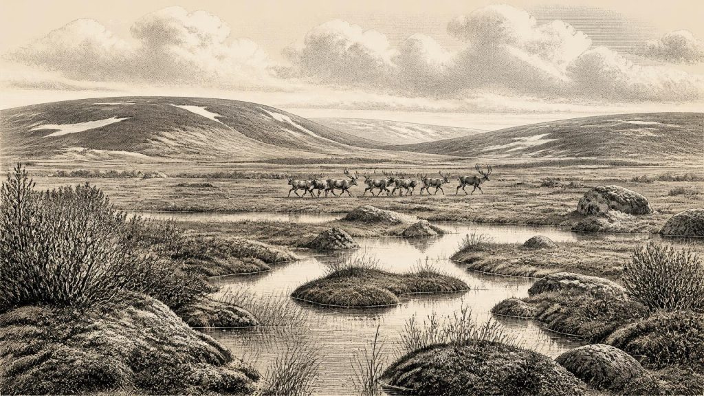
Around 31,136 BCE, Ireland formed part of an unstable Late Pleistocene landscape, rather than a setting with recoverable annual history. Derryvree, County Fermanagh, preserves a buried, ice-free freshwater wetland dated broadly to MIS 3, supporting treeless tundra vegetation. Castlepook Cave, County Cork, produced fossils of reindeer, mammoth, giant deer, predators and Ireland’s only known spotted hyaena remains, demonstrating intermittent access by cold-stage fauna. A marked reindeer bone may indicate human butchery, but cannot prove settlement or cultural affiliation. Expanding ice later transformed and obscured landscapes. Evidence reveals changing environments and animals, not named people, institutions, trade or events with certainty.
Dateline
The label 31,136 BCE is a modern way of locating an exceptionally remote point in Ireland’s past, not a year that anyone then living could have named, recorded or remembered. It falls at roughly 33,100 years before AD 1950, within the Late Pleistocene and Marine Isotope Stage 3. That apparent precision is misleading. Neither archaeology nor palaeoenvironmental science can identify an event, season, community or political occurrence in Ireland in this particular calendar year. The evidence consists instead of deposits and fossils dated across broad ranges, some of them with substantial uncertainty and some recovered by antiquarian excavations whose original contexts were imperfectly recorded.
Accordingly, Ireland around this point is best understood as part of a changing Ice-Age interval rather than as the setting for an annual historical narrative. The most responsible account is local and conditional: parts of the landmass were, at different times, capable of supporting cold-adapted plants and animals; other parts were affected by advancing or retreating ice; and the evidence for people is intriguing but not yet sufficient to demonstrate a settled population.
A Date Without a Chronicle
Modern prehistory uses several clocks. “Before Present” conventionally counts backwards from AD 1950; radiocarbon years are measurements derived from the remaining radioactive carbon in once-living material; and calibrated calendar ages convert those measurements through curves based on independently dated records. A conventional radiocarbon age is therefore not automatically a calendar age. At more than 30,000 years ago, even a good measurement commonly corresponds to a wide calibrated range, while old samples and old excavations add further complications.
The date in question lies close to the beginning of the better-resolved growth phase of the last British–Irish Ice Sheet, but it should not be imagined that Ireland was uniformly ice-covered, uniformly ice-free, or climatically stable. Recent syntheses stress that evidence for ice margins before about 31,000 years ago is patchy and uncertain. The great maximum of the last ice sheet came later: offshore work places extensive ice on the Atlantic shelf west of Ireland by about 26,800 calibrated years BP, with retreat beginning by about 25,900 cal BP. The landscape around 31,136 BCE was therefore part of a longer transition towards a far more extensive glaciation, not simply an early version of the fully glaciated Ireland of the Last Glacial Maximum.
Derryvree’s Buried Wetland
The clearest Irish environmental evidence relevant to this broad period comes from Derryvree, near Maguiresbridge in County Fermanagh. Roadworks in 1969 exposed an unusual sequence within a drumlin: freshwater silts and fine sands lay between two thick tills, the unsorted sediments deposited by glacier ice. The organic, water-laid layer is important precisely because glaciers later buried and protected it. It preserves a short archive of an environment that existed between episodes of glaciation rather than a continuous record of all Ireland.
Colhoun, Dickson, McCabe and Shotton reported a radiocarbon determination of 30,500 ± 1,100 radiocarbon years BP for the Derryvree organic deposits, known as BIRM-166. This is a conventional radiocarbon result, not a precise calibrated calendar date, and its error range alone spans more than two millennia. It should therefore not be assigned to 31,136 BCE as though it described that exact year. Its value is broader: it demonstrates that, during the Middle Midlandian or MIS 3 cold stage, ground in south Fermanagh was at least temporarily free of glacier ice and held freshwater pools, saturated mossy ground and sediment-choked channels.
Plant macrofossils, pollen and insects from the deposit point to an open, treeless tundra or muskeg-like wetland. The vegetation was not a forested Irish countryside: it was a low-growing mosaic of wetland plants, mosses and herbs, with open water in places and exposed mineral ground nearby. Such an environment could be severe without being lifeless. It also shows why a single description of “Ice-Age Ireland” is inadequate. Conditions in one Fermanagh basin cannot be projected without qualification to the south-west coast, the mountains, the Irish Sea basin or every other part of the modern island.
Animals at the Western Edge
County Cork offers a different kind of archive. Castlepook Cave, near Doneraile and sometimes called Mammoth Cave, yielded one of Ireland’s most significant collections of Late Pleistocene mammals during excavations undertaken principally between 1904 and 1908. The National Museum of Ireland holds much of this material. The assemblage includes reindeer, woolly mammoth, giant deer, brown bear, wolf, foxes, mountain hare, lemmings and spotted hyaena. Castlepook is the only presently known Irish locality for spotted-hyaena remains.
These animals do not establish that every species shared the cave, or the Cork landscape, at the same moment. Cave deposits can mix remains accumulated over long periods; carnivores can carry bones into dens; water, sediment movement and early collecting can rearrange them; and later radiocarbon reassessment has shown that some legacy dates need caution. The strongest conclusion is that Ireland lay within the wider range of continental cold-stage faunas during parts of MIS 3. Reindeer and mammoth imply open grazing landscapes; lemmings and Arctic fox fit cold conditions; hyaenas, wolves and bears indicate a functioning predator and scavenger community. They do not supply a census for 31,136 BCE.
Spotted hyaena is nevertheless a useful emblem of the lost ecosystem. Its presence in Cork is hard to reconcile with an image of Ireland as an isolated, empty refuge. It suggests intermittent connections, whether across changing coasts, through Britain or by other routes available when sea levels and ice margins differed greatly from those of today. The exact route and timing of animal movements remain unresolved. Lower sea levels changed the shape of the Irish Sea region, but the evidence does not licence a simple claim of a permanent dry-land bridge from continental Europe to Ireland.
The Human Question
The most consequential possible evidence for people in Ireland at this depth of time is a reindeer femur from Castlepook reported to carry a deep mark consistent with use of a sharp stone tool. Public accounts have associated the bone with an age of roughly 33,000 years. If microscopic study, dating and context ultimately confirm that the mark was made during fresh-bone butchery, it would indicate a human encounter with a reindeer in Ireland during the Upper Palaeolithic—perhaps involving meat, marrow, hide or sinew.
That proposition must remain carefully limited. A date on an animal bone dates the animal’s death within a probability range; it does not, by itself, date a cut, establish who made it, or demonstrate an occupation. Castlepook has not produced a securely associated hearth, stone-tool assemblage, dwelling floor, burial, human bone or repeated settlement sequence of comparable age. The material derives from early excavations rather than a modern stratigraphic investigation. Natural surface damage, carnivore activity, excavation marks and subsequent handling must all be excluded before a single modification is treated as proof of butchery.
Nor can the possible visitors be assigned responsibly to the Aurignacian, Gravettian or another named continental archaeological tradition. Those labels depend on diagnostic artefact assemblages, which Ireland has not yielded for this period. The reindeer femur, if anthropogenic, would support a brief act of human activity, not a claim that a resident people, language, ancestry or continuous Irish population had begun. Later advances of ice would have eroded, buried or displaced many surfaces where camps might once have stood, helping to explain why the record is so sparse without turning absence of evidence into proof of either presence or absence.
No Kingdoms, No Trade Network
There were no political affairs in the historical sense that can be recovered for Ireland at this date: no named leaders, territories, diplomacy, battles, law or institutions. Equally, there is no evidence for religious monuments, formal burial grounds, art, writing, learning traditions or exchange networks. It would be misleading to populate the landscape with tribes, chiefs or rituals merely because human groups elsewhere in Europe possessed rich social worlds. Ireland’s evidence does not identify such communities here.
If people did visit, their economy was almost certainly not an economy of farms, fields or markets. At most, the Castlepook evidence could suggest opportunistic hunting or carcass processing within a mobile subsistence regime. The more securely documented economy was ecological: herbivores moved through open habitats; carnivores exploited prey and carrion; wetland plants occupied shallow pools; and glaciers periodically altered the terrain on a scale no human group could control. “Settlement” in the strict archaeological sense cannot presently be demonstrated.
An Ireland Recast by Ice
The chief development around 31,136 BCE was environmental instability. The buried Fermanagh wetland records a rare ice-free interval in one locality; the Cork caves record an animal world whose composition has no modern Irish equivalent; and the expanding ice-sheet system foreshadowed the destruction or concealment of much older ground surface. Regional change, rather than politics, is the story: water collecting between tills, tundra vegetation taking hold, animals reaching the western edge of Europe, and renewed ice ultimately remaking the land.
For that reason, this date should be treated as a point within a wide archaeological horizon. The evidence can responsibly illuminate a cold, largely treeless and variably accessible Ireland, rich in environmental change and occasionally visited by large mammals. It cannot yield an event of the year, a named person or a calendar-day beginning for Irish history. Its importance lies in showing how much of Ireland’s deepest past survives not in chronicles, but in a freshwater silt bed beneath a Fermanagh drumlin and fossil bones from a Cork cave.
Primary Sources
- A Middle Midlandian Freshwater Series at Derryvree, Maguiresbridge, County Fermanagh, Northern Ireland
- A Reconsideration of the Radiocarbon Dating of the Marine Isotope Stage 3 Fauna from Southern Ireland
- The Irish Quaternary Fauna Project
- Occurrence of Mammalia Relicts at Site Castlepook Cave
- Spotted Hyena Skull
- Archaeology Research Excavation Grant 2022
- Growth and Retreat of the Last British–Irish Ice Sheet, 31,000 to 15,000 Years Ago: the BRITICE-CHRONO Reconstruction
- The Timing and Magnitude of the British–Irish Ice Sheet Between Marine Isotope Stages 5d and 2
- Timing and Pace of Ice-Sheet Withdrawal Across the Marine–Terrestrial Transition West of Ireland During the Last Glaciation
- Maximum Extent and Dynamic Behaviour of the Last British–Irish Ice Sheet West of Ireland
- Sedimentology and Chronology of the Advance and Retreat of the Last British-Irish Ice Sheet on the Continental Shelf West of Ireland
- Advance and Retreat of the Marine-Terminating Irish Sea Ice Stream Into the Celtic Sea During the Last Glacial: Timing and Maximum Extent
- Dimensions and Chronology of the Last Ice Sheet in Western Ireland
- Trimlines, Blockfields and the Vertical Extent of the Last Ice Sheet in Southern Ireland
- Figure 6.—The Subdivision of the Quaternary Period in Ireland
- Landscapes and Environments of the Last Glacial-Interglacial Transition: a Time of Amazingly Rapid Change in Ireland
- Introduction to the Late Quaternary and Holocene of Northern Ireland
- Archaeological Heritage of County Cork
- New Insights on the Fauna of Ireland's Younger Dryas and Early Holocene from Alice & Gwendoline Cave
- IntCal20 Northern Hemisphere Radiocarbon Age Calibration Curve (0–55 cal kBP)
- A Stratigraphic Framework for Abrupt Climatic Changes During the Last Glacial Period Based on Three Synchronized Greenland Ice-Core Records
- The Geological Collections