

Maguirebridge Before the Ice31133 BCE
Around 31,133 BCE, Ireland lay within the Late Pleistocene’s unstable MIS 3 cold stage, not at a precisely datable moment. At Derryvree near Maguiresbridge, County Fermanagh, organic freshwater sediments between glacial tills demonstrate a local ice-free interval before renewed glaciation. Mosses, sedges, grasses, insects and aquatic plants indicate a treeless, periglacial wetland with seasonal ecological productivity. Greenagho and southern cave deposits add evidence of regional variation, including mammoth, reindeer, giant deer and spotted hyaena. A possibly cut-marked reindeer bone suggests, but cannot prove, human activity. The record documents changing environments, not settlements or events, as expanding ice later overwhelmed landscapes.
Dateline
Modern calendar-year precision is not available for Ireland in 31,133 BCE. No person living then recorded a date, and no surviving Irish deposit can be assigned securely to that single year. The label is nevertheless useful as a point within the Late Pleistocene, broadly Marine Isotope Stage 3 (MIS 3), during the Midlandian cold stage. In conventional archaeological terms it lies about 33,082 years before AD 1950. That arithmetic must not be mistaken for an event-date. At this depth of time, radiocarbon results require calibration and are expressed as broad probability ranges; environmental layers often represent years, centuries or longer intervals rather than a moment.
A Cold-Stage Window
The closest Irish evidence comes from Derryvree, near Maguiresbridge in County Fermanagh. Road construction in 1969 cut through a drumlin and exposed a striking sequence: a freshwater deposit of fine sands and silts, containing organic remains, lay between two thick tills. Tills are unsorted sediments left by glacier ice. The order of deposition is therefore secure even where exact dating is not: ice formed the lower till; later, at least this locality became ice-free long enough for water, sediment and living organisms to accumulate; a renewed advance of ice eventually covered and sealed the deposit beneath upper till.
Organic material from the freshwater horizon, catalogue number Birm-166, produced a conventional radiocarbon age of 30,500 years BP, with a substantial uncertainty. Published calibrations place it broadly at about 36,900–31,700 calendar years BP, approximately 34,950–29,750 BCE. The notional year 31,133 BCE falls within that wide span. It cannot be attached to a particular season, pond level, plant, animal or human action at Derryvree. Yet the bed is an exceptional witness to conditions in an Irish locality during the later part of MIS 3.
This distinction between evidence and interpretation matters. The sediments directly demonstrate that a freshwater environment and organic material existed at Derryvree during an interval between glacial advances. The plant, insect and sediment evidence supports reconstruction of a cold, open, periglacial wetland. It does not establish that all Ireland had the same vegetation, that the island was entirely ice-free, or that a single climatic phase prevailed without interruption. Ireland was environmentally varied, and the climate system of the North Atlantic was notably unstable.
Wet Ground, Open Country
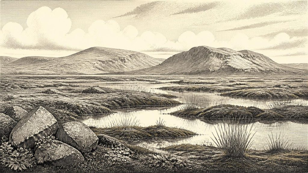
The Derryvree assemblage indicates a treeless landscape with tundra-like and muskeg characteristics. Mosses, sedges, grasses and herbaceous plants dominated; dwarf shrubs and scattered juniper could occur in suitable places. Fossil remains of aquatic and wet-ground plants, together with insects associated with shallow water, wet organic ground and open vegetation, point to pools, saturated margins and plant-rich mud rather than a dry, featureless plain. The scene was not necessarily snow-covered throughout the year. Periglacial means a severe environment shaped by frost, seasonal thaw and ground freezing near an ice margin, not an unchanging frozen desert.
Winters were evidently harsh, and tree growth was severely constrained. In summer, however, exposed vegetation, shallow fresh water and wetland plants supported an ecological community. The important historical fact is not that modern Fermanagh had somehow appeared in miniature, but that a functioning cold-climate ecosystem existed here between episodes of glaciation. Its survival as a buried bed is partly a matter of chance. Later ice altered or removed vast quantities of older ground surface across Ireland, leaving the country with a fragmentary record of the period.
Greenagho, near Belcoo in the same county, provides related evidence for an interstadial or ice-free interval in northern Ireland, while cave faunas in the south show that parts of the island could support substantial mammals during MIS 3. These records should be placed beside one another, not forced into a single map for one imagined year. Derryvree records a wetland in Fermanagh; southern caves record animals accumulated in particular cave systems; offshore and landform studies trace later ice expansion. Together they show change across regions and through time, rather than a stable national landscape.
Animals and the Cave Record
At Castlepook Cave, also known as Mammoth Cave, near Doneraile in north County Cork, old excavations recovered a mixed collection of Pleistocene animal remains. Modern re-dating has reinforced the importance of southern Irish cave faunas for MIS 3. The evidence supports the presence, at different points within that broad period, of cold-stage large mammals and predators including mammoth, reindeer, giant deer and spotted hyaena. It demonstrates that parts of Ireland were available to an open-country fauna before the later, more extensive growth of the last ice sheet.
It would be wrong, however, to turn this list into a census for 31,133 BCE. Cave assemblages are produced through many processes: carnivores carry in prey; animals die naturally; water and sediment move bones; earlier excavators disturb deposits; and bones of different ages can become associated in museum collections. The revised Castlepook dates also show why older radiocarbon results must be revisited as laboratory techniques improve. They strengthen the case for an ancient faunal horizon, but do not tell us which species stood outside the cave in any particular year.
A reindeer femur from the Castlepook collection has been publicly described as bearing a deep mark consistent with cutting or chopping by a stone tool, and has been assigned broadly to around 31,000 BCE. If that mark is confirmed as human butchery, it would be momentous evidence that people processed a reindeer in Ireland during the Upper Palaeolithic. It would not prove a permanent settlement, a named population, continuous occupation, a hunting territory or descent from those visitors. The fragment derives from an old, disturbed cave collection, not a securely excavated occupation floor with associated hearths, tools and dwellings. For this year, it is responsible to treat the find as a significant but limited and still interpretative indication, not as the beginning of a detailed Irish human history.
People Beyond the Evidence
There is no evidence from Ireland around this date for political communities, rulers, borders, diplomacy or organised warfare. Nor is there evidence for villages, cultivated fields, livestock, pottery, buildings, graves, monuments, exchange networks or a written tradition. Religion, language, kinship rules, music, art and learning are equally beyond recovery from the Irish record. Their absence from the account is not a judgement that such things could not have existed among any people who may have reached the island; it is a recognition that archaeology cannot responsibly supply their contents here.
Contemporary Upper Palaeolithic societies elsewhere in north-west Europe show that mobile hunter-gatherers could possess sophisticated knowledge, social ties and symbolic cultures. That comparison helps explain what a small visiting group might have been capable of, but it is not evidence that those practices occurred in Ireland. If people did reach the island during MIS 3, their economy may have involved short-term hunting and carcass processing, perhaps linked to reindeer or other game. This remains an inference from a single possible butchery trace and from continental analogy, not a demonstrated Irish economy or trade system.
Travel itself cannot be reconstructed with confidence. Sea level was lower during the Ice Age than today, exposing additional continental shelf in places and changing coastlines. But lower sea level did not automatically create a simple land bridge to every part of Ireland, and the relevant shorelines now lie largely offshore. The island’s position at the north-western edge of Europe, its variable marine separations and the severe climate made any movement consequential. No Irish evidence identifies a route, boat technology, season of crossing or place of origin for hypothetical visitors.
Ice on the Horizon
The wider importance of this interval lies in what followed. Modern reconstructions of the British–Irish Ice Sheet indicate that major ice-sheet growth was under way across the region after about 34,000 years ago, with its maximum volume achieved much later, around 23,000 years ago. At the date represented here, Ireland was therefore not simply “before the Ice Age”: it was already within the last glacial period, in a landscape where local ice-free wetlands and animal habitats existed amid a changing climate and an expanding ice-sheet system.
Derryvree preserves the contrast with unusual clarity. Beneath its later till is evidence for water, mosses, sedges, insects and open ground; above it is the material signature of renewed glaciation. The deposit gives no episode of kingship, battle or migration to place in 31,133 BCE. Instead, it offers something more fundamental: proof that Ireland’s deep past included local ecological opportunity between glacial advances, and a warning against treating a modern year-number as if it were an ancient diary entry. Around this point in time, the best history is an environmental one—specific in its sediments and organisms, careful in its dates, and candid about its silences.
Primary Sources
- A Middle Midlandian Freshwater Series at Derryvree, Maguiresbridge, County Fermanagh, Northern Ireland
- Middle Midlandian Interstadial Deposits at Greenagho, Near Belcoo, County Fermanagh, Northern Ireland
- Palaeoecology
- A Reconsideration of the Radiocarbon Dating of the Marine Isotope Stage 3 Fauna from Southern Ireland
- Trimlines, Blockfields and the Vertical Extent of the Last Ice Sheet in Southern Ireland
- Growth and Retreat of the Last British–Irish Ice Sheet, 31,000 to 15,000 Years Ago: the BRITICE-CHRONO Reconstruction
- Late Pleistocene Chronostratigraphy and Ice Sheet Limits, Southern Ireland
- Stratigraphic and Palaeo-Geomorphological Evidence for the Glacial-Deglacial History of the Last British-Irish Ice Sheet in the North-Western Irish Sea
- Bayesian Modelling the Retreat of the Irish Sea Ice Stream
- Maximum Extent and Readvance Dynamics of the Irish Sea Ice Stream and Irish Sea Glacier Since the Last Glacial Maximum
- The Irish Quaternary Fauna Project
- New Insights on the Fauna of Ireland's Younger Dryas and Early Holocene from Alice & Gwendoline Cave
- Archaeological Heritage of County Cork
- Our Ancient Landscapes: Hunter-Gatherers in Ireland
- The IntCal20 Northern Hemisphere Radiocarbon Age Calibration Curve (0–55 cal kBP)
- A Stratigraphic Framework for Abrupt Climatic Changes During the Last Glacial Period Based on Three Synchronized Greenland Ice-Core Records: Refining and Extending the INTIMATE Event Stratigraphy
- High-Resolution Record of Northern Hemisphere Climate Extending into the Last Interglacial Period
- A Pliocene-Pleistocene Stack of 57 Globally Distributed Benthic δ18O Records
- Field Guides
- Publications
- Glacio-Geological Databases: Quaternary
- A Lithostratigraphical Framework for Onshore Quaternary and Neogene (Tertiary) Superficial Deposits of Great Britain and the Isle of Man