Derryvree’s Dwarf-Willow Wetland31098 BCE
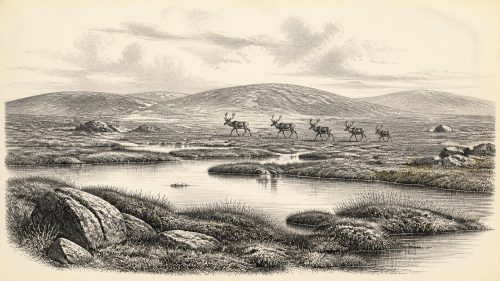
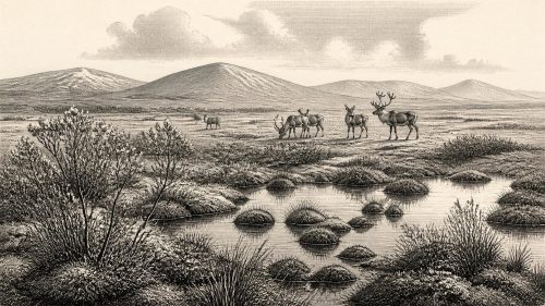
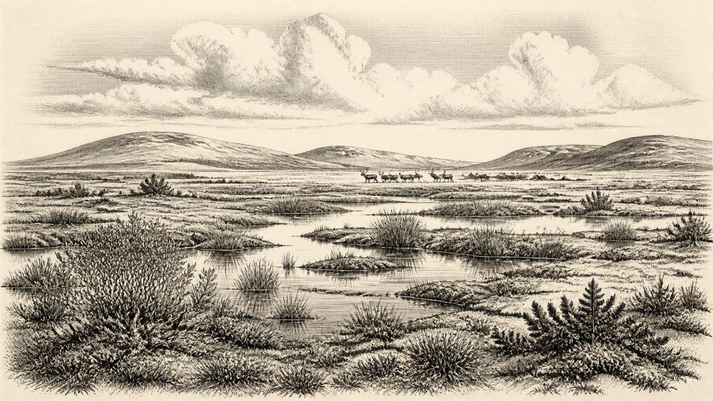
Around 31,098 BCE, a modern approximation within Marine Isotope Stage 3, Ireland experienced unstable Late Pleistocene conditions before the Last Glacial Maximum. At Derryvree, County Fermanagh, organic sediments between glacial tills preserve evidence of an ice-free, treeless wetland with sedges, grasses, dwarf willow, mosses, pools and cold-adapted insects. Castlepook Cave, County Cork, records reindeer, mammoth, giant deer, bears, wolves, hyaenas and other fauna, though its mixed deposits cannot represent one community. These sites show varied open habitats amid growing glacial influence. Human presence remains unproven: a possible butchered bone is inconclusive, while secure evidence dates much later in caves there.
Dateline
A Date Without a Diary
Modern calendar-year precision is not available for Ireland in 31,098 BCE. No community on the island kept a calendar, wrote an account, or left an archaeological sequence capable of identifying a particular twelve-month span so far back. The date is a modern conversion, approximately 33,047 years before AD 1950, the conventional reference point for radiocarbon dating. At this depth in time, the responsible unit is a calibrated range, not a named year or an event.
The date falls within the Late Pleistocene, during Marine Isotope Stage 3, a long and climatically unstable part of the last Ice Age. It preceded the local maximum of the last British–Irish Ice Sheet by several millennia. Ireland was not simply an island smothered continuously by ice, nor a familiar green landscape awaiting settlement. Conditions changed sharply between regions and over long spans of time; advancing ice, exposed ground, frost action, wetlands and open animal country all formed part of the picture. The record is fragmentary because later glaciers eroded, buried and rearranged much of what had existed.
The most useful Irish evidence for the broad interval embracing this nominal date comes from an unlikely source: a buried organic deposit exposed in a road cutting at Derryvree, near Maguiresbridge in County Fermanagh. It is an environmental archive, not a settlement. Its value lies precisely in showing what kinds of plants, insects and waters could persist in an ice-age Ireland, while also marking the limits of what historians can claim about people.
Waterlogged Ground Between Ice Advances
At Derryvree, workers cutting through a drumlin in 1969 exposed organic silts sealed between two layers of glacial till. The lower and upper tills record separate episodes in which ice moved across the locality; between them lay sediments formed when the ground was not overridden by glacier ice. The deposit produced a conventional radiocarbon age of about 30,500 radiocarbon years BP. Later discussion has expressed that result as a broad calibrated interval of roughly 36,900–31,700 calendar years BP. The nominal year considered here sits towards the younger end of that published range, not at a point that can be fixed more closely.
This distinction matters. A radiocarbon determination dates organic material, subject to laboratory uncertainty and calibration; it does not label an annual political or environmental episode. Nor should the Derryvree bed be treated as a photograph of all Ireland. It describes a local Fermanagh basin during an ice-free interval, preserved by exceptional circumstances beneath later deposits. Yet it is among the clearest direct windows into the island’s terrestrial environment at this depth of time.
Pollen, plant macrofossils, spores and insect remains point to an open, treeless tundra or muskeg landscape. Sedges and grasses were prominent. Fossil evidence includes dwarf willow, juniper, mountain-avens, lesser clubmoss and the bog plant bogbean. Mosses grew around wet ground, while pools held aquatic life. Such evidence indicates that plants found today in upland, Arctic or sub-Arctic settings could once thrive at much lower elevations in Ireland. It also suggests a mosaic rather than a uniform wasteland: saturated ground, shallow freshwater, mossy margins and open herb-rich terrain lay close together.
The interpretation of climate is necessarily broader than a weather report. The flora and beetles support cold conditions, severe winters and short growing seasons, with repeated freezing and thawing shaping soils and slopes. The absence of a closed forest is important. Trees may be represented by long-distance pollen, but the local vegetation was not woodland. Derryvree instead preserves an environment in which low plants took advantage of brief summers and wet hollows, while exposed ground remained vulnerable to wind and frost.
An Island Before the Great Expansion
The Derryvree evidence complicates any simple claim that Ireland was wholly glaciated at this time. It demonstrates that north-central Ireland was ice-free when the organic bed accumulated. Geological reconstructions nevertheless show that the wider British–Irish Ice Sheet was growing during the period around and after 31,000 years ago. By the local Last Glacial Maximum, broadly between about 26,000 and 20,000 years ago, ice covered much of Ireland and extended onto surrounding shelves. The timing, thickness and routes of that expansion varied markedly from one sector to another.
Thus 31,098 BCE belongs to a transition, not a single climatic tableau. In northern Fermanagh, a cold wetland could support a distinctive plant and invertebrate community. Elsewhere, ice masses, high ground, coastlines and river systems may have followed different histories. Ice-sheet research can map major landforms and constrain broad phases, but it cannot yet produce a definitive island-wide map for this individual modern calendar year. It is safer to speak of changing habitats and increasing glacial influence than of exact coastlines or provincial zones.
Sea level was lower globally than today because much water was locked in continental ice sheets. That fact altered the Irish Sea basin, but it does not prove that a straightforward, permanent land bridge joined Ireland to Britain or continental Europe at this moment. Ice margins and marine passages changed repeatedly, and many former lowlands now lie beneath the sea. Any discussion of travel must therefore remain conditional. The geography created opportunities and barriers whose exact combination is still difficult to reconstruct.
Castlepook’s Animal Evidence
More than 300 kilometres south of Derryvree, Castlepook Cave near Doneraile in north County Cork preserves Ireland’s richest known late Pleistocene vertebrate collection. Early twentieth-century excavation recovered a very large but imperfectly documented body of bone, later studied and redated by the Irish Quaternary Fauna Project and subsequent researchers. The cave has yielded remains of reindeer, woolly mammoth, giant deer, brown bear, wolf, Arctic fox, mountain hare, lemmings and spotted hyaena.
Several Castlepook specimens have radiocarbon ages that fall within the wider Marine Isotope Stage 3 interval, including reindeer, mammoth, giant deer, brown bear and hyaena. The assemblage establishes that large grazers and browsers, together with formidable predators and cold-adapted small mammals, reached southern Ireland during the later Ice Age. It supports the wider inference from Derryvree that parts of Ireland could, at times, sustain open-country ecosystems rather than continuous forest or universal ice cover.
But a cave bone assemblage is not a census. Carnivores carried prey into caves; floodwater could shift bones; different chambers accumulated material at different times; and much excavation took place before modern recording standards. A list of species cannot be assumed to represent a single season or one simultaneously living community. Castlepook is especially significant because of its richness, but its complicated formation history requires caution in every reconstruction.
Spotted hyaena is a striking example. Its bones, coprolites and tooth-marked prey remains indicate that Castlepook served, at least during some phases, as a hyaena den or feeding place. Mammoth and giant deer need not have lived beside every reindeer, bear or lemming represented in the collection. What the site securely reveals is ecological possibility across a long span: cold, open habitats could support varied herbivores and carnivores in Ireland before the ice sheet’s fullest expansion.
People: A Question, Not a Population
No securely excavated camp, hearth, dwelling, stone-tool assemblage, burial or settlement is known from Ireland around this date. Consequently, there is no sound basis for describing an Irish population’s language, family arrangements, clothing, artistic practices or seasonal routine in 31,098 BCE. There are likewise no recoverable political affairs: no rulers, states, borders, treaties, warfare or diplomacy can be assigned to the island. Farming, formal trade and monumental religion belong to much later Irish prehistory.
A reindeer femur fragment from Castlepook has been proposed as bearing a chop mark made during butchery and has attracted understandable attention as a possible sign of Upper Palaeolithic human activity around 33,000 years ago. If future analysis confirms that interpretation, it would suggest that people reached Ireland and processed an animal during this broad period. It would still not demonstrate permanent settlement, a local technological tradition or continuous occupation. The specimen comes from an old collection, without an associated stone-tool assemblage or an undisturbed occupation surface, so the mark and its context require continuing specialist scrutiny.
The firm published evidence for human activity in Ireland remains much later: cut marks on a brown-bear kneecap from Alice and Gwendoline Cave, County Clare, dated to about 12,810–12,590 calibrated years BP. That gap is essential context. Ireland around 31,098 BCE may have been visited by people, but it cannot responsibly be populated with an established society merely because humans elsewhere in Upper Palaeolithic Europe hunted, travelled, made art and maintained social ties.
Deep History, Carefully Told
The economy visible in the evidence is ecological rather than human. Wetland plants fixed carbon in Fermanagh mud; insects occupied pools and mossy margins; herbivores ranged through open country; hyaenas and other predators consumed carcasses in Cork. These are evidence-based statements. A human hunting economy, exchange network or maritime route is interpretation beyond what the Irish record can presently support. Even the possibility of an early human incursion is best treated as a research question rather than a settled chapter of national history.
Religion and learning are similarly beyond recovery. The Derryvree plants and Castlepook bones have no testimony to beliefs, stories, ritual places or inherited knowledge. That silence should not be mistaken for an absence of culture among any people who may have visited; it reflects the absence of securely attributable archaeological remains. The material record is better at preserving mud, pollen and bone than intention, speech or memory.
What survives from this approximate time is nevertheless important. Derryvree records a functioning, cold-climate freshwater landscape between glacial advances. Castlepook shows that impressive mammals and their predators found routes into Ireland’s far south-western edge of Europe. Together they replace a blank, frozen caricature with a more exact image: an environmentally varied land, increasingly threatened by advancing ice, rich in local ecological detail, and still almost beyond the reach of human history.
Primary Sources
- A Middle Midlandian Freshwater Series at Derryvree, Maguiresbridge, County Fermanagh, Northern Ireland
- Irish Pleistocene Biostratigraphy
- Trimlines, Blockfields and the Vertical Extent of the Last Ice Sheet in Southern Ireland
- Growth and Retreat of the Last British–Irish Ice Sheet, 31,000 to 15,000 Years Ago: The BRITICE-CHRONO Reconstruction
- Growth and Retreat of the Last British–Irish Ice Sheet, 31,000 to 15,000 Years Ago: The BRITICE-CHRONO Reconstruction
- Deglaciation Chronology of the Donegal Ice Centre, North-West Ireland
- A Reconsideration of the Radiocarbon Dating of the Marine Isotope Stage 3 Fauna from Southern Ireland
- The Irish Quaternary Fauna Project
- Castlepook Cave
- Spotted Hyena Skull
- Heritage Artefacts of County Cork
- Archaeological Heritage of County Cork
- On the Cave of Castlepook, Near Doneraile, Co. Cork
- Palaeoecology
- BSBI: Selaginella selaginoides
- BSBI: Salix herbacea
- BSBI: Menyanthes trifoliata
- The IntCal20 Northern Hemisphere Radiocarbon Age Calibration Curve (0–55 cal kBP)
- A Stratigraphic Framework for Abrupt Climatic Changes During the Last Glacial Period Based on Three Synchronized Greenland Ice-Core Records
- Ireland: Submerged Prehistoric Sites and Landscapes
- The Colonization of Ireland: A Human Ecology Perspective
- First Evidence of a Late Upper Palaeolithic Human Presence in Ireland
- New Insights on the Fauna of Ireland's Younger Dryas and Early Holocene from Alice & Gwendoline Cave
- Irish Quaternary Association: Field Guides