Derryvree’s Ice-Free Interval30943 BCE
30,943 BCE denotes no dated Irish event but a late Marine Isotope Stage 3 environmental interval. Derryvree, County Fermanagh, preserves freshwater silts between glacial tills, demonstrating an intervening cold, largely treeless wetland of pools, sedges, herbs, mosses and exposed ground, rather than continuous ice cover. Castlepook Cave, County Cork, records animals including mammoth, reindeer, giant deer, bear, wolves and hyaena, though remains accumulated over long periods. A possibly cut-marked reindeer bone offers limited evidence of human activity, not settlement. Changing ice, sea levels and routes shaped a landscape before expanding ice sheets transformed habitats and subsequently obscured evidence from view.
Dateline
“30,943 BCE” is a modern chronological label, not a year for which Ireland preserves an event, ruler, battle, settlement or dated human life. At this depth in time, calendar-year precision is unavailable. The responsible setting is the later Pleistocene, in the closing part of Marine Isotope Stage 3 (MIS 3), when climate across the north Atlantic changed sharply over centuries and millennia. Archaeological and environmental records can illuminate broad intervals, but not a particular Irish day or season. The evidence most relevant to this point comes from fossil-bearing caves in the south and buried freshwater deposits in Fermanagh, supplemented by the geological record of the growing British–Irish Ice Sheet.
A Date Within a Long Interval
The date lies about 32,900 calendar years before the conventional radiocarbon reference year of AD 1950. That arithmetic does not make it equivalent to a radiocarbon age. Radiocarbon years must be calibrated against independently dated records of past atmospheric carbon, and the resulting calendar ranges may be broad or irregular so far back in time. The Derryvree freshwater deposit near Maguiresbridge, County Fermanagh, produced a conventional radiocarbon determination of 30,500 +1,170/−1,030 BP. It has been placed broadly in a calibrated late-MIS-3 interval, roughly c. 37,000–32,000 calibrated years BP. Thus 30,943 BCE falls near the younger end of a long environmental window rather than identifying the moment when the sediment was laid down.
The useful historical question is therefore not “what happened in Ireland in 30,943 BCE?” but “what sort of Irish landscape is securely attested around this phase?” The answer is neither an unbroken ice sheet nor a familiar green island of woodland and farms. At some times and in some regions, there were ice-free tracts of cold, open ground, freshwater hollows and large-mammal habitat. At other times, glaciers advanced, altered drainage, buried sediments and erased evidence. The patchiness of the record is itself central to the story.
Fresh Water Between the Tills
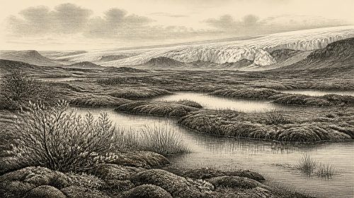
Derryvree is the clearest local archive. Road works in 1969 cut through a drumlin about two kilometres north-east of Maguiresbridge and exposed fine sands and organic freshwater silts sandwiched between two thick, distinct tills. Till is unsorted sediment left by glacier ice. The sequence therefore records a simple but powerful order: glaciation, an interval in which the locality supported freshwater sediment and living organisms, then renewed glaciation. It does not prove that every part of Ireland was ice-free simultaneously, nor does it establish a stable climate lasting unchanged for thousands of years.
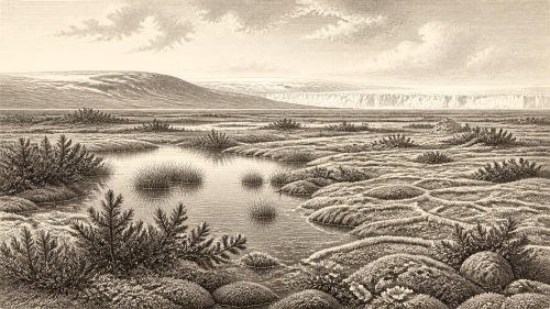
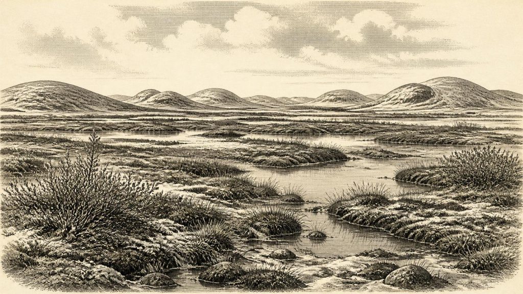
The fossil contents reveal a severe but inhabited wetland landscape. Poorly preserved pollen, plant macrofossils, mosses and insects point to low, open vegetation: grasses, sedges, herbs, juniper and cold-adapted mosses rather than forest. Finds including bogbean, water-milfoil, mountain-avens, dwarf willow and lesser clubmoss indicate shallow or slow-moving fresh water, wet margins and exposed ground nearby. The insect evidence is of northern, cold-climate character. Researchers have accordingly described the setting as tundra or a muskeg-like mosaic: saturated, organic-rich ground with pools, mossy margins and frost-affected soils.
That description needs care. “Tundra” is an environmental comparison, not a claim that Derryvree duplicated any modern Arctic landscape. The sediments represent one lowland locality, accumulated over time. Nevertheless, they decisively rule out an image of an entirely lifeless, permanently ice-covered Fermanagh. In the favourable season, water, sedge-rich forage and flowering plants existed. Winters were likely long and hard; freeze-and-thaw processes disturbed soil and restricted trees. Windswept ridges and drier mineral ground may have looked very different from sheltered wet hollows only a short distance away.
Castlepook’s Faunal Record
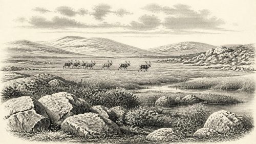
County Cork supplies the other major line of evidence. Castlepook Cave, near Doneraile and sometimes called Mammoth Cave, has yielded Ireland’s most important pre-Last Glacial Maximum assemblage of large vertebrates. Its documented fauna includes woolly mammoth, reindeer, giant deer, brown bear, wolf, foxes including Arctic fox, mountain hare, lemmings and spotted hyaena. This is a striking reminder that Ireland could at intervals form part of a wider north-west European world of cold-stage mammals, very different from the island’s later fauna.
But a cave collection is not a census of one landscape in one year. Castlepook was excavated principally in the early twentieth century under Richard J. Ussher, before modern standards of controlled excavation, and bones could have entered its passages through carnivore activity, natural deaths, water movement and later disturbance. New accelerator radiocarbon work has shown that several earlier determinations were too young, while also confirming that Castlepook accumulated remains over a very long span. Individual animals from different chambers, layers and generations should not be assembled into a single imagined herd.
Even so, the broad ecological conclusion is secure. Reindeer and mammoth require a landscape capable of supporting large herbivores; wolves and hyaenas indicate predators and scavengers within that wider food web. Hyaena-chewed bones also warn against mistaking every concentration of broken bone for a human food deposit. The cave’s significance lies in showing repeated animal access to southern Ireland during MIS 3, not in proving that all recorded species occupied north Cork in 30,943 BCE itself.
The Human Question
The most provocative object connected with this period is a reindeer femur from Castlepook reported to bear a sharp mark consistent with stone-tool butchery. Modern dating and reassessment have made it a potentially important indication that people may have handled a carcass in Ireland before the Last Glacial Maximum. If the modification is confirmed as human-made and contemporary with the bone, it would push Irish human activity far earlier than the well-established Late Glacial evidence from Alice and Gwendoline Cave in County Clare.
Yet the claim must remain qualified. Ireland has produced no human bone, unequivocal lithic assemblage, hearth, dwelling floor, burial or securely excavated camp dating to this broad early period. One marked bone cannot reveal whether a small group visited briefly, hunted locally, scavenged an animal, crossed from neighbouring lands, or established any recurring presence. Nor does it identify a named people, language, religion or social order. The safest interpretation is narrow: the bone is an important but still limited possible trace of human carcass processing, deserving further microscopic study, dating and controlled excavation.
Modern humans were present elsewhere in Europe during the Upper Palaeolithic, using stone tools and pursuing mobile subsistence strategies in cold and fluctuating environments. That continental context makes a short-lived visit to Ireland conceivable. It does not turn possibility into evidence of a permanent Irish population. Later glacier growth would in any case have made long-term continuity highly unlikely, while it also destroyed or concealed many potential traces.
No Polities, No Known Conflict
There is no evidence for political affairs, diplomacy, organised warfare, leaders, territories or institutions in Ireland at this date. There are likewise no known settlements from which everyday domestic routines can be reconstructed. If people entered the island, they were almost certainly few in number and highly mobile, but that is an inference from the sparse evidence and wider Upper Palaeolithic comparison, not a fact demonstrated by an Irish camp.
For the same reason, religion, art, learning and language are archaeologically silent. No cave art, portable art, grave, shrine or ritual deposit of this age is securely known from Ireland. It would be misleading to furnish the period with imagined shamans, clan chiefs or ceremonies merely because such themes are familiar from later prehistory. The intellectual achievement visible here belongs instead to modern science: geologists, palaeoecologists, zooarchaeologists and radiocarbon specialists reading a fragmentary record of mud, pollen, mosses, bones and marks on bone.
Movement, Coast and Economy
There was no Irish economy in the later historical sense: no farming, markets, coinage, metalworking or documented exchange network. The economy of the landscape was ecological. Wetlands produced plant matter and freshwater; open vegetation supported herbivores; carnivores and scavengers fed on those herbivores. A visiting hunter might have valued meat, marrow, hide, sinew, antler and bone from reindeer, but Castlepook does not prove which resources, if any, people took from the individual represented by the marked femur.
Sea level was lower than today because vast quantities of water were locked in northern ice sheets, and the geography around Ireland differed greatly from the modern coastline. However, it is unsafe to picture an uninterrupted, permanent land bridge to Britain or continental Europe. Ice margins, sea passages, exposed shelves, river systems and coastlines changed through time; routes usable by animals or humans may have opened and closed. The animal record establishes connection at intervals, but not the exact route travelled by any species.
Approaching a Major Transformation
By the broader transition from MIS 3 towards MIS 2, the British–Irish Ice Sheet was expanding into the conditions that culminated in the Last Glacial Maximum. Different sectors reached their maxima at different times, and the timing and extent of Irish ice remain subjects of active research. For Ireland, the important point is that the Derryvree wetland and Castlepook fauna belong to a world vulnerable to profound reorganisation. Ice could advance across former habitat, reroute water and entomb the very deposits through which the earlier landscape is now known.
Around 30,943 BCE, then, Ireland is best seen through Derryvree’s freshwater silts and Castlepook’s cave bones. The evidence supports cold, mostly treeless and varied environments; intermittent ice-free ground; pools and sedge-rich wetlands in Fermanagh; and a wider Irish fauna that included reindeer, mammoth and hyaena. It permits a cautious possibility of human presence, but no history of settlement or society. Far from being empty of historical meaning, this sparse record shows how Ireland’s later human story was preceded by deep environmental instability, animal movement and landscapes repeatedly remade by ice.
Primary Sources
- A Middle Midlandian Freshwater Series at Derryvree, Maguiresbridge, County Fermanagh, Northern Ireland
- A reconsideration of the radiocarbon dating of the Marine Isotope Stage 3 fauna from southern Ireland
- The Irish Quaternary Fauna Project
- Irish Pleistocene Biostratigraphy
- Early Midlandian–Middle Midlandian, Pleistocene, Northern Ireland
- Palaeoecology
- New Insights on the Fauna of Ireland's Younger Dryas and Early Holocene from Alice & Gwendoline Cave
- The Mesolithic in Ireland: When Was It?
- Archaeological Heritage of County Cork
- The Exploration of Castlepook Cave, Co. Cork. With 3 Plates
- British–Irish Ice Sheet and Polar Front History of the Goban Spur, Offshore Southwest Ireland Over the Last 250,000 Years
- Maximum Extent and Dynamic Behaviour of the Last British–Irish Ice Sheet West of Ireland
- The Deglaciation of the Western Sector of the Irish Ice Sheet from the Inner Continental Shelf to its Terrestrial Margin
- Pattern and Timing of Retreat of the Last British-Irish Ice Sheet
- Reconstructing the Last Irish Ice Sheet 2: A Geomorphologically-Driven Model of Ice Sheet Growth, Retreat and Dynamics
- Last Glacial Maximum Cirque Glaciation in Ireland and Implications for the Spatial Extent of the Last Irish Ice Sheet
- The Timing and Magnitude of the British–Irish Ice Sheet Between Marine Isotope Stages 5d and 2
- Dimensions and Chronology of the Last Ice Sheet in Western Ireland
- New Data for the Last Glacial Maximum in Great Britain and Ireland
- The Last Scottish Ice Sheet
- Our Ancient Landscapes: Hunter-Gatherers in Ireland
- Publications