

Derryvree’s Alternate Water-Milfoil30868 BCE
Around 30,868 BCE, Ireland cannot be described through a specific annual event, but through uncertain Late Pleistocene evidence. Derryvree, County Fermanagh, preserves a freshwater deposit between glacial tills, indicating cold, open tundra wetlands with sedges, mosses and aquatic plants during an interval between ice advances. Castlepook Cave, County Cork, contains time-mixed remains of cold-stage mammals, including reindeer, mammoth and hyaena, demonstrating Ireland’s changing ecological connections before the Last Glacial Maximum. An incised reindeer bone may indicate butchery by Upper Palaeolithic visitors, but lacks associated settlement evidence. These archives reveal dynamic environments, not permanent population or calendar precision for this date.
Dateline
30,868 BCE is a modern calendar label, not a date that Ice Age evidence can resolve to a particular Irish year, season or generation. It falls about 32,817 years before AD 1950, within the Late Pleistocene and broadly within Marine Isotope Stage 3 (MIS 3). For Ireland at this depth of time, the responsible historical unit is a wide calibrated range rather than a numbered year. No chronicle, settlement sequence or archaeological layer identifies what happened in this one year. What can be examined is a changing island landscape, the animals that occupied it, and one exceptionally limited possible trace of people.
The closest chronological guide is the freshwater deposit uncovered beneath a drumlin at Derryvree, near Maguiresbridge in County Fermanagh. Its radiocarbon result of 30,500 +1,170/−1,030 radiocarbon years BP must be calibrated, and carries a broad calendar-age range rather than a pinpoint date. Published treatments place it in the mid-to-late 30,000s calibrated years BP, with uncertainty extending into the early 30,000s. Thus 30,868 BCE may fall within the broad span represented by the deposit; it cannot be assigned to a particular sediment layer or moment in its formation.
A Landscape Between Ice Advances
Derryvree was exposed in roadworks in 1969. The section contained silts and fine sands with organic material between two thick tills: sediments laid down directly by glacier ice. That order is crucial evidence. It establishes that glaciation occurred, that a freshwater environment subsequently existed at the site, and that ice later returned to cover and preserve the deposit. It does not mean that all Ireland was ice-free at once, nor that the Fermanagh basin was a stable refuge for millennia.
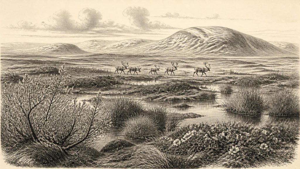
The plants and small animal remains in the intervening freshwater bed indicate an open tundra environment under periglacial conditions. Periglacial means intensely cold ground conditions shaped by frost, repeated freezing and thawing, short growing seasons and sparse tree cover; it does not necessarily mean glacier ice stood on that exact patch of ground. Fossils include sedges, mosses, mountain-avens, dwarf willow, lesser clubmoss and bogbean, while aquatic evidence includes alternate water-milfoil. Together they suggest wet hollows, shallow water and marshy ground embedded in an open, cold landscape rather than woodland.
Such a scene would have been varied at close range. Sedges and aquatic plants show that water remained available locally, while arctic-alpine plants point to exposed, low-growing vegetation able to survive severe cold. In warmer parts of the short summer, wetlands could have been productive places for insects, waterfowl and grazing animals. Yet this was no pastoral landscape. Thin soils, frost action, seasonal snow and violent climatic shifts constrained plant growth. The available evidence describes ecological conditions, not an unbroken view across an entire island.
Approaching the Last Glacial Maximum
At this date Ireland was not yet necessarily in the maximum phase of the last British–Irish Ice Sheet. The fullest Late Glacial ice extent developed later, broadly during Marine Isotope Stage 2, and reconstructions show rapid regional growth of the wider ice sheet after about 32,000 years ago. The dating and extent of Irish ice margins remain unevenly known, especially inland. It would therefore be misleading either to picture the whole island beneath a single continuous ice cap in 30,868 BCE or to imagine an inviting, uniformly habitable country.
The better interpretation is of instability. Local ice, bare permafrost-affected ground, wetlands, river corridors and grass-herb tundra could coexist in different places and alter over long timescales. Sea level was substantially lower than today because much water was stored in global ice sheets, changing the shape of the surrounding continental shelves. But lower sea level alone does not prove an easy route into Ireland. The physical geography of the Irish Sea region, ice margins and the availability of viable animal habitat changed repeatedly. Any connection with Britain or continental Europe must be treated as a geographical possibility requiring site-specific evidence, not as proof of a known migration route.
Castlepook’s Animal Archive
The strongest southern Irish evidence relevant to this era comes from Castlepook Cave, also called Mammoth Cave or Doneraile Cave, in north County Cork. Excavations in the early twentieth century recovered more than 2,000 bones from its limestone passages and chambers. Later radiocarbon programmes showed that its fauna accumulated over a long and mixed period, rather than representing one hunt, one season or one intact occupation floor. Re-dating has placed some specimens substantially earlier than older measurements suggested, and individual animal remains span roughly 45,700 to 19,950 radiocarbon years BP.
That long timespan is a warning as well as an opportunity. Castlepook does not supply a snapshot of 30,868 BCE. Cave sediments were disturbed during their original deposition, by carnivores and water, and by nineteenth- and early twentieth-century excavation. Some bones could have been moved or redeposited. Nonetheless, the collection demonstrates that Ireland was part of a wider north-west European cold-stage fauna. Recorded animals include reindeer, woolly mammoth, giant deer, brown bear, wolf, Arctic fox, mountain hare, stoat, collared lemming, Norwegian lemming and spotted hyaena.
This assemblage should not be turned into a fanciful procession in which every species lived together at the cave mouth. Their dated remains represent different episodes within a changing climatic interval. Nor does a cave full of bone automatically signify a human hunting camp. Hyaenas and other carnivores accumulated animal remains, while natural deaths, scavenging and geological processes also contributed. What Castlepook securely shows is that cold-adapted and open-country mammals reached Ireland before the Last Glacial Maximum, and that cave systems can preserve fragments of a fauna otherwise largely erased by later ice and erosion.
A Single Possible Human Trace
One Castlepook specimen has given this period unusual historical importance: a reindeer femur bearing a deep incision. It has been reported as dating to about 33,000 years ago and the mark has been interpreted by zooarchaeologist Ruth Carden as having been made on fresh bone by a sharp stone tool, consistent with butchery. If that interpretation is sustained, it would be evidence that one or more Upper Palaeolithic people processed a reindeer in Ireland far earlier than the formerly accepted late-glacial human record.
Its limits deserve equal emphasis. The dated bone is not a dated camp. There is no securely associated hearth, stone-tool assemblage, dwelling, burial, worked-bone industry, human skeleton or stratified occupation surface of comparable age at Castlepook. Radiocarbon dates the death of the animal’s bone, while the identification of a surface mark as a stone-tool cut is a separate taphonomic judgement. The specimen can support a carefully framed possibility of human activity; it cannot demonstrate permanent settlement, a population size, a language, a named people, kinship groups or continuous ancestry into later Irish history.
This distinction also rules out conventional political history. There is no evidence for leaders, territories, alliances, warfare, diplomacy, law or institutions in Ireland at this time. Nor can religion, art, education or formal exchange networks be reconstructed. If people briefly reached the island, they may have belonged to highly mobile hunter-gatherer populations familiar with cold environments elsewhere in Europe. That is an inference from the wider Upper Palaeolithic world, not a fact demonstrated by an Irish settlement. It should not be used to populate Ireland with a community for which the archaeological record has not yet been found.
Everyday Life Without a Settlement
The evidence permits a more modest account of possible everyday activity. A reindeer carcass, if butchered by people, would have supplied meat, fat, hide, sinew, marrow and bone: valuable materials in a cold landscape. Reindeer also indicate an environment with seasonal forage and open terrain. But whether the animal was killed locally, scavenged, brought to the cave or encountered by a passing party is unknown. The cave’s fauna cannot establish how long anyone stayed, whether children and families were present, or whether the visit formed part of a repeated seasonal route.
Nor is there evidence of an economy in the later sense of farming, livestock, fields, stores or trade. Agriculture lay many millennia in the future. The ecological economy visible in the evidence was one of animal movement and plant productivity, regulated by climate. Carnivores, herbivores and scavengers moved through an Irish landscape that could temporarily support them, then became increasingly constrained as ice expanded. The dramatic later reorganisation of the island’s ecology helps explain why continuity is so hard to demonstrate: advancing glaciers could destroy campsites, rework deposits and make earlier routes unusable.
What This Date Can Mean
For 30,868 BCE, Ireland’s history is therefore best told through two complementary archives. Derryvree preserves the local environmental evidence for a cold, open tundra wetland between glacial episodes. Castlepook preserves a time-averaged record of mammals that crossed or survived within a changing Ice Age landscape, alongside a single debated but potentially consequential sign of butchery. Neither archive yields calendar-year precision; neither authorises a story of an established Irish people.
Yet the evidence matters precisely because it is so early and so fragile. It shows that pre-Last Glacial Maximum Ireland was not an empty abstraction beneath an eternal ice sheet. It was an environmentally dynamic part of north-western Europe, occupied at different times by remarkable cold-stage animals and perhaps visited by people. The research priority is not to force certainty from one incised bone or one buried wetland, but to recover securely stratified deposits, refine dates and test interpretations. Around this nominal year, that caution is the most truthful form of history.
Primary Sources
- A Middle Midlandian Freshwater Series at Derryvree, Maguiresbridge, County Fermanagh, Northern Ireland
- The Irish Quaternary Fauna Project
- A reconsideration of the radiocarbon dating of the Marine Isotope Stage 3 fauna from southern Ireland
- Castlepook Cave: Cork County Geological Site Report
- 2022:564 – Castlepook Cave, Castlepook South, Cork
- Archaeology Research Excavation Grant Report: Castlepook Caves Project
- Growth and retreat of the last British–Irish Ice Sheet, 31,000 to 15,000 years ago: the BRITICE-CHRONO reconstruction
- Late Pleistocene chronostratigraphy and ice sheet limits, southern Ireland
- Last Glacial Maximum cirque glaciation in Ireland and implications for reconstructions of the Irish Ice Sheet
- The deglaciation of the western sector of the Irish Ice Sheet from the inner continental shelf to its terrestrial margin
- Maximum extent and dynamic behaviour of the last British–Irish Ice Sheet west of Ireland
- Early deglaciation of the British–Irish Ice Sheet on the Atlantic margin
- The IntCal20 Northern Hemisphere Radiocarbon Age Calibration Curve (0–55 cal kBP)
- IntCal20 Approach to Radiocarbon Calibration Curve Construction: A New Methodology Using Bayesian Splines and Errors-in-Variables
- Menyanthes trifoliata
- Salix herbacea
- Dryas octopetala
- Selaginella selaginoides
- Myriophyllum alterniflorum
- Archaeological Heritage of County Cork
- New insights on the fauna of Ireland’s Younger Dryas period
- The colonization of Ireland: A human ecology perspective
- Studies on the early settlement of Scotland and Ireland
- Occurrence of mammalia relicts at site Castlepook Cave