

Derryvree’s Icebound Waters30839 BCE
Around 30,839 BCE, Ireland was a climatically unstable Late Pleistocene landscape, not a documented historical society. At Derryvree, County Fermanagh, freshwater silts preserved between glacial tills record an ice-free interval within MIS 3, dated broadly to 34,950–29,750 BCE. Plant remains indicate shallow water, sedgy wetlands, sparse tundra vegetation and frost-disturbed ground, rather than woodland. Later ice buried the deposits, while wider ice-sheet extent remained variable and uncertain. Castlepook Cave in Cork shows intermittent presence of diverse mammals, including reindeer, mammoth and hyaena, but not a single community. Possible human traces remain contested; secure Irish human evidence is far later indeed.
Dateline
30,839 BCE is a modern chronological label, not a year that anyone in Ireland could have named or recorded. It corresponds roughly to 32,788 years before AD 1950, the conventional reference point for radiocarbon chronology. Modern calendar-year precision is not available at this depth of time: no Irish settlement, burial, written record or securely annual natural archive can be assigned to this particular year. The responsible historical approach is therefore to place it within calibrated ranges. Around this point, Ireland lay in the Late Pleistocene, broadly within Marine Isotope Stage 3 (MIS 3), a cold and climatically changeable part of the last Ice Age.
The clearest Irish evidence relevant to this date comes from Derryvree near Maguiresbridge in County Fermanagh. There, roadworks in 1969 exposed freshwater silts and fine sands enclosed between two substantial layers of glacial till in a drumlin. The stratigraphy establishes an important sequence: ice had previously affected the site; an ice-free interval then permitted freshwater sediment, plant remains and small animal traces to accumulate; later ice covered and preserved them. Organic material from the deposit produced the conventional radiocarbon determination Birm-166, 30,500 radiocarbon years before present, with a large uncertainty. Modern calibration places the deposit broadly around 36,900–31,700 calibrated years BP, or roughly 34,950–29,750 BCE. The numbered year considered here falls within that wide range, but cannot be pinpointed inside it.
A Wetland Between Glaciers
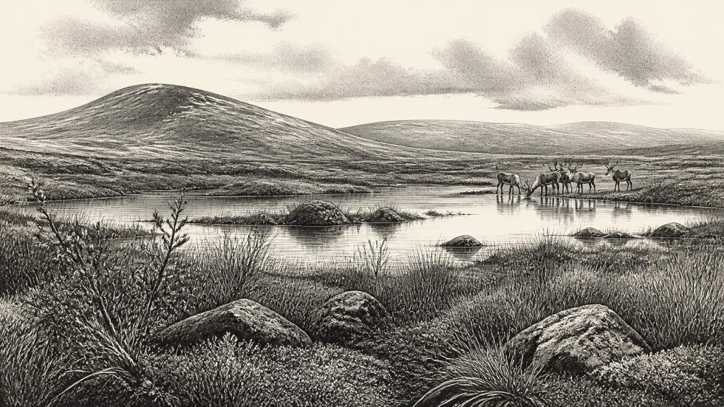
Derryvree was not an Irish landscape of forests, fields or villages. The evidence indicates a periglacial setting: terrain shaped by severe cold, frost action and seasonally frozen ground, but not continuously smothered by glacier ice. Fresh water nevertheless existed locally. Fine sediment settled in a pool or sluggish watercourse, while wet ground developed at its margins. This was a small environmental refuge in a wider, difficult landscape, not proof that all of Ireland was similarly ice-free or hospitable.
Plant evidence is especially valuable because it records habitats rather than imagined scenery. Pollen was poorly preserved and dominated by herbs, while macrofossils and moss remains supplied much of the detail. The assemblage includes plants associated with open, cold ground and wet margins: sedges and grasses, bogbean, mountain avens, dwarf willow, lesser clubmoss and a distinctive range of mosses. Such remains support a mosaic of shallow water, sedgy edges, damp organic ground, sparse tundra-like vegetation and exposed frost-disturbed surfaces. They do not demonstrate a dense woodland. A few grains of tree pollen can travel considerable distances, so they cannot responsibly be treated as evidence for local pine or hazel forest.
Climate, Ice and Changing Coasts
This was an interval of instability rather than a single unchanging ‘Ice Age’ condition. The British–Irish Ice Sheet had advanced and retreated repeatedly over longer timescales, and its extent before the Last Glacial Maximum remains actively debated. Derryvree itself proves that ice had withdrawn sufficiently from this part of Fermanagh for a freshwater environment to form, before a later advance laid down the upper till. It does not establish the position of every ice margin across the island in 30,839 BCE.
The major maximum of the last British–Irish Ice Sheet came later. Current reconstructions place the overall maximum extent of the ice sheet around 26,000 years ago, with different sectors growing and retreating at different times; the Irish Sea Ice Stream reached its far south-western extent between about 27,000 and 24,000 calibrated years BP. Thus the date considered here belongs to the lead-up to, rather than the height of, the Last Glacial Maximum. Northern and central parts of Ireland may already have experienced significant ice expansion, while the evidence from Fermanagh and Cork warns against drawing one neat boundary around the whole island.
Sea level was also lower than today, but this should not be converted into a simple story of a reliable land bridge between Ireland and Britain. Ice volume, local crustal movements, changing coastlines and marine ice all mattered. The precise accessibility of Ireland at any particular moment in MIS 3 remains uncertain. It is safer to say that the island’s geographical setting differed profoundly from the present, while the actual routes used by animals—or any people—cannot be reconstructed from Derryvree alone.
Animals in the Irish Landscape
For a complementary record, archaeologists turn south to Castlepook Cave near Doneraile in north County Cork. Its deposits, excavated principally in the early twentieth century, contain a remarkable Late Pleistocene bone assemblage. The Irish Quaternary Fauna Project showed that a wider range of mammals reached Ireland intermittently between at least about 45,000 and 20,000 radiocarbon years ago. Dated specimens from Castlepook include reindeer, brown bear, giant deer, mammoth, wolf and spotted hyaena; other material points to further cold-adapted animals. These finds reveal that Ireland was not biologically empty during much of MIS 3.
Yet Castlepook is not a snapshot of one living community. Cave bones accumulated across many millennia through several processes: animals could die in fissures, carnivores could carry prey or scavenged parts indoors, running water could redeposit material, and early excavations did not preserve the contextual detail expected today. A mammoth bone and a reindeer bone from the cave need not represent animals that met in the same season, much less at the same watering place. The cave supports the broad conclusion that a varied large-mammal fauna used or reached Ireland during this phase; it cannot furnish a complete food web for 30,839 BCE.
That faunal evidence nevertheless helps make sense of the Derryvree vegetation. Open, patchy, cold-climate habitats could support grazing and browsing animals, while caves, escarpments and watercourses created varied local settings. Predators and scavengers were part of this world. The contrast with modern Ireland is striking, but it should not encourage visions of an endless, uniform ‘mammoth steppe’. Local water, shelter, snow cover, soils and the shifting proximity of ice would have made conditions highly varied.
People: A Question, Not a Settlement
No excavated dwelling, hearth, tool assemblage or burial demonstrates a settled human community in Ireland at this date. There were no known farms, permanent villages, political institutions, named peoples, trade networks or diplomatic relationships to describe. Agriculture lay tens of millennia in the future. Nor is there evidence from which to infer a local language, religious system, art tradition, leadership structure or formal conflict. Silence here is evidence of the limits of the record, not a licence to fill it with familiar prehistoric stereotypes.
Castlepook has, however, introduced a carefully qualified possibility. A reindeer femur from the cave has been reported as bearing a deep mark consistent with the use of a sharp stone tool, and the object has been presented as possible evidence for very early human activity in Ireland, around 33,000 years ago. If that interpretation is sustained by further study, it could indicate a brief Upper Palaeolithic visit or butchery episode within the broad era considered here. It would still not prove a resident population, a camp at Castlepook, or a human presence in the specific modern year 30,839 BCE. The bone comes from a complex, disturbed cave archive, and the interpretation requires securely contextualised corroboration.
Society Beyond the Evidence
It is possible that mobile hunter-gatherers moving through north-west Europe had the skills to exploit reindeer and other large game, to make stone tools and to travel through severe seasonal environments. That is a wider European comparison, not direct evidence for a social group living in Ireland. The responsible conclusion is narrower: people may have reached Ireland during MIS 3, but there is no securely demonstrated society here at 30,839 BCE. The presently firm archaeological evidence for human presence belongs much later, in the terminal Pleistocene, including a butchered brown-bear bone from Alice and Gwendoline Cave in County Clare dated to about 12,800–12,600 calibrated years BP.
Accordingly, political affairs, diplomacy and warfare cannot be recovered for this date. There are no monuments whose construction can be tied to it, no exchanged objects showing trade, no domestic rubbish revealing diet, and no ritual deposits that can support claims about belief. Even the apparently simple question of whether people were present depends on a single contested line of material evidence from far away in Cork. The principal history of Ireland around 30,839 BCE is environmental: water gathering in a Fermanagh hollow, hardy plants taking hold around its margins, animals moving through changing cold-country habitats, and ice advancing again to conceal the evidence.
The Value of a Buried Record
Derryvree’s importance lies precisely in its restraint. The freshwater beds do not offer heroic founders or a dated event. They preserve an interval between glaciations, demonstrating that Ireland’s Late Pleistocene history was not one uninterrupted ice cover. In the space between two tills, silts, mosses and seeds record the conditions under which life persisted. For the modern label 30,839 BCE, that is the most historically meaningful conclusion: Ireland was a changing, regionally varied Ice Age landscape, environmentally alive but archaeologically elusive, on the threshold of much more extensive glaciation to come.
Primary Sources
- A Middle Midlandian Freshwater Series at Derryvree, Maguiresbridge, County Fermanagh, Northern Ireland
- The Irish Quaternary Fauna Project
- A Reconsideration of the Radiocarbon Dating of the Marine Isotope Stage 3 Fauna from Southern Ireland
- Growth and Retreat of the Last British–Irish Ice Sheet, 31,000 to 15,000 Years Ago: The BRITICE-CHRONO Reconstruction
- The Timing and Magnitude of the British–Irish Ice Sheet Between Marine Isotope Stages 5d and 2: Implications for Glacio-Isostatic Adjustment, High Relative Sea Levels and ‘Giant Erratic’ Emplacement
- Advance and Retreat of the Marine-Terminating Irish Sea Ice Stream into the Celtic Sea During the Last Glacial: Timing and Maximum Extent
- Trimlines, Blockfields and the Vertical Extent of the Last Ice Sheet in Southern Ireland
- Timing, Pace and Controls on Ice Sheet Retreat: An Introduction to the BRITICE-CHRONO Transect Reconstructions of the British-Irish Ice Sheet
- The IntCal20 Northern Hemisphere Radiocarbon Age Calibration Curve (0–55 cal kBP)
- Bayesian Analysis of Radiocarbon Dates
- Palaeoecology
- Dryas octopetala
- Heritage Artefacts of County Cork
- Ireland: Submerged Prehistoric Sites and Landscapes
- First Evidence of a Late Upper Palaeolithic Human Presence in Ireland
- New Insights on the Fauna of Ireland’s Younger Dryas and Early Holocene from Alice & Gwendoline Cave
- The Mesolithic in Ireland: When Was It?
- Dimensions and Chronology of the Last Ice Sheet in Western Ireland
- New Data for the Last Glacial Maximum in Great Britain and Ireland
- Stratigraphic and Palaeo-Geomorphological Evidence for the Glacial-Deglacial History of the Last British-Irish Ice Sheet in the North-Western Irish Sea