

Derryvree Under Gathering Ice30757 BCE
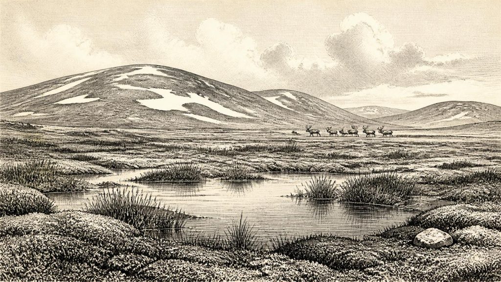
30,757 BCE cannot be treated as a precisely recoverable Irish year; evidence instead describes a broad MIS 3 interval. At Derryvree, County Fermanagh, freshwater sediments between glacial tills record a temporary ice-free wetland, with tundra vegetation, insects and seasonal meltwater, before advancing ice buried it. Castlepook Cave, County Cork, preserves mixed animal remains spanning many millennia, including mammoth, reindeer, giant deer, predators and later cold-adapted species, indicating open steppe-tundra. A possibly cut-marked reindeer bone suggests, but cannot prove, brief Upper Palaeolithic human visits. No evidence supports permanent settlement, political structures, religion, trade or agriculture; environmental change dominates the record overall.
Dateline
“30,757 BCE” is a modern chronological label, not a year that can be recovered from Ireland’s Ice Age record. No written calendar existed, and neither a bone, a cave deposit nor a buried wetland can responsibly be assigned to that single year. In archaeological convention the date lies about 32,707 years before AD 1950, during the later part of Marine Isotope Stage 3 (MIS 3), within Ireland’s Midlandian cold stage. The evidence comes instead in long, calibrated ranges, often with uncertainties of centuries or millennia. The most useful Irish environmental sequence spans a broad interval, not a moment: deposits at Derryvree, near Maguiresbridge in County Fermanagh, have been related to roughly 36,900–31,700 calibrated years BP. The numbered year therefore belongs within a landscape history rather than an annal of events.
A Wetland Between Glaciers
Derryvree is the key to a careful reconstruction. Roadworks in 1969 cut through a drumlin about two kilometres north-east of Maguiresbridge and exposed an extraordinary layer of freshwater silts, fine sands and organic matter trapped between two thick sheets of glacial till. The lower till demonstrates that ice had previously crossed the locality; the upper till shows that ice later returned and buried the wetland. Between those episodes, however, a basin held freshwater and supported plants, insects and other life. The original radiocarbon determination, 30,500 +1,170/−1,030 radiocarbon years BP, has a wide calibrated equivalent, but securely places the deposit deep in the last glacial cycle.
This is direct evidence for local conditions in south Fermanagh, not a licence to draw a single climatic map for the whole island. A buried pool records a sheltered, waterlogged hollow; it cannot tell us precisely what lay beyond every ridge, coast and mountain. Yet it decisively rules out a picture of Ireland as continuously sealed under featureless ice. Around the broad period represented by Derryvree, exposed ground in at least part of the north-west supported standing or slow-moving water, mossy margins and low vegetation. It was a harsh periglacial world, but not a lifeless one.
Open Tundra, Seasonal Water
The biological remains from Derryvree point to open, largely treeless tundra or muskeg: wet ground with pools, sedges, mosses, herbs and sparse vegetation on drier patches. Pollen survived poorly, but the plant macrofossils and mosses matter greatly because they were deposited close to where the plants grew. Their northern and alpine affinities, together with the insects recovered from the sequence, indicate severe cold and seasonal frost. The presence of freshwater species is equally important. Meltwater and summer thaw created habitats in which aquatic plants and wetland vegetation could persist. Ireland at this time was neither a permanently frozen desert nor a later, familiar green island of woods and pasture.
There was no closed forest. Occasional grains of tree pollen in such deposits need not represent local woodland: they may have travelled long distances on the wind or been redeposited from older sediments. The stronger signal is of low herbaceous cover, exposed mineral ground and damp hollows. Such country would have altered rapidly through the year. In the short growing season, pools could fill with meltwater and plants could flower, while winter brought prolonged cold, snow cover and frozen soils. A nineteenth-century traveller would not have recognised the terrain as Ireland, though its limestone, bedrock basins and emerging drainage routes helped determine where water gathered.
Ice Was Advancing, Not Absent
The wider setting was unstable. The great British–Irish Ice Sheet had not yet reached its fullest overall extent, which current reconstructions place around 26,000 years ago, but ice was building rapidly across Ireland and Britain from about 31,000 years ago. This was not a simple southward wall or an island-wide event experienced at once. Ice caps and glaciers developed in upland source areas; marine and terrestrial margins behaved differently; and expansion, retreat and readvance varied by region. Recent ice-sheet modelling stresses that there was no single instant when every sector was at a maximum.
For Ireland around this nominal year, the responsible conclusion is therefore regional change. Some ground had become available for tundra and freshwater habitats; elsewhere, mountain ice, snowfields or advancing lobes constrained movement and remodelled the land. The Derryvree sequence preserves one interval of exposure before later ice sealed it. Far from being a static backdrop, ice was a principal agent of regional change: it redirected drainage, transported sediment, eroded earlier surfaces and repeatedly removed or disturbed evidence of animals and people. That destructive history helps explain why the archaeological record is so sparse.
Castlepook’s Animal Archive
County Cork offers the other major window on Ireland in this broad period. Castlepook Cave, near Doneraile, is the island’s richest known cave repository for vertebrate remains dating towards and through the period before the Last Glacial Maximum. More than 2,000 bones have been recovered from its passages and chambers. Direct dates from individual specimens stretch across a long span, roughly 45,700 to 19,950 years BP, so the collection is emphatically not a single living community or one event. Water movement, carnivore activity and early excavations have also mixed and disturbed deposits.
Nevertheless, its fauna demonstrates that cold-stage Ireland was reached by large and small mammals at different times. Woolly mammoth, giant deer, reindeer, brown bear and spotted hyaena are represented, while later cold-stage material includes Arctic fox, wolf and lemmings. The combination supports an interpretation of open, productive steppe-tundra habitats rather than dense woodland. Reindeer and mammoth, in particular, evoke mobile grazing animals using broad, low-vegetation country; hyaenas and wolves indicate predators and scavengers within that food web. But it would be wrong to place every listed species beside one another at 30,757 BCE. The cave’s long chronology permits only a wider environmental reconstruction.
The Reindeer Bone and Human Possibility
Castlepook also raises, but does not settle, the question of people. A reindeer femur from the old collections has been interpreted as bearing a deep fresh-bone cut or chop mark made by a sharp stone tool. Public discussion has associated the specimen with about 33,000 years ago. If the modification is confirmed as human-made and contemporary with the animal’s death, it would indicate that an Upper Palaeolithic person or group processed a reindeer in Ireland during the broad MIS 3 interval. That would be a major discovery.
The limits of the claim are as important as its promise. A date on bone dates the animal, not automatically the mark; a cave find need not be the place where the carcass was killed or butchered; and Castlepook has not yielded a securely associated hearth, stone-tool assemblage, dwelling, burial or intact occupation surface of this age. No named individual, community or population can be recovered from the evidence. The cautious position is that Ireland may have received brief human visits during favourable phases of the Ice Age, but permanent settlement around this date is unproven. The only directly observable action is a possible episode of carcass processing.
Society Beyond Recovery
Consequently, political affairs, diplomacy and organised conflict are beyond the evidence. There are no states, chiefs, boundaries, treaties or battle sites that can be assigned to Ireland at this date. Nor can religion be reconstructed: no shrine, burial, figurine, painted cave wall, ornament or ritual deposit securely belongs to this interval. Culture and learning survive only indirectly, in the possibility that visitors knew how to make and use stone-edged tools, read animal movements and endure a difficult seasonal environment. Such abilities are plausible by comparison with Upper Palaeolithic societies elsewhere in Europe, but comparison is interpretation, not Irish proof.
The same restraint applies to economy and trade. There is no evidence for farming, herding, metallurgy, exchange networks or maritime commerce. If people were present, their livelihood would most likely have depended on mobile hunting and gathering, perhaps focused on seasonally available animals and plant resources; yet even that is a conditional inference rather than a documented Irish economy. Lower global sea levels altered the surrounding shelf, and animal arrivals show that routes into Ireland existed at least intermittently in the wider cold-stage world. The exact pathways, whether over exposed ground, ice margins or short water crossings, remain uncertain.
An Environmental History, Not an Annal
The chief Irish development around 30,757 BCE was environmental. Freshwater occupied a Fermanagh hollow between glacial episodes; tundra plants and insects made use of a brief ecological opening; cold-adapted mammals ranged through suitable country; and ice was gathering again on a scale that would transform the island. Castlepook and Derryvree do not tell a story of kingdoms or a dated human drama. They reveal something older and more fragile: a changing Ice Age Ireland in which water, mosses, sedges, grazing animals, predators and perhaps occasional people occupied ground that later ice would conceal.
Primary Sources
- A Middle Midlandian Freshwater Series at Derryvree, Maguiresbridge, County Fermanagh, Northern Ireland
- Palaeoecology: Middle Midlandian Palaeoenvironment of South Fermanagh
- Figure 6.— The Subdivision of the Quaternary Period in Ireland
- A Reconsideration of the Radiocarbon Dating of the Marine Isotope Stage 3 Fauna from Southern Ireland
- The Irish Quaternary Fauna Project
- Castlepook Cave: County Geological Site Report
- Growth and Retreat of the Last British–Irish Ice Sheet, 31,000 to 15,000 Years Ago: The BRITICE-CHRONO Reconstruction
- The Timing and Magnitude of the British–Irish Ice Sheet Between Marine Isotope Stages 5d and 2
- The Last Eurasian Ice Sheets – a Chronological Database and Time-Slice Reconstruction, DATED-1
- Character of Advance and Retreat of the Southwest Sector of the British-Irish Ice Sheet During the Last Glaciation
- Late Pleistocene Chronostratigraphy and Ice Sheet Limits, Southern Ireland
- Last Glacial Maximum Cirque Glaciation in Ireland and Implications for Reconstructions of the Irish Ice Sheet
- Freshwater Organic Deposits and Stratified Sediments Between Early and Late Midlandian (Devensian) Till Sheets, at Aghnadarragh, County Antrim, Northern Ireland
- Occurrence of Mammalia Relicts at Site Castlepook Cave
- 2022:564 – Castlepook Cave, Castlepook South, Cork
- Heritage Artefacts of County Cork 2021
- First Evidence of a Late Upper Palaeolithic Human Presence in Ireland
- New Insights on the Fauna of Ireland's Younger Dryas and Early Holocene from Alice & Gwendoline Cave
- The Problem of a Late Quaternary Landbridge Between Britain and Ireland
- Deglaciation, Earth Crustal Behaviour and Sea-Level Changes in the Determination of Insularity: A Perspective from Ireland





