Fermanagh’s Tundra Plant Archive30758 BCE
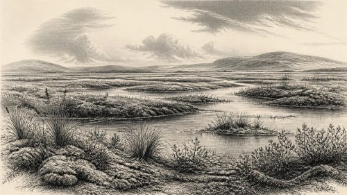
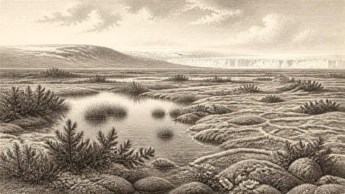
Around 30,758 BCE, Ireland lay within the unstable later Marine Isotope Stage 3, not a precisely datable historical year. At Derryvree in County Fermanagh, freshwater sediments between glacial tills record a temporary ice-free, cold, treeless wetland supporting bogbean, mountain avens, clubmoss and tundra plants. These deposits demonstrate local environmental change, not island-wide conditions. As ice expanded towards its later maximum, habitats repeatedly shifted. Castlepook Cave in Cork preserves cold-stage fauna, including reindeer, mammoth and hyaena, indicating periodically suitable open landscapes. A possibly tool-marked reindeer bone suggests brief Upper Palaeolithic human activity, but proves neither settlement nor society. Evidence remains fragmentary.

Dateline
A Date Beyond Calendar Precision
30,758 BCE is a useful modern label, but it cannot identify a particular Irish day, season, generation or event. No written chronology existed, and the scientific dates available for this depth of time come with substantial margins of uncertainty. The most responsible setting is the later part of Marine Isotope Stage 3, within the Midlandian cold stage of the Irish Pleistocene. Radiocarbon laboratories report ages in radiocarbon years before present, conventionally before 1950; researchers then calibrate them against changing atmospheric carbon levels. That conversion creates ranges, not calendar anniversaries.
The nearest securely relevant Irish environmental record is at Derryvree townland, near Maguiresbridge in County Fermanagh. A road cutting exposed a remarkable sequence inside a drumlin: glacial till below, freshwater silts and fine sands with organic material in the middle, and another thick till above. Organic material from the freshwater bed gave a conventional radiocarbon determination of 30,500 +1,170/−1,030 BP. Using modern calibration, this broadens to approximately 36,900–31,700 calibrated years BP, or roughly 34,950–29,750 BCE. The nominal year 30,758 BCE falls within that broad range, but cannot be assigned to one particular layer, plant, animal or moment at the site.
What Derryvree proves is nevertheless important. Before a later glacial advance sealed the deposits, this part of Fermanagh was locally free of overriding ice long enough for a freshwater body and its margins to accumulate sediment, plants and small animals. It is evidence for an episode of cold, open country and wet ground in Ireland, not evidence for a modern-looking island, a settled village or a year-specific historical occurrence.
A Wetland Between Glaciers
The Derryvree deposit preserves a difficult but vivid environmental archive. Its pollen was poorly preserved, yet the plant macrofossils, mosses, spores and aquatic remains show a treeless, periglacial landscape. “Periglacial” does not mean permanently ice-covered: it denotes terrain shaped by intense cold, seasonal freezing and thawing, sparse vegetation and ground processes associated with nearby or recurrent glacier ice.
Recognisable remains include bogbean (Menyanthes trifoliata), mountain avens (Dryas octopetala) and lesser clubmoss (Selaginella selaginoides), alongside mosses, sedges and other herbaceous plants. Bogbean and water plants indicate shallow freshwater or saturated margins; mountain avens points towards exposed, cold open ground. Together they support a mosaic rather than a uniform wilderness: pools and wet hollows, sedgy edges, thinly vegetated mineral soils and stretches of tundra-like vegetation. There is no basis for imagining forest. The few tree pollen grains reported from the deposit may have travelled long distances, been redeposited, or otherwise fail to represent local woodland.
The name Ireland is used here only for the geographical area. The political Ireland of later centuries did not exist. Nor did the present coastline, rivers or soils. Ice, lowered sea level, changing drainage and sediment movement altered the physical geography repeatedly. Derryvree itself is an unusually local record: it cannot demonstrate that all regions of the island were ice-free at once, or that the same plants covered every valley and upland.
Approaching Major Ice Expansion
This date belongs to a volatile phase before the best-defined maximum of the last British–Irish Ice Sheet. The ice sheet did not grow everywhere at the same speed or attain its greatest reach simultaneously. Newer reconstructions place major expansion and maximum limits in different sectors over a long interval, broadly from about 31,000 to 22,000 years ago, with the largest overall ice volume around 23,000 years ago. Evidence for the earliest build-up is less certain than evidence for later retreat, because advancing ice destroyed or buried many older deposits.
Derryvree’s position between two tills captures that instability in physical form. First, ice deposited the lower till. Then an ice-free freshwater interval permitted biological communities to establish and organic sediment to gather. Finally, a later advance laid down the upper till and protected the older wetland from complete erosion. This is not a simple story of an Ice Age steadily getting colder. It records regional shifts between glacier occupation and exposed, bitterly cold ground.
For people or animals moving through the wider region, those shifts would have mattered enormously. Watercourses, frozen ground, vegetation, grazing and routes across lowlands changed as ice margins advanced or retreated. Yet the Derryvree evidence does not tell us the precise seasonality of its pool, the depth of winter snow, or whether any human party saw it.
Animals in the Southern Caves
County Cork’s Castlepook Cave, near Doneraile and historically known as Mammoth Cave, supplies the other major Irish window onto this broad period. Cave excavations, mainly undertaken in the early twentieth century, recovered a rich but complicated collection of animal bones. Subsequent dating and re-dating have placed significant elements of the fauna within Marine Isotope Stage 3. Reindeer, woolly mammoth, giant deer, brown bear, wolf, Arctic fox, mountain hare, lemmings and spotted hyaena are among animals reported from Castlepook or comparable Irish cave collections.
The assemblage demonstrates that Ireland was periodically part of a wider north-west European ecological world capable of supporting large grazing mammals, browsers, predators and scavengers. Reindeer and mammoth evoke open grazing landscapes, while hyaena is especially significant: the National Museum of Ireland describes Castlepook as the country’s principal site for mammals of the last cold stage, and its hyaena material signals a fauna far richer than that of later historic Ireland.
But a cave bone collection is not a photograph of one afternoon. Different specimens can be thousands of years apart; carnivores, natural deaths, water, cave processes and antiquarian excavation methods all affected what survived and where it was recorded. It would be wrong to place every species in one simultaneous herd, or to infer a precise food web for 30,758 BCE. The sound conclusion is broader: suitable cold-stage habitats existed in parts of Ireland during this long, unstable interval.
The Human Question
Castlepook has also transformed the question of human presence. A reindeer femur from the old collection has been publicised as dating to about 33,000 years ago and as bearing an incision interpreted by zooarchaeologist Ruth Carden as a mark made by a sharp stone tool while a carcass was processed. If that interpretation is confirmed through continuing study, it would be Ireland’s earliest known indication of Upper Palaeolithic human activity, vastly earlier than the well-attested Mesolithic settlement of the early Holocene.
Its limits are as important as its promise. The bone is not a house, hearth, burial, camp floor or stone-tool assemblage. No securely associated dwelling, food-preparation area or stratified settlement of this age has been identified at Castlepook. The original cave excavations disturbed much of the deposit, making it difficult to reconstruct the find’s precise context. A single modified bone may indicate a brief visit and butchery episode; it cannot establish a resident population, ancestry, language, cultural identity or an unbroken occupation of Ireland.
At 30,758 BCE, therefore, human presence in Ireland is possible and increasingly plausible in the broad archaeological discussion, but not demonstrable year by year. Any visitors would have belonged to mobile Upper Palaeolithic hunter-gatherer worlds known elsewhere in Europe. Comparisons make short hunting or scavenging visits conceivable, especially in landscapes frequented by large herbivores, but comparison is interpretation, not direct Irish evidence.
No Polities, No Trade Network
There is no evidence from Ireland around this date for political authority, diplomacy, warfare, tribal names, formal religion, trade routes, farming, permanent settlement or literacy. Nor can archaeology recover personal beliefs from Derryvree’s silts or Castlepook’s disturbed bone deposits. It would be misleading to fill the silence with later Celtic, medieval or modern ideas of Ireland.
Society, if people were present at all, must remain an open question. Hunter-gatherers elsewhere possessed practical knowledge, social ties, languages and cultural traditions, but no artefact assemblage presently allows those qualities to be described specifically for Ireland at this time. The most defensible “economy” is ecological: wetland plants grew where water persisted; herbivores used open country; carnivores and scavengers followed animal resources; and glacial change continually reorganised viable habitats.
The enduring historical importance of this period lies in its fragmentary evidence. A freshwater bed beneath a Fermanagh drumlin and bones in a north Cork cave show that Ice Age Ireland was neither timelessly frozen nor simply empty. It was a changing northern landscape, intermittently habitable for specialised plants and animals, and perhaps briefly reached by people, on the eve of far more extensive glaciation.
Primary Sources
- A Middle Midlandian Freshwater Series at Derryvree, Maguiresbridge, County Fermanagh, Northern Ireland
- The Irish Quaternary Fauna Project
- A Reconsideration of the Radiocarbon Dating of the Marine Isotope Stage 3 Fauna from Southern Ireland
- Spotted Hyena Skull
- Heritage Artefacts of County Cork 2021
- Archaeology Research Excavation Grant 2022: Final Report
- Palaeoecology
- Menyanthes trifoliata
- Dryas octopetala
- Selaginella selaginoides
- The IntCal20 Northern Hemisphere Radiocarbon Age Calibration Curve (0–55 cal kBP)
- The Timing and Magnitude of the British–Irish Ice Sheet Between Marine Isotope Stages 5d and 2
- Growth and Retreat of the Last British–Irish Ice Sheet, 31,000 to 15,000 Years Ago: the BRITICE-CHRONO Reconstruction
- BRITICE-CHRONO Maps and GIS Data of the Last British-Irish Ice Sheet 31 to 15 ka
- Exploring Controls of the Early and Stepped Deglaciation on the Western Margin of the British Irish Ice Sheet
- Character of Advance and Retreat of the Southwest Sector of the British-Irish Ice Sheet During the Last Glaciation
- Trimlines, Blockfields and the Vertical Extent of the Last Ice Sheet in Southern Ireland
- First Evidence of a Late Upper Palaeolithic Human Presence in Ireland
- New Insights on the Fauna of Ireland’s Younger Dryas and Early Holocene from Alice & Gwendoline Cave
- Pattern and Timing of Retreat of the Last British-Irish Ice Sheet