
Derryvree’s Subdrumlin Wetland30700 BCE
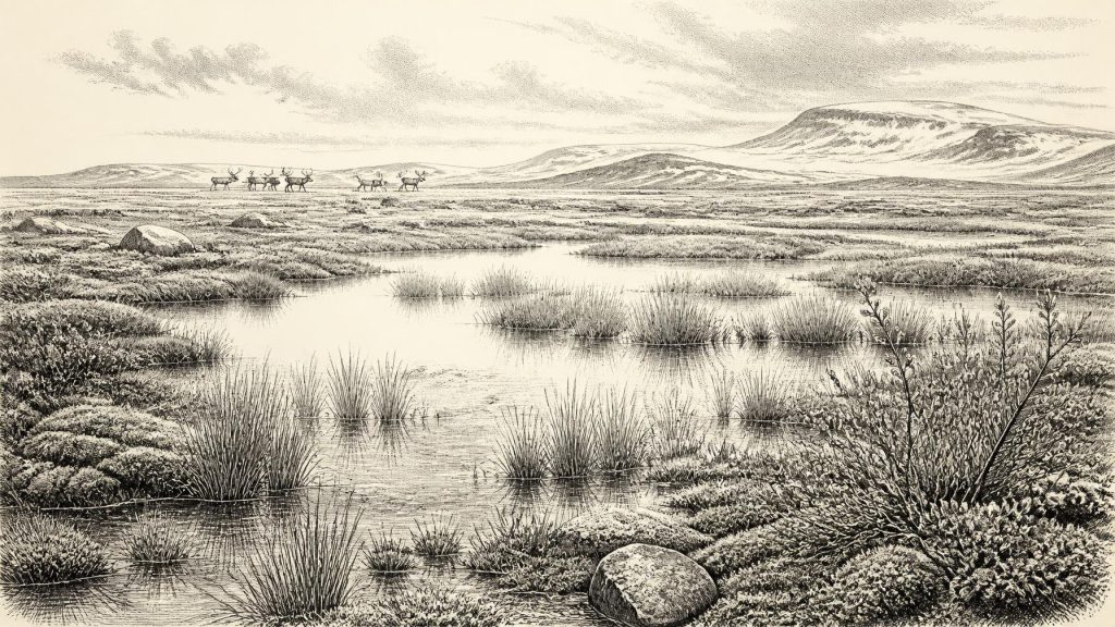
Around 30,700 BCE, Ireland lay within the climatically unstable Midlandian glaciation, although evidence cannot describe a single calendar year. At Derryvree, County Fermanagh, freshwater silts between two glacial tills preserve a wetland interval broadly dated to this period. Pollen, plants, mosses and insects indicate open, treeless tundra with standing water, frost and short growing seasons. Cave remains show varied cold-stage mammals, but do not prove contemporaneous communities. A modified reindeer bone may suggest human presence about 33,000 years ago, yet remains inconclusive. No evidence supports settlements, political societies or customs. Ireland’s record is an environmental history, fragmented by ice advances.
Dateline
The label 30,700 BCE creates an impression of precision that the evidence cannot sustain. No Irish document, settlement sequence or securely dated human biography can be assigned to this calendar year. In archaeological terms, it corresponds roughly to 32,650 calibrated years before present (where “present” is conventionally AD 1950), within the later Pleistocene and the climatically unstable Marine Isotope Stage 3. The responsible history of Ireland at this point is therefore not a year-by-year narrative. It is an account of a changing ice-age landscape, reconstructed from sediments, fossil plants, insects, animal bones, cave deposits and the marks left by glaciers.
The most illuminating Irish evidence comes from sites dated broadly around this era, rather than precisely to it. It shows that parts of the island could, between glacial advances, contain freshwater, tundra vegetation and substantial mammals. It does not show a named people, a polity, a village, a battle or a ritual community. Where interpretation goes beyond the physical record, it must remain explicitly tentative.
A Date Within a Long Cold Age
Thirty thousand seven hundred BCE fell during the Irish Midlandian glaciation, the local name for the last glacial period. This was not one unbroken age of ice. Northern Atlantic climates shifted sharply between colder stadial phases and relatively milder interstadials; glaciers advanced, thinned or withdrew locally, while vegetation and animals responded to changing temperature, moisture and seasonality. The full Last Glacial Maximum, when the British–Irish Ice Sheet reached its greatest late-Pleistocene extent, lay later, broadly after about 26,500 calibrated years before present. Around 30,700 BCE, Ireland was approaching that more severe phase, but its exact ice cover varied by region and remains difficult to reconstruct.
Chronology itself requires care. Radiocarbon laboratories report ages in radiocarbon years, not directly in calendar years. Atmospheric carbon-14 has fluctuated over time, so results must be calibrated against independently dated records. At more than thirty millennia ago, even calibrated dates commonly span centuries or millennia. A modern calendar conversion is useful for orientation, but it does not mean that archaeologists can identify a particular season, generation or event in 30,700 BCE.
The Derryvree Evidence
At Derryvree near Maguiresbridge in County Fermanagh, roadworks in 1969 cut through a drumlin: an elongated hill formed beneath moving glacier ice. The exposure revealed an exceptional sequence. A lower till, deposited by ice, was overlain by freshwater silts and fine sands containing organic remains; above these lay another substantial till sheet from a later glacial advance. The central deposit is therefore a rare surviving interval in which ice had ceased to occupy that locality long enough for a wetland or shallow freshwater body to develop, before ice returned and sealed the evidence.
Organic material from the Derryvree freshwater series, laboratory sample Birm-166, gave a conventional radiocarbon age of 30,500 years before present, with an uncertainty of roughly a millennium either way. Published calibrations place the deposit broadly at approximately 36,900–31,700 calibrated years before present, or about 34,950–29,750 BCE. The requested date lies within that broad range. Yet it would be wrong to say that the wetland was observed in 30,700 BCE, or that every organism in its deposits lived together. The layer accumulated over time, and its date range is much wider than a single year.
What Derryvree does demonstrate is important. Plant pollen, macrofossils, mosses and insect remains point to an open, treeless, frost-influenced environment. The original investigators described tundra vegetation and a periglacial climatic regime: ground affected by repeated freezing and thawing, short growing seasons, exposed terrain and limited woodland. Such conditions were severe, but they were not lifeless. Freshwater and damp ground provided local refuges for plants and invertebrates even in a wider landscape shaped by cold.
Water, Moss and Open Ground
The Derryvree remains support a mosaic rather than a single uniform plain. Aquatic and waterside plants indicate standing or slow-moving fresh water; sedges, mosses and hardy herbs imply wet margins and open soils. Finds cited from the deposit include bogbean, water-milfoil, dwarf willow, mountain avens and other cold-tolerant taxa. These names should not be turned into a photographic reconstruction of the whole island. They show what survived in or near one local basin during the period represented by the sediments. They nevertheless rule out an image of continuous dense forest.
Beyond the wetland, wind, frost and sparse vegetation would have exposed soils and bedrock. Seasonal meltwater may have braided across valleys, while snow cover, frozen ground and sudden thaws influenced drainage. A later ice advance buried this local archive beneath till, preserving it while simultaneously erasing much evidence from the wider surface. That destructive power explains why the Irish record is so uneven: the landscape was repeatedly reworked, and any campsites or organic traces on exposed ground were exceptionally vulnerable to removal.
There was no recognisable Irish coastline in the modern sense. Global sea level was much lower than today because large volumes of water were held in continental ice sheets, while ice loading and changes in sea level altered the form of surrounding shelves and channels. Ireland’s connections with Britain and continental Europe changed through time, but the available evidence does not permit a simple claim that a particular route was open in this one year. Animal and possible human movements depended on shifting ice margins, terrain, water crossings and ecological corridors.
Animals in a Changing Fauna
Irish caves, especially in the south, preserve a striking but complicated mammal record. The Irish Quaternary Fauna Project found that a wide range of mammals reached Ireland between at least about 45,000 and 20,000 years ago. Castlepook Cave near Doneraile in north County Cork has produced remains attributed to mammoth, reindeer, giant deer, brown bear, wolf, Arctic fox, hare and spotted hyaena, among others. The assemblage is evidence that Ireland could support, or at least receive, a cold-stage fauna far richer than the island’s later historic fauna.
It is not, however, a census for 30,700 BCE. Many cave collections were excavated in the nineteenth and early twentieth centuries, often without modern stratigraphic recording. Bones from separate episodes can be mixed by carnivores, water, collapse, excavation and later handling. Direct radiocarbon dates obtained during later research have improved the picture, but they also show that individual animals entered caves at different times. A giant-deer bone from Castlepook has a conventional radiocarbon determination of about 32,060 years before present, while other specimens fall at younger dates. The defensible conclusion is broad: open, cold landscapes in late Pleistocene Ireland could sustain herbivores and predators, not that all listed animals shared one valley at one moment.
Spotted hyaena remains are especially useful as a warning against easy narratives. Caves can be carnivore dens, places where scavenged bones accumulated, or traps and shelters used intermittently by several species. A bone inside a cave tells us that an animal, or part of it, arrived there; it does not automatically identify a hunting ground, migration route or human settlement.
The Human Question
The strongest reason for public interest in this period is a re-examined reindeer femur from Castlepook Cave. Reported in 2021, the bone bears a deep linear modification interpreted as consistent with a broad stone-tool cut mark, and it was reported as dating to around 33,000 years ago. If that interpretation is upheld, it would imply that people reached Ireland during the Upper Palaeolithic far earlier than the formerly accepted terminal-Pleistocene evidence. It would be a major discovery.
Its implications must not be overstated. A modified bone is evidence for a possible act of carcass processing, not proof of a permanent population, named cultural group, camp, family or migration stream. The object comes from an old cave collection, not a modern excavation with an intact occupation floor, hearth, tool assemblage and sequence of dates. Nor does it demonstrate that people were present at Derryvree, or specifically in 30,700 BCE. Until additional securely stratified sites, artefacts or human remains are identified, any account of human life at this date remains provisional.
No Kingdoms, No Recorded Customs
Accordingly, there is no evidence for political affairs, diplomacy, organised warfare, institutions, social rank, language, religion, art or formal learning in Ireland at this time. Neither is there evidence for farming, fields, livestock, metallurgy, long-distance trade networks or permanent built settlements. Those absences are not proof that no person ever crossed the landscape; they are limits of the surviving record.
If occasional Upper Palaeolithic visitors did reach Ireland, their economy would most plausibly have centred on immediate mobility and the use of animal and plant resources, as elsewhere in Ice Age north-west Europe. That is an inference from comparable regions, not a demonstrated Irish way of life. The Irish evidence does not yet permit claims about hunting methods, clothing, boats, kinship, beliefs or exchange. The clearest historical fact is the incompleteness of the archive.
An Environmental History
Ireland around 30,700 BCE is therefore best understood as an environmental history. At Derryvree, a freshwater basin formed between episodes of glaciation and supported a tundra wetland. Across the island, cold-stage animal communities existed during favourable intervals, while advancing ice, frost and unstable drainage repeatedly transformed habitats and destroyed evidence. The later expansion of the British–Irish Ice Sheet would impose still more formidable conditions and break any continuity that may have existed.
The great significance of this date is not an event that happened in a calendar year. It is the reminder that Ireland’s deep past includes intervals of open water beneath a cold sky, dwarf vegetation at wetland margins, large mammals moving through changing ecological corridors, and perhaps brief human visits that remain difficult to prove. The evidence is fragmentary, but it is enough to show that the island’s history began long before its first farms, monuments and written names.
Primary Sources
- A Middle Midlandian Freshwater Series at Derryvree, Maguiresbridge, County Fermanagh, Northern Ireland
- The Irish Quaternary Fauna Project
- Irish Pleistocene Biostratigraphy
- The Timing and Magnitude of the British–Irish Ice Sheet Between Marine Isotope Stages 5d and 2
- Growth and Retreat of the Last British–Irish Ice Sheet, 31,000 to 15,000 Years Ago: The BRITICE-CHRONO Reconstruction
- Timing and Pace of Ice-Sheet Withdrawal Across the Marine–Terrestrial Transition West of Ireland During the Last Glaciation
- Trimlines, Blockfields and the Vertical Extent of the Last Ice Sheet in Southern Ireland
- Dimensions and Chronology of the Last Ice Sheet in Western Ireland
- Deglaciation Chronology of the Donegal Ice Centre, North-West Ireland
- Radiocarbon Constraints on the Age of the Maximum Advance of the British-Irish Ice Sheet in the Celtic Sea
- First Evidence of a Late Upper Palaeolithic Human Presence in Ireland
- New Insights on the Fauna of Ireland’s Younger Dryas and Early Holocene from Alice & Gwendoline Cave
- The IntCal20 Northern Hemisphere Radiocarbon Age Calibration Curve (0–55 cal kBP)
- Composition and Consequences of the IntCal20 Radiocarbon Calibration Curve
- IntCal Publications
- Palaeoecology: Quaternary Studies in Northern Ireland
- Soils of County Waterford
- A New Greenland Ice Core Chronology for the Last Glacial Termination
- A 60,000 Year Greenland Stratigraphic Ice Core Chronology
- New Data for the Last Glacial Maximum in Great Britain and Ireland
- Reindeer Bone Found in Cork Cave Shows Human Activity in Ireland 33,000 Years Ago
- The Antiquity of Man in Ireland
