
Castlepook’s Uncertain Reindeer30701 BCE
Around 30,701 BCE, Ireland’s history is reconstructed from broad archaeological ranges rather than annual events. Derryvree, County Fermanagh, preserves freshwater organic beds dated approximately 36,900–31,700 calibrated years before present, indicating a cold, treeless periglacial wetland with plants, insects and seasonal open water between glacial episodes. Castlepook Cave, County Cork, yielded diverse Ice Age fauna, including mammoth, reindeer, giant deer, hyaena, wolf and Arctic fox, demonstrating wider European connections. A potentially cut-marked reindeer femur may indicate brief human activity, but proves neither settlement nor population. Climatic shifts and expanding ice repeatedly altered habitats, obscuring earlier evidence across Ireland during this period.
Dateline
Modern calendar-year precision is not available for Ireland in 30,701 BCE. The number is a useful modern label, not an anniversary that can be tied to a recorded event, a ruler, a journey or even a particular season. In the archaeological convention that counts years before AD 1950, it lies roughly 32,650 years ago, within the Late Pleistocene and Marine Isotope Stage 3 (MIS 3), a long and climatically unstable part of the last Ice Age. The appropriate history is therefore one of broad calibrated ranges, fossils, buried sediments and carefully limited conclusions.
This point falls within the wide age range of one of Ireland’s most informative deposits of the period: the organic freshwater beds at Derryvree near Maguiresbridge, County Fermanagh. It also lies close to the broad interval represented by Castlepook, or Mammoth Cave, near Doneraile in north County Cork, where an exceptional collection of Ice Age animal remains has been recovered. Neither place supplies a chronicle for a single year. Together, however, they show that parts of Ireland supported changing cold-climate ecosystems before the last great expansion of the British–Irish Ice Sheet.
A Date Within a Range
At Derryvree, roadworks in 1969 cut through a drumlin and revealed a remarkable sequence: a thick glacial till, then freshwater silts and fine sands containing organic material, followed by another thick till. Till is the unsorted mixture of rock and sediment deposited directly by glacier ice. The sequence establishes an important order of events: ice had affected the area; a period followed in which water, plants and sediment accumulated; and ice later returned or expanded over the site. It does not identify an exact year for any of those changes.
The organic layer produced radiocarbon determination BIRM-166, conventionally dated to 30,500 radiocarbon years before present, with a substantial uncertainty of +1,170 and −1,030 years. Radiocarbon years are not identical to calendar years, because atmospheric carbon-14 has varied through time. Calibration converts the result into a probability range rather than a date of annual precision. Published interpretations place the Derryvree deposit broadly between about 36,900 and 31,700 calibrated years before present. The modern label 30,701 BCE sits within that span, but the deposit formed over a prolonged interval and cannot tell us what happened on that nominal date.
Wet Ground Between Glaciers
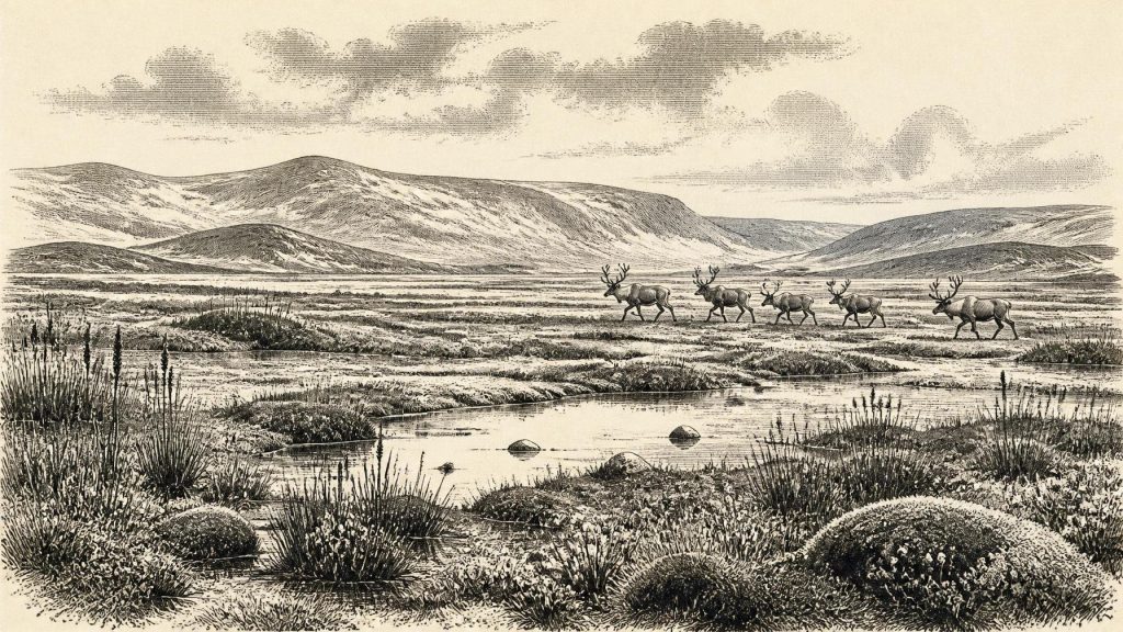
The plants and insects preserved at Derryvree provide the clearest Irish evidence for everyday environmental conditions close to this period. The assemblage has been interpreted as a cold, treeless, periglacial wetland: a landscape affected by severe freezing, thawing and short growing seasons, rather than the wooded island of later prehistory. Mosses, sedges and aquatic or waterside plants indicate shallow pools, wet hollows and slow-moving or standing freshwater. Finds including bogbean and water-milfoil show that liquid water persisted locally during at least part of the year; mountain-avens and lesser clubmoss point towards exposed, cold ground.
“Tundra” should not be mistaken for lifelessness. Derryvree preserved a functioning, though exacting, wetland community. Plants rooted in saturated sediment, insects occupied aquatic and terrestrial niches, and decaying organic matter accumulated in a basin sheltered long enough from ice to become an archive. The evidence is local, not a map of the entire island. It cannot establish whether every Irish valley was ice-free at once, nor whether a particular species was present throughout the year. Yet it decisively challenges any picture of an Ireland that was simply a uniform sheet of ice at all times during MIS 3.
On the wider North Atlantic scale, Greenland ice cores record abrupt oscillations between colder stadials and relatively milder interstadials during this part of the last glacial period. Ireland’s surviving terrestrial record is too fragmentary to match every one of those shifts precisely. Nonetheless, the Derryvree sequence is entirely consistent with a world in which changes in temperature, moisture, ice margins and drainage repeatedly transformed habitats over centuries and millennia. The major political force, in the loose sense of a power reshaping the land, was climate: advancing and retreating ice, changing watercourses and shifting vegetation.
Animals at Mammoth Cave
Castlepook Cave offers a different kind of evidence. Its deposits, excavated largely in the early twentieth century and supplemented by later work, have yielded Ireland’s richest important collection of pre-Last Glacial Maximum mammal remains. The recorded fauna includes woolly mammoth, reindeer, giant deer, brown bear, wolf, Arctic fox, lemmings and spotted hyaena. The National Museum of Ireland holds a notable spotted-hyaena skull from the cave. These animals demonstrate that southern Ireland was reached, at intervals, by a much more varied cold-stage fauna than survives on the island today.
The cave was not a neatly sealed snapshot of one day’s ecosystem. Bones may have accumulated through natural deaths, carnivore denning and scavenging, water movement, sediment disturbance and the excavation methods of a period before modern recording standards. Direct redating has also shown that some older Irish cave radiocarbon determinations understated the true antiquity of specimens. It would therefore be wrong to assemble every species recovered at Castlepook into one imagined herd outside the cave in 30,701 BCE. The sounder conclusion is that the broader landscape could, at different times, sustain or be traversed by large herbivores, predators and scavengers adapted to open, cold environments.
Reindeer are especially significant because they fit a landscape of open ground and seasonal movement. Mammoths and giant deer imply sufficient grazing and browsing resources across wider areas; hyaenas and wolves show that carcasses and prey also supported a formidable carnivore guild. Caves can over-represent predators, which favour protected dens and may carry bones inside. Even so, Castlepook is strong evidence that Ireland lay within wider north-west European faunal connections, rather than beyond the reach of Ice Age mammals.
The Mark on a Reindeer Bone
The most intriguing, and most uncertain, human question concerns a Castlepook reindeer femur. Palaeozoologist Ruth Carden identified a mark on the bone as one potentially made by a sharp stone tool during butchery. County Cork heritage publications have presented the animal as dating broadly to around 30,000 BCE. If the mark is confirmed as a human cut mark, it would be the closest known indication that people handled an animal in Ireland around this general period, vastly earlier than the long-established evidence for post-glacial settlement.
That possibility must not be expanded into a lost Irish society. The femur comes from an old cave collection, not from a securely excavated occupation floor. No associated stone-tool assemblage, hearth, dwelling, burial, human remains, artwork or substantial spread of butchered food waste of comparable age has been demonstrated in Ireland. A single altered bone cannot reveal whether a visitor killed the reindeer, processed a carcass brought in by others, stayed for hours or weeks, travelled with a family group or returned in later seasons. It certainly cannot identify a language, ancestry, named archaeological culture or permanent population.
A brief visit by mobile Upper Palaeolithic hunters is a reasonable hypothesis, especially given the animal movements indicated by the cave fauna and the wider European context. It remains an inference rather than a proven settlement history. The secure evidence is a reindeer bone, its broad date and a proposed human modification. This distinction matters because later glacier advance probably eroded, buried or reworked many older landscapes where camps and tools might otherwise have survived.
No Polities, No Proven Trade
There is no evidence from which to narrate political affairs, diplomacy, organised warfare or formal institutions in Ireland at this depth of time. Nor can archaeology responsibly describe an Irish religion, artistic tradition, educational system or social hierarchy for 30,701 BCE. These are not gaps to be filled by romantic images of “tribes”. If people reached the island, they would have possessed social relationships, knowledge and beliefs; but none can presently be recovered from the Irish evidence.
Likewise, no cultivated field, domestic animal, pottery vessel, metal object, house, grave, shrine, monument or traded import can be assigned to this date. There is no basis for claiming a maritime trade network, even though lower global sea levels altered coastlines and the surrounding shelf. Lower seas do not automatically mean that a simple, permanent land bridge connected Ireland to Britain, and the routes used by animals or any people remain unresolved. The economy visible in the record is ecological: plants growing in wet ground, herbivores moving through open country, carnivores using caves and ice repeatedly changing what land was habitable.
An Environmental Frontier
The most important development around this notional year was not a human event but Ireland’s position at an environmental frontier. Derryvree records a locally ice-free freshwater landscape during a broad cold interval; Castlepook records mammals moving through, or living within reach of, southern Ireland. In later millennia the last British–Irish Ice Sheet expanded to a far greater extent, reshaping the land and making the early archaeological record exceptionally difficult to recover.
For that reason, 30,701 BCE should be understood as a window rather than a date of certainty. Its Ireland was cold, open and regionally variable: wetland plants and insects in Fermanagh, large mammals and carnivores in Cork, and ice conditions that changed on timescales far beyond a human calendar. The possible cut-marked reindeer bone adds a compelling question about early visitors. It does not yet supply a population, a settlement or a story of continuous occupation. What survives is more fragmentary, but no less remarkable: a small body of evidence for life on Europe’s far western edge before ice again transformed the island.
Primary Sources
- A Middle Midlandian Freshwater Series at Derryvree, Maguiresbridge, County Fermanagh, Northern Ireland
- A Reconsideration of the Radiocarbon Dating of the Marine Isotope Stage 3 Fauna from Southern Ireland
- First Evidence of a Late Upper Palaeolithic Human Presence in Ireland
- New Insights on the Fauna of Ireland's Younger Dryas and Early Holocene from Alice & Gwendoline Cave
- Spotted Hyena Skull
- Castlepook Caves
- Heritage Artefacts of County Cork
- Archaeological Heritage of County Cork
- Castlepook Cave, Co. Cork, 2022 Excavation Report
- Introduction to the Late Quaternary and Holocene of Northern Ireland
- Irish Quaternary Association Guide 16: Fermanagh and Tyrone
- The Timing and Magnitude of the British–Irish Ice Sheet Between Marine Isotope Stages 5d and 2
- Growth and Retreat of the Last British–Irish Ice Sheet, 31,000 to 15,000 Years Ago: the BRITICE-CHRONO Reconstruction
- BRITICE-CHRONO Maps and GIS Data of the Last British-Irish Ice Sheet 31 to 15 ka
- Trimlines, Blockfields and the Vertical Extent of the Last Ice Sheet in Southern Ireland
- Dimensions and Chronology of the Last Ice Sheet in Western Ireland
- Oscillating Retreat of the Last British-Irish Ice Sheet on the Continental Shelf Offshore Galway Bay, Western Ireland
- Radiocarbon Constraints on the Age of the Maximum Advance of the British-Irish Ice Sheet in the Celtic Sea
- A Stratigraphic Framework for Abrupt Climatic Changes During the Last Glacial Period Based on Three Synchronized Greenland Ice-Core Records
- The IntCal20 Northern Hemisphere Radiocarbon Age Calibration Curve (0–55 cal kBP)
- Pleistocene Vertebrates in the British Isles
- Exhibition Galleries: National Museum of Ireland – Natural History
