
Derryvree’s Moss-Rich Interval30617 BCE
Thirty thousand six hundred and seventeen BCE cannot identify a recoverable Irish year, but falls within a broadly dated Late Pleistocene interval represented at Derryvree, County Fermanagh. There, freshwater silts and organic muds between glacial tills show that an ice-free hollow supported tundra-like wetland vegetation, insects and shallow water before renewed glaciation. The deposit’s wide calibrated range precludes precise reconstruction. Elsewhere, changing ice, sea levels and routes created shifting habitats. Southern cave faunas demonstrate that cold-adapted mammals reached Ireland. A marked reindeer bone may suggest human carcass processing, but proves neither settlement nor population. Evidence records environmental change, not societies
Dateline
The label 30,617 BCE is useful for ordering a modern timeline, but it cannot identify a recoverable year in Ireland’s deep past. No calendar, written testimony, annual settlement layer or dated human event survives from this period. In the archaeological convention of “before present”, with present fixed at AD 1950, it falls roughly 32,566 calendar years ago: within the Late Pleistocene, Marine Isotope Stage 3, and a profoundly unstable phase of the last Ice Age. The responsible history of Ireland at this point is therefore a history of sediments, fossils, ice and uncertainty—not of rulers, wars or anniversaries.
The best evidence is regional and ranges across millennia. A nominal date of 30,617 BCE lies within the broad calibrated age span assigned to a remarkable freshwater deposit at Derryvree, near Maguiresbridge in County Fermanagh. It does not prove that every feature described below existed in that precise year. Rather, it allows the Derryvree evidence to illuminate the kind of landscape that occurred in this part of Ireland during the wider interval.
Dating an Interval, Not a Day
Derryvree was exposed by roadworks in 1969, when a cutting passed through a drumlin: an elongated hill shaped from glacial sediment. Investigators found silts, fine sands and organic muds sandwiched between two thick layers of till, the unsorted debris left by glacier ice. The sequence is unusually eloquent. Ice had previously occupied the site; then water and vegetation accumulated in an ice-free hollow; later, advancing ice buried the deposit beneath a second till.
Organic material from the freshwater beds produced the conventional radiocarbon determination BIRM-166: 30,500 radiocarbon years before present, with a substantial laboratory uncertainty of +1,170 and −1,030 years. Radiocarbon years are not calendar years. Atmospheric carbon-14 has varied over time, so measurements must be calibrated against independently dated records. Published discussion has placed the Derryvree determination broadly at about 36,900–31,700 calibrated years before present, approximately 34,950–29,750 BCE. Later Bayesian modelling similarly treats it as evidence of an Irish ice-free phase before the major growth of the last ice sheet, while warning that it is an old measurement with wide uncertainty.
That large range is not a defect to be concealed; it is the central fact of the evidence. The nominal year 30,617 BCE falls within it, but cannot be assigned to a particular season, shoreline or plant community at Derryvree. Nor should a single Fermanagh basin be made to stand for the whole island. What the deposit securely demonstrates is more modest and more valuable: for a period during this part of the last glacial cycle, northern Ireland contained ground free of glacier ice long enough for freshwater sediment, plants and insects to accumulate.
A Cold Freshwater Landscape
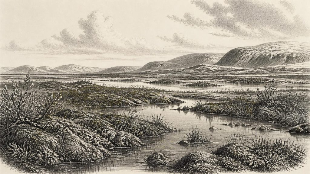
The Derryvree flora and fauna point to open tundra vegetation and a periglacial regime. “Periglacial” means a landscape strongly governed by freezing, thawing and frost action, often near an ice margin but not necessarily beneath a glacier. It was not the wooded, wet Ireland familiar today. Trees did not form a closed forest around the basin. Instead, low vegetation, wet ground and shallow freshwater created a patchwork in which mosses, sedges, grasses, herbs and dwarf shrubs could persist.
Plant remains from the beds include dwarf willow and bogbean or buckbean, while fossil pollen and other botanical evidence include water-milfoil. These are not a licence to reconstruct a modern pond or peatland in exact detail. Preservation is selective; pollen may travel; and a fossil species tells us that an organism was present within the catchment or nearby, not the precise abundance of every plant. Yet taken together, the remains strongly support a mosaic of saturated ground, mossy surfaces, sedge margins and pools or slow water. Earlier investigators compared the setting to muskeg, a useful but imperfect analogy for cold, waterlogged terrain rich in mosses and organic matter.
This was a harsh environment, but not an empty one. Insect remains and the plant assemblage indicate cold-adapted ecological communities. Seasonal contrasts probably mattered greatly. Short growing seasons allowed vegetation to flower and reproduce; winter frost, snow cover and frozen ground restricted water movement and reshaped exposed soils. The fresh water at Derryvree is particularly important because it records a local refuge from blanket ice, even while the wider North Atlantic world remained cold and prone to abrupt climatic swings.
Ice, Water and a Changing Island
Ireland’s last glacial history was not a simple march from cold to colder conditions. The British–Irish Ice Sheet waxed and waned, with different sectors advancing and retreating at different times. Marine evidence from the western Irish shelf indicates considerable ice loading and changing relative sea levels before the Last Glacial Maximum. Other studies suggest that parts of western and north-central Ireland were ice-free during intervals before the main late-glacial build-up. These findings explain why apparently conflicting observations—organic wetlands beneath tills in Fermanagh, marine deposits along the west coast, and glacially modified uplands elsewhere—need not describe the same moment.
By the eventual Last Glacial Maximum, conventionally placed around 27,000–23,000 calibrated years ago in Ireland and its offshore shelf, ice expanded much farther and transformed much of the landscape. Derryvree predates that culminating phase. Its lower and upper tills show that the site itself experienced more than one episode of glaciation, but they cannot establish the exact thickness, direction or duration of ice across every Irish county at 30,617 BCE.
Sea level was substantially lower globally than today because enormous quantities of water were locked in continental ice sheets. The outlines of Ireland and its surrounding shelves therefore differed markedly from modern coastlines. Lower sea level may have reduced some sea crossings and altered routes through the Irish Sea basin, but it does not follow that Ireland was continuously joined to Britain or continental Europe by a simple, dry land bridge at this particular date. Ice, proglacial lakes, rivers, sea channels and terrain all changed through time. Movement by animals or people must be considered within that complicated and shifting geography.
Animals and the Cave Record
Southern Ireland’s cave deposits show that Ice Age animals reached the island during broader Marine Isotope Stage 3 intervals. Castlepook Cave near Doneraile, County Cork, has yielded remains attributed to mammoth, reindeer, giant deer, brown bear, wolf, spotted hyaena, Arctic fox and small cold-adapted mammals, including lemmings. These remains do not establish that every species lived beside the Derryvree wetland at the same time. Cave deposits commonly combine material accumulated over long spans through animal deaths, carnivore activity, water movement and older excavation practices. They nevertheless demonstrate that Ireland could support, at favourable times, a varied cold-stage fauna associated with open habitats.
Large herbivores imply forage over wide areas; carnivores and scavengers imply predation, competition and carcass use. Such evidence suggests mobile ecological networks, not settled pastoral landscapes. Reindeer in particular evoke seasonal movement across open country, but no Irish trackway, kill site or herd route can be securely tied to this nominal year. The correct picture is one of possible animal corridors and changing habitats, rather than a fixed parade of Ice Age beasts.
People: Possibility Without a Proven Settlement
The question of people requires still greater restraint. A reindeer femur from Castlepook has been reported as roughly 33,000 years old and bears a deep mark interpreted as consistent with cutting or chopping by a sharp stone tool. If that interpretation is upheld, it may indicate that one or more people processed a reindeer carcass in Ireland during this broad period. It is a significant possibility, especially because it challenges older assumptions that the island had no human visitors before the end of the Ice Age.
It is not, however, proof of a population living in Ireland in 30,617 BCE. The specimen lacks a securely associated hearth, stone-tool assemblage, dwelling floor, burial or undisturbed occupation surface. Its cave context was disturbed by both natural processes and early collecting. The animal’s date does not automatically date any surface modification, and one marked bone cannot reveal population size, language, ancestry or the permanence of a visit. Ireland has no demonstrated village, camp, art site or cemetery from this exact horizon.
Accordingly, there is no evidence for political institutions, chiefs, diplomacy, organised warfare, formal religion, trade systems or learned traditions in Ireland at this date. Nor is there evidence for farming, livestock, fields, permanent houses, pottery or monuments. Upper Palaeolithic communities elsewhere in Europe possessed sophisticated technologies and symbolic practices, but analogy is not evidence. Those achievements show what contemporaries on the continent could do; they cannot be transferred uncritically to a sparsely documented Irish landscape.
What Can Responsibly Be Said
Around the broad period represented by 30,617 BCE, parts of Ireland were not permanently smothered beneath the ice that would later reach its Last Glacial Maximum extent. At Derryvree in Fermanagh, an ice-free freshwater hollow supported a cold, open, tundra-like wetland before later glaciation sealed its record below till. Across the island, habitats and access routes altered repeatedly with climate and moving ice. Cave faunas show that substantial mammals entered southern Ireland during comparable cold-stage intervals, while a single marked reindeer bone keeps open—without settling—the question of very early human visits.
This is Ireland before its known societies, but not before history in the widest sense. The moss-rich mud at Derryvree preserves the environmental preconditions from which later Irish landscapes would eventually emerge: water collecting in hollows, plants colonising exposed ground, animals moving through temporary corridors, and ice repeatedly remaking the land. Its lesson is not a lost event of 30,617 BCE. It is the scale of time required to understand the island at all.
Primary Sources
- A Middle Midlandian Freshwater Series at Derryvree, Maguiresbridge, County Fermanagh, Northern Ireland
- Exploring Controls of the Early and Stepped Deglaciation on the Western Margin of the British-Irish Ice Sheet
- Radiocarbon Constraints on the History of the Western Irish Ice Sheet Prior to the Last Glacial Maximum
- Trimlines, Blockfields and the Vertical Extent of the Last Ice Sheet in Southern Ireland
- Dimensions and Chronology of the Last Ice Sheet in Western Ireland
- Last Glacial Maximum Cirque Glaciation in Ireland and Implications for Reconstructions of the Irish Ice Sheet
- Late Pleistocene Chronostratigraphy and Ice Sheet Limits, Southern Ireland
- Timing and Pace of Ice-Sheet Withdrawal Across the Marine–Terrestrial Transition West of Ireland During the Last Glaciation
- Early Deglaciation of the British-Irish Ice Sheet on the Atlantic Shelf Northwest of Ireland Driven by Glacioisostatic Depression and High Relative Sea Level
- Stratigraphic and Palaeo-Geomorphological Evidence for the Glacial-Deglacial History of the Last British-Irish Ice Sheet in the North-Western Irish Sea
- Pattern and Timing of Retreat of the Last British-Irish Ice Sheet
- New Data for the Last Glacial Maximum in Great Britain and Ireland
- Ireland: Submerged Prehistoric Sites and Landscapes
- The Colonization of Ireland: A Human Ecology Perspective
- The Irish Quaternary Fauna Project
- Palaeolithic Ireland – New Evidence Emerges from the Emerald Isle
- The IntCal20 Northern Hemisphere Radiocarbon Age Calibration Curve (0–55 cal kBP)
- A Stratigraphic Framework for Abrupt Climatic Changes During the Last Glacial Period Based on Three Synchronized Greenland Ice-Core Records: Refining and Extending the INTIMATE Event Stratigraphy
- The Greenland Ice Core Chronology 2005, 15–42 ka: Part 1, Constructing the Time Scale
- Figure 6—The Subdivision of the Quaternary Period in Ireland
- Myriophyllum alterniflorum DC.
- Menyanthes trifoliata L.
- Salix herbacea L.
- New Insights on the Fauna of Ireland's Younger Dryas and Early Holocene from Alice & Gwendoline Cave