The Derryvree Sedge Archive30630 BCE
Around 30,630 BCE, Ireland’s history is reconstructed from uncertain Ice Age evidence rather than annual records. Derryvree, County Fermanagh, preserves freshwater sediments between glacial tills, indicating a cold, treeless wetland with sedges, mosses, aquatic plants and locally habitable ground during an ice-free interval. The climate and British–Irish Ice Sheet remained highly unstable, while low sea levels did not guarantee a land bridge. Castlepook Cave’s diverse mammal remains demonstrate intermittent Late Pleistocene animal presence. A possibly tool-marked reindeer bone suggests early human activity, but proves neither settlement nor population. Later glaciation destroyed or buried evidence, leaving environmental change as clearest record.
Dateline
Modern calendar-year precision is not available for Ireland around 30,630 BCE. Nobody on the island recorded a date, and the surviving evidence consists of sediments, fossil plants, animal bone and landforms whose ages carry margins of error. The label corresponds to roughly 32,580 calendar years before AD 1950, placing it in the Late Pleistocene, within Marine Isotope Stage 3. It is best understood not as a recoverable Irish ‘year’, but as a point within a rapidly changing Ice Age interval. On Greenland ice-core chronologies it lies close to the onset of Greenland Interstadial 5, a brief northern warming episode; that provides climatic context, not proof that Ireland changed on the same day or in the same way.
A Record Beneath Two Tills
The closest Irish environmental archive for this broad part of the Ice Age lies at Derryvree, near Maguiresbridge in County Fermanagh. Road works in 1969 cut through a drumlin and exposed freshwater silts and fine sands trapped between two thick sheets of till: debris laid down by separate advances of glacier ice. The sequence is unusually eloquent. It establishes that ice had occupied the site, that an interval followed in which open freshwater and wet ground developed, and that later ice overrode and sealed the deposit. It is not an annual diary, but it is direct evidence that parts of Ireland could become ice-free between glacial advances.
A conventional radiocarbon determination from the Derryvree organic material, BIRM-166, was 30,500 radiocarbon years BP, with a substantial uncertainty of +1,170/−1,030 years. Such a result cannot simply be converted into an exact BCE date: radiocarbon years and calendar years differ, and calibration at this depth of time produces broad probability ranges rather than a single answer. The deposit should therefore be used as a nearby Middle Midlandian environmental horizon, not asserted to be the precise landscape of 30,630 BCE. Its importance is that it preserves the kind of cold, non-glacial terrain that existed in Ireland before the fullest expansion of the last British–Irish Ice Sheet.
Water, Moss and Open Ground
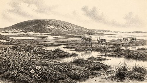
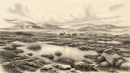
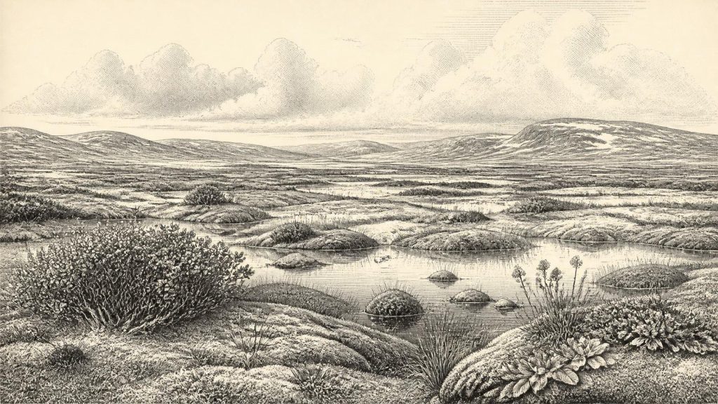
Derryvree was no forested landscape. Pollen, plant macrofossils and insect evidence point to a treeless, periglacial wetland or muskeg: a mosaic of shallow water, sedgy margins, mosses and exposed mineral ground under severe seasonal conditions. Fossils include plants associated with cold, open habitats and freshwater, among them dwarf willow, mountain avens, bogbean and water-milfoil. Their presence demonstrates local habitats rather than a uniformly bleak plain. Pools or slow water supported aquatic vegetation; mossy, organic ground lay around them; low shrubs and herbs endured where conditions allowed.
This evidence must nevertheless be kept at its proper scale. A fossil seed or pollen grain records that a plant grew within the catchment or reached the deposit; it does not map every hillside, prove a continuous plant cover, or establish the weather in a particular season. The image of a ‘tundra’ is useful if it conveys an open, cold and largely treeless environment, but misleading if it suggests that every district resembled a modern Arctic landscape. Ireland’s relief, drainage, soil and proximity to the Atlantic would have created local contrasts. Derryvree illuminates Fermanagh especially, not the whole island in equal detail.
A Volatile Ice-Age Island
The wider setting was one of climatic instability. The British–Irish Ice Sheet did not simply grow smoothly to a single maximum and then retreat. Its margins and internal sectors advanced, stagnated and withdrew at different times. Modern reconstructions place the later maximum extent of the ice sheet broadly between about 30,000 and 22,000 years ago, depending on region, with Ireland and its continental shelf extensively ice-covered at the height of the Last Glacial Maximum. Around the date considered here, that fuller glaciation was impending or developing rather than a settled, island-wide condition that can be represented by one map.
Sea level was far lower than today because so much water was stored in global ice sheets, yet low sea level alone does not demonstrate an easy land route into Ireland. The former Irish Sea basin had its own complex bathymetry, glacial loading and changing water levels. Research on Irish insularity has repeatedly cautioned against imagining a simple, enduring land bridge to Britain. For people or animals, movement may have involved exposed coastal plains, ice margins, temporary routes and sea crossings whose viability changed through time. The fossil record proves that mammals reached Ireland intermittently; it does not reconstruct the route taken by every herd or traveller.
Castlepook’s Animal World
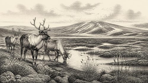
County Cork provides the principal faunal complement to the Fermanagh wetland. Castlepook Cave, near Doneraile and also known as Mammoth Cave, has yielded Ireland’s richest assemblage of Pleistocene vertebrates. Its recorded fauna includes woolly mammoth, reindeer, giant deer, brown bear, wolf, foxes, mountain hare, lemmings and spotted hyaena. Together these finds show that, during the wider Late Pleistocene interval, southern Ireland supported or received a much more varied cold-country mammal community than survives today.
That list should not be turned into a single tableau dated to 30,630 BCE. Cave deposits accumulated over long periods through animal deaths, carnivore activity, water movement, sediment disturbance and early excavation. Individual bones have their own dates, and species may have used the area centuries or millennia apart. A hyena tooth-marked bone can indicate scavenging or feeding; a mammoth bone establishes that mammoths occurred in the wider Irish record; neither alone proves a stable local population, a particular herd size or a shared moment with every other species. The evidence supports ecological possibility and repeated animal presence, not a cinematic census.
The Human Question
Castlepook also raises the most consequential question about people. A reindeer femur from the cave has been publicised as carrying a deep mark made on fresh bone by a sharp stone tool and as dating to around 33,000 years ago. If the identification of the mark as human butchery is sustained, it would be exceptionally early evidence of human handling of an animal in Ireland. It would imply a brief Upper Palaeolithic encounter with the island far earlier than the long-recognised post-glacial settlement record.
But it cannot responsibly be enlarged into a population history. The bone is not part of a securely sealed campsite with associated flint tools, hearths, dwelling remains, human burials or repeated food debris. Its date is the age of the animal bone, while the diagnosis of a surface incision requires separate taphonomic judgement. Nor does the find establish whether people killed the reindeer, processed a carcass scavenged from predators, stayed in the cave, travelled with families, or returned. At 30,630 BCE specifically, no Irish settlement, person, tool industry or human group can be securely identified.
What Cannot Be Recovered
For that reason, political affairs, diplomacy, warfare, named leaders and territorial boundaries are beyond the evidence. There are no towns, farms, fields, roads, monuments, writing or durable institutions from Ireland that can be assigned to this time. Nor is there evidence for Irish trade networks, exchange goods or a regular maritime economy. A mobile hunter-gatherer visit, if one occurred, would have involved knowledge, cooperation and practical skill; yet the nature of any group’s social organisation remains unknown. Comparisons with Upper Palaeolithic communities in Britain or continental Europe may suggest possibilities, but they cannot be substituted for Irish finds.
The same restraint applies to religion, culture and learning. No Irish shrine, grave, figurative art, musical instrument or ritual deposit belongs securely to this date. It is reasonable to recognise that Ice Age people elsewhere possessed complex traditions and technical knowledge, but it is not evidence that a particular belief, ceremony or image existed in Ireland. The environmental record does, however, preserve a different kind of history: one of plants surviving near ice, freshwater gathering in a drumlin basin, large mammals moving through changing habitats, and later glaciers erasing or burying much of what had gone before.
Thus the most important Irish development around 30,630 BCE was environmental rather than political. Ireland stood within a fluctuating north-west European Ice Age world. Derryvree’s freshwater sediments show that cold, open and locally habitable ground existed between ice advances; Castlepook’s fauna confirms that sizeable mammals reached the island during the wider period; the marked reindeer bone offers a striking but still limited possibility of human activity. The archive is fragmentary precisely because subsequent ice repeatedly reshaped the land. Its silences are part of the history—and a reason to distinguish carefully between what the evidence demonstrates and what it merely invites us to imagine.
Primary Sources
- A Middle Midlandian Freshwater Series at Derryvree, Maguiresbridge, County Fermanagh, Northern Ireland
- Irish Pleistocene Biostratigraphy
- Quaternary Deposits and Glacial Stratigraphy in Ireland
- The Irish Quaternary Fauna Project
- Castlepook Cave, County Cork: County Geological Site Report
- Castlepook Cave, Doneraile, County Cork, Excavation Report 2022
- Heritage Artefacts of County Cork
- Growth and Retreat of the Last British–Irish Ice Sheet, 31,000 to 15,000 Years Ago: the BRITICE-CHRONO Reconstruction
- Pattern and Timing of Retreat of the Last British-Irish Ice Sheet
- Dimensions and Chronology of the Last Ice Sheet in Western Ireland
- Exploring Controls of the Early and Stepped Deglaciation on the Western Margin of the British Irish Ice Sheet
- Ireland: Submerged Prehistoric Sites and Landscapes
- Land-Bridge, Relative Sea-Level Change, Glacial Rebound Modelling and Palaeogeography
- The Problem of a Late Quaternary Landbridge Between Britain and Ireland
- The IntCal20 Northern Hemisphere Radiocarbon Age Calibration Curve (0–55 cal kBP)
- Independent Tephrochronological Evidence for Rapid and Synchronous Oceanic and Atmospheric Temperature Rises Over the Greenland Stadial-Interstadial Transitions Between ca. 32 and 40 ka b2k
- Menyanthes trifoliata
- Salix herbacea
- Dryas octopetala
- Myriophyllum alterniflorum
- New Insights on the Fauna of Ireland’s Younger Dryas and Early Holocene from Alice & Gwendoline Cave