

Derryvree’s Ice-Free Wetland30343 BCE
Around 30,343 BCE, Ireland lay within the climatically unstable Late Pleistocene, although no specific calendar-year history can be recovered. At Derryvree, County Fermanagh, organic freshwater sediments between glacial tills demonstrate a local ice-free interval, preserving evidence of open, periglacial wetland with sedges, mosses, shallow pools and cold-adapted insects. This does not show that all Ireland was ice-free. Pre-Last Glacial Maximum cave deposits, especially Castlepook, indicate diverse fauna including mammoth, reindeer, giant deer and predators. A possibly butchered reindeer bone suggests an unconfirmed early human visit, but no secure settlement exists. Environmental reconstruction, constrained by uncertain dating, remains the principal evidence.
Dateline
The label 30,343 BCE gives a useful place in a modern timeline, but it must not be mistaken for a recoverable Irish calendar year. There are no written records, annual chronicles, named peoples or securely dated events for Ireland at this depth in time. In conventional archaeological terms it falls about 32,300 years before AD 1950, within the Late Pleistocene and Marine Isotope Stage 3 (MIS 3), a long and climatically unstable phase of the last Ice Age. The responsible history of Ireland at this point is therefore a history of ranges, deposits and probabilities rather than of a particular day, season or generation.
The closest important Irish evidence is not a settlement but a buried freshwater deposit at Derryvree, near Maguiresbridge in County Fermanagh. Organic silts and fine sands there produced a conventional radiocarbon age of 30,500 +1,170/−1,030 BP. Modern calibration does not turn that result into a single calendar date: it places the deposit broadly in the later 30,000s to earlier 30,000s calibrated years before present. That wide interval overlaps the chronological horizon represented by 30,343 BCE, but cannot establish conditions in that numbered year itself. It does, however, illuminate the sort of cold, changeable Irish landscape that existed during part of this pre-Last Glacial Maximum world.
A Freshwater Interval Between Glaciers
Derryvree was exposed during road works in 1969, when a cut through a drumlin revealed an exceptional sequence. A freshwater bed of silts, fine sand and organic matter lay between two thick sheets of till, the stony, unsorted sediment left directly by glacier ice. Its position matters as much as its fossils. Ice had previously crossed the locality; subsequently, water and wet ground persisted long enough to accumulate sediment and preserve biological remains; later, glacier ice advanced again and sealed the archive beneath the developing drumlin.
This is firm evidence for an ice-free interval at one south-Fermanagh site, not proof that all Ireland was simultaneously free of ice. The size and configuration of ice cover changed across the island and its continental shelf, while later glaciation eroded or buried much earlier evidence. Yet Derryvree decisively demonstrates that Ireland’s last glacial cycle was not one unbroken period of universal ice cover. At some time within the dated range, fresh water occupied a local basin in an exposed, severe but living landscape.
At 30,343 BCE, Ireland was still several millennia before the fullest development of the Last Glacial Maximum, conventionally placed broadly between about 26,000 and 19,000 years ago. Recent reconstruction of the British–Irish Ice Sheet also stresses that advance, maximum extent and retreat were asynchronous: different marine and terrestrial sectors behaved differently. It is consequently misleading to picture the island as either wholly frozen or uniformly habitable at this earlier date. The sounder picture is regional instability, with glacier margins, periglacial terrain, meltwater and available animal habitat changing over long spans.
Mosses, Pools and Open Ground
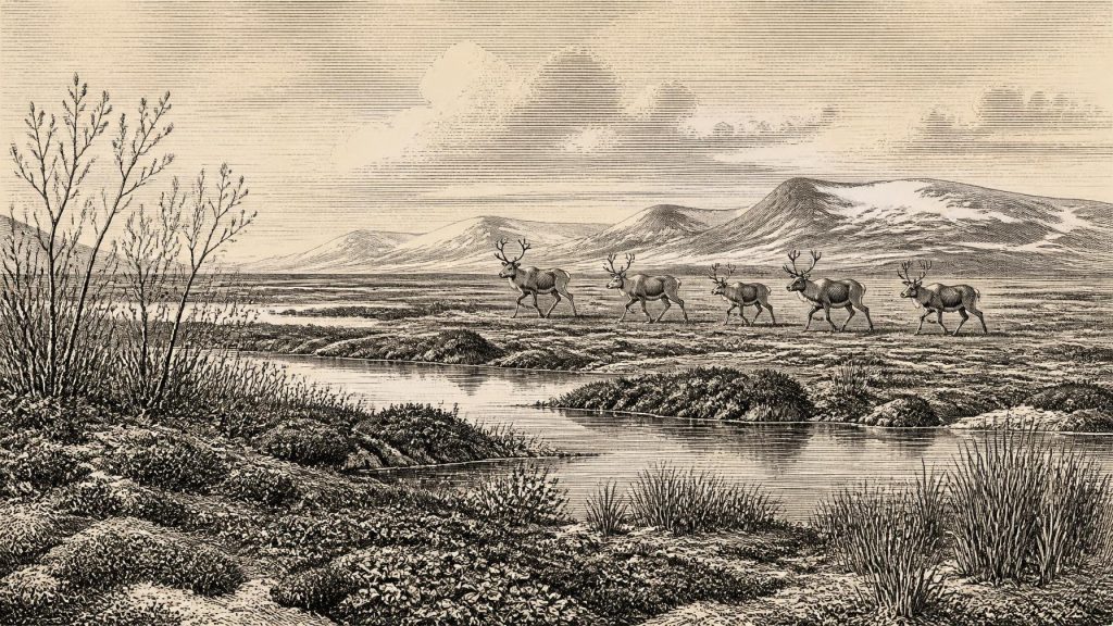
Derryvree’s plant and insect evidence supplies the clearest impression of everyday ecology. Pollen was poorly preserved, but plant macrofossils, spores and moss remains point towards largely open, treeless ground. Sedges and grasses belonged beside wet hollows; bogbean, or Menyanthes trifoliata, indicates freshwater or marshy margins; aquatic water-milfoil indicates shallow pools. Dwarf willow, mountain avens, clubmosses and hardy herbs suggest patches of cold-tolerant vegetation on better-drained ground. Mosses were abundant. The assemblage is best understood as a mosaic rather than a single unbroken tundra carpet: shallow water, sedgy margins, mossy wet ground and sparsely vegetated mineral soils existed close together.
That landscape was periglacial. Frost, thaw, snow cover, strong seasonal contrasts and limited plant cover shaped its soils. Fossil insects have northern and cold-climate affinities, while one species has more steppe-associated preferences. Together they support an interpretation of harsh winters, brief productive summers and open country rather than woodland. They do not provide a thermometer for 30,343 BCE, nor do they prove that every valley had the same vegetation. The evidence records local habitat and a broad climatic regime, not a precise annual weather report.
In this setting, the major political and regional change was not government or warfare but the movement of ice and water. A local wetland could form when ice retreated or stood away from the site, then disappear when drainage altered, sediment accumulated or a renewed advance overtook it. Later ice was both destructive and preservative: it transformed the landscape into drumlin country while protecting the Derryvree layer from complete removal. The modern terrain of Fermanagh thus contains an archive of earlier environments concealed within its glacial landforms.
Animals in a Changing Ireland
Animal bones from Irish caves show that the island supported a striking Ice Age fauna during favourable parts of the wider Late Pleistocene. Castlepook Cave near Doneraile, County Cork, is especially important. Its pre-Last Glacial Maximum deposits have yielded woolly mammoth, reindeer, giant deer, brown bear, wolf, Arctic fox, mountain hare, lemmings and spotted hyaena. The cave assemblage spans a long period, with individual remains of different dates and histories; it must not be treated as a census from one moment or as proof that all species met at one watering place.
Nevertheless, these finds establish that animals repeatedly reached and inhabited Ireland before the Last Glacial Maximum. Reindeer and giant deer could exploit open grazing and browsing country; hares, foxes and lemmings belonged to cold-adapted communities; large predators and scavengers followed prey and carcasses. Mammoth remains are a reminder that, before later ice expansion, parts of Ireland could be connected ecologically to the wider north-west European world. Sea level was much lower than today, and the geography of Britain, Ireland and the surrounding shelf was radically different, though the exact land and sea routes available at any particular time remain matters for reconstruction rather than certainty.
The fauna also cautions against romantic uniformity. Carnivores carried bones into caves, scavenged them and disturbed deposits. Water moved material; early excavations were not conducted to modern standards; and later glacier action removed unknown quantities of evidence elsewhere. A bone in a cave proves the presence, death or transport of an animal, but not necessarily a resident population at a specific nearby landscape patch. The chief historical conclusion is robust nonetheless: pre-maximum Ireland was biologically connected enough, at intervals, to sustain a diverse cold-stage mammal community.
The Human Question
Whether people were present around this horizon is the most important unresolved human question. A reindeer femur from Castlepook, recovered from old excavations and later examined by Ruth Carden, bears marks interpreted as consistent with stone-tool butchery. It has been reported as dating to roughly 33,000 years ago. If the marks and association are confirmed through continued study, it would indicate a very early human visit to Ireland, far earlier than the island’s securely evidenced Late Upper Palaeolithic activity.
But responsible wording matters. The find is a single, exceptional bone from a complex cave collection, not a stratified camp with hearths, stone tools, dwellings, burials or a clear occupation surface. It cannot identify a people, language, social group or permanent settlement. Nor can it demonstrate continuous habitation. At most, it opens the serious possibility that Upper Palaeolithic hunter-gatherers entered Ireland during a pre-maximum interval and processed a reindeer there. Future dating, microscopic analysis of the marks and excavation of undisturbed deposits are needed to test that interpretation.
Thus there is no evidence for political institutions, diplomacy, organised conflict, farming, trade networks or formal religion in Ireland in 30,343 BCE. Nor is there evidence for villages, cultivated land, pottery, metalwork or monuments. If people did briefly travel through Ireland, comparison with contemporary European hunter-gatherers suggests that mobility, knowledge of animal movements, sheltered places, fuel and workable stone would have been essential. That is an inference from wider Upper Palaeolithic lifeways, however, not a description recovered from an Irish settlement.
Culture Preserved in Science
For this period, culture and learning are visible chiefly in the modern methods used to recover a lost world. Stratigraphy establishes the order of deposits; pollen and seeds identify plants; insect remains refine habitat reconstruction; zooarchaeology identifies animals and bone modification; radiocarbon dating supplies age ranges; and calibration converts radiocarbon determinations into probabilistic calendar ranges. Each method has limits, especially beyond 30,000 years ago, where samples are scarce, uncertainty broadens and later disturbance is consequential.
The most important development around the notional date was therefore environmental, not political: an Ireland in which ice, open wetland and animal movement repeatedly rearranged the possibilities for life. Derryvree preserves one rare window onto that changing world. Its freshwater plants and cold-climate insects show that even amid the last Ice Age, a drumlin basin in Fermanagh was not simply a blank white wilderness. It was a seasonally active wetland, later entombed by ice, whose surviving traces set the proper scale for 30,343 BCE: not a year of known events, but a fragile interval of water, moss, frost and moving life.
Primary Sources
- A Middle Midlandian Freshwater Series at Derryvree, Maguiresbridge, County Fermanagh, Northern Ireland
- Palaeoecology: The Middle Midlandian Palaeoenvironment of South Fermanagh
- Irish Pleistocene Biostratigraphy
- A Reconsideration of the Radiocarbon Dating of the Marine Isotope Stage 3 Fauna from Southern Ireland
- Castlepook Cave: County Geological Site Report
- The Irish Quaternary Fauna Project
- Growth and Retreat of the Last British–Irish Ice Sheet, 31,000 to 15,000 Years Ago: the BRITICE-CHRONO Reconstruction
- Pattern and Timing of Retreat of the Last British-Irish Ice Sheet
- Late Pleistocene Chronostratigraphy and Ice Sheet Limits, Southern Ireland
- Last Glacial Maximum Cirque Glaciation in Ireland and Implications for Reconstructions of the Irish Ice Sheet
- Radiocarbon Constraints on the Age of the Maximum Advance of the British–Irish Ice Sheet in the Celtic Sea
- The IntCal20 Northern Hemisphere Radiocarbon Age Calibration Curve (0–55 cal kBP)
- European Vegetation During Marine Oxygen Isotope Stage 3
- Dimensions and Chronology of the Last Ice Sheet in Western Ireland
- Sedimentology and Chronology of the Advance and Retreat of the Last British-Irish Ice Sheet on the Continental Shelf West of Ireland
- Stratigraphic and Palaeo-Geomorphological Evidence for the Glacial-Deglacial History of the Last British-Irish Ice Sheet in the North-Western Irish Sea
- New Insights on the Fauna of Ireland's Younger Dryas and Early Holocene From Alice & Gwendoline Cave
- Castlepook Cave, Co. Cork, 2022
- The Archaeological Heritage of County Cork
- Archaeological Excavations at Killuragh Cave, Co. Limerick: A Persistent Place in the Landscape from the Early Mesolithic to the Late Bronze Age








