Derryvree’s Permafrost Pondlife30761 BCE
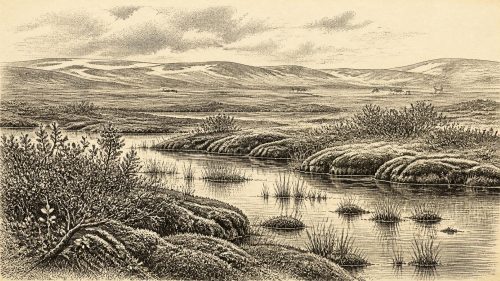
Around 30,761 BCE, Ireland cannot be described through annual events, but through Late Pleistocene environmental evidence. At Derryvree, County Fermanagh, organic freshwater sediments between glacial tills indicate a temporary ice-free, periglacial wetland during Marine Isotope Stage 3. Mosses, sedges, bogbean and mountain avens show cold, treeless tundra conditions with shallow water and summer thaw. Castlepook Cave, County Cork, contains remains from different periods, including mammoth, reindeer, giant deer, predators and cold-adapted mammals, demonstrating varied harsh habitats. A possibly cut-marked reindeer bone suggests intermittent human presence, but provides no proof of settlement. Ice-sheet fluctuations shaped survival and preservation of evidence today.
Dateline
Modern calendar-year precision is not available for Ireland in 30,761 BCE. No people living on the island named this year, wrote about it, or left an archaeological layer that can be assigned to a single season. The date is a modern chronological label, approximately 32,710 years before AD 1950, the conventional reference point for radiocarbon chronology. What can be recovered is a wider environmental interval in the Late Pleistocene, within Marine Isotope Stage 3: a cold, unstable world preceding the Last Glacial Maximum. The most illuminating Irish evidence is not a settlement, tomb or tool-kit, but a buried freshwater deposit at Derryvree near Maguiresbridge in County Fermanagh.
Derryvree does not prove that a particular event occurred in 30,761 BCE. Its organic sediments produced a conventional radiocarbon age of 30,500 +1,170/−1,030 radiocarbon years BP. Calibration converts such laboratory measurements into calendar estimates, but at this depth in time the resulting ranges are broad. The deposit has been discussed in a provisional calibrated span of roughly c. 36,900–31,700 cal BP. Thus 30,761 BCE lies near the younger end of a wide period to which the deposit may be relevant, not at a sharply dated point within it. Its value is precisely that it offers a rare, local glimpse of life in Ireland between episodes of glaciation.
A Pool Between Ice Advances
Road works in 1969 cut through a drumlin at Derryvree, about two kilometres north-east of Maguiresbridge. Beneath the familiar moulded hill lay a sequence of glacial deposits: a lower till, organic-rich freshwater silts and fine sands, and an upper till. Till is the unsorted debris laid down directly by ice. The layered sequence therefore records a change from ice-covered ground to an ice-free or ice-marginal freshwater setting, followed eventually by renewed glaciation. It is one of the reasons Derryvree has long occupied an important place in accounts of the Irish Pleistocene.
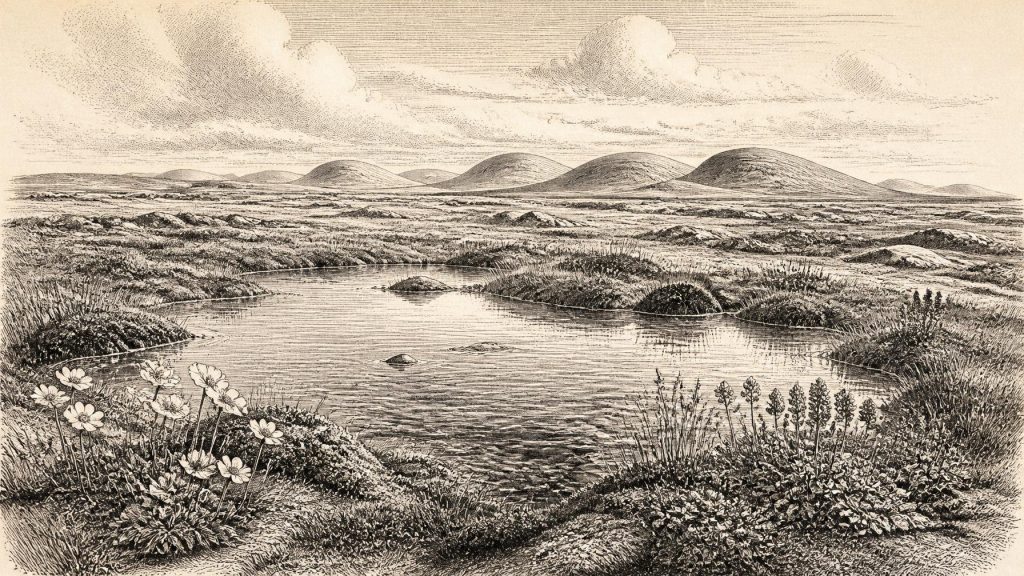
The freshwater layers were not the sediment of a great lake or a prosperous landscape. They suggest shallow, cold water, mud and plant-rich margins in a periglacial terrain. The insects and plant remains are of northern, full-glacial character. Pollen was poorly preserved, but what survived was largely herbaceous; macrofossils supplied the clearer evidence. Mosses, sedges and aquatic plants reveal a wetland embedded in open country. The inference is not of woodland, farms or permanent villages, but of a low-growing tundra or muskeg-like mosaic, patterned by pooled meltwater, sedge margins, exposed mineral soil and frost.
Mountain Avens and Bogbean
Two of the most evocative Derryvree finds are mountain avens, Dryas octopetala, and bogbean, Menyanthes trifoliata. Mountain avens is now an Arctic-alpine plant, familiar in Ireland chiefly from specialised limestone and upland habitats. Its fossil presence signals cold, open conditions, though a fossil plant cannot by itself provide a thermometer reading. Bogbean, represented by a recognisable fossil seed, is a plant of wet ground and shallow fresh water. Together with the moss flora and sedges, these remains make the strongest case for a small freshwater habitat bordered by treeless tundra vegetation.
That reconstruction needs careful limits. Fossil assemblages preserve what entered the sediment and survived burial; they do not provide a complete census of every species nearby. Nor should present-day vegetation be projected wholesale into the past. Yet the combination of aquatic and terrestrial remains makes a coherent picture: a landscape with enough summer thaw and standing water to support pond and fen plants, but cold enough to exclude a closed forest. The Derryvree horizon is consequently a record of environmental resilience at the edge of ice, rather than evidence for a mild interlude.
The wider climate was neither static nor uniformly severe across Ireland. Marine and terrestrial records show that the British–Irish Ice Sheet changed repeatedly in extent and behaviour during the last glacial cycle. At about this broad period, ice masses existed in parts of the wider British–Irish region, while some Irish localities retained ice-free landscapes. The very existence of the Derryvree freshwater series shows that south Fermanagh was not continuously overridden during its formation. It does not establish that all Ireland was open, nor that its coastlines and routes were the same as those of the present day. Glacial erosion, later ice movement and rising post-glacial seas have removed or concealed much evidence.
Animals in the Southern Caves
County Cork offers a different kind of evidence. Castlepook Cave, near Doneraile, produced a remarkable collection of Late Pleistocene animal remains during excavations begun by Richard J. Ussher in 1904. Reassessment and improved radiocarbon pretreatment have shown that several older determinations from southern Irish caves underestimated the antiquity of the bones. Castlepook preserves evidence from more than one episode, not a single snapshot. Its fauna includes, at various times, woolly mammoth, reindeer, giant deer, brown bear, wolf, Arctic fox, hare, lemmings and spotted hyaena.
These animals should not all be placed together in one imagined herd at 30,761 BCE. Cave assemblages accumulate over long periods, and bone movement by water, roof-fall, scavenging and excavation complicates their original relationships. Bears may have used caves as dens; hyaenas could have carried prey remains to lairs; bones could later have been redistributed. Nevertheless, the wider pattern confirms that Ireland supported changing communities of large herbivores, carnivores and cold-adapted small mammals during parts of MIS 3. Mammoth, reindeer and hyaena point towards open habitats with substantial grazing resources, while their dates and associations demonstrate change through time rather than an unbroken animal population.
For everyday life in the non-human landscape, this means seasonal scarcity as well as opportunity. Plants grew low to the ground; waterways and wet hollows concentrated moisture and forage; the availability of carrion, prey and shelter would have drawn predators towards favourable places. A cave was not necessarily a refuge in the human sense. At Castlepook it could be a carnivore den, a trap for bones entering fissures, or a shelter repeatedly used by animals at different dates. Derryvree, conversely, preserves the quieter evidence of pond life and vegetation. Together the sites show that Ireland was ecologically varied, though harsh, rather than simply a blank expanse of ice.
The Uncertain Human Trace
Human history at this date remains markedly less secure than environmental history. A reindeer femur from Castlepook has been reported as bearing a deep mark interpreted as a fresh-bone cut or chopping action made with a sharp stone implement. Public heritage accounts have associated the specimen with an age around 33,000 years ago. If the identification of the mark as human-made and contemporary with carcass processing is sustained, it would be important evidence for a brief Upper Palaeolithic presence in Ireland long before the better-established terminal Pleistocene evidence.
But it would still not amount to a settlement. There is no securely associated lithic assemblage, hearth, dwelling floor, burial, human skeleton or repeated occupation surface of comparable age from Ireland. The bone came from an old cave collection whose context was disturbed and incompletely recorded by modern standards. The responsible conclusion is therefore limited: a humanly modified reindeer bone is a serious and potentially transformative clue, but not proof of a resident population, a hunting camp at Castlepook, or activity in Fermanagh in this particular modern-numbered year.
Nothing can responsibly be said of political affairs, diplomacy, named communities, language, religious observance or artistic traditions in Ireland at this point. There is no evidence for chiefs, territories, war bands, exchange networks or organised trade. Even if small human groups occasionally reached the island, their social arrangements cannot be recovered from the present record. The absence of evidence is partly historical and partly geological: mobile people leave slight traces, while later ice and water destroy, bury or mix them. It should not be converted either into a romantic story of Ice Age tribes or into certainty that no person ever arrived.
An Environmental History, Not an Annal
Ireland around 30,761 BCE is best approached through the scale of millennia. Derryvree supplies direct evidence of freshwater life amid a cold, treeless, periglacial landscape. Castlepook and other southern caves demonstrate that late Pleistocene animal communities could include formidable predators and large grazing mammals, although their bones belong to different phases and require careful dating. The expanding and contracting ice sheet reshaped the ground, controlled drainage and determined which deposits survived for later discovery.
The most important development was therefore environmental, not political: Ireland remained a changing northern refuge and frontier during a long glacial deterioration. In south Fermanagh, a shallow wetland supported mosses, sedges, bogbean and mountain avens before later ice sealed its record beneath a drumlin. That buried pond-life is more historically secure than any supposed event of the year itself. It reveals a real Irish landscape, inhabited certainly by plants and animals, and perhaps visited intermittently by people, but still far beyond the reach of an annual chronicle.
Primary Sources
- Early Midlandian–Middle Midlandian, Pleistocene, Northern Ireland
- Palaeoecology
- Figure 6.— The Subdivision of the Quaternary Period in Ireland
- The Irish Quaternary Fauna Project
- A Reconsideration of the Radiocarbon Dating of the Marine Isotope Stage 3 Fauna from Southern Ireland
- The Exploration of Castlepook Cave, County Cork
- The Exploration of Castlepook Cave, Co. Cork. With 3 Plates.
- 2022:564 – Castlepook Cave, Castlepook South, Cork
- Archaeology Research Excavation Grant 2022: Castlepook Cave Project Final Report
- Heritage Artefacts of County Cork
- New Insights on the Fauna of Ireland’s Younger Dryas and Early Holocene
- Growth and Retreat of the Last British–Irish Ice Sheet, 31,000 to 15,000 Years Ago: the BRITICE-CHRONO Reconstruction
- The Timing and Magnitude of the British–Irish Ice Sheet Between Marine Isotope Stages 5d and 2
- Late Pleistocene Chronostratigraphy and Ice Sheet Limits, Southern Ireland
- Timing and Pace of Ice-Sheet Withdrawal Across the Marine–Terrestrial Transition West of Ireland During the Last Glaciation
- Trimlines, Blockfields and the Vertical Extent of the Last Ice Sheet in Southern Ireland
- British–Irish Ice Sheet and Polar Front History of the Goban Spur, Offshore Southwest Ireland Over the Last 250,000 Years
- First Evidence of a Late Upper Palaeolithic Human Presence in Ireland
- The Colonization of Ireland: A Human Ecology Perspective
- Menyanthes trifoliata
- Dryas octopetala